Hagerman is a city in Gooding County, Idaho, United States. The population was 872 at the 2010 census, up from 656 in 2000. The area is noted for its fossil beds and the Thousand Springs of the Eastern Snake Plain Aquifer. Hagerman is home to a national fish hatchery, a university research station, and extensive aquaculture, assisted by an abundance of geothermal water for temperature regulation.
| Name: | Hagerman city |
|---|---|
| LSAD Code: | 25 |
| LSAD Description: | city (suffix) |
| State: | Idaho |
| County: | Gooding County |
| Elevation: | 2,953 ft (900 m) |
| Total Area: | 0.61 sq mi (1.58 km²) |
| Land Area: | 0.59 sq mi (1.52 km²) |
| Water Area: | 0.02 sq mi (0.06 km²) |
| Total Population: | 872 |
| Population Density: | 1,518.71/sq mi (586.24/km²) |
| ZIP code: | 83332 |
| Area code: | 208 |
| FIPS code: | 1634300 |
| GNISfeature ID: | 0372957 |
Online Interactive Map
Click on ![]() to view map in "full screen" mode.
to view map in "full screen" mode.
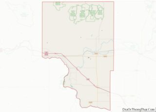
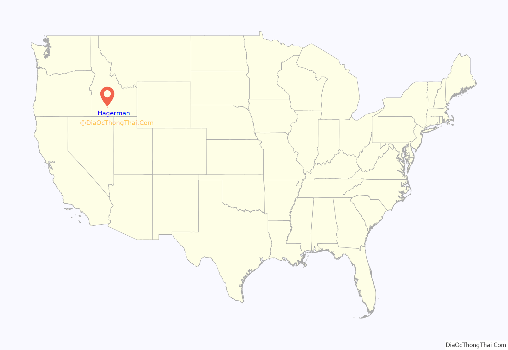
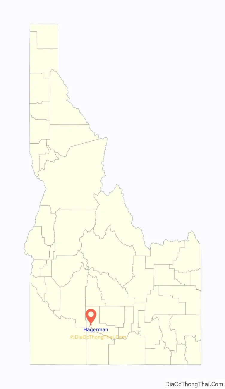
Hagerman location map. Where is Hagerman city?
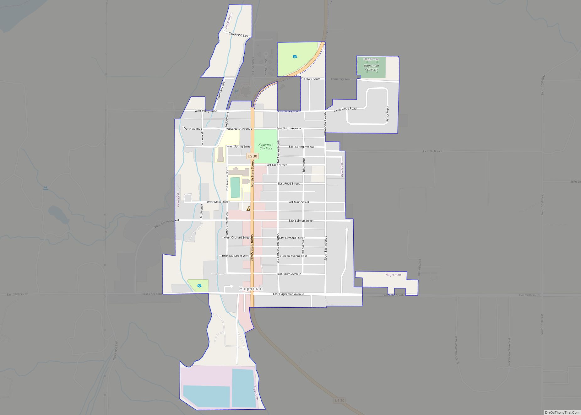
Hagerman Road Map
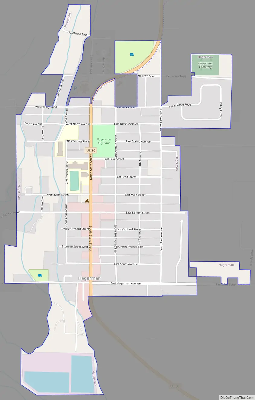
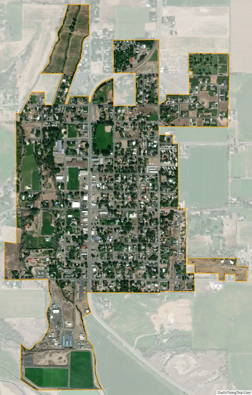
Hagerman city Satellite Map
Geography
Hagerman is located at 42°49′1″N 114°53′51″W / 42.81694°N 114.89750°W / 42.81694; -114.89750 (42.816904, -114.897546).
According to the United States Census Bureau, the city has a total area of 0.60 square miles (1.55 km), of which, 0.58 square miles (1.50 km) is land and 0.02 square miles (0.05 km) is water.
See also
Map of Idaho State and its subdivision:- Ada
- Adams
- Bannock
- Bear Lake
- Benewah
- Bingham
- Blaine
- Boise
- Bonner
- Bonneville
- Boundary
- Butte
- Camas
- Canyon
- Caribou
- Cassia
- Clark
- Clearwater
- Custer
- Elmore
- Franklin
- Fremont
- Gem
- Gooding
- Idaho
- Jefferson
- Jerome
- Kootenai
- Latah
- Lemhi
- Lewis
- Lincoln
- Madison
- Minidoka
- Nez Perce
- Oneida
- Owyhee
- Payette
- Power
- Shoshone
- Teton
- Twin Falls
- Valley
- Washington
- Alabama
- Alaska
- Arizona
- Arkansas
- California
- Colorado
- Connecticut
- Delaware
- District of Columbia
- Florida
- Georgia
- Hawaii
- Idaho
- Illinois
- Indiana
- Iowa
- Kansas
- Kentucky
- Louisiana
- Maine
- Maryland
- Massachusetts
- Michigan
- Minnesota
- Mississippi
- Missouri
- Montana
- Nebraska
- Nevada
- New Hampshire
- New Jersey
- New Mexico
- New York
- North Carolina
- North Dakota
- Ohio
- Oklahoma
- Oregon
- Pennsylvania
- Rhode Island
- South Carolina
- South Dakota
- Tennessee
- Texas
- Utah
- Vermont
- Virginia
- Washington
- West Virginia
- Wisconsin
- Wyoming