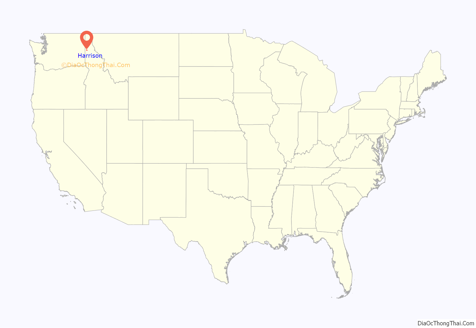
Harrison is a city in Kootenai County, Idaho, United States. The population was 203 at the 2010 census. Harrison is located on the eastern shore of Lake Coeur d’Alene, immediately south of where the Coeur d’Alene River flows into the lake.
| Name: | Harrison city |
|---|---|
| LSAD Code: | 25 |
| LSAD Description: | city (suffix) |
| State: | Idaho |
| County: | Kootenai County |
| Elevation: | 2,205 ft (672 m) |
| Total Area: | 4.40 sq mi (11.40 km²) |
| Land Area: | 3.56 sq mi (9.23 km²) |
| Water Area: | 0.84 sq mi (2.18 km²) |
| Total Population: | 203 |
| Population Density: | 60.64/sq mi (23.41/km²) |
| ZIP code: | 83833, 83842 |
| Area code: | 208 |
| FIPS code: | 1635200 |
| GNISfeature ID: | 0396617 |
| Website: | www.cityofharrisonid.com |
Online Interactive Map
Click on ![]() to view map in "full screen" mode.
to view map in "full screen" mode.
Harrison location map. Where is Harrison city?
History
The community was named for President Benjamin Harrison.
Harrison was incorporated 124 years ago in 1899 and was once the largest city on Lake Coeur d’Alene.
Harrison developed from a squatters homestead to a thriving village in about twelve years. A branch of the O.R. & N. Railroad from Tekoa, Washington, to Harrison was completed in 1890 and was a prime factor in the development of Harrison.
In 1891, Silas W. Crane settled on a timbered tract which joins the present city on the south and east. He built the first house in Harrison which remained in the Crane family until 1936. The building is now used as the Crane House Museum. The same year Fred Grant purchased the Fisher Brothers Sawmill in St. Maries and moved it to Harrison. Known as Grants Mill, it had a capacity of 60 thousand feet per day.
In 1892, S.W. Crane opened a general store. The first post office was established in 1893, the name was chosen and W.E. Crane became the first postmaster. W.S. Bridgeman opened a Gen. Merc. in 1893, and another general store was opened in 1894 by W.A. Reiniger.
The first newspaper, The Signal, was established in 1895, later it was known as the Mountain Messenger and in 1900 became known as The Searchlight. A paper with that name is still published annually by the Oldtime Picnic Committee.
In 1895, a Methodist church was erected and School District #29 was formed. The first year of school was taught by Mr. Edelbute in the Methodist Church. The first school was erected in 1896 and by 1903 there were 59 students.
The original townsite was in the form of a triangle and covered approximately 23 acres (9.3 ha). The Village of Harrison was incorporated on July 21, 1899. The first meeting of the board of trustees for the Village of Harrison was held July 24, 1899. George W. Thompson was elected chairman.
In August 1905, a Spokane company was granted a franchise to put in a water system with a pumping plant at a cost of $20,000. An electric light plant was also installed in 1901 by Kimmel Brothers at a cost of $8,000.
The following year came the telephone, connecting Harrison with points up the St. Joe and Coeur d’Alene rivers. Rocky Mountain Bell purchased the property later that year and Harrison was connected to the outside world.
The next few years saw the opening of the First National Bank of Harrison, the Opera House, various drug, grocery, hardware, furniture, clothing & jewelry stores along with tailoring, blacksmithing and shoemaker shops, and restaurants, hotels and a hospital. For a time around the turn of the century, Harrison was the largest town in Kootenai County; the city directory in 1911 reported a population of 1,250. Harrison’s growth was a result of the development of eight or more sawmills & box factories. With the mills and woods jobs, approx. 280 men were employed with a combined monthly payroll around $25,000. Millions of board feet of timber were stored in the lake at Harrison. Lake Coeur d’Alene and the St.Joe and Coeur d’Alene rivers were the major transportation routes for timber coming out of the areas forests.
In 1917, the Grant Lumber Company caught fire and the ensuing blaze consumed about half of the residential area of Harrison and about half of the business district. Much of the town was never rebuilt. The easiest way to get to Harrison was by water. The OWR&N Company which absorbed the OR&N railroad, constructed a 600-passenger steamer called “The Harrison” for transportation. There were several other steamers such as the Georgie Oakes that carried passengers and freight making the depot a popular place for area children. Passenger service was discontinued in the early 1920s but they continued to haul freight until 1932 when the line was abandoned.
Many early day photos are on display at the Crane Historical Society Museum along with a lot of information about Harrison. Community spirit continues today with the Old Time Picnic, which is always held the last weekend in July.
Harrison’s trail head for the Trail of the Coeur d’Alenes rail trail is a welcome addition to the area and helps to keep the town “alive” during the off season of lake traffic. The Trail is 72 miles (116 km) of easy riding and runs from Plummer to Mullan on the former right-of-way of the Union Pacific Railroad. In the mid 2010s, a Resort Condominiums International was constructed at Arrow Point on Lake Coeur d’Alene just north of town.
Harrison Road Map
Harrison city Satellite Map
Geography
Harrison is located at 47°26′59″N 116°46′50″W / 47.44972°N 116.78056°W / 47.44972; -116.78056 (47.449779, -116.780674).
According to the United States Census Bureau, the city has a total area of 0.76 square miles (1.97 km), of which 0.69 square miles (1.79 km) is land and 0.07 square miles (0.18 km) is water.
Harrison is located 28 miles (45 km) south of Interstate 90 on the Lake Coeur d’Alene Scenic Byway, Highway 97.
The Coeur d’Alene River flows into Lake Coeur d’Alene on Harrison’s northern edge. The lower reaches of the river’s valley are filled with smaller lakes, and as such water dominates much of the local geography. The Saint Joe Mountains of the Bitterroot Range rise high above the flat lakes around Harrison.
See also
Map of Idaho State and its subdivision:- Ada
- Adams
- Bannock
- Bear Lake
- Benewah
- Bingham
- Blaine
- Boise
- Bonner
- Bonneville
- Boundary
- Butte
- Camas
- Canyon
- Caribou
- Cassia
- Clark
- Clearwater
- Custer
- Elmore
- Franklin
- Fremont
- Gem
- Gooding
- Idaho
- Jefferson
- Jerome
- Kootenai
- Latah
- Lemhi
- Lewis
- Lincoln
- Madison
- Minidoka
- Nez Perce
- Oneida
- Owyhee
- Payette
- Power
- Shoshone
- Teton
- Twin Falls
- Valley
- Washington
- Alabama
- Alaska
- Arizona
- Arkansas
- California
- Colorado
- Connecticut
- Delaware
- District of Columbia
- Florida
- Georgia
- Hawaii
- Idaho
- Illinois
- Indiana
- Iowa
- Kansas
- Kentucky
- Louisiana
- Maine
- Maryland
- Massachusetts
- Michigan
- Minnesota
- Mississippi
- Missouri
- Montana
- Nebraska
- Nevada
- New Hampshire
- New Jersey
- New Mexico
- New York
- North Carolina
- North Dakota
- Ohio
- Oklahoma
- Oregon
- Pennsylvania
- Rhode Island
- South Carolina
- South Dakota
- Tennessee
- Texas
- Utah
- Vermont
- Virginia
- Washington
- West Virginia
- Wisconsin
- Wyoming
