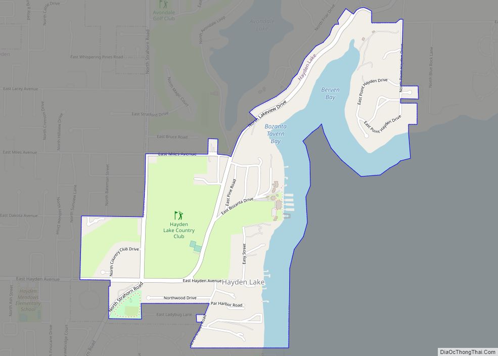
Hayden Lake is a city in Kootenai County, Idaho, United States. Located in the northern portion of the state, it is considered a suburb of the city of Coeur d’Alene. Its population was 574 at the 2010 census. The city was named after the nearby Lake Hayden, which is now more commonly also known as Hayden Lake, after the city.
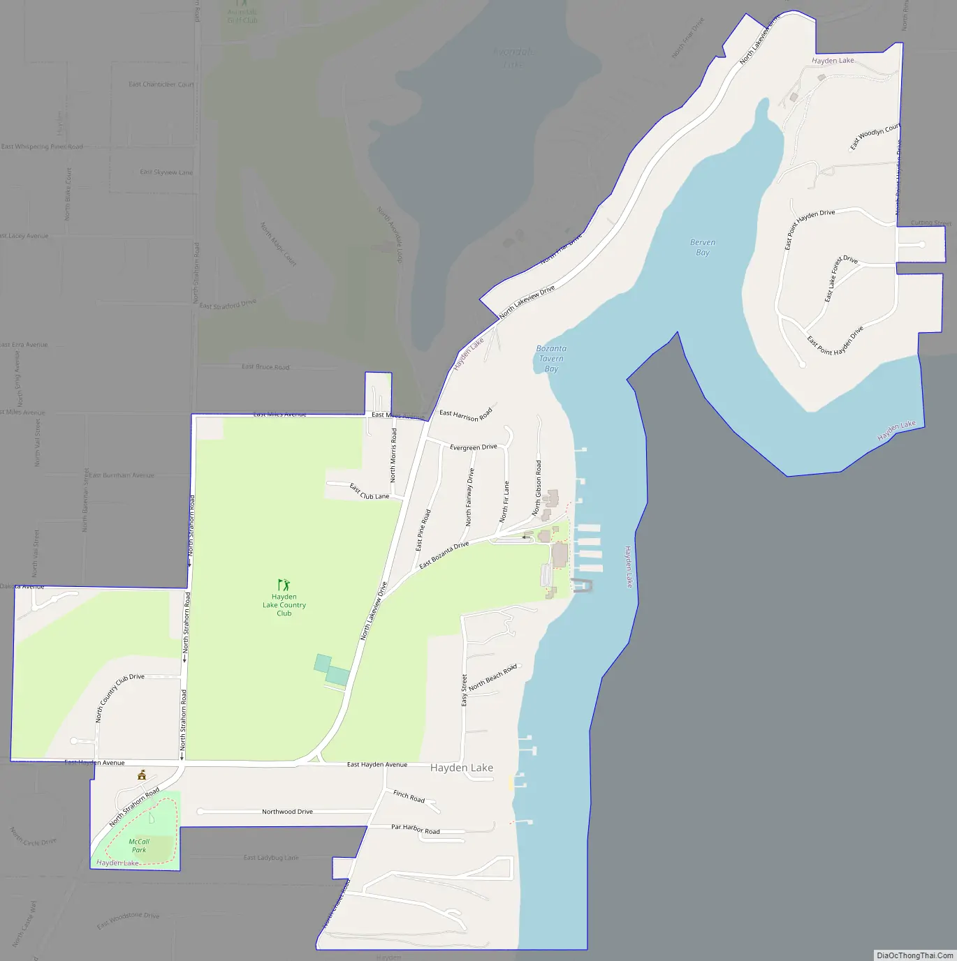
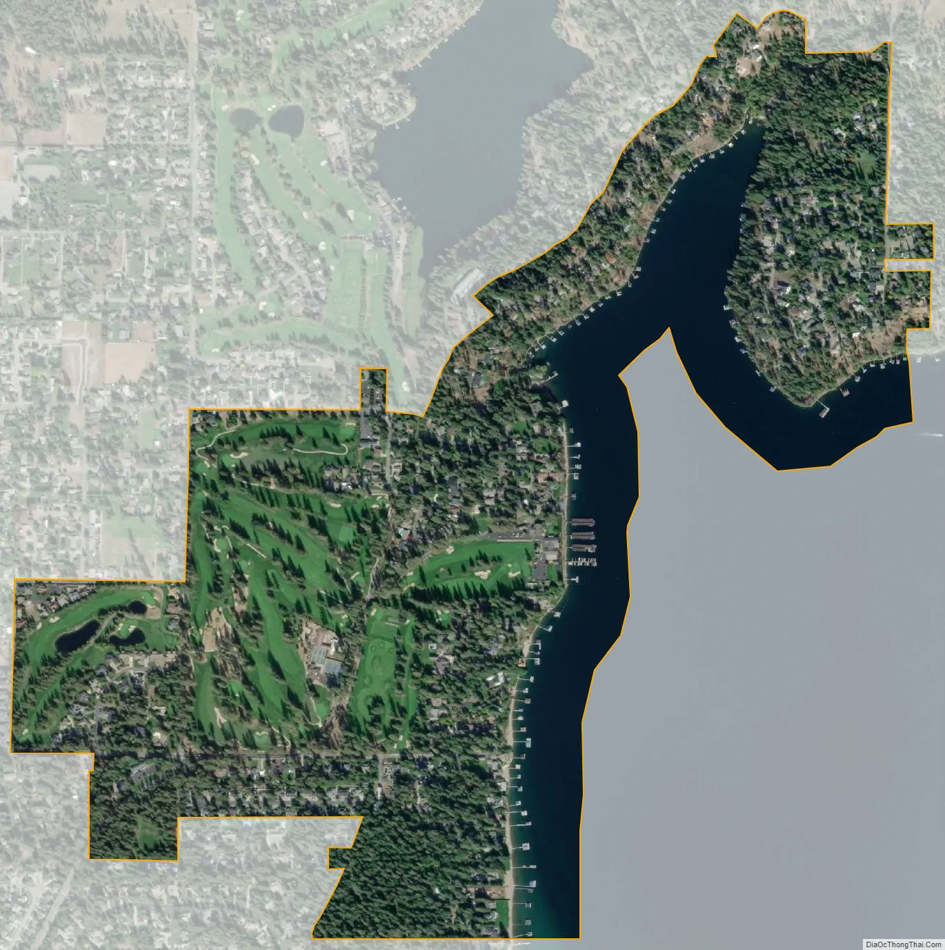
The city is located around the Hayden Lake Country Club and a small portion of the northern part of the lake. Most of the lake is surrounded by the larger city of Hayden. The shores of the lake are filled with summer cabins to large historical and modern mansions and the historic Hayden Lake Country Club lies at the center of the community.
| Name: | Hayden Lake city |
|---|---|
| LSAD Code: | 25 |
| LSAD Description: | city (suffix) |
| State: | Idaho |
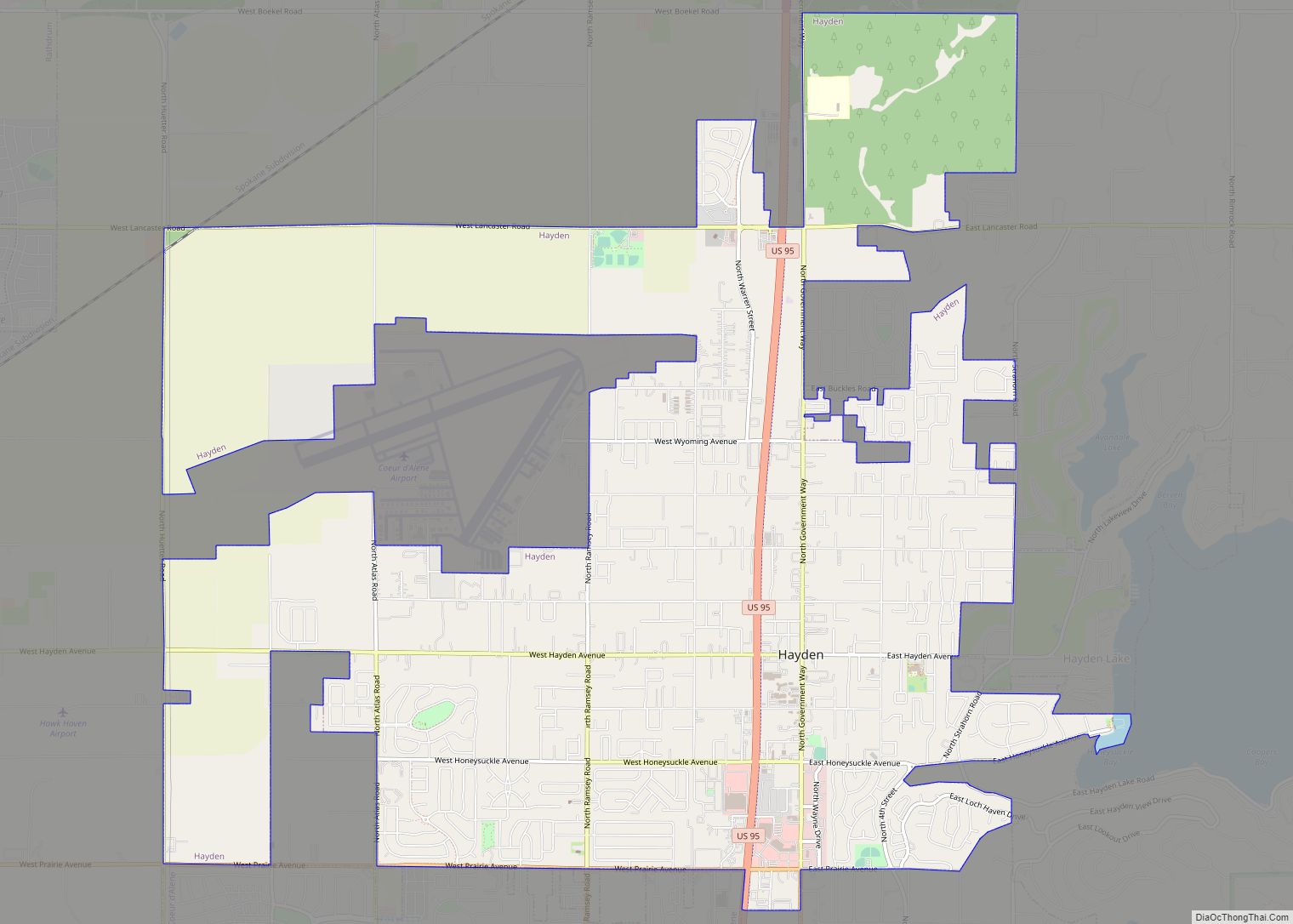
| County: | Kootenai County |
| Elevation: | 2,287 ft (697 m) |
| Total Area: | 0.78 sq mi (2.03 km²) |
| Land Area: | 0.61 sq mi (1.58 km²) |
| Water Area: | 0.17 sq mi (0.45 km²) |
| Total Population: | 574 |
| Population Density: | 1,019.64/sq mi (393.64/km²) |
| ZIP code: | 83835 |
| Area code: | 208 |
| FIPS code: | 1636460 |
| GNISfeature ID: | 0396631 |
Online Interactive Map
Click on ![]() to view map in "full screen" mode.
to view map in "full screen" mode.
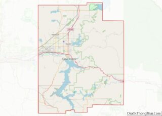
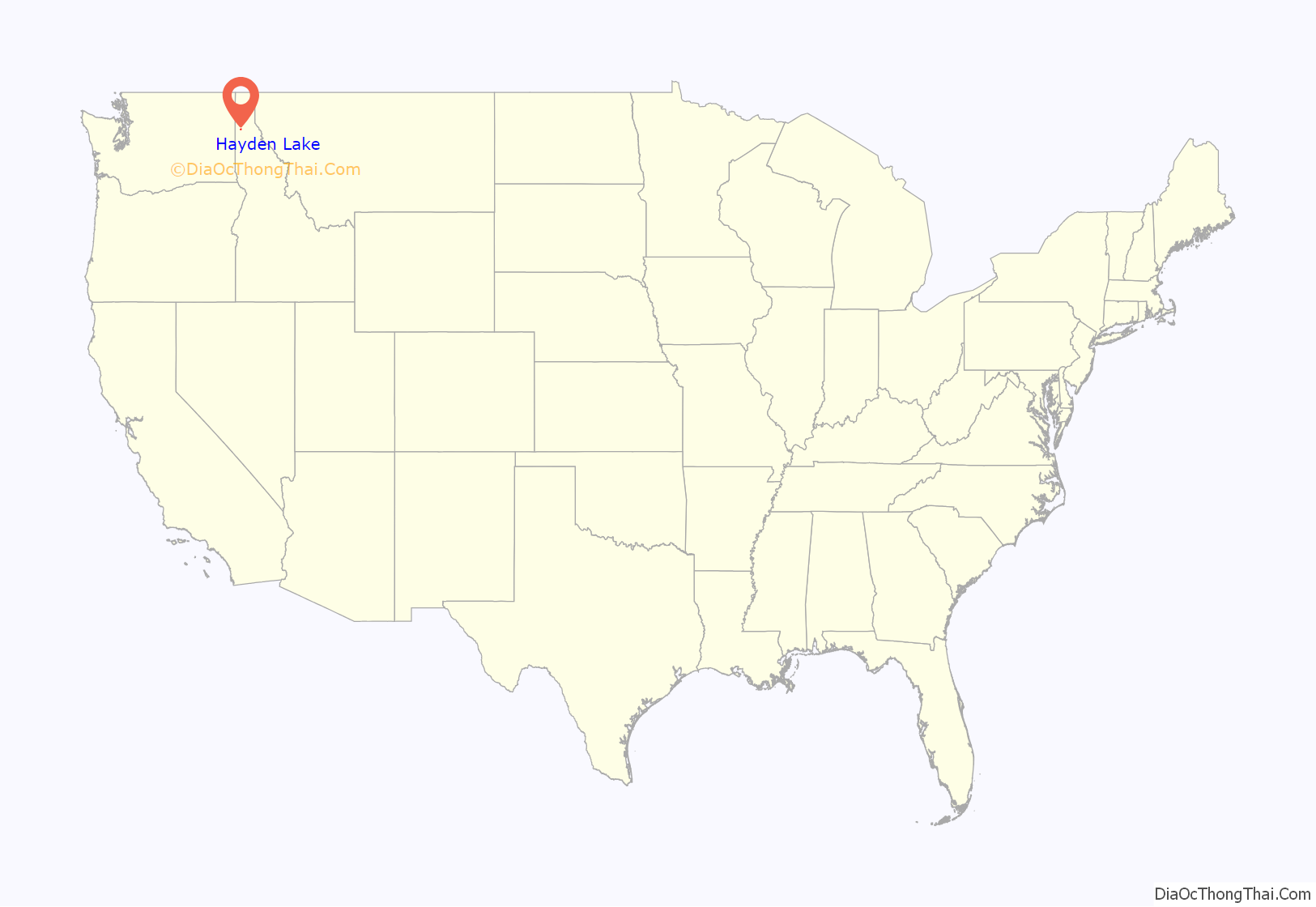
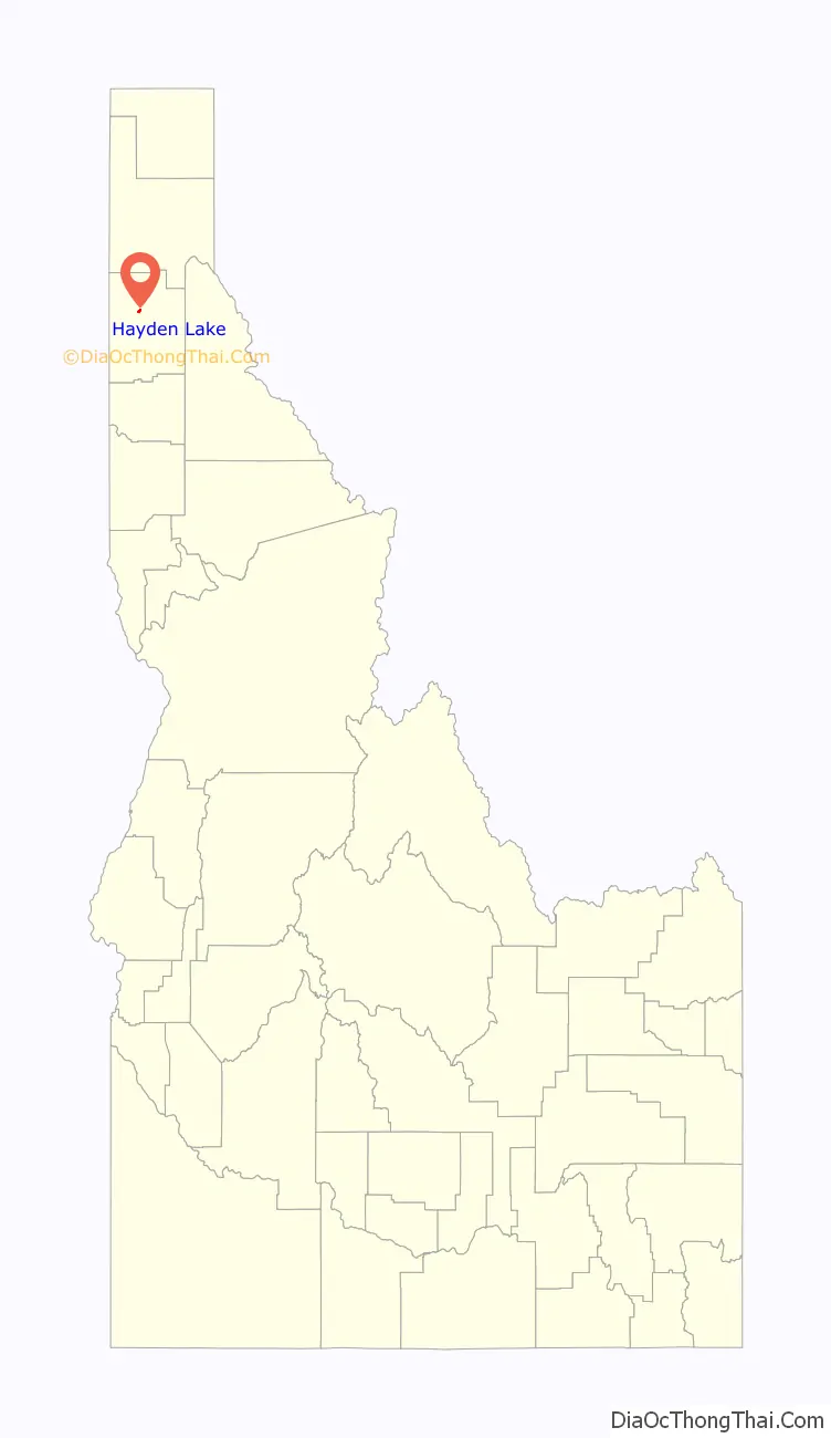
Hayden Lake location map. Where is Hayden Lake city?
History
The Coeur D’Alene tribe territory centered around what is now Hayden Lake and nearby Lake Coeur d’Alene, gathering plants, including abundant huckleberries, fish and wildlife. The first white man to visit the area was Father DeSmet while serving as a missionary to the Coeur d’Alene Indians. While visiting, he named it Lake DeNuf and recorded several stories told by the local tribe about the lake and the surrounding area.
Hayden Lake’s natural beauty attracted several wealthy people in the early 1900s. The F. Lewis Clark Mansion was built in 1910, and was the most expensive home in Idaho at the time. In 1914, Lewis mysteriously disappeared and was never seen or heard from again. In 1907, the Hayden Lake Country Club became a gathering place for many area socialites, such as Bing Crosby. A railway expansion made travel easy from nearby Spokane. HLCC opened the first 18-hole golf course in the state of Idaho in 1912.
From the 1970s until 2001, the neo-Nazi Aryan Nations had its headquarters in a 20-acre (8.1 ha) compound in Kootenai County near Hayden Lake. In September 2000, the Southern Poverty Law Center won a $6.3 million judgment against the Aryan Nations from an Idaho jury, who awarded punitive and compensatory damages to Victoria Keenan and her son, Jason, who were attacked by Aryan Nations guards in 1999. Bullets struck the Keenans’ car several times, then the car crashed and an Aryan member held the Keenans at gunpoint. As a result of the judgment, Richard Butler turned the compound over to the Keenans, who then sold the property to a philanthropist who subsequently donated it to North Idaho College, which designated the land as a “peace park”.
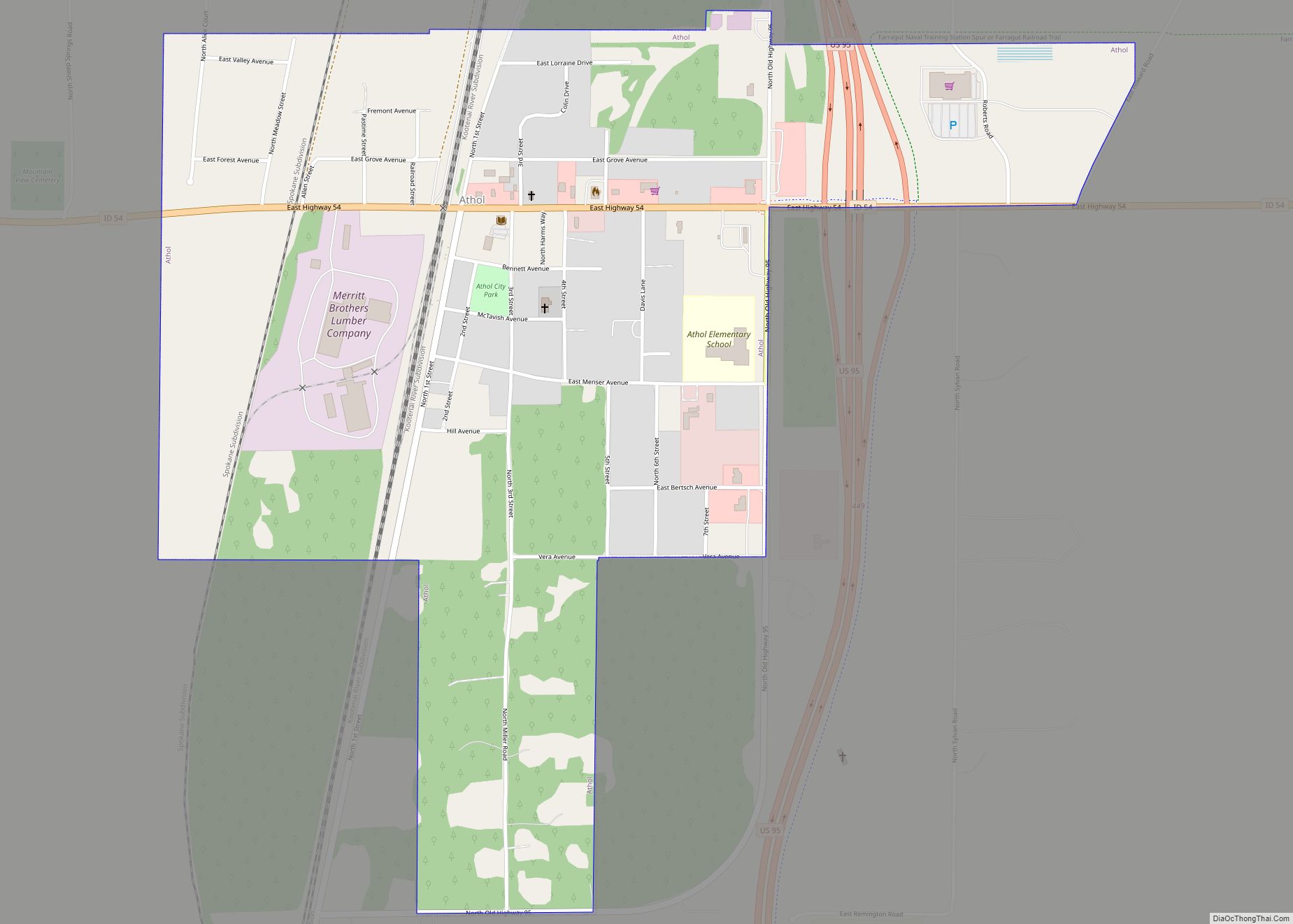
Hayden Lake Road Map
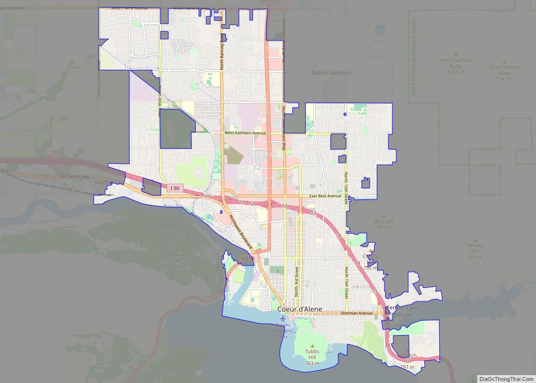
Hayden Lake city Satellite Map
Geography
Hayden Lake is located at 47°45′53″N 116°45′21″W / 47.76472°N 116.75583°W / 47.76472; -116.75583 (47.764720, -116.755931).
According to the United States Census Bureau, the city has a total area of 0.68 square miles (1.76 km), of which 0.59 square miles (1.53 km) is land and 0.09 square miles (0.23 km) is water.
Geology
Hayden Lake, like Lake Coeur d’Alene and other lakes surrounding the Spokane Valley and Rathdrum Prairie, was formed by the Missoula Floods, most recently 12,000 to 15,000 years ago. The Purcell Lobe of the Cordilleran Ice Sheet flowed south from Canada, carving the basin of present-day Lake Pend Oreille and damming the Clark Fork river. The impounded river repeatedly filled to form Glacial Lake Missoula and broke through the ice dam, resulting in massive floods that filled the Rathdrum Prairie area with sand, gravel, and boulders. Large eddy bars formed downstream from bedrock obstructions, thereby damming tributary valleys and creating lakes.
See also
Map of Idaho State and its subdivision:- Ada
- Adams
- Bannock
- Bear Lake
- Benewah
- Bingham
- Blaine
- Boise
- Bonner
- Bonneville
- Boundary
- Butte
- Camas
- Canyon
- Caribou
- Cassia
- Clark
- Clearwater
- Custer
- Elmore
- Franklin
- Fremont
- Gem
- Gooding
- Idaho
- Jefferson
- Jerome
- Kootenai
- Latah
- Lemhi
- Lewis
- Lincoln
- Madison
- Minidoka
- Nez Perce
- Oneida
- Owyhee
- Payette
- Power
- Shoshone
- Teton
- Twin Falls
- Valley
- Washington
- Alabama
- Alaska
- Arizona
- Arkansas
- California
- Colorado
- Connecticut
- Delaware
- District of Columbia
- Florida
- Georgia
- Hawaii
- Idaho
- Illinois
- Indiana
- Iowa
- Kansas
- Kentucky
- Louisiana
- Maine
- Maryland
- Massachusetts
- Michigan
- Minnesota
- Mississippi
- Missouri
- Montana
- Nebraska
- Nevada
- New Hampshire
- New Jersey
- New Mexico
- New York
- North Carolina
- North Dakota
- Ohio
- Oklahoma
- Oregon
- Pennsylvania
- Rhode Island
- South Carolina
- South Dakota
- Tennessee
- Texas
- Utah
- Vermont
- Virginia
- Washington
- West Virginia
- Wisconsin
- Wyoming