Richfield is a city in Lincoln County, Idaho, in the United States. The population was 482 at the 2010 census.
| Name: | Richfield city |
|---|---|
| LSAD Code: | 25 |
| LSAD Description: | city (suffix) |
| State: | Idaho |
| County: | Lincoln County |
| Elevation: | 4,298 ft (1,310 m) |
| Total Area: | 0.66 sq mi (1.70 km²) |
| Land Area: | 0.66 sq mi (1.70 km²) |
| Water Area: | 0.00 sq mi (0.00 km²) |
| Total Population: | 482 |
| Population Density: | 756.10/sq mi (291.80/km²) |
| ZIP code: | 83349 |
| Area code: | 208, 986 |
| FIPS code: | 1667600 |
| GNISfeature ID: | 0398042 |
| Website: | www.cityofrichfield.us |
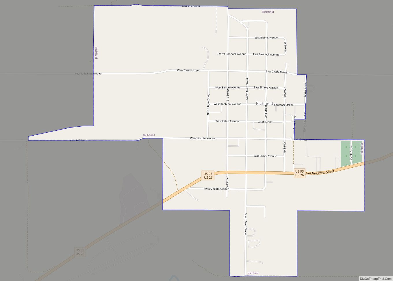
Online Interactive Map
Click on ![]() to view map in "full screen" mode.
to view map in "full screen" mode.
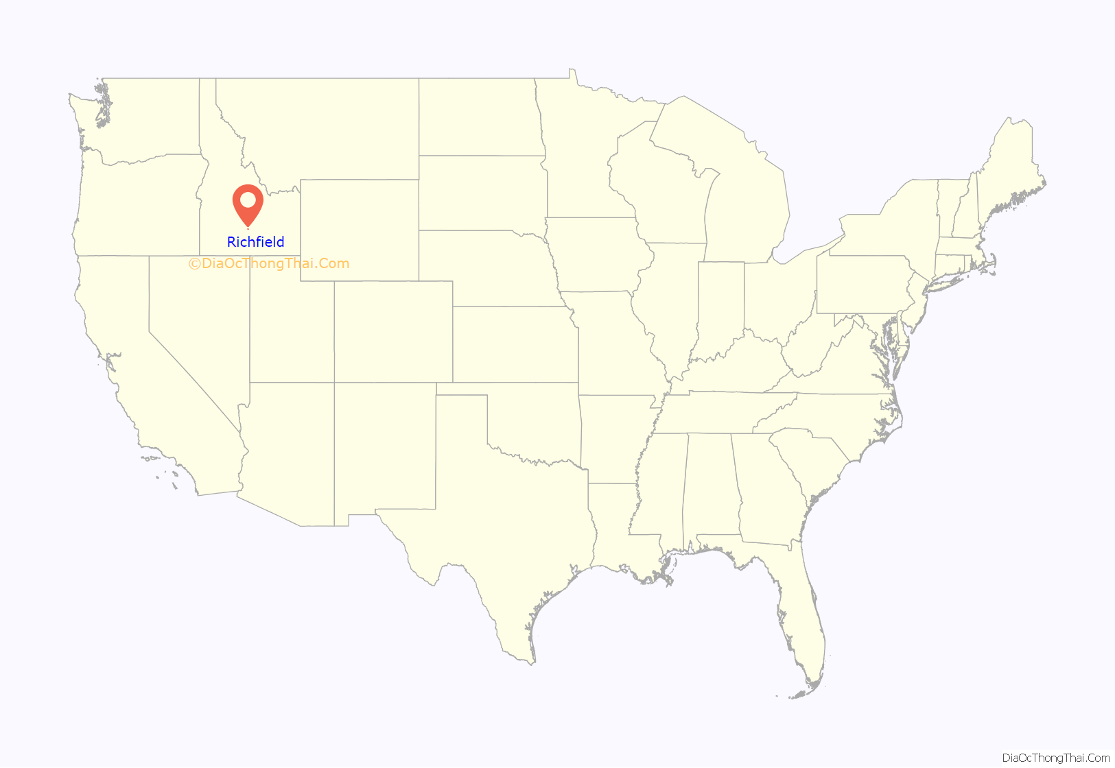
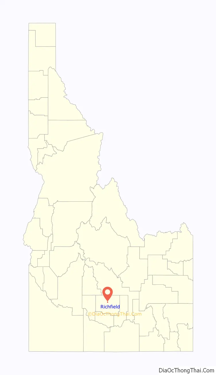
Richfield location map. Where is Richfield city?
History
A book about the History of the Richfield area was written in 1995 by Alice Crane Behr and Maureen Hancock Ward. It was subsequently published and printed. The text of this book is available at the Richfield City Website.
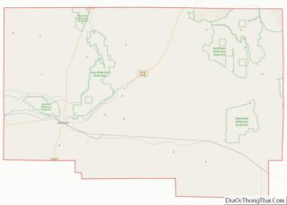
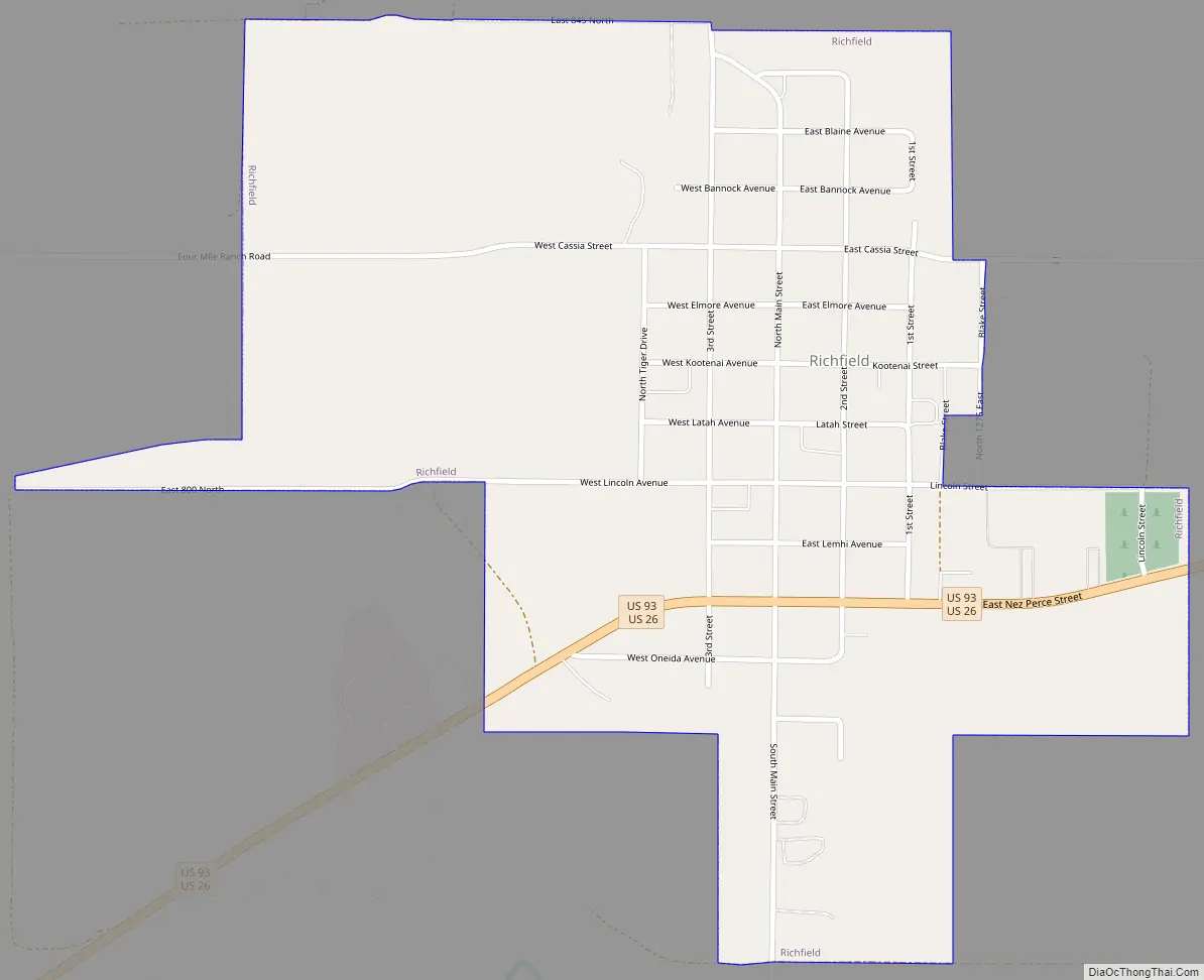
Richfield Road Map
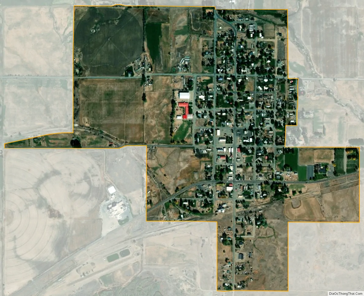
Richfield city Satellite Map
Geography
Richfield is located at 43°3′9″N 114°9′11″W / 43.05250°N 114.15306°W / 43.05250; -114.15306 (43.052629, -114.153041).
According to the United States Census Bureau, the city has a total area of 0.66 square miles (1.71 km), all of it land.
The Little Wood River flows nearby, and the Richfield region is supplied with irrigation water diverted from the Big Wood River near Magic Reservoir.
See also
Map of Idaho State and its subdivision:- Ada
- Adams
- Bannock
- Bear Lake
- Benewah
- Bingham
- Blaine
- Boise
- Bonner
- Bonneville
- Boundary
- Butte
- Camas
- Canyon
- Caribou
- Cassia
- Clark
- Clearwater
- Custer
- Elmore
- Franklin
- Fremont
- Gem
- Gooding
- Idaho
- Jefferson
- Jerome
- Kootenai
- Latah
- Lemhi
- Lewis
- Lincoln
- Madison
- Minidoka
- Nez Perce
- Oneida
- Owyhee
- Payette
- Power
- Shoshone
- Teton
- Twin Falls
- Valley
- Washington
- Alabama
- Alaska
- Arizona
- Arkansas
- California
- Colorado
- Connecticut
- Delaware
- District of Columbia
- Florida
- Georgia
- Hawaii
- Idaho
- Illinois
- Indiana
- Iowa
- Kansas
- Kentucky
- Louisiana
- Maine
- Maryland
- Massachusetts
- Michigan
- Minnesota
- Mississippi
- Missouri
- Montana
- Nebraska
- Nevada
- New Hampshire
- New Jersey
- New Mexico
- New York
- North Carolina
- North Dakota
- Ohio
- Oklahoma
- Oregon
- Pennsylvania
- Rhode Island
- South Carolina
- South Dakota
- Tennessee
- Texas
- Utah
- Vermont
- Virginia
- Washington
- West Virginia
- Wisconsin
- Wyoming