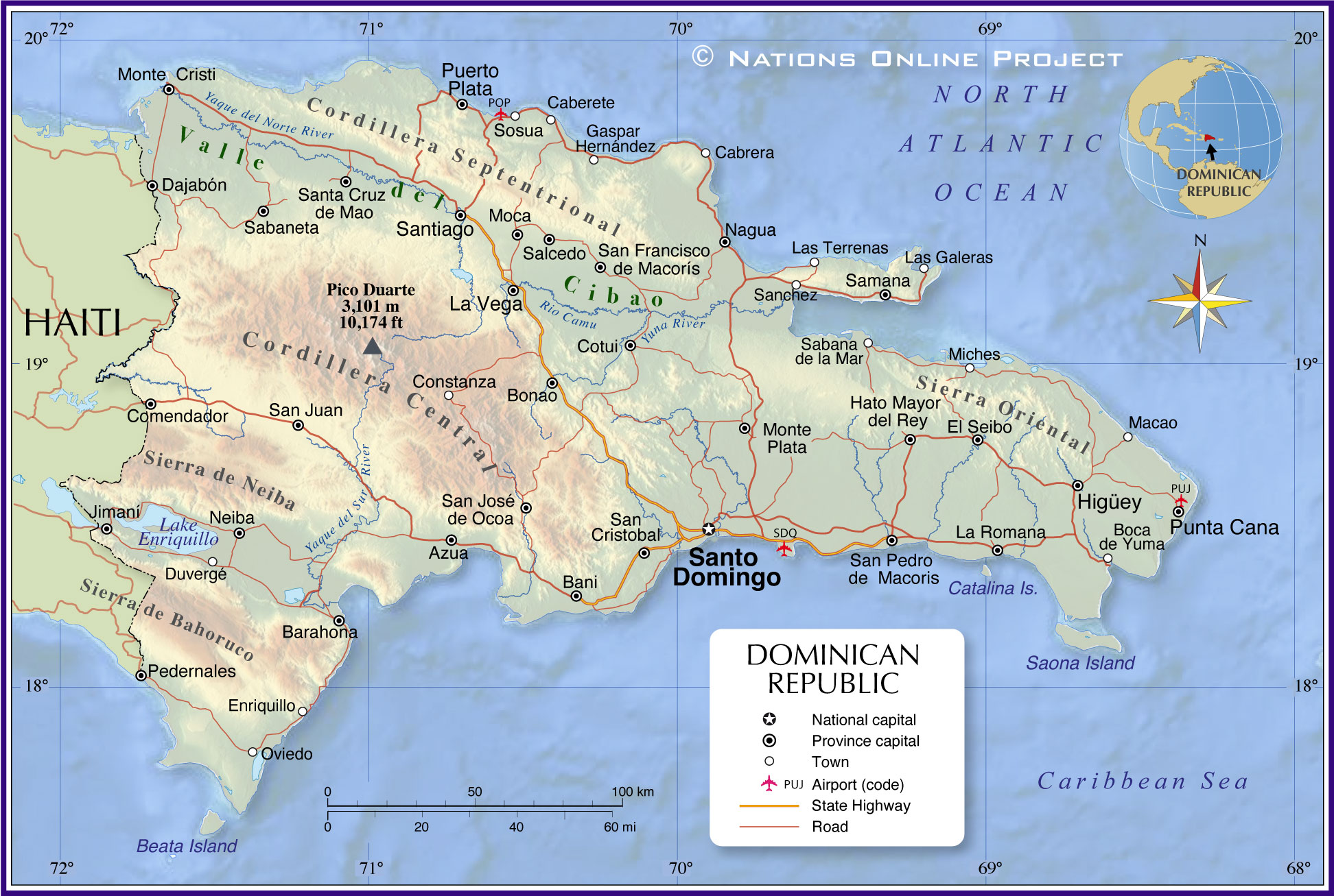
The Dominican Republic, occupying the eastern two-thirds of the island of Hispaniola, is the 2nd largest country in the Caribbean. It has an area of 48,671 sq. km (18,792 sq mi).
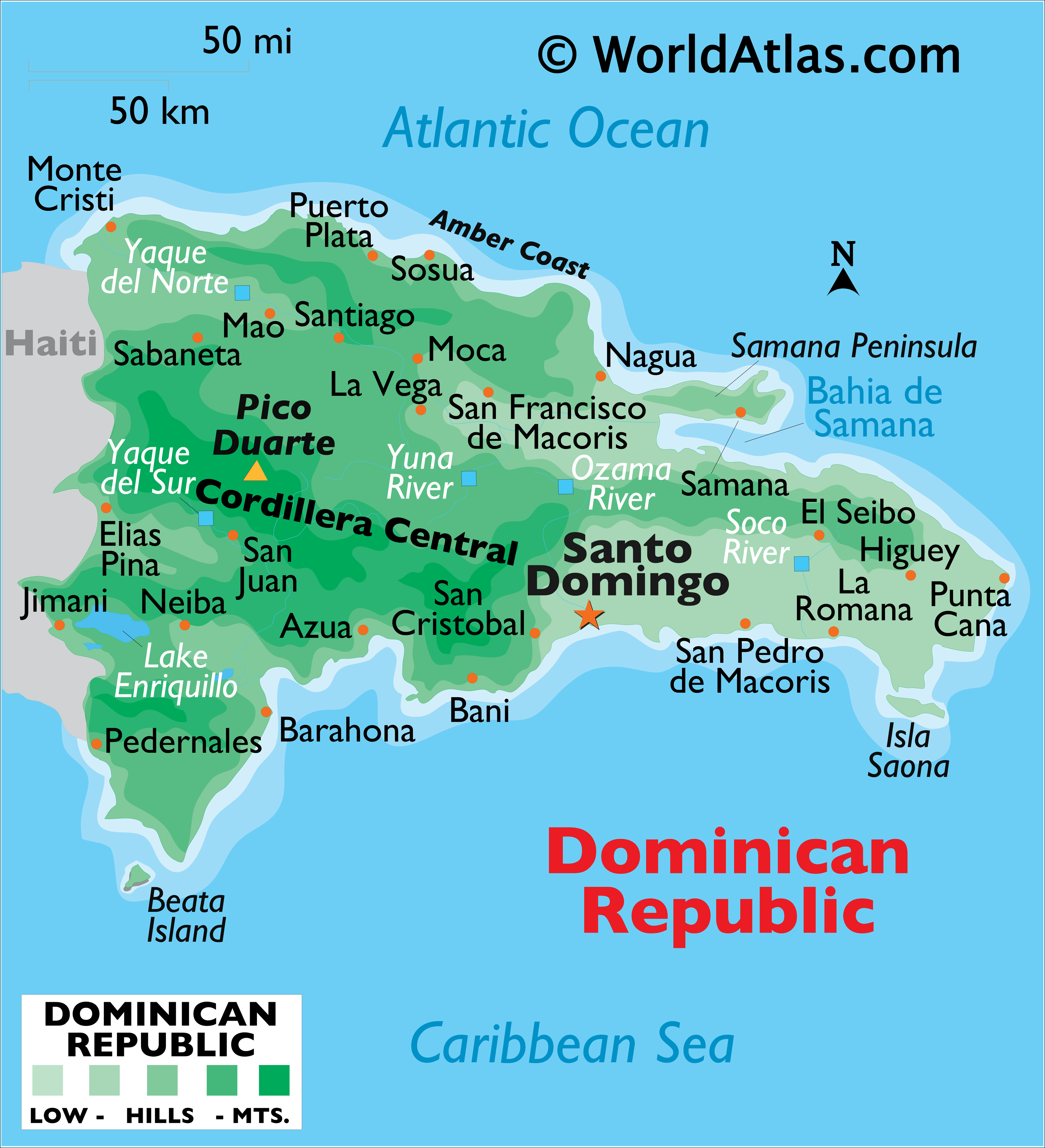
As observed on the physical map of the country above, Dominican Republic is mountainous in the central and west, while extensive lowlands dominate the southeast. There are four significant mountain ranges in the Dominican Republic, with the rugged Cordillera Central – the highest and largest range. It include Pico Duarte, the country’s highest point, and the highest point in the Caribbean. Several peaks there exceed 5,000 ft. Lesser ranges cover the northern coastlines and the south-western border areas with Haiti. Compared to the tropical conditions in the west, the lowlands of the southeast are exceptionally dry, with very little usable plant growth.
There are many small offshore islands and cats that are part of the Dominican territory. The two largest islands near shore are Saona, in the southeast, and Beata, in the southwest.
Lake Enriquillo in the far southwest is the largest lake. It’s a saltlake at 131ft (40m) below sea level, the lowest point in the Caribbean. The largest river is the Yaque del Norte. Dozens of smaller rivers and streams drain the country from the mountains to the sea.
| Flag: |  |
|---|---|
| Legal Name: | Dominican Republic |
| Capital Value: | Santo Domingo |
| Official languages: | Spanish |
| Demonym(s): | Dominican Quisqueyan (colloquial) |
| Government: | Unitary presidential republic |
| Legislature: | Congress |
| Total Area: | 48,670 km² |
| Land Area: | 48,320 km² |
| Water Area: | 350 km² |
| Population: | 10,738,958 |
| Density: | 220/km (569.8/sq mi) (65th) |
| GDP: | $88.94 Billion |
| GDP Per Capita: | $8,282.12 |
| Currency Value: | Dominican pesos (DOP) |
| Driving side: | right |
| Calling code: | +1-809, +1-829, +1-849 |
| Internet TLD: | .do |
The Dominican Republic is a Caribbean nation that shares the island of Hispaniola with Haiti to the west. It has a rich and varied geography, from lush tropical rainforests and rugged mountain ranges to white-sand beaches and crystal-clear waters. The Dominican Republic’s map highlights its many wonders, from its bustling cities to its many natural attractions.
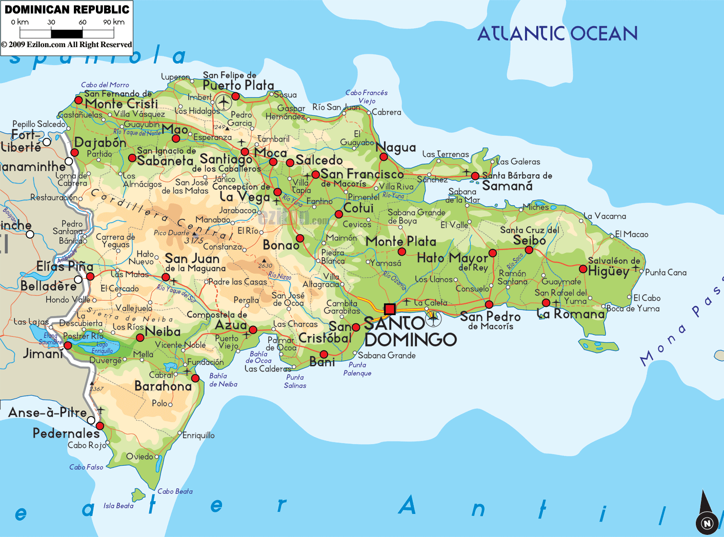
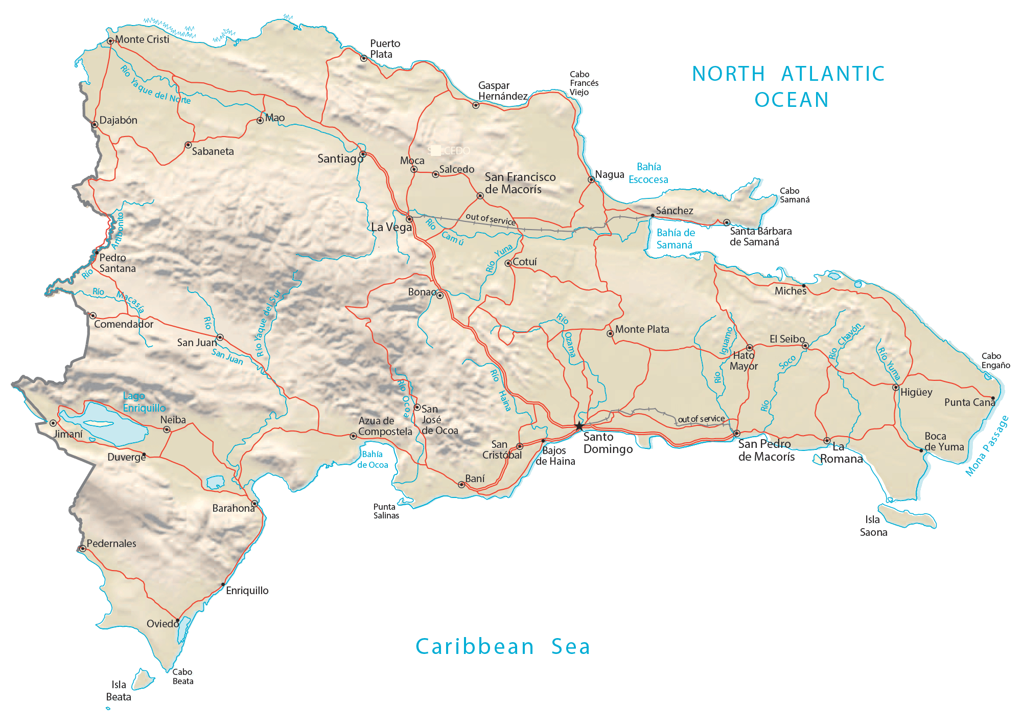
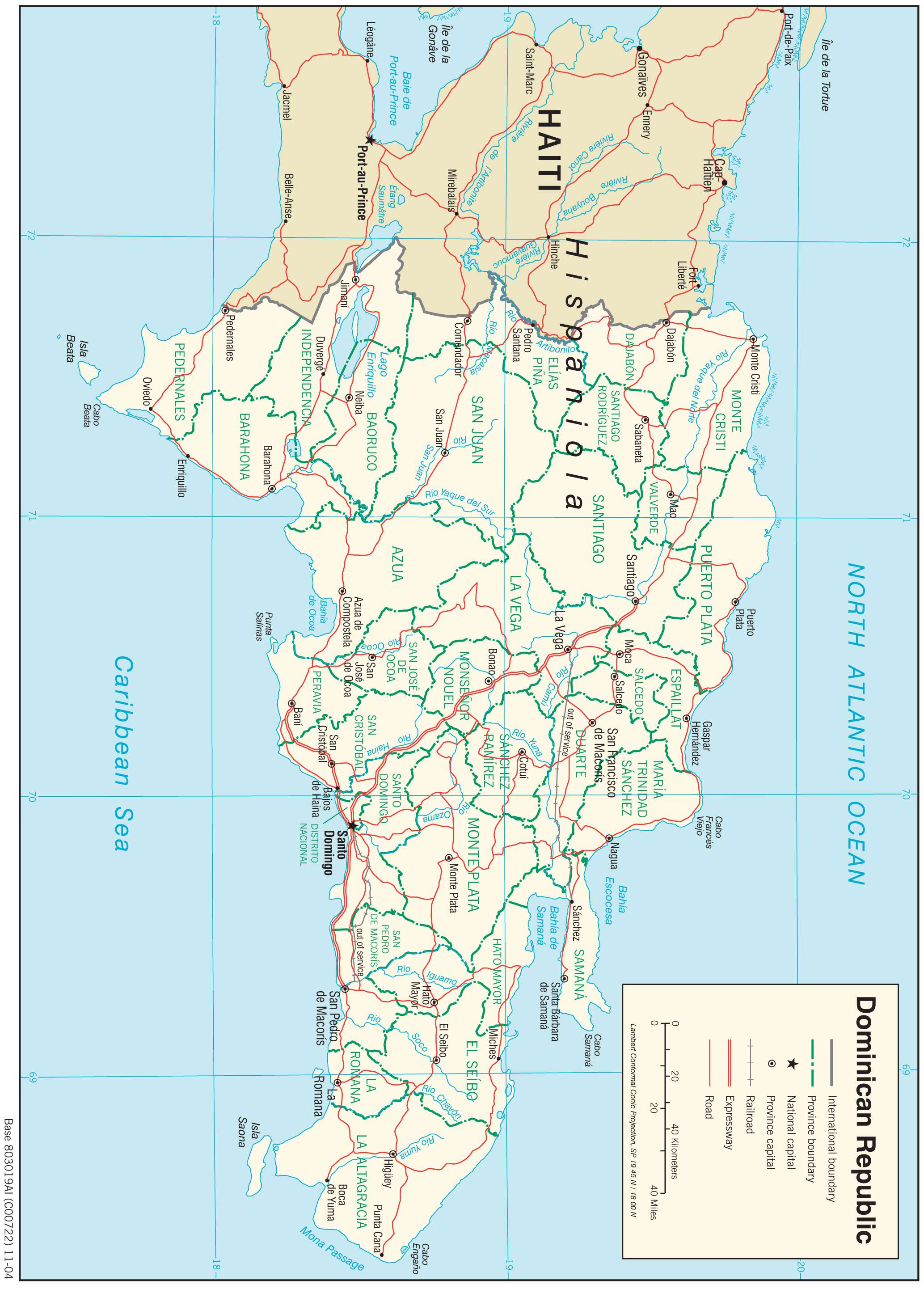
The reference map of the Dominican Republic is an excellent way to get an overview of the country. It shows the major cities, highways, airports, and other points of interest. It also provides a general view of the country’s geography, including its mountain ranges, rivers, and lakes.
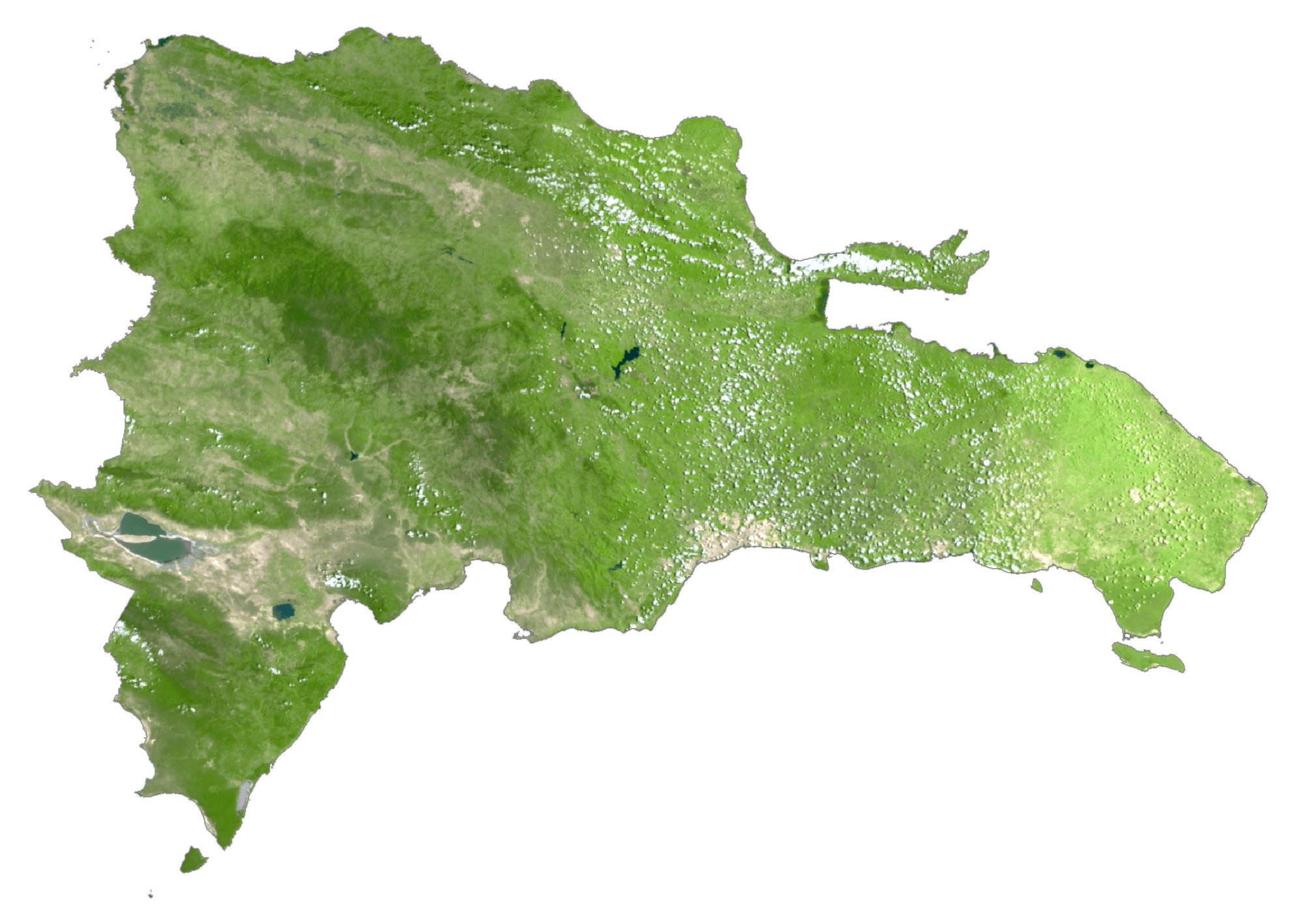
The satellite imagery of the Dominican Republic provides a detailed look at the country’s terrain. The imagery reveals the lush rainforests, mountain ranges, and coastal areas in stunning detail. It also highlights the country’s many cities, highways, and other points of interest.
The physical map of the Dominican Republic is a great way to explore the country’s diverse landscape. It shows the country’s major rivers, lakes, and mountain ranges in addition to its cities, highways, and other points of interest.
The Dominican Republic map is a great resource for anyone looking to explore this beautiful Caribbean nation. It includes everything from cities and highways to lakes and rivers, and provides a detailed look at the country’s varied geography. Whether you’re planning a vacation, a business trip, or just looking for more information about the Dominican Republic, the map has something for everyone.
Discover the beauty and diversity of the Dominican Republic with this comprehensive map. It features a reference map, satellite imagery, and a physical map, providing an overview of the country’s cities, highways, rivers, lakes, and other points of interest. Plan your next trip to the Dominican Republic with this helpful map!
Online Interactive Political Map
Click on ![]() to view map in "full screen" mode.
to view map in "full screen" mode.
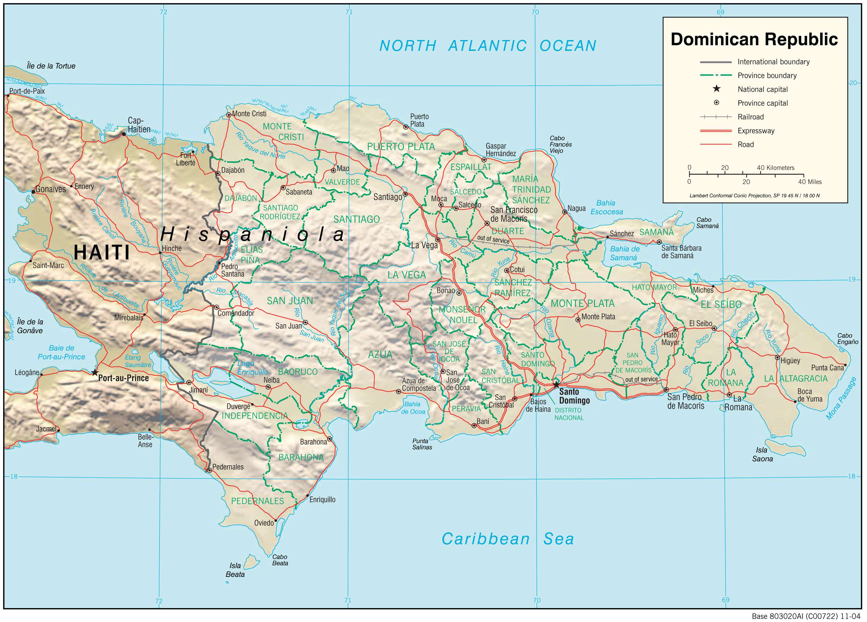
The Dominican Republic is divided into 31 provinces and the National District (Distrito Nacional). In alphabetical order, the provinces are: Azua, Baoruco, Barahona, Dajabon, Duarte, Elias Pina, El Seibo, Espaillat, Hato Mayor, Hermanas Mirabal, Independencia, La Altagracia, La Romana, La Vega, Maria Trinidad Sanchez, Monsenor Nouel, Monte Cristi, Monte Plata, Pedernales, Peravia, Puerto Plata, Samana, Sanchez Ramirez, San Cristobal, San Jose de Ocoa, San Juan, San Pedro de Macoris, Santiago, Santiago Rodriguez, Santo Domingo and Valverde. The provinces are further subdivided into municipalities and municipal districts.
Covering an area of 48,671 sq.km, the Dominican Republic is the 2nd largest island country of the Greater Antilles island chain in the Caribbean Sea. Located on the southeastern coast of the Hispaniola islands, on the banks of the Ozama River is, Santo Domingo – the capital and the largest city of the Dominican Republic. It is the administrative, cultural, commercial, industrial and financial center of the country. Santo Domingo also serves as the country’s chief seaport.
Location Maps
Where is Dominican Republic?
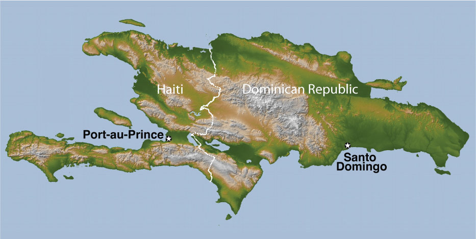
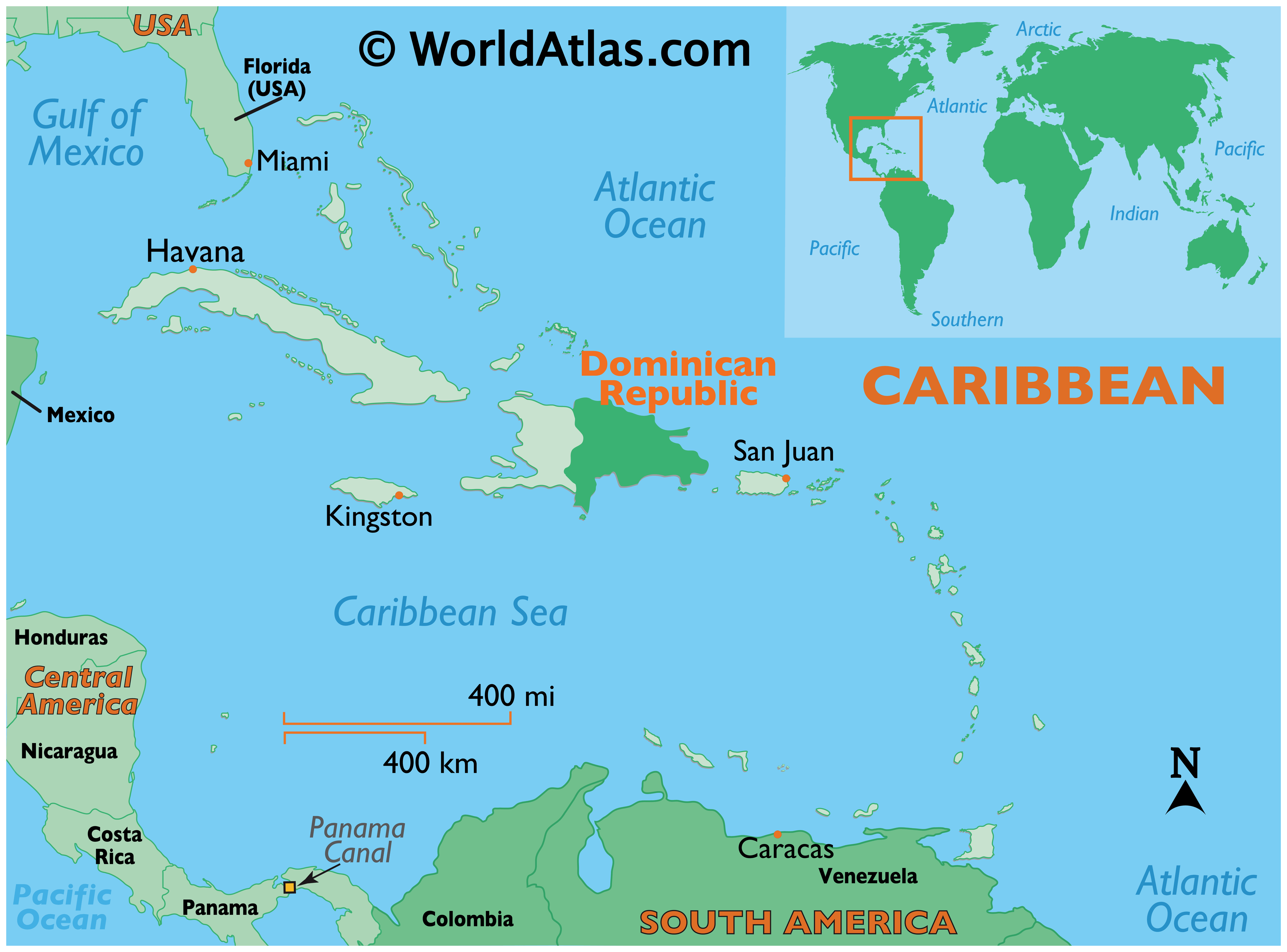
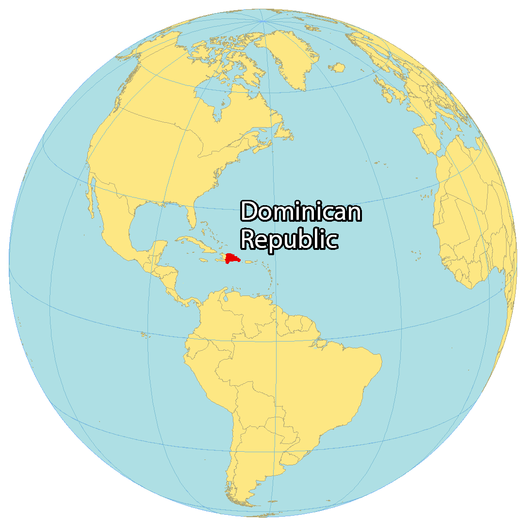
The Dominican Republic is an island located in the Caribbean within the Greater Antilles archipelago. It’s situated on Hispaniola Island, next to Haiti to the west. Also, it’s close to Puerto Rico to the east and is just 133 kilometers (83 mi) away. Whereas the Bahamas are to the northwest, and Venezuela is to the south.
Altogether, the country occupies an area of 48,671 square kilometers (18,792 sq mi) which is slightly smaller than Costa Rica. In comparison to Haiti to the west, the Dominican Republic makes up about two-thirds of the landmass. Santo Domingo is the capital and largest city, located along the southern coastline.

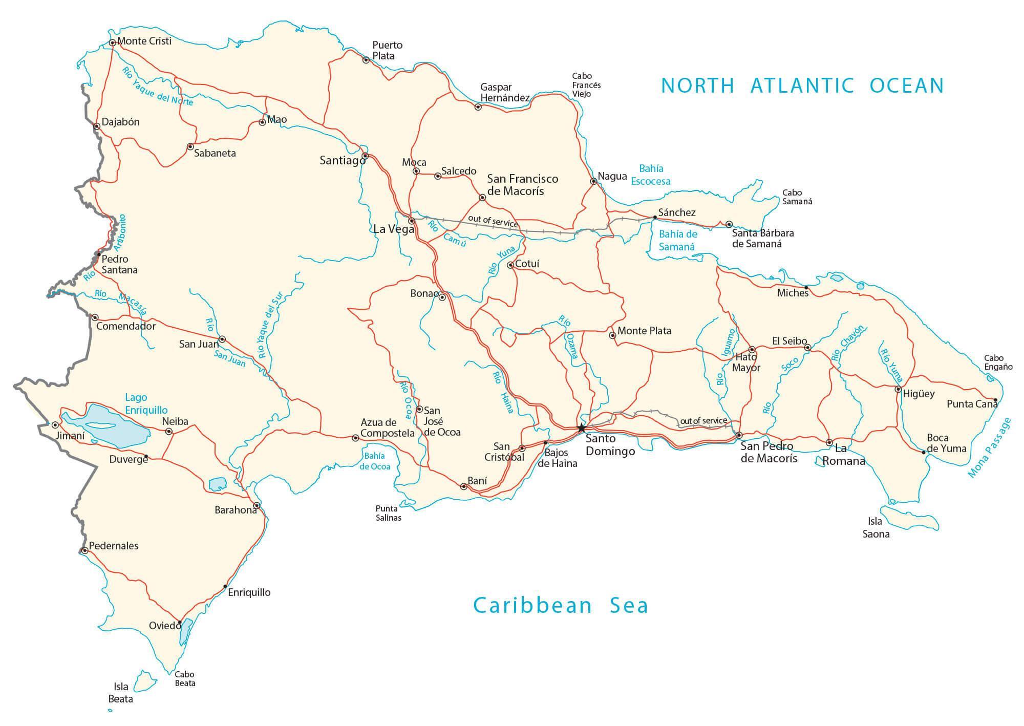
High Definition Political Map of Dominican Republic
Physical Map of Dominican Republic
Transportation Map of Dominican Republic
Dominican Republic Satellite Map
Topo Map