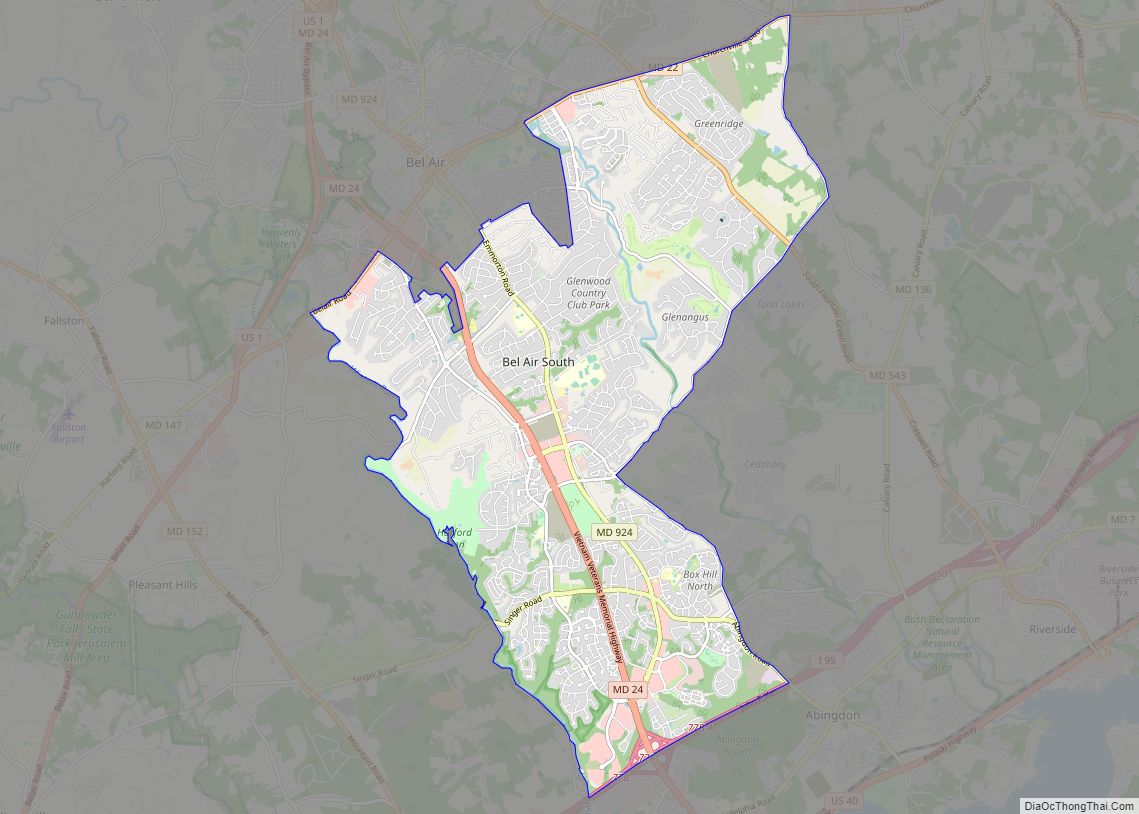
Bel Air South is a census-designated place (CDP) in Harford County, Maryland, United States. The population was 47,709 at the 2010 census, up from 39,711 in 2000.
| Name: | Bel Air South CDP |
|---|---|
| LSAD Code: | 57 |
| LSAD Description: | CDP (suffix) |
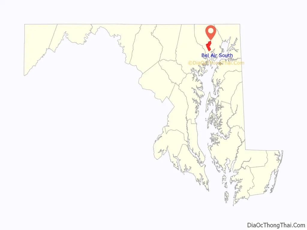
| State: | Maryland |
| County: | Harford County |
| Elevation: | 350 ft (110 m) |
| Total Area: | 21.37 sq mi (55.34 km²) |
| Land Area: | 21.27 sq mi (55.10 km²) |
| Water Area: | 0.09 sq mi (0.24 km²) |
| Total Population: | 27,763 |
| Population Density: | 2,709.66/sq mi (104,622/km²) |
| FIPS code: | 2405950 |
Online Interactive Map
Click on ![]() to view map in "full screen" mode.
to view map in "full screen" mode.
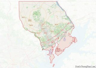
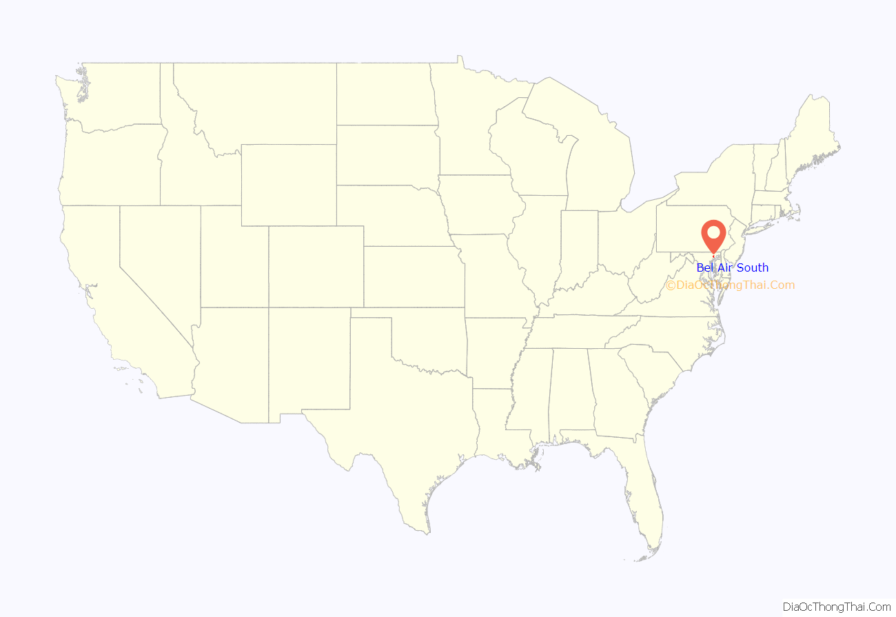
Bel Air South location map. Where is Bel Air South CDP?
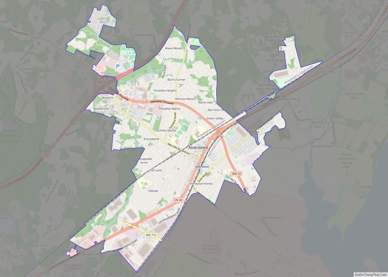
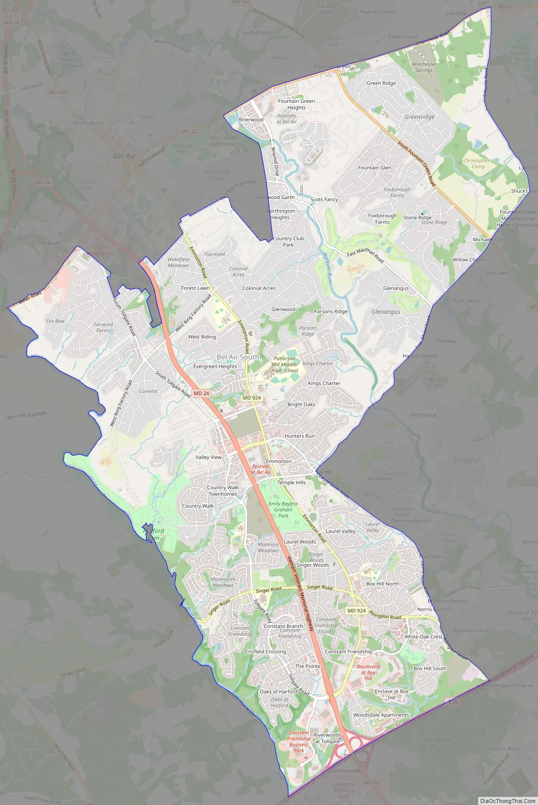
Bel Air South Road Map
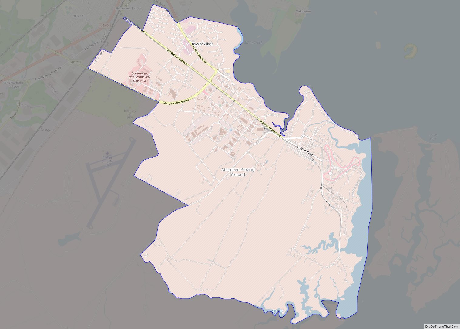
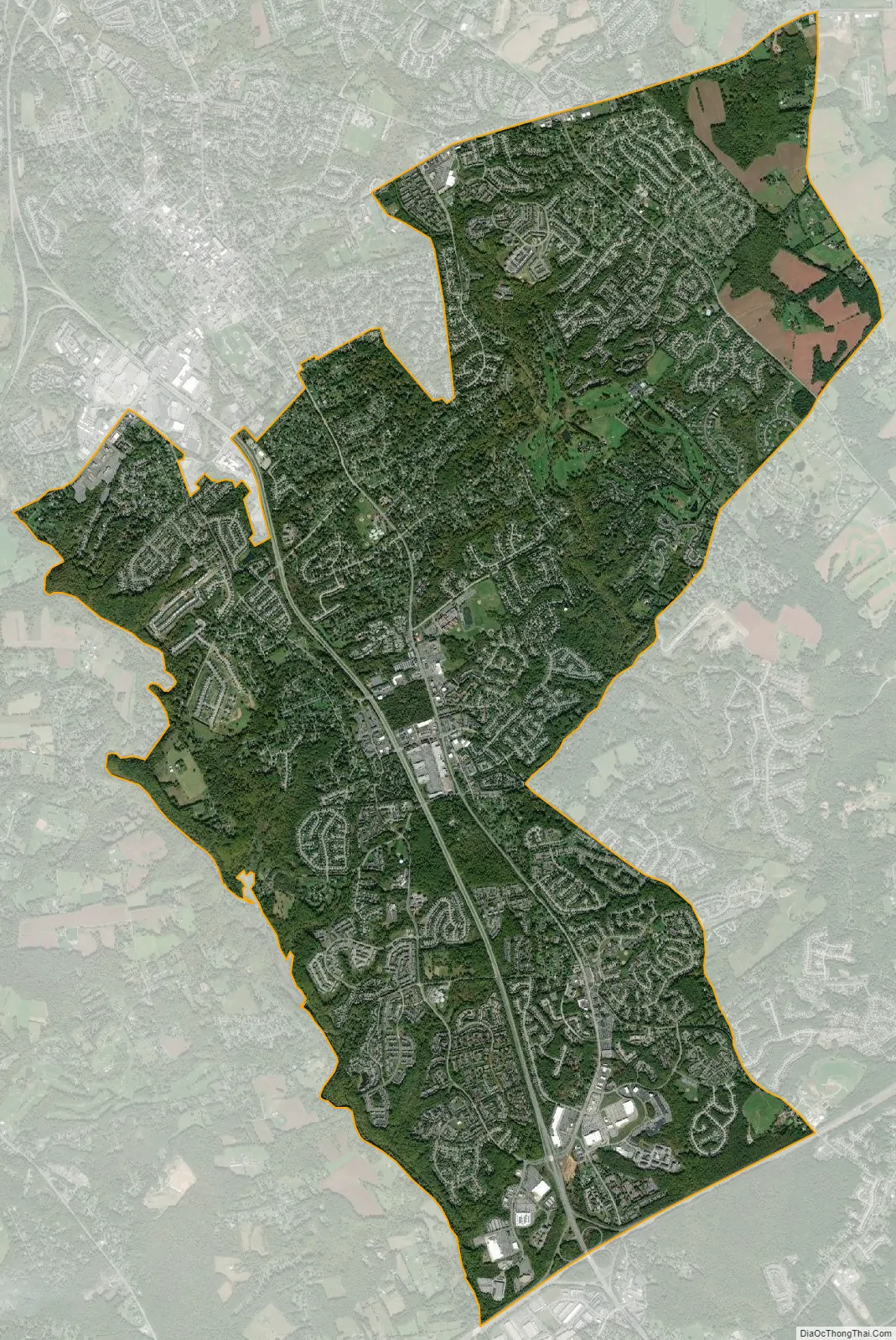
Bel Air South city Satellite Map
Geography
Bel Air South is located southwest of the center of Harford County at 39°30′10″N 76°19′8″W / 39.50278°N 76.31889°W / 39.50278; -76.31889 (39.502757, −76.318971). It is bordered to the north by the town of Bel Air (the Harford County seat) and the Bel Air North CDP. It is bordered to the south by Edgewood.
From the Bel Air town limits, the boundary of the Bel Air South CDP follows:
- Maryland Route 22 (Churchville Road) east to Schucks Road
- Schucks Road south to East Wheel Road
- East Wheel Road southwest to Laurel Bush Road
- Laurel Bush Road southeast to Abingdon Road
- Abingdon Road southeast to Interstate 95
- Interstate 95 southwest to Winters Run (I-95 forms the boundary with Edgewood)
- Winters Run northwest (upstream) to Baltimore Pike
- Baltimore Pike northeast to the Bel Air town limits.
Maryland Route 24 is the main road through the CDP, leading north into Bel Air and south across I-95 at Exit 77 to Edgewood. Via I-95, Baltimore is 22 miles (35 km) to the southwest.
According to the United States Census Bureau, the Bel Air South CDP has a total area of 15.8 square miles (40.8 km), of which 15.7 square miles (40.6 km) are land and 0.1 square miles (0.2 km), or 0.46%, are water.
The unincorporated community of Emmorton is near the geographic center of the CDP. Fountain Green is an unincorporated community in the northeast part of the CDP.
See also
Map of Maryland State and its subdivision: Map of other states:- Alabama
- Alaska
- Arizona
- Arkansas
- California
- Colorado
- Connecticut
- Delaware
- District of Columbia
- Florida
- Georgia
- Hawaii
- Idaho
- Illinois
- Indiana
- Iowa
- Kansas
- Kentucky
- Louisiana
- Maine
- Maryland
- Massachusetts
- Michigan
- Minnesota
- Mississippi
- Missouri
- Montana
- Nebraska
- Nevada
- New Hampshire
- New Jersey
- New Mexico
- New York
- North Carolina
- North Dakota
- Ohio
- Oklahoma
- Oregon
- Pennsylvania
- Rhode Island
- South Carolina
- South Dakota
- Tennessee
- Texas
- Utah
- Vermont
- Virginia
- Washington
- West Virginia
- Wisconsin
- Wyoming