Havre de Grace (/hævər dɪˈɡreɪs/), abbreviated HdG, is a city in Harford County, Maryland. It is situated at the mouth of the Susquehanna River and the head of Chesapeake Bay. It is named after the port city of Le Havre, France, which in full was once Le Havre de Grâce (French, “Harbor of Grace”).
The population was 12,952 at the 2010 U.S. census. In 2014, Smithsonian magazine called it one of the 20 best small U.S. towns to visit.
| Name: | Havre de Grace city |
|---|---|
| LSAD Code: | 25 |
| LSAD Description: | city (suffix) |
| State: | Maryland |
| County: | Harford County |
| Incorporated: | 1785 |
| Elevation: | 56 ft (17 m) |
| Total Area: | 6.32 sq mi (16.37 km²) |
| Land Area: | 5.89 sq mi (15.25 km²) |
| Water Area: | 0.43 sq mi (1.12 km²) 20.17% |
| Total Population: | 14,807 |
| Population Density: | 2,514.35/sq mi (970.83/km²) |
| ZIP code: | 21078 |
| Area code: | 410 |
| FIPS code: | 2437600 |
| GNISfeature ID: | 0590437 |
| Website: | www.havredegracemd.com |
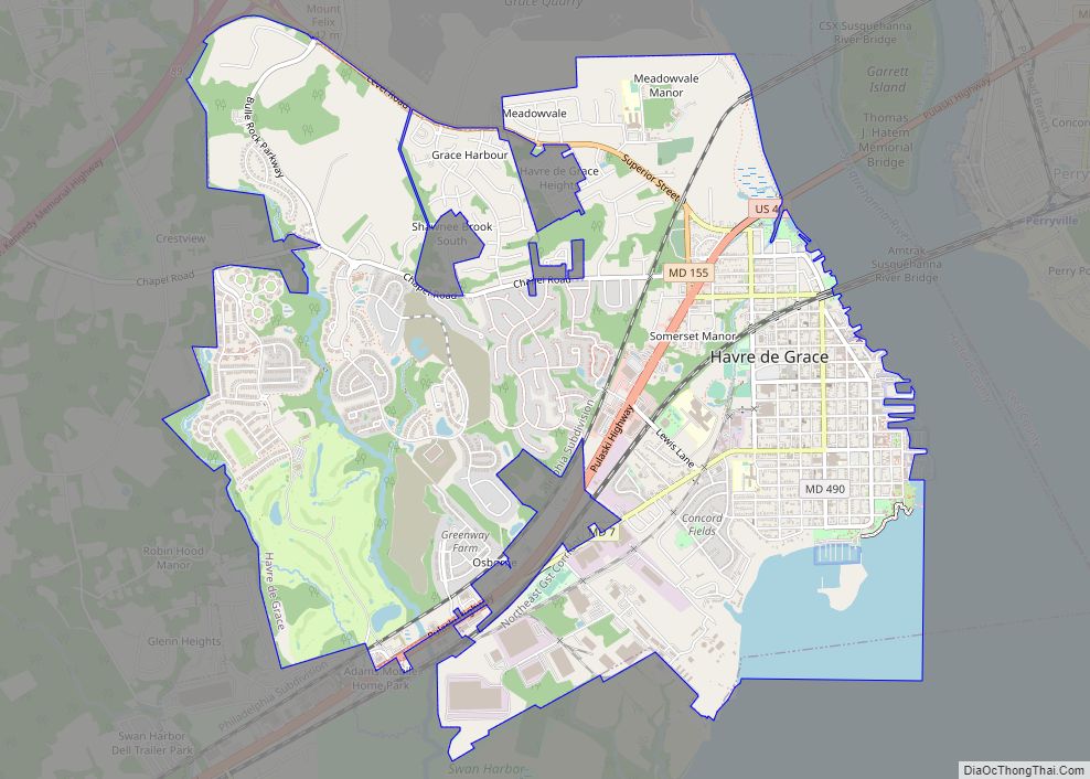
Online Interactive Map
Click on ![]() to view map in "full screen" mode.
to view map in "full screen" mode.
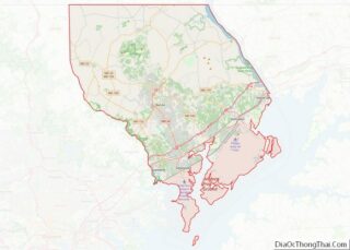
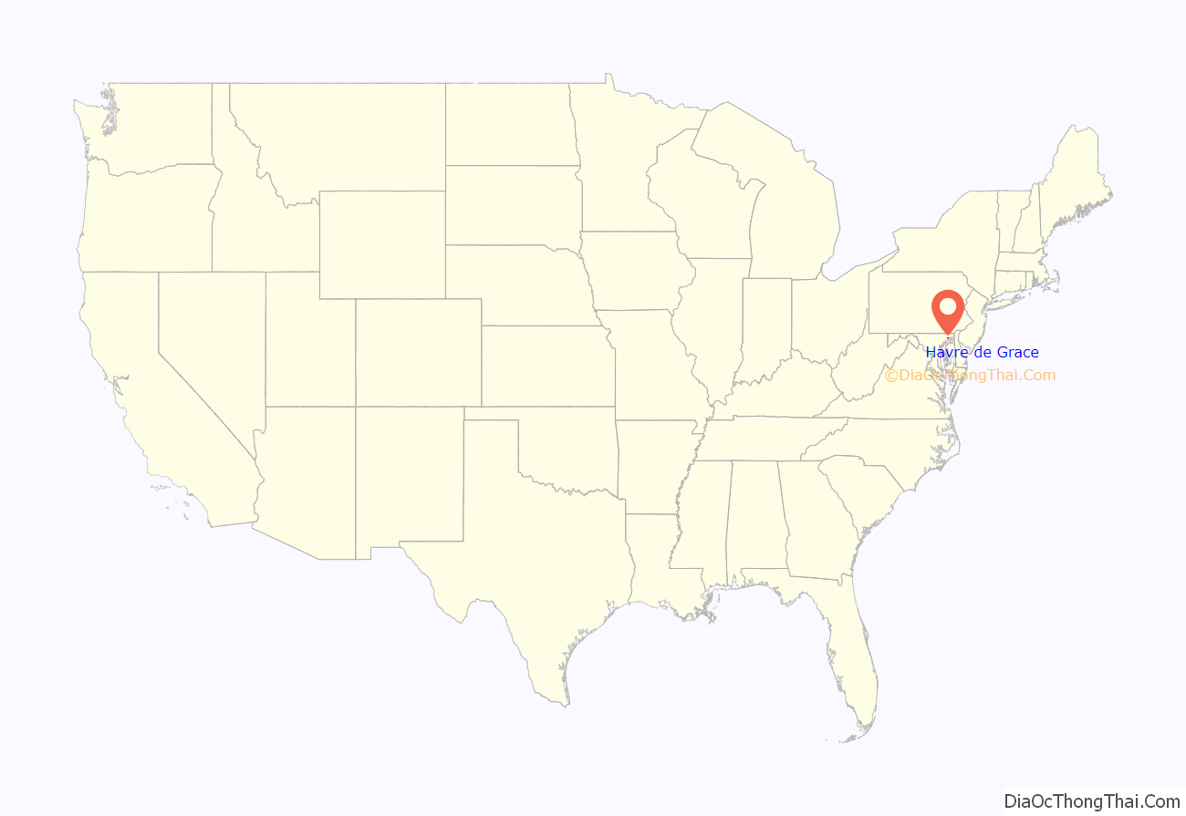
Havre de Grace location map. Where is Havre de Grace city?
History
Early history
During the Revolutionary War, the small hamlet known as Harmer’s Town was visited several times by General Lafayette, who became considered a hero of the war. He commented that the area reminded him of the French seaport of Le Havre on the English Channel. It had originally been named Le Havre-de-Grâce. Inspired by Lafayette’s comments, the residents incorporated the town as Havre de Grace in 1785.
George Washington stayed overnight in the town in 1789 on the journey to New York City for his first inauguration. During the First Congress in 1789, Havre de Grace missed by only one vote being named the capital of the fledgling United States.
19th century
On May 3, 1813, during the War of 1812, Havre de Grace was attacked by British Rear Admiral George Cockburn whose marines burned and plundered the village. American Lieutenant John O’Neill single-handedly manned a cannon to help defend the town. He was wounded, captured by the British, and soon released. In gratitude, Havre de Grace made O’Neill and his descendants the hereditary keepers of the Concord Point lighthouse, which marks the mouth of the Susquehanna River.
The early industry of Havre de Grace included oyster and crab harvesting. Extensive fruit orchards were cultivated in and near the town. Products were shipped to markets along the East Coast and upriver.
The town was the southern terminus for the Proprietors of the Susquehanna Canal and later the Susquehanna and Tidewater Canal. This was built to bypass difficult navigational areas of the lower Susquehanna River between Havre de Grace and Wrightsville, Pennsylvania, where it connected to the Pennsylvania Canal. It was built between 1836 and 1840. Operations on the canal declined after 1855 because of competition from railroads, which could carry freight more quickly. The Lock Keeper’s house and remnants of the canal exist today as a museum.
Havre de Grace was a primary town on the Eastern route of the Underground Railroad in Maryland, as refugee slaves could cross the Susquehanna to havens in the free state of Pennsylvania, traveling on to Philadelphia and New York. Prior to 1840, escaped slaves from communities along the western shore of the Chesapeake Bay came to Havre de Grace and often took the ferry across the Susquehanna River to safe sites in Lancaster and Chester counties in Pennsylvania. When “vigilance increased at the ferry”, the African-American refugees were guided upriver to cross to Columbia, Pennsylvania, a town established by abolitionist Quakers. Because Havre de Grace had varied transportation across the river, refugees were often successful in making their way to the North.
In the 19th century, Havre de Grace became known for duck hunting, and was a seasonal destination for hunters. They stayed at the town hotels and hired local guides to escort them hunting on the river and along the bay. Local artisans became known for making high quality decoys, which they carved and painted. Prime examples are displayed today at the Decoy Museum of the city.
By the 1860s, a large population of free African Americans had settled in the town. It had enough business to support independent artisans, and numerous jobs associated with shipping on the river and canal and, increasingly, with the railroads. During the American Civil War, this town was one of seven sites where the Army recruited for volunteers for the U.S. Colored Troops, composed of African-American men. Although located in the tidewater area of Harford County, which still had large plantations and slaveholders, the city’s river and canals tied it to northern industry and trade in Pennsylvania and beyond. These provided urban jobs for free blacks, and the town had a strong proportion of Northern sympathizers among whites.
In 1878, the town became a city and established its own government. Shortly after 1878, Stephen J. Seneca opened a fruit-packing factory in the S. J. Seneca Warehouse, with a tin can factory next to Havre de Grace Waterfront. Seneca made improvements to canning with his patents, such as the “Can-soldering machines” of 1889, and 1891. By 1899, Seneca had become a canned goods broker. The first railroad was constructed along St. Clair Street (now Pennington Ave.) to the river, so Seneca’s factory was well-positioned for both water and rail shipping. Up until the Second World War, many farmers in Harford County brought their produce to the Seneca Factory (later run as Stockhams Cannery). S.J. Seneca lived at 200 North Union Ave., served as Mayor of Havre de Grace (1893-1894), and donated funds and land to build the Methodist Church.
The Seneca cannery, now adapted for use as an antique shop, is a very good example of a late 19th-century brick industrial building. It has a severely classical facade and massive stone buttresses at the rear.
20th century
Many patents followed the opening of the S. J. Seneca Cannery. 1901 The Baling-press. 1905 The Cooker 1905 The Tomato-scalder. 1917 Improved Tomato-scalder. 1917 The Can-opener. 1918 The Machine for peeling tomatoes.
Havre de Grace was known as “The Graw” from 1912 through the 1950s. It prospered as a stop for north–south travelers. These included gangsters and gamblers en route to New York City from the South following the “pony routes”. The Havre de Grace Racetrack operated from 1912 to 1950. Chicago gangster Al Capone was reported to have stayed at the former “Chesapeake Hotel” (now known as “Backfin Blues; Creole de Graw”). At the end of the 1950s, the state removed the horse track. Its race and betting rights were bought by the larger Pimlico Race Course in Baltimore.
In 1949, the city denied a license to use a city park and arrested a Jehovah’s Witnesses preacher. The resulting case reached the US Supreme Court; in Niemotko v. Maryland (1951), the court ruled that Jehovah’s Witnesses were protected by constitutional rights to the free exercise of religion, and the city should have granted them the permit to speak in the park.
A few tenant farmhouses remain from the large Mitchel plantation that overlooked the city. In the 1980s, Havre de Grace began to undergo extensive redevelopment as people were attracted to its unique character. Historic properties were renovated and sometimes adapted for new uses. In addition, former farmland was redeveloped for construction of new houses and, later, townhouse communities. It became a destination for people with “second homes” for vacations on the bay and retirees. Historic lands and older forests are being cleared, and expensive houses are now extending and growing along Chapel Road northwest toward Webster Village. Since the late 20th century, the city has benefited through development of new properties, antique stores, and other retail venues.
Per capita income doubled in the city from 1990 to 2000, with the arrival of wealthier residents to the newer suburban projects around and in the city. Some commute to jobs elsewhere; others are retirees. New suburban developments since the 1990s brought thousands of middle-to-upper-class residents to the town. Many working-class citizens who used to live in the city have been displaced by rising property values and gentrification.
21st century
In September 2003, Hurricane Isabel flooded the city about two blocks into downtown, destroying the promenade. It was rebuilt in 2004, with help from Americorps NCCC. Today, it serves as a waterfront boardwalk and nature walk from Tydings Park to the Maritime Museum, and on to Concord Point Lighthouse.
Havre de Grace expanded in the early 21st century by annexing land. Housing development is moderate but steady.
Havre de Grace has been affected by the BRAC activities of the Department of Defense. DOD recently moved activities and personnel from various bases to the Aberdeen Proving Ground (APG), a few miles away, which has added to the demand for housing and services.
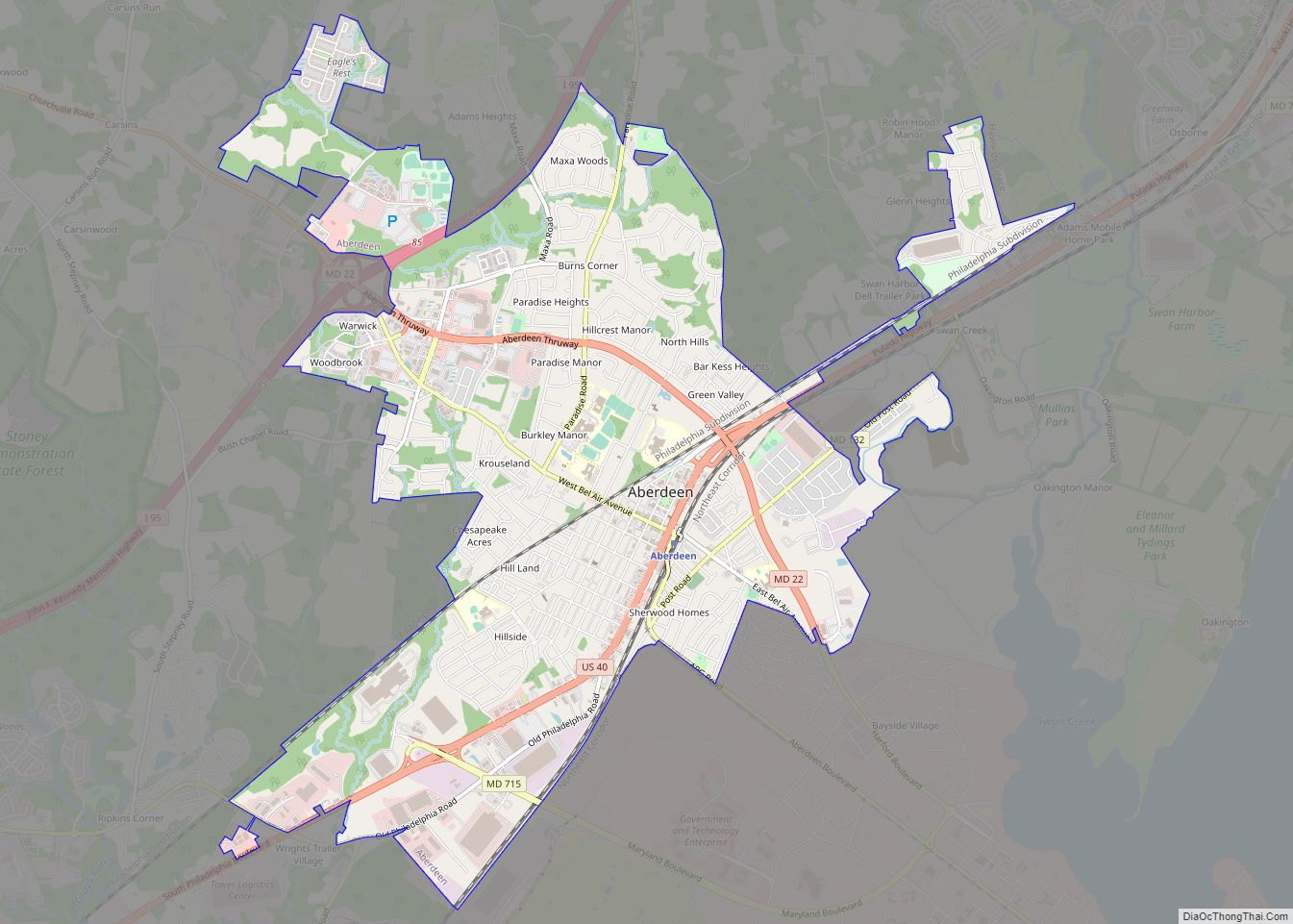
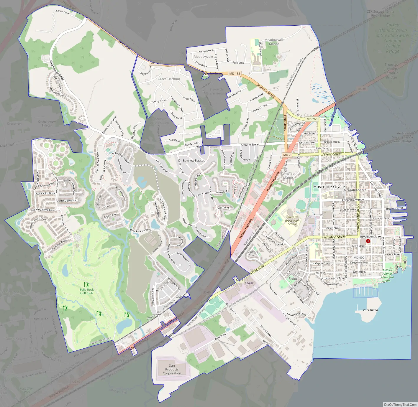
Havre de Grace Road Map
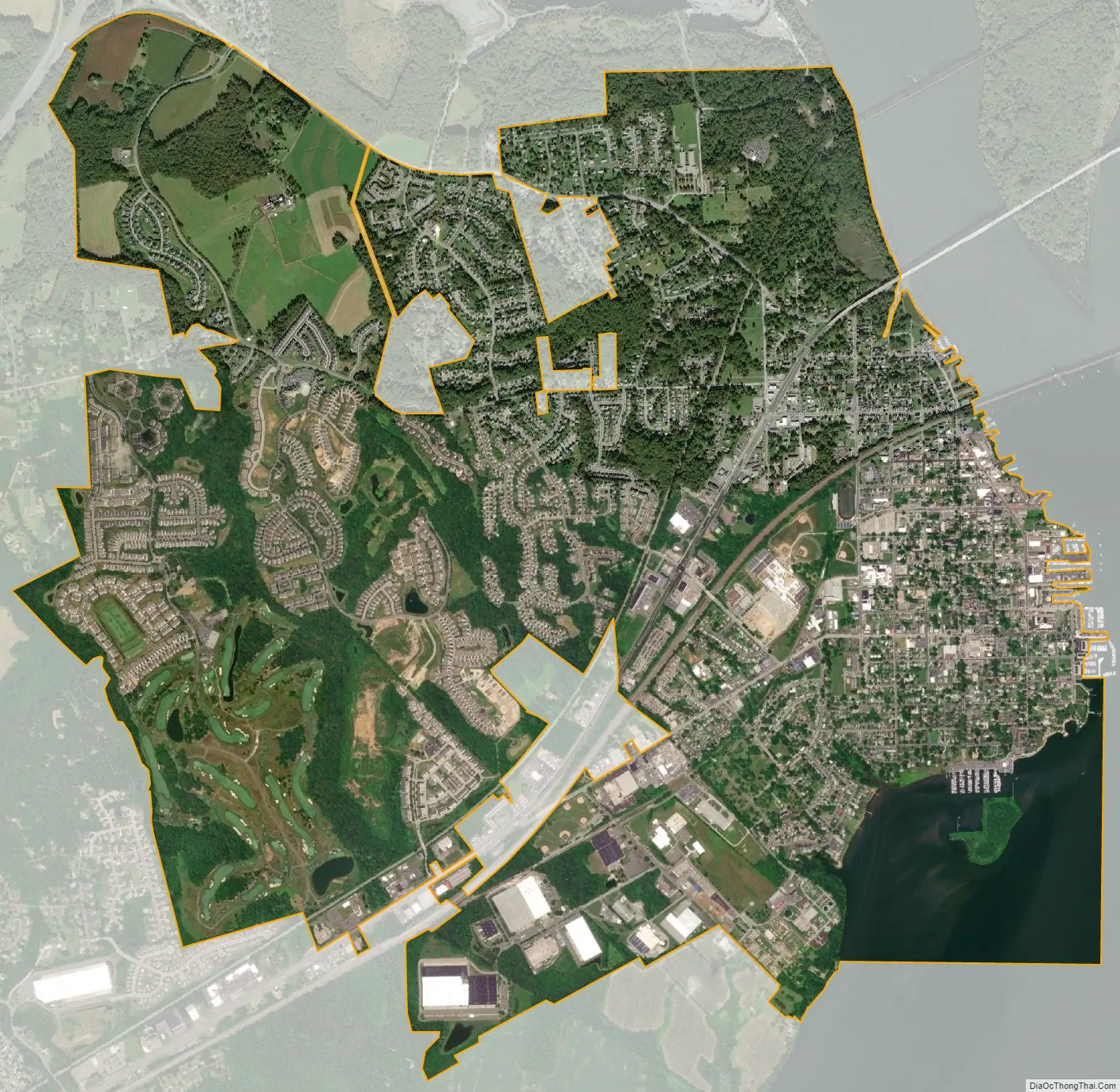
Havre de Grace city Satellite Map
Geography
Havre de Grace is located at 39°32′54″N 76°5′51″W / 39.54833°N 76.09750°W / 39.54833; -76.09750 (39.548412, −76.097554) at the mouth of the Susquehanna River.
According to the U.S. Census Bureau, the city has a total area of 6.89 square miles (17.85 km), of which 5.50 square miles (14.24 km) is land and 1.39 square miles (3.60 km) is water.
Havre de Grace is 40 miles (64 km) northeast of Baltimore, 40 miles (64 km) west of Wilmington, Delaware, 68 miles (109 km) southwest of Philadelphia, 75 miles (121 km) northeast of Washington, D.C., and 154 miles (248 km) southwest of New York City.
Climate
The climate in this area is characterized by hot, humid summers and generally mild to cool winters. According to the Köppen Climate Classification system, Havre de Grace has a humid subtropical climate, abbreviated “Cfa” on climate maps.
See also
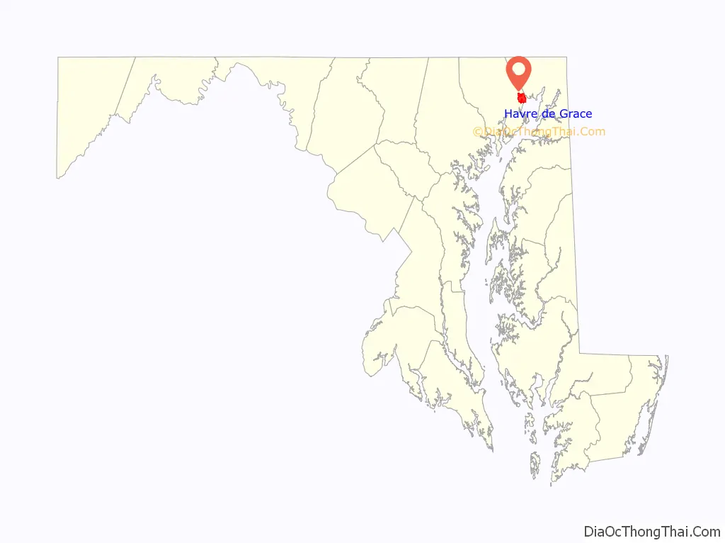
Map of Maryland State and its subdivision: Map of other states:- Alabama
- Alaska
- Arizona
- Arkansas
- California
- Colorado
- Connecticut
- Delaware
- District of Columbia
- Florida
- Georgia
- Hawaii
- Idaho
- Illinois
- Indiana
- Iowa
- Kansas
- Kentucky
- Louisiana
- Maine
- Maryland
- Massachusetts
- Michigan
- Minnesota
- Mississippi
- Missouri
- Montana
- Nebraska
- Nevada
- New Hampshire
- New Jersey
- New Mexico
- New York
- North Carolina
- North Dakota
- Ohio
- Oklahoma
- Oregon
- Pennsylvania
- Rhode Island
- South Carolina
- South Dakota
- Tennessee
- Texas
- Utah
- Vermont
- Virginia
- Washington
- West Virginia
- Wisconsin
- Wyoming