Fallston is a census-designated place (CDP) in Harford County, Maryland, United States. The population was 8,958 at the 2010 census, up from 8,427 in 2000. Fallston is a semi-rural community consisting mostly of farms and suburban-like developments.
| Name: | Fallston CDP |
|---|---|
| LSAD Code: | 57 |
| LSAD Description: | CDP (suffix) |
| State: | Maryland |
| County: | Harford County |
| Elevation: | 466 ft (142 m) |
| Total Area: | 14.02 sq mi (36.32 km²) |
| Land Area: | 14.00 sq mi (36.26 km²) |
| Water Area: | 0.03 sq mi (0.07 km²) |
| Total Population: | 9,306 |
| Population Density: | 664.81/sq mi (256.68/km²) |
| ZIP code: | 21047 |
| Area code: | 410, 443 |
| FIPS code: | 2427700 |
| GNISfeature ID: | 0584343 |
Online Interactive Map
Click on ![]() to view map in "full screen" mode.
to view map in "full screen" mode.
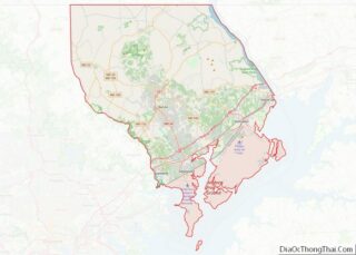
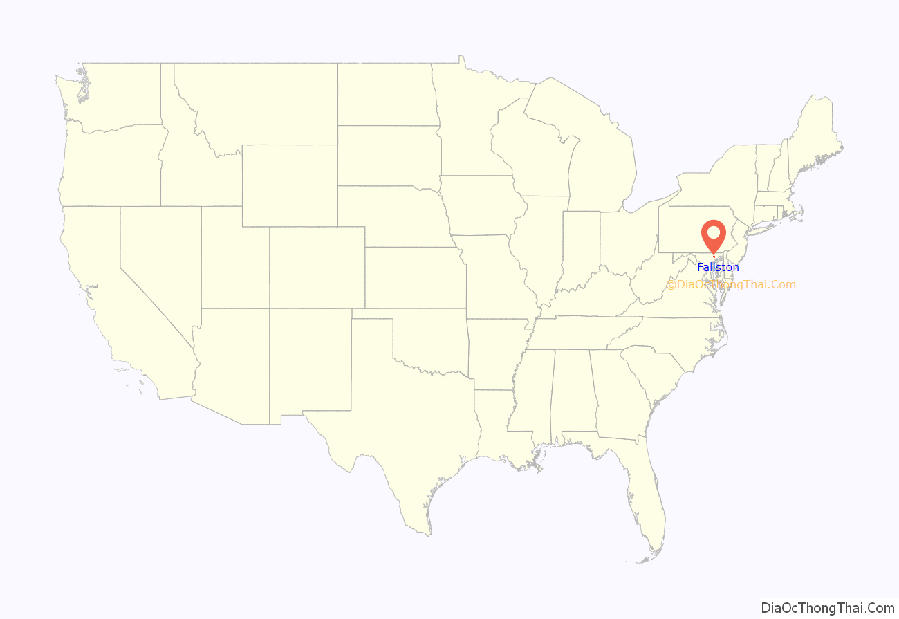
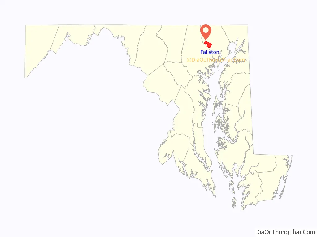
Fallston location map. Where is Fallston CDP?
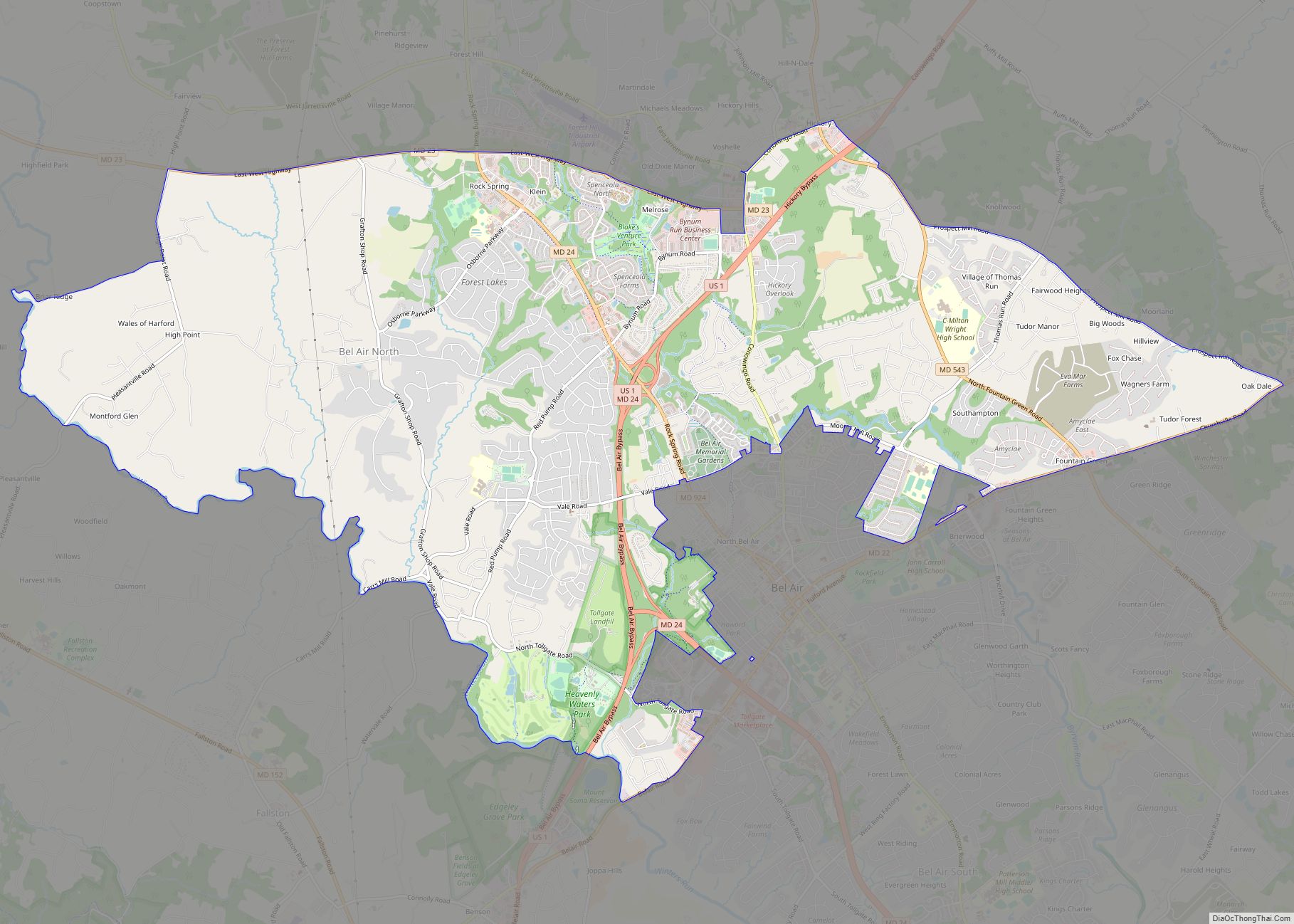
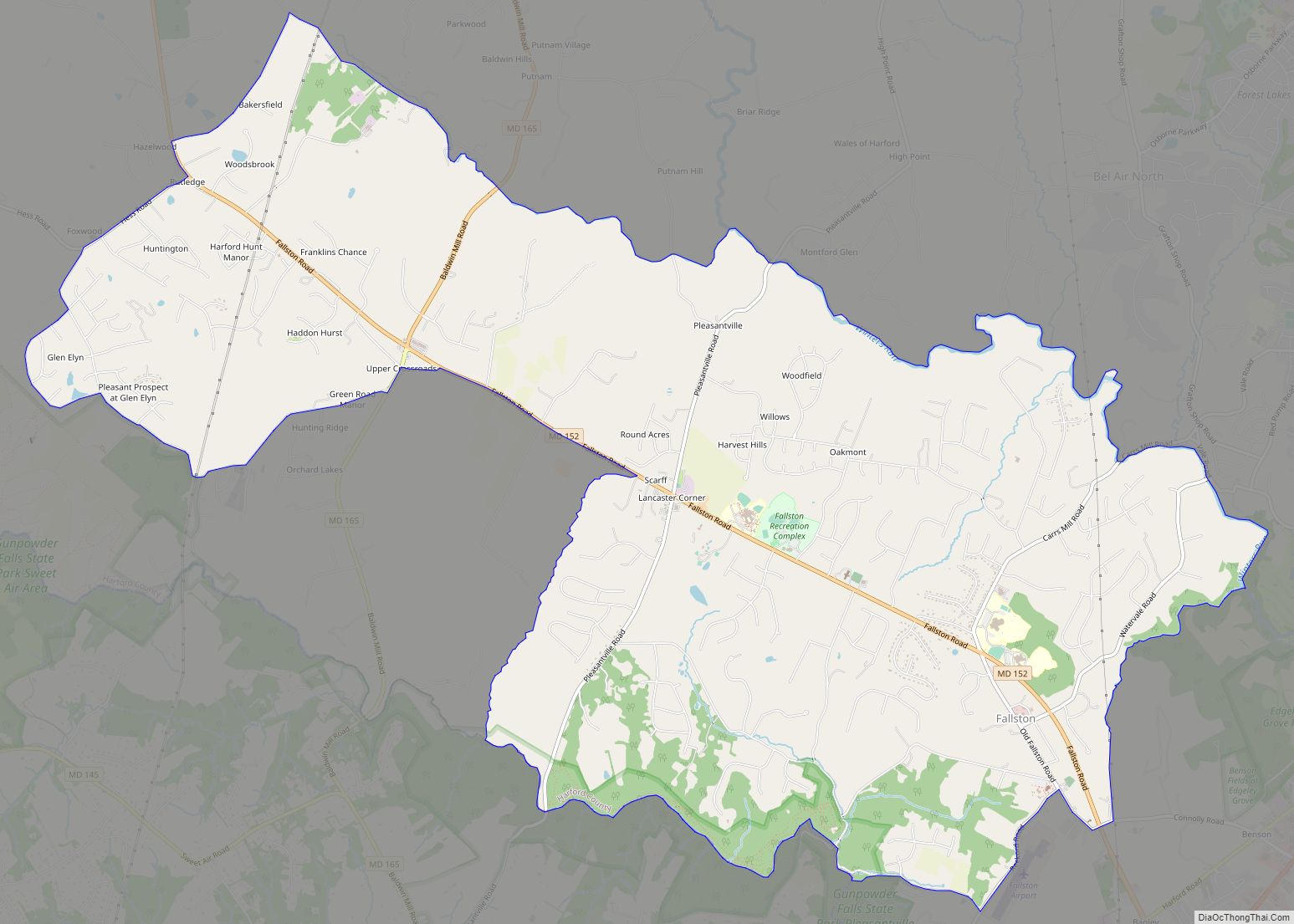
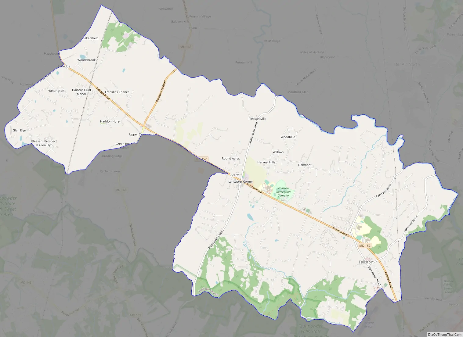
Fallston Road Map
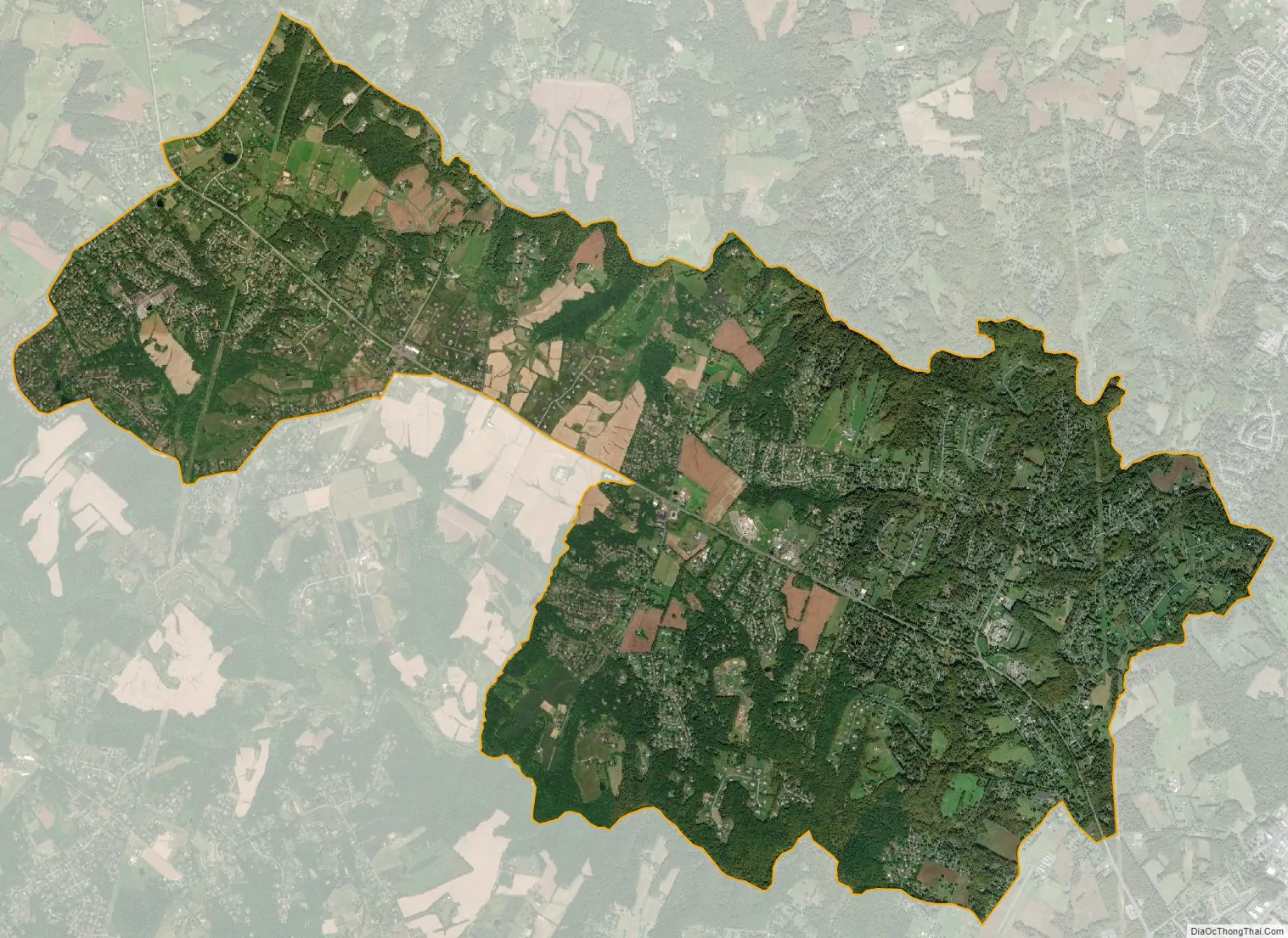
Fallston city Satellite Map
Geography
Fallston is located in western Harford County at 39°31′55″N 76°26′17″W / 39.53194°N 76.43806°W / 39.53194; -76.43806 (39.532006, −76.438021). It is bordered to the south by Baltimore County and to the northeast by the Bel Air North CDP. The Little Gunpowder Falls river forms the southern border of the Fallston CDP and the county line, while Winters Run forms the border with Bel Air North.
Maryland Route 152 is the main road through Fallston, leading southeast 6 miles (10 km) to Interstate 95 at Exit 74 and northwest 7 miles (11 km) to Maryland Route 146 near Jarrettsville. The original community of Fallston is in the southeastern part of the CDP on Old Fallston Road just southwest of MD 152, and the CDP extends northwest along MD 152 to Hess Road and Engle Road. Maryland Route 165 passes through the west side of the Fallston CDP, crossing MD 152 at Upper Crossroads, and leads north 4 miles (6 km) to Jarrettsville and south four miles to Baldwin in Baltimore County. Fallston is 30 miles (48 km) northeast of downtown Baltimore via MD 152 and I-95.
According to the United States Census Bureau, the Fallston CDP has a total area of 14.0 square miles (36.3 km), of which 0.03 square miles (0.07 km), or 0.20%, are water.
Bon Air, Little Falls Meetinghouse and Rockdale are listed on the National Register of Historic Places.
See also
Map of Maryland State and its subdivision: Map of other states:- Alabama
- Alaska
- Arizona
- Arkansas
- California
- Colorado
- Connecticut
- Delaware
- District of Columbia
- Florida
- Georgia
- Hawaii
- Idaho
- Illinois
- Indiana
- Iowa
- Kansas
- Kentucky
- Louisiana
- Maine
- Maryland
- Massachusetts
- Michigan
- Minnesota
- Mississippi
- Missouri
- Montana
- Nebraska
- Nevada
- New Hampshire
- New Jersey
- New Mexico
- New York
- North Carolina
- North Dakota
- Ohio
- Oklahoma
- Oregon
- Pennsylvania
- Rhode Island
- South Carolina
- South Dakota
- Tennessee
- Texas
- Utah
- Vermont
- Virginia
- Washington
- West Virginia
- Wisconsin
- Wyoming