Edmonston is a town in Prince George’s County, Maryland, United States. As of the 2010 census, the town population was 1,445.
The community is located 2.5 miles (4.0 km) from Washington, D.C. Edmonston’s ZIP code is 20781.
| Name: | Edmonston town |
|---|---|
| LSAD Code: | 43 |
| LSAD Description: | town (suffix) |
| State: | Maryland |
| County: | Prince George’s County |
| Incorporated: | 1924 |
| Elevation: | 20 ft (6 m) |
| Total Area: | 0.42 sq mi (1.09 km²) |
| Land Area: | 0.41 sq mi (1.06 km²) |
| Water Area: | 0.01 sq mi (0.03 km²) |
| Total Population: | 1,617 |
| Population Density: | 3,963.24/sq mi (1,528.66/km²) |
| ZIP code: | 20781 |
| Area code: | 301, 240 |
| FIPS code: | 2425425 |
| GNISfeature ID: | 0597374 |
| Website: | www.edmonstonmd.gov |
Online Interactive Map
Click on ![]() to view map in "full screen" mode.
to view map in "full screen" mode.
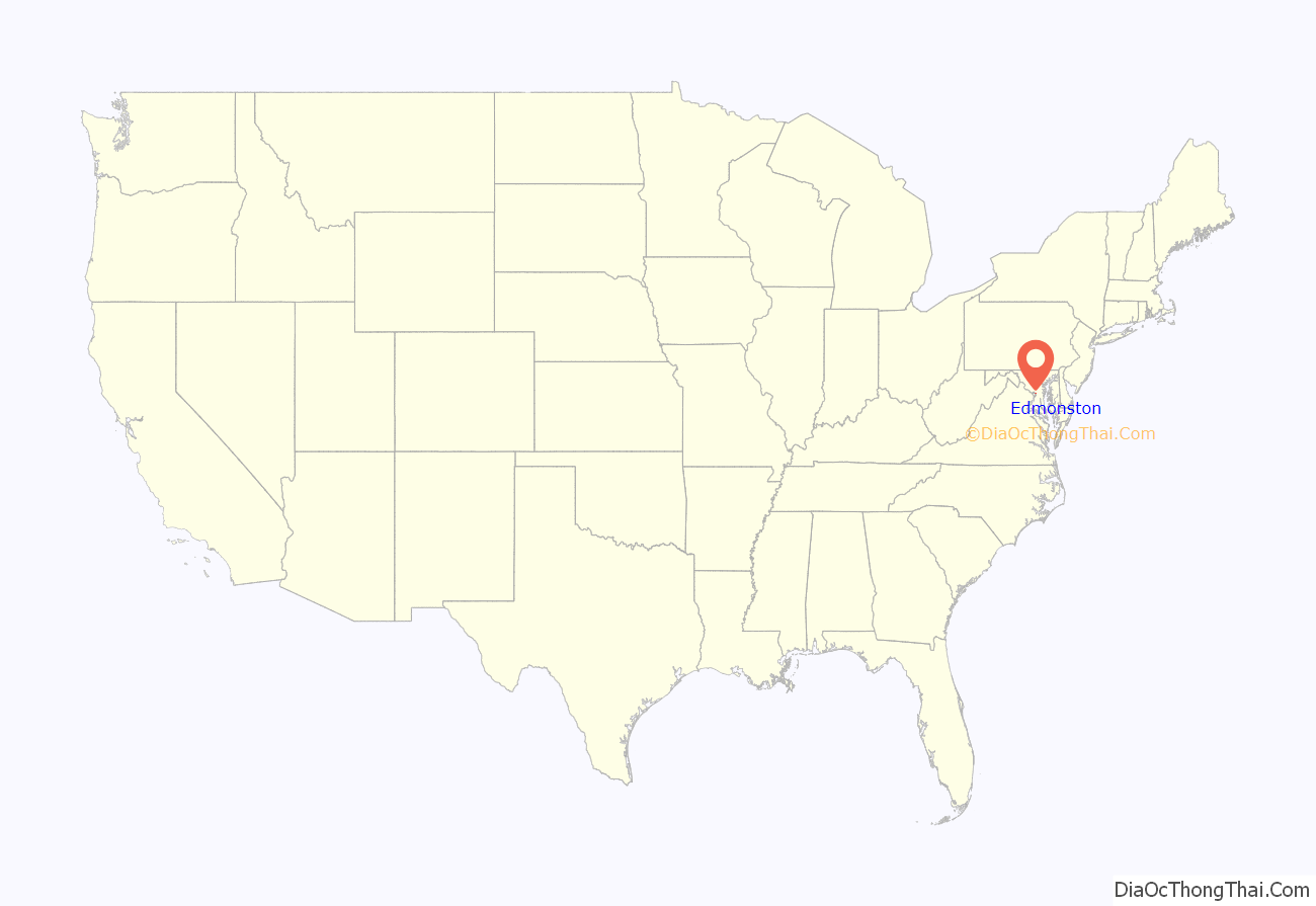
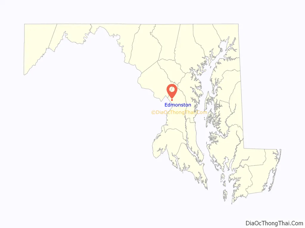
Edmonston location map. Where is Edmonston town?
History
The area of present-day Edmonston probably acquired its name from Captain James Edmonston, a member of a prominent Bladensburg, Maryland, family. He was called “Captain” because he owned a large ship. In 1742, he paid five shillings for a piece of land upon which the town of Edmonston eventually developed. The Edmonston Family had been active in local Revolutionary War effort and were descendants of the Family Edmonstone of Duntreath Castle, Scotland.
The first modern settlers of the community were Adam Francis Plummer and his wife Emily Saunders Arnold Plummer, who had been slaves of the powerful Calvert family on the Riversdale Plantation in present-day Riverdale Park. After the Civil War, Adam Plummer purchased ten acres of land for $1000, south of the plantation and sought out and recovered family members that had been sold during slavery to deep south plantations, thus establishing the settlement. A skilled horticulturalist, Plummer named the settlement Mt. Rose after his favorite plant and copious rose gardens. Notably, Adam Plummer kept a diary as a slave which today is the only known living slave diary and is a featured exhibit of the Smithsonian Institution’s Anacostia Community Museum.
Two subdivisions that would later comprise the town of Edmonston were platted in 1903: East Hyattsville and Palestine. The eastern section was developed in 1903 by J. Harris Rogers on two parcels of land he purchased in the 1880s and 1890s. Rogers platted 70 acres (280,000 m) into a subdivision of more than 170 lots known as East Hyattsville. The western half began with the subdivision of Dr. Charles A. Wells. Wells purchased the 90-acre (360,000 m) Palestine Farm from Benjamin Franklin Guy in 1878 and 1879 and continued the farm’s dairy operations until 1903. In that year, 25 of the farm’s acres were subdivided into 62 building lots of various sizes. Within the first decade, 55 houses were constructed in both subdivisions and many of them remain today. The earliest buildings were simple vernacular buildings such as the “I” house that were later adapted to the constraints of the narrow suburban building lot.
In the late 19th century, a pumping station was constructed in the Palestine subdivision that supplied water to the city of Hyattsville. In 1920, operations were taken over by the Washington Suburban Sanitary Commission. Also in the Palestine subdivision was the first school to serve the future town of Edmonston. Constructed in 1915, the building has undergone several phases of additions and alterations.
After World War I, the residents of East Hyattsville and Palestine began a movement toward incorporation to improve services. Compared to the established Hyattsville, incorporated in 1886, East Hyattsville contained more working class residents, more modest houses, and more immigrants. When incorporating in 1924, the residents decided to choose a name that would give the town an identity independent from Hyattsville and chose “Edmonston” after a major north-south road adjacent to the town and the original landowner. By 1924, there were several hundred residents; at 49th Avenue and Decatur Street, there was a small neighborhood center with a few stores and a post office. Only the small grocery store remains today. The first items on the agenda for the new municipality were street paving and lighting, construction of a concrete bridge across the Anacostia River, and arrangement with the fledgling Washington Suburban Sanitary Commission to bring water and sewer pipes into the town.
Edmonston’s mayor in 1927 was Kinjiro Matsudaira, the grandson of a Japanese feudal lord. His election received attention in the Philadelphia press at the time with the somewhat inaccurate lead, “Japanese Elected Mayor of American City for the First Time in History.” His father, Tadaatsu, came to the United States in 1872 to study and stayed to marry an American woman and pursue a distinguished career in civil engineering. Kinjiro Matsudaira, born in Pennsylvania in 1885, was elected Mayor of Edmonston for a second time in 1943, during World War II.
In 1925, an undeveloped part of the original Palestine subdivision was platted as the Funkhouser subdivision. The land was divided into 40 lots upon which Robert Funkhouser constructed a small bungalow on each. The houses were completed in 1926 and quickly sold. Throughout the 1930s and 1940s, development consisted of sporadic house construction on vacant lots within the established subdivisions. After World War II, the Edmonston Terrace subdivision was constructed consisting of an organized development of 41 nearly identical two-story, brick side-gable houses. Residential construction during the 1950s and 1960s returned to infill. Also constructed during the 1960s was the Fountain Park apartment complex.
From 2003-2006, Edmonston struggled from a series of floods resulting from high volumes of stormwater and the now-inadequate flood pumping station. The Town successfully advocated Prince George’s County Government for a new state-of-the-art $6 million facility, which received recognition for its utilization of three massive Archimedes’ screws, a flood pumping technology developed by the eponymous ancient Greek mathematician rarely utilized on such a scale in the United States.
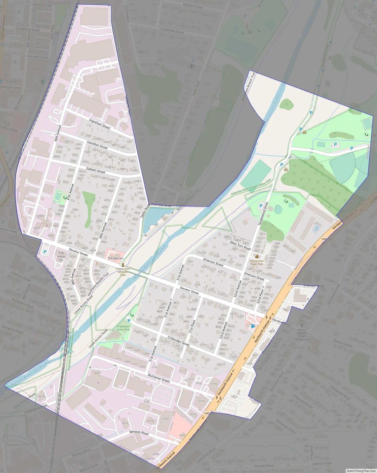
Edmonston Road Map
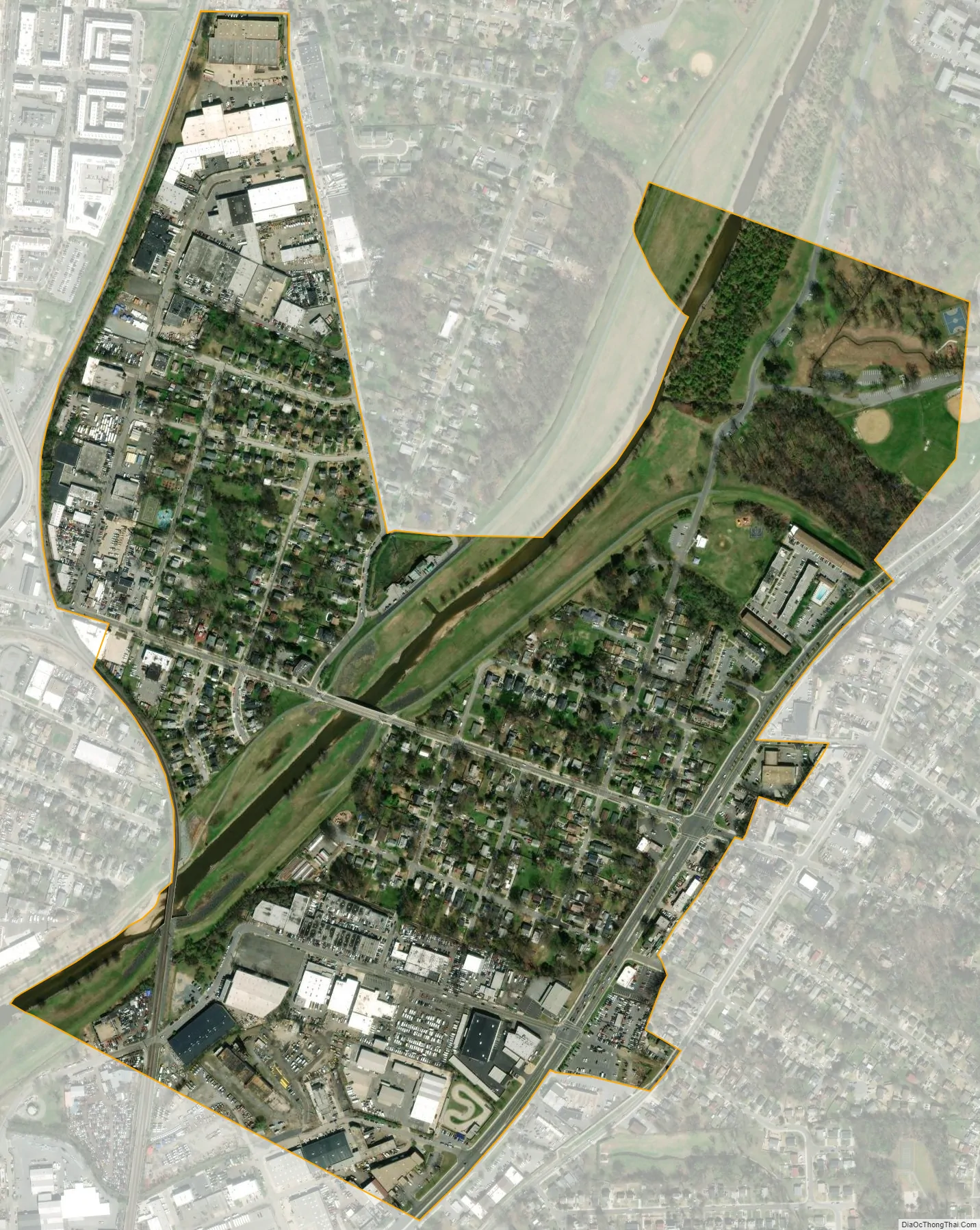
Edmonston city Satellite Map
Geography
Edmonston is located at 38°57′3″N 76°56′0″W / 38.95083°N 76.93333°W / 38.95083; -76.93333 (38.950793, -76.933423).
According to the United States Census Bureau, the town has a total area of 0.40 square miles (1.04 km), of which 0.39 square miles (1.01 km) is land and 0.01 square miles (0.03 km) is water.
See also
Map of Maryland State and its subdivision: Map of other states:- Alabama
- Alaska
- Arizona
- Arkansas
- California
- Colorado
- Connecticut
- Delaware
- District of Columbia
- Florida
- Georgia
- Hawaii
- Idaho
- Illinois
- Indiana
- Iowa
- Kansas
- Kentucky
- Louisiana
- Maine
- Maryland
- Massachusetts
- Michigan
- Minnesota
- Mississippi
- Missouri
- Montana
- Nebraska
- Nevada
- New Hampshire
- New Jersey
- New Mexico
- New York
- North Carolina
- North Dakota
- Ohio
- Oklahoma
- Oregon
- Pennsylvania
- Rhode Island
- South Carolina
- South Dakota
- Tennessee
- Texas
- Utah
- Vermont
- Virginia
- Washington
- West Virginia
- Wisconsin
- Wyoming


