Hyattsville is a city in Prince George’s County, Maryland, United States, and also a close, urban suburb of Washington, D.C. The population was 21,187 at the 2020 United States Census.
| Name: | Hyattsville city |
|---|---|
| LSAD Code: | 25 |
| LSAD Description: | city (suffix) |
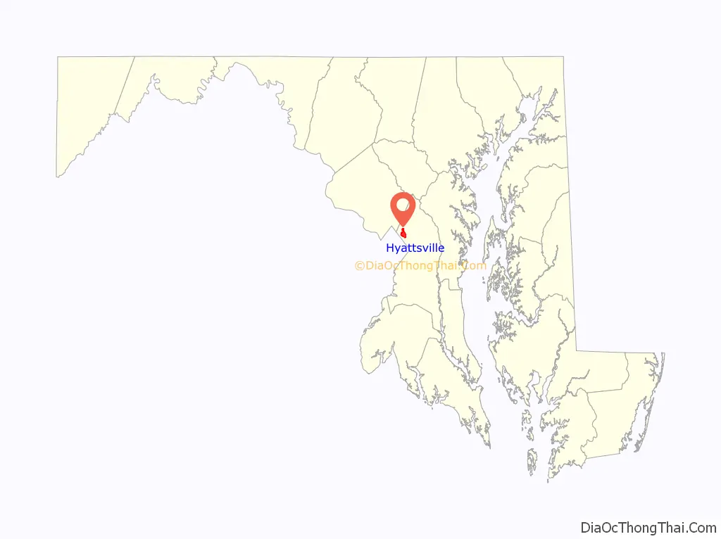
| State: | Maryland |
| County: | Prince George’s County |
| Incorporated: | 1886 |
| Elevation: | 105 ft (32 m) |
| Total Area: | 2.73 sq mi (7.07 km²) |
| Land Area: | 2.71 sq mi (7.01 km²) |
| Water Area: | 0.03 sq mi (0.07 km²) |
| Total Population: | 21,187 |
| Population Density: | 7,832.53/sq mi (3,024.22/km²) |
| Area code: | 301, 240 |
| FIPS code: | 2441250 |
| GNISfeature ID: | 0597595 |
| Website: | www.hyattsville.org |
Online Interactive Map
Click on ![]() to view map in "full screen" mode.
to view map in "full screen" mode.
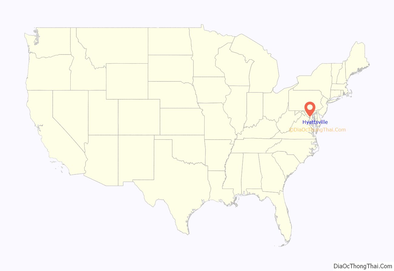
Hyattsville location map. Where is Hyattsville city?
History
Before Europeans reached the area, the upper Anacostia River was home to Nacotchtank/Anaquashtank people, a Piscataway-speaking Algonquian peoples who lived throughout what is now the Washington, D.C. area. European encroachment and diseases decimated their population and by the 1680s the Nacotchtank/Anaquashtank had largely moved away and merged with other tribes. In the 1720s, John Beall acquired land in the area and established Beall Town, but the town did not prosper like its neighbor Bladensburg. The opening of the Washington–Baltimore Turnpike (modern day US 1) in 1812 and the B&O Railroad Washington Branch line in 1835 brought more settlers to the area.
The city’s founder, Christopher Clark Hyatt (1799–1884), purchased his first parcel of land in the area in 1845. Hyatt opened a store and began mail delivery, officially naming the nascent community “Hyattsville” in his 1859 application to become postmaster. In the years following the Civil War, Hyatt and other local landowners subdivided their properties and sold lots, and the population of Hyattsville grew. Hyattsville was incorporated as a city on April 7, 1886.
Revitalization projects
Since 2000, the city has undergone a major redevelopment, including significant residential and retail development in the Arts District Hyattsville (located in the Gateway Arts District), and the area surrounding the Prince George’s Plaza Metro station and The Mall at Prince Georges. In the latter area, University Town Center contains residential condos, student housing, office buildings, a public plaza, and retail space, including a 14-screen movie theater and several restaurants, as well as a campus of Prince George’s Community College. As of 2020, additional residential and retail development is underway near the West Hyattsville Metro station. Along Route 1, craft brewers and distillers have played a notable role in revitalizing old commercial properties.
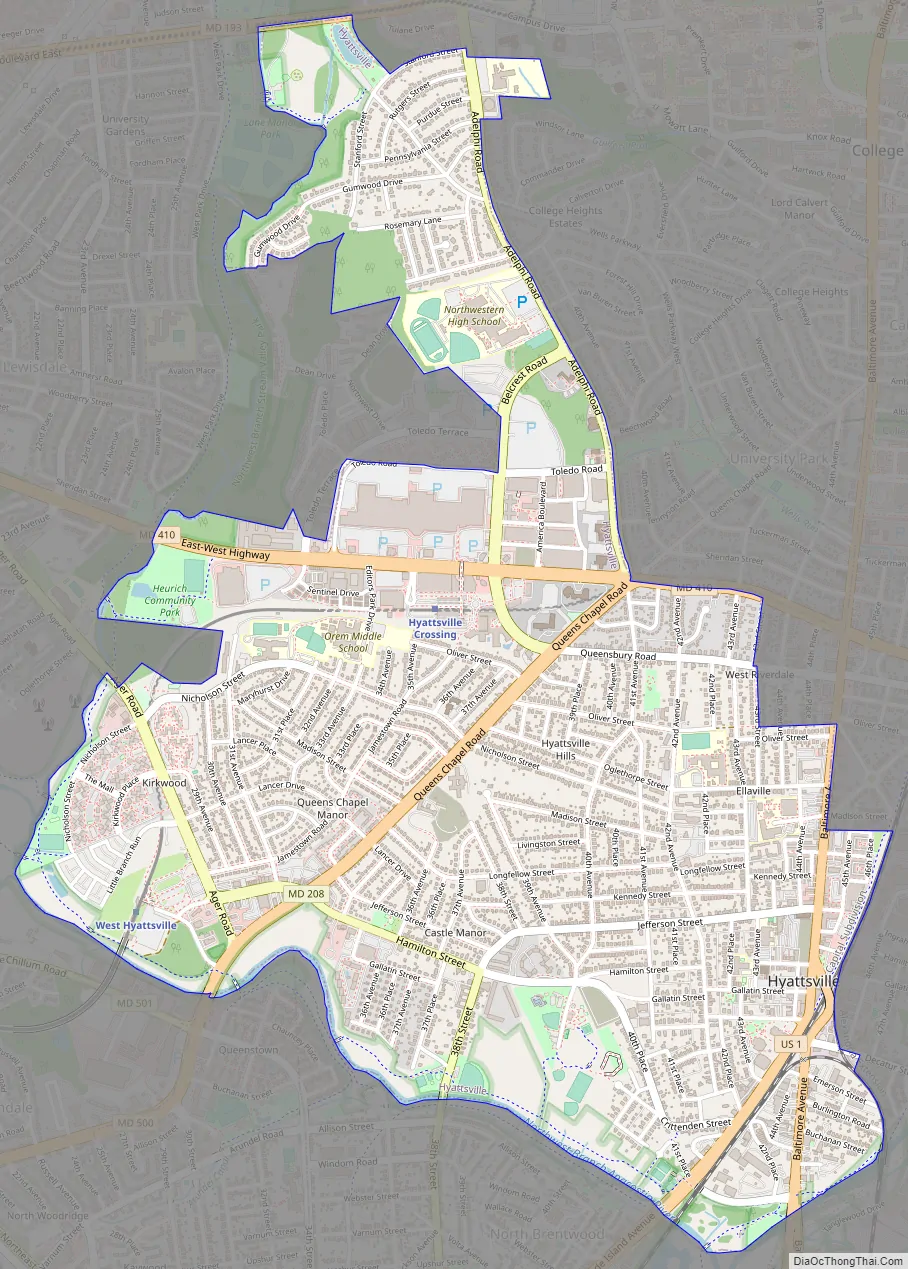
Hyattsville Road Map
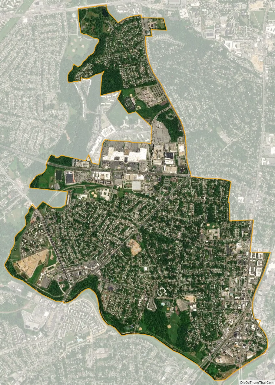
Hyattsville city Satellite Map
Geography
The City of Hyattsville consists of six subdivisions; Hyattsville Hills, Downtown Hyattsville, Kirkwood, Queens Chapel Manor, Castle Manor, and University Hills. Historic Hyattsville reportedly consists of the Hyattsville Hills, Downtown Hyattsville, and Castle Manor subdivisions.
According to the United States Census Bureau, the city has a total area of 2.70 square miles (6.99 km), of which 2.67 square miles (6.92 km) is land and 0.03 square miles (0.08 km) is water.
Climate
Typical of central Maryland, Hyattsville lies within the humid subtropical climate zone (Köppen: Cfa), characterized by hot humid summers and generally cool to mild winters, with high annual precipitation. Hyattsville lies within USDA plant hardiness zone 7a.
See also
Map of Maryland State and its subdivision: Map of other states:- Alabama
- Alaska
- Arizona
- Arkansas
- California
- Colorado
- Connecticut
- Delaware
- District of Columbia
- Florida
- Georgia
- Hawaii
- Idaho
- Illinois
- Indiana
- Iowa
- Kansas
- Kentucky
- Louisiana
- Maine
- Maryland
- Massachusetts
- Michigan
- Minnesota
- Mississippi
- Missouri
- Montana
- Nebraska
- Nevada
- New Hampshire
- New Jersey
- New Mexico
- New York
- North Carolina
- North Dakota
- Ohio
- Oklahoma
- Oregon
- Pennsylvania
- Rhode Island
- South Carolina
- South Dakota
- Tennessee
- Texas
- Utah
- Vermont
- Virginia
- Washington
- West Virginia
- Wisconsin
- Wyoming


