Fairmount Heights is a town in Prince George’s County, Maryland, United States. Per the 2020 census, the population was 1,528. The town was formally incorporated in 1935, making the town the second oldest African-American-majority municipality in Prince George’s County. The town is composed of six subdivisions: Fairmount Heights (1900), Waterford (1907), Mount Weissner (1909), North Fairmount Heights (1910), West Fairmount Heights (1911) and Sylvan Vista (1923).
| Name: | Fairmount Heights town |
|---|---|
| LSAD Code: | 43 |
| LSAD Description: | town (suffix) |
| State: | Maryland |
| County: | Prince George’s County |
| Incorporated: | 1935 |
| Elevation: | 98 ft (30 m) |
| Total Area: | 0.27 sq mi (0.69 km²) |
| Land Area: | 0.27 sq mi (0.69 km²) |
| Water Area: | 0.00 sq mi (0.00 km²) |
| Total Population: | 1,528 |
| Population Density: | 5,766.04/sq mi (2,228.08/km²) |
| Area code: | 301 |
| FIPS code: | 2427400 |
| GNISfeature ID: | 0597387 |
| Website: | www.fairmountheightsmd.gov |
Online Interactive Map
Click on ![]() to view map in "full screen" mode.
to view map in "full screen" mode.
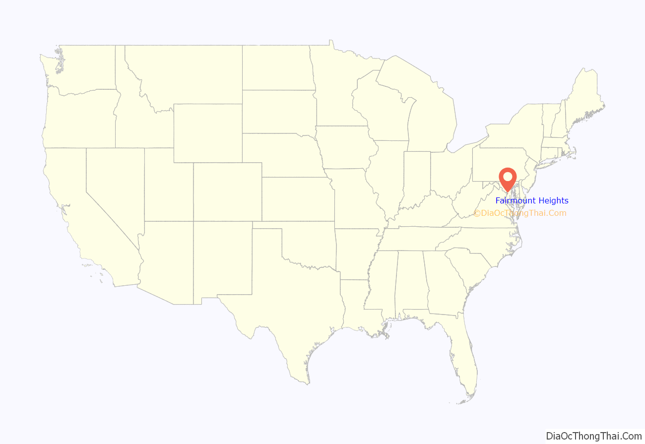
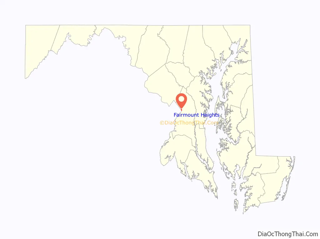
Fairmount Heights location map. Where is Fairmount Heights town?
History
Two Washington, D.C. land developers and lawyers, Allen Clark and Robinson White, platted the first subdivision of Fairmount Heights; separate developers platted the remaining five. Land speculators had purchased the farms that were previously in the area and consolidated the land for development. Clark and White sold the lots to African-Americans. Service on the Washington, Baltimore and Annapolis Electric Railway to the Gregory Station of nearby Seat Pleasant was established in 1908. Fairmount Heights incorporated in 1935 with all six subdivisions. The Fairmount Heights Historic District was added to the National Register of Historic Places in 2011.
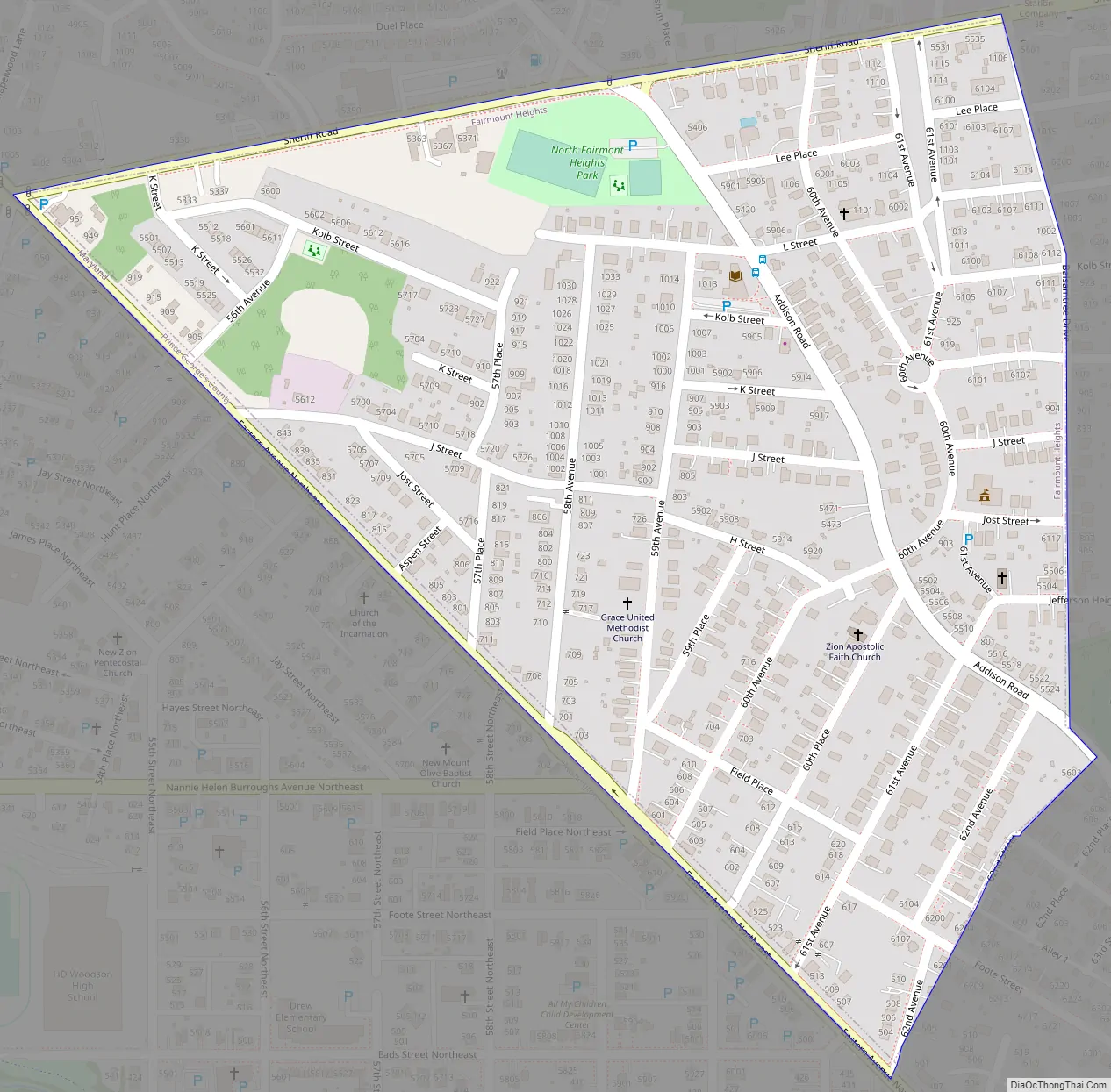
Fairmount Heights Road Map
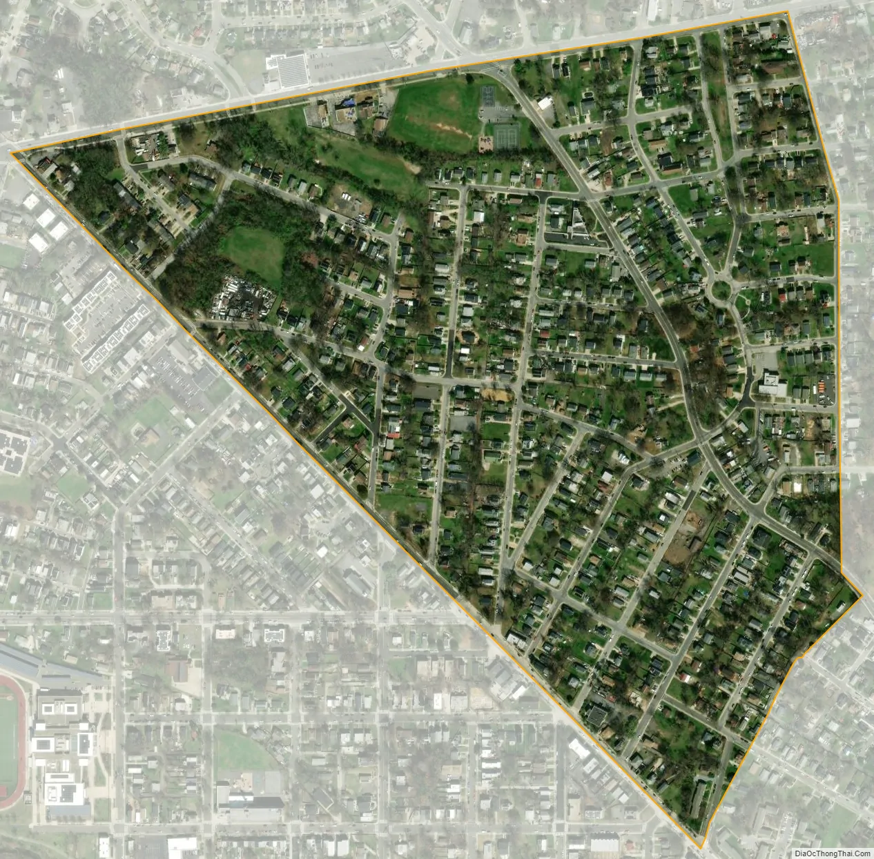
Fairmount Heights city Satellite Map
Geography
Fairmount Heights is located at 38°54′6″N 76°54′52″W / 38.90167°N 76.91444°W / 38.90167; -76.91444 (38.901761, −76.914504).
According to the United States Census Bureau, the town has a total area of 0.27 square miles (0.70 km), all land.
See also
Map of Maryland State and its subdivision: Map of other states:- Alabama
- Alaska
- Arizona
- Arkansas
- California
- Colorado
- Connecticut
- Delaware
- District of Columbia
- Florida
- Georgia
- Hawaii
- Idaho
- Illinois
- Indiana
- Iowa
- Kansas
- Kentucky
- Louisiana
- Maine
- Maryland
- Massachusetts
- Michigan
- Minnesota
- Mississippi
- Missouri
- Montana
- Nebraska
- Nevada
- New Hampshire
- New Jersey
- New Mexico
- New York
- North Carolina
- North Dakota
- Ohio
- Oklahoma
- Oregon
- Pennsylvania
- Rhode Island
- South Carolina
- South Dakota
- Tennessee
- Texas
- Utah
- Vermont
- Virginia
- Washington
- West Virginia
- Wisconsin
- Wyoming


