Gambrills refers to two neighboring places in Anne Arundel County, Maryland, United States, located in the Annapolis metro area: the unincorporated community of Gambrills, and the Gambrills census-designated place (CDP). The area was named after Augustine Gambrill, plantation owner. The CDP covers an expansive range that falls within the communities of Crofton, Waugh Chapel, and Odenton. It also borders Davidsonville, Crownsville, Millersville, and Prince George’s County, Maryland. In 2022, the population of the CDP was 2,837. The median-income of residents was $140,238. Gambrills is served by routes 3, 32 and MARC, the Maryland commuter rail service. There is a MARC station in the neighboring town of Odenton.
| Name: | Gambrills CDP |
|---|---|
| LSAD Code: | 57 |
| LSAD Description: | CDP (suffix) |
| State: | Maryland |
| County: | Anne Arundel County |
| Elevation: | 90 ft (30 m) |
| Total Area: | 7.60 sq mi (19.67 km²) |
| Land Area: | 7.60 sq mi (19.67 km²) |
| Water Area: | 0.00 sq mi (0.00 km²) |
| Total Population: | 3,034 |
| Population Density: | 399.42/sq mi (154.22/km²) |
| ZIP code: | 21054 |
| FIPS code: | 2431350 |
| GNISfeature ID: | 2583626 |
Online Interactive Map
Click on ![]() to view map in "full screen" mode.
to view map in "full screen" mode.
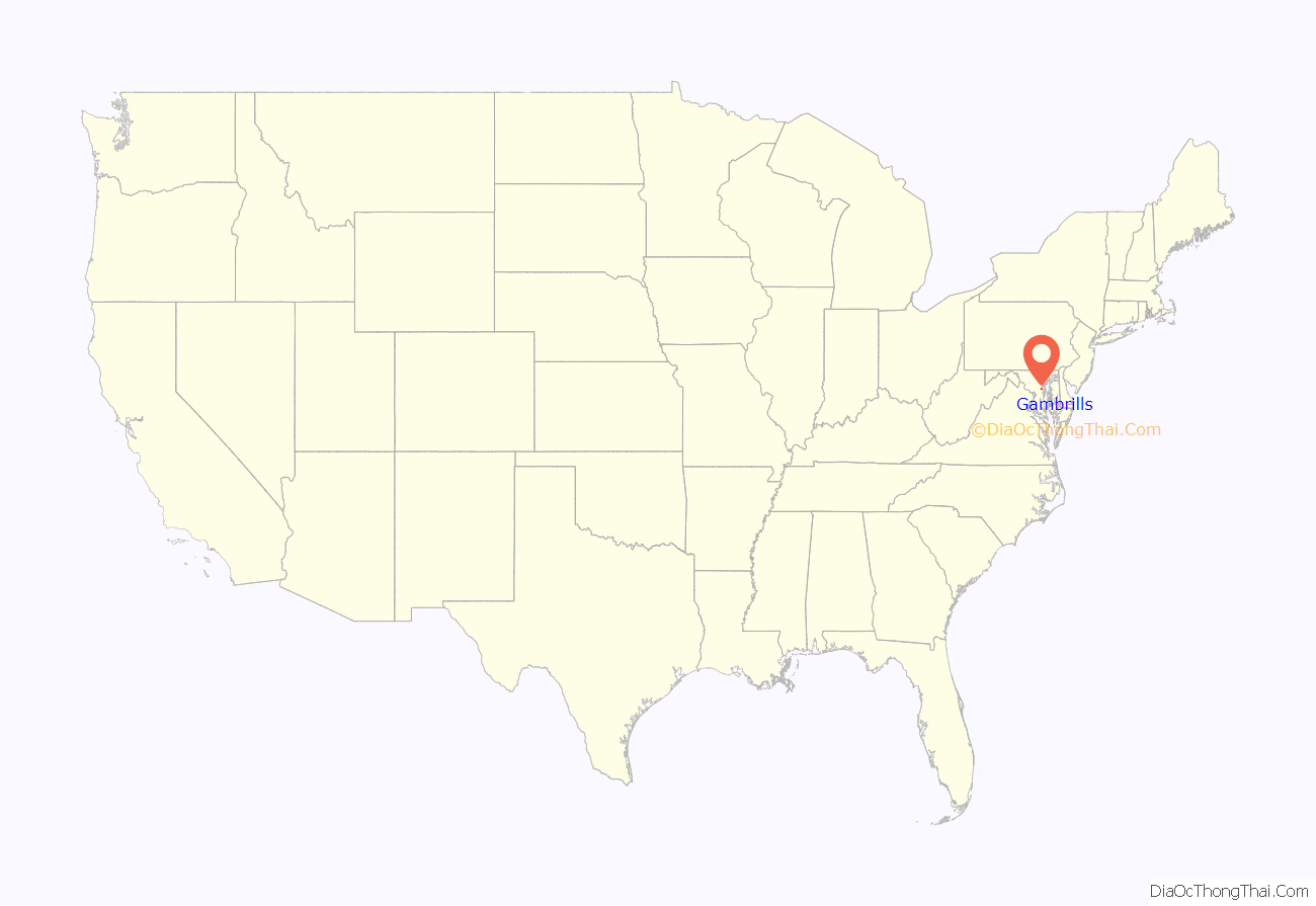
Gambrills location map. Where is Gambrills CDP?

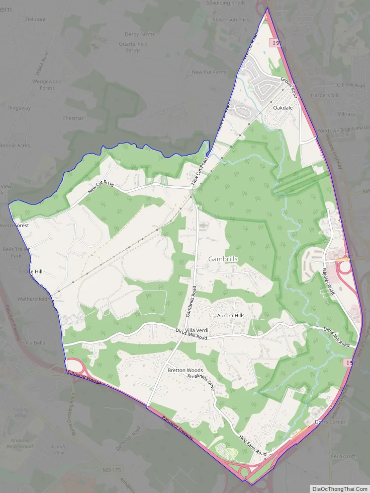
Gambrills Road Map
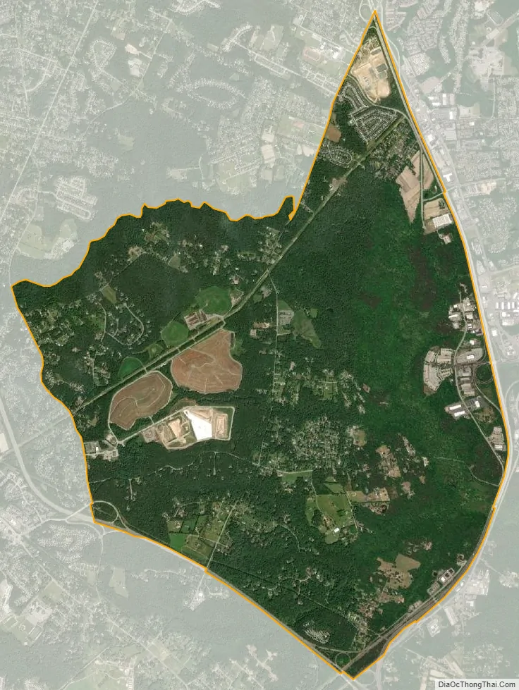
Gambrills city Satellite Map
Geography
The original village of Gambrills is located along Maryland Route 175 (Annapolis Road), 2 miles (3 km) southeast of the center of Odenton and extends south and southeast around Crofton.
See also
Map of Maryland State and its subdivision: Map of other states:- Alabama
- Alaska
- Arizona
- Arkansas
- California
- Colorado
- Connecticut
- Delaware
- District of Columbia
- Florida
- Georgia
- Hawaii
- Idaho
- Illinois
- Indiana
- Iowa
- Kansas
- Kentucky
- Louisiana
- Maine
- Maryland
- Massachusetts
- Michigan
- Minnesota
- Mississippi
- Missouri
- Montana
- Nebraska
- Nevada
- New Hampshire
- New Jersey
- New Mexico
- New York
- North Carolina
- North Dakota
- Ohio
- Oklahoma
- Oregon
- Pennsylvania
- Rhode Island
- South Carolina
- South Dakota
- Tennessee
- Texas
- Utah
- Vermont
- Virginia
- Washington
- West Virginia
- Wisconsin
- Wyoming


