Odenton (/ˈoʊdəntən/ OH-dən-tən) is a census-designated place (CDP) in Anne Arundel County, Maryland, United States, located approximately 10–20 minutes from the state capital, Annapolis. The population was 37,132 at the 2010 census, up from 20,534 at the 2000 census. The town’s population growth rate of 80.8% between 2000 and 2010 was the greatest of any town in western Anne Arundel County. Odenton is located west of Annapolis, south of Baltimore, and northeast of Washington.
In recent years, Odenton has become the fastest-growing city in the county with 2010 census numbers reporting 42% growth. This is because of its proximity to Fort George G. Meade, which contains NSA headquarters, US Cyber Command (established 2009), and the Defense Information Systems Agency (moved to Fort Meade in 2011). Odenton’s growth can also be attributed to it being centrally located between Annapolis, Baltimore, and Washington, D.C. The development has been fueled by the construction of the massive Piney Orchard development, progress in the ongoing development of Odenton Town Center, and construction of the NSA East Campus Integration Program scheduled for completion in 2028.
| Name: | Odenton CDP |
|---|---|
| LSAD Code: | 57 |
| LSAD Description: | CDP (suffix) |
| State: | Maryland |
| County: | Anne Arundel County |
| Founded: | 1868 |
| Elevation: | 90 ft (48 m) |
| Total Area: | 14.77 sq mi (38.24 km²) |
| Land Area: | 14.77 sq mi (38.24 km²) |
| Water Area: | 0.00 sq mi (0.00 km²) |
| Total Population: | 42,947 |
| Population Density: | 2,908.70/sq mi (1,123.05/km²) |
| ZIP code: | 21113 |
| Area code: | 410, 443, 667 |
| FIPS code: | 2458300 |
| GNISfeature ID: | 0590935 |
Online Interactive Map
Click on ![]() to view map in "full screen" mode.
to view map in "full screen" mode.
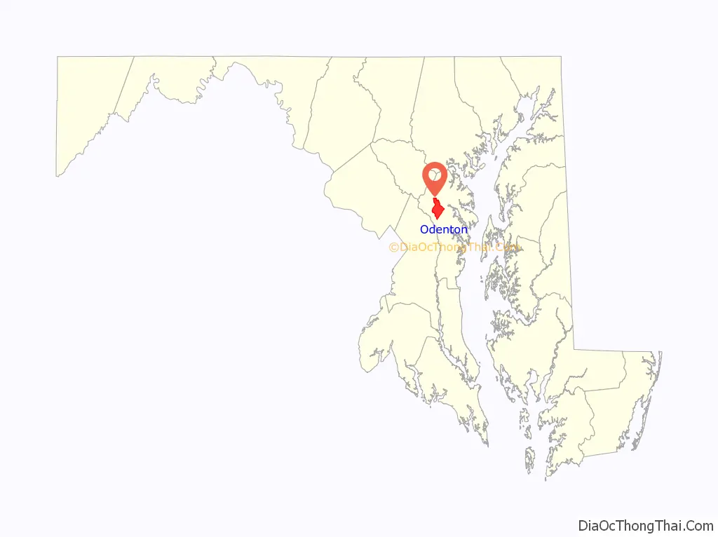
Odenton location map. Where is Odenton CDP?

History
In 1840, the steam-powered Annapolis and Elk Ridge Railroad (A&ER) was built across a sparsely settled farming community that would later become Odenton. At the beginning of the Civil War, Union soldiers guarded this railroad line because it was the only link between the North and the nation’s capital. Rail traffic through Baltimore had been disrupted by southern sympathizers, so supplies, mail and soldiers flowed through Annapolis and west Anne Arundel County to Washington.
The town of Odenton, nicknamed “The Town a Railroad Built” by Catherine L. O’Malley, was formed in 1868 with the construction of the Baltimore Potomac (B&P) Railroad connecting Baltimore and Washington, D.C. Where the B&P crossed the A&ER, a train station and telegraph office were constructed and named for Oden Bowie, president of the B&P and former governor of Maryland. Train service to the station began on July 2, 1872. The rail junction (today’s MARC station) at Odenton Road, already a busy thoroughfare from Annapolis to Frederick, became the site of Odenton’s first commercial center. The Watts and Murray general stores served railroad workers and farmers, and in 1871 a post office was established. A town grew near the junction, houses were built for railroad workers, a Methodist church was dedicated in 1891 and a grade school opened in 1892.
Small villages developed around these various railroad lines, but none amounted to more than a cluster of shops and homes around a train station and post office. The 1878 Maryland Directory listed the following towns: Conaway, Odenton, Patuxent, Sappington, and Woodwardville. Odenton was the largest, with a population of 100, a church, a school and two stores. In nearby Woodwardville, where the B&P crossed the Little Patuxent River, A. G. Woodward was the postmaster and operated a general merchandise store in a village of 50 people. Two churches and a school served that community. Land was worth from $5 and $30 per acre, producing wheat, corn and tobacco.
Canneries, primarily for tomatoes, were built in many locations in Anne Arundel County, including Odenton and Woodwardville. The George M. Murray Canning House, built in the late 19th century on Odenton Road (behind present day 1380 and 1382 Odenton Road) was a successful operation into the early 1900s.
Shortly after 1900, another company built an electric interurban railroad parallel to the B&P and also electrified the former A&ER. Train service on these lines began in 1908. The Washington, Baltimore and Annapolis Electric Railroad provided public transportation to central Maryland.
In 1914, the United States Naval Academy purchased the 800-acre (3.2 km) Hammond Manor Farm in neighboring Gambrills for the construction of a dairy following the 1910 typhoid fever outbreak at the academy. The academy operated the dairy until 1998. Until 2005 it was the home of Dean Foods’ Horizon Organic dairy. The farm is currently the home of Maryland Sunrise Farm.
In 1917, at the advent of World War I, Odenton’s growth was spurred by the establishment of Fort Meade. The United States Department of War acquired 19,000 acres (77 km) of land west of Odenton to develop a training camp, displacing numerous farmers, merchants and public and private enterprises, many of whom moved east to nearby Odenton. The Epiphany Chapel and Church House at Fort Meade was listed on the National Register of Historic Places in 2001. This growth accelerated in the 1950s with the establishment of the National Security Agency on the fort and Friendship International Airport (now the Baltimore-Washington International Thurgood Marshall Airport) a few miles to the north. Odenton still maintains its railroad history through the Dennis F. Sullivan Maintenance Facility, operated by Amtrak, which maintains track, bridges and other structures on the Amtrak/MARC line between Baltimore and Washington. All of this, as well as the suburban expansion of Baltimore and Washington, D.C., have transformed Odenton from a farmland region to a business, residential and industrial center in Anne Arundel County.
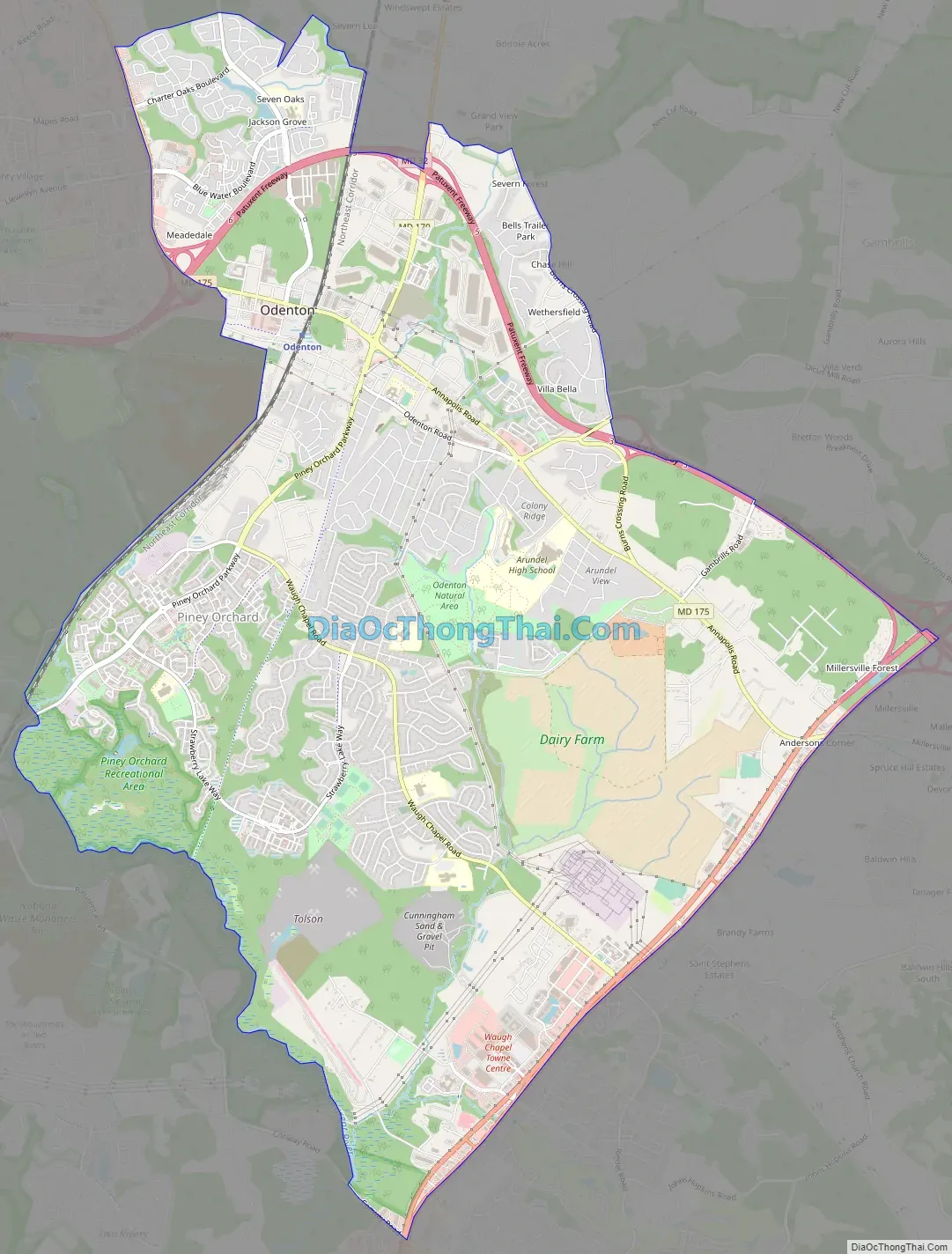
Odenton Road Map
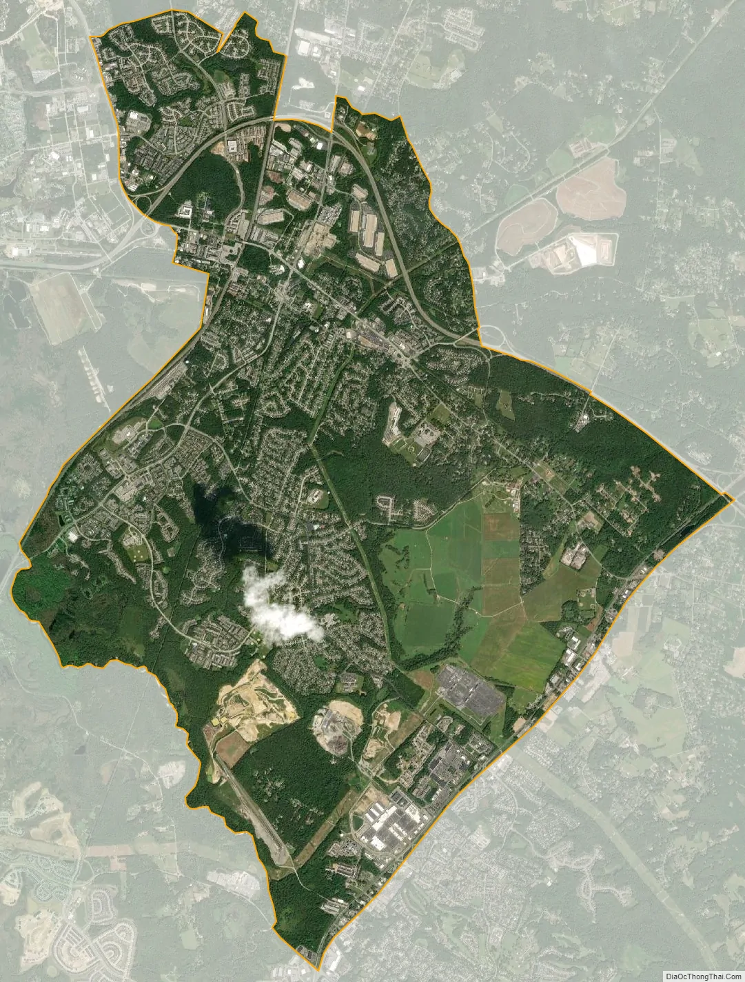
Odenton city Satellite Map
Geography
Odenton is located at 39°04′17″N 76°41′59″W / 39.071276°N 76.699756°W / 39.071276; -76.699756 (39.071276, −76.699756).
According to the United States Census Bureau, the CDP has a total area of 14.8 square miles (38.3 km), all of it land.
See also
Map of Maryland State and its subdivision: Map of other states:- Alabama
- Alaska
- Arizona
- Arkansas
- California
- Colorado
- Connecticut
- Delaware
- District of Columbia
- Florida
- Georgia
- Hawaii
- Idaho
- Illinois
- Indiana
- Iowa
- Kansas
- Kentucky
- Louisiana
- Maine
- Maryland
- Massachusetts
- Michigan
- Minnesota
- Mississippi
- Missouri
- Montana
- Nebraska
- Nevada
- New Hampshire
- New Jersey
- New Mexico
- New York
- North Carolina
- North Dakota
- Ohio
- Oklahoma
- Oregon
- Pennsylvania
- Rhode Island
- South Carolina
- South Dakota
- Tennessee
- Texas
- Utah
- Vermont
- Virginia
- Washington
- West Virginia
- Wisconsin
- Wyoming


