Glen Burnie is an unincorporated town and census-designated place (CDP) in Anne Arundel County, Maryland, United States. It is a suburb of Baltimore. The population was 72,891 at the 2020 census.
| Name: | Glen Burnie CDP |
|---|---|
| LSAD Code: | 57 |
| LSAD Description: | CDP (suffix) |
| State: | Maryland |
| County: | Anne Arundel County |
| Founded: | 1812 |
| Elevation: | 52 ft (16 m) |
| Total Area: | 18.02 sq mi (46.67 km²) |
| Land Area: | 17.31 sq mi (44.84 km²) |
| Water Area: | 0.71 sq mi (1.84 km²) |
| Total Population: | 72,891 |
| Population Density: | 4,210.43/sq mi (1,625.69/km²) |
| ZIP code: | 21060-21062 |
| Area code: | 410, 443, and 667 |
| FIPS code: | 2432650 |
| GNISfeature ID: | 0590311 |
Online Interactive Map
Click on ![]() to view map in "full screen" mode.
to view map in "full screen" mode.
Glen Burnie location map. Where is Glen Burnie CDP?


History
In 1812, Elias Glenn, a district attorney, established a county seat near what is currently known as Brooklyn Park. He named his property “Glennsburne”. The name was changed to “Glennsbourne Farm”, and eventually “Glenburnie”, as the property was passed through Glenn’s descendants. Records also show the name as “Tracey’s Station” and “Myrtle”, after local postmaster Samuel Sewell Tracey and one of Tracey’s boarders, before the final decision was made.
In 1854, William Wilkins Glenn, Elias Glenn’s grandson, incorporated the Curtis Creek Mining, Furnace and Manufacturing Company into his family’s property. The business flourished during the 19th century, and with it came several thousand acres of land in northern Anne Arundel County.
Upon the death of William Wilkins Glenn, his son, brother and nephew began to manage the family’s business affairs, and Glenburnie became an official state subdivision in 1888. The Glenn family contracted George T. Melvin and Henry S. Mancha to lay out and promote the town. It would not be until 1930 that postmaster Louis J. DeAlba decided two words were better than one, and gave the town a final name change to the current Glen Burnie.
Among the earliest Glen Burnie schools was First Avenue Elementary, built in 1899. The oldest area church is St. Alban’s Episcopal, which was built in 1904, with many of its bricks dating back to Marley Chapel, an early Maryland parish from the 1730s. Crain Highway, one of Glen Burnie’s main thoroughfares (named after Robert Crain), opened in 1927 and Ritchie Highway (Maryland Route 2, named for ex-Governor Albert C. Ritchie) followed in 1939. Ritchie Highway carried nearly all Baltimore-area traffic headed for Annapolis and the Chesapeake Bay Bridge until an alternate bypass road, Interstate 97, opened in the 1980s.
Until 1950 the Baltimore and Annapolis Railroad provided passenger and freight service through Glen Burnie from Annapolis to Baltimore; passenger service ended in February 1950 due to increased competition from buses and private automobiles, but freight service continued until Hurricane Agnes did so much damage to a trestle crossing the Severn River in Annapolis that the trestle was condemned for use by trains by the Army Corps of Engineers in the late 1960s. (The trestle remained as a haven for fishermen and crabbers until it was dismantled.) North Glen Burnie is now served by the Baltimore Light Rail system’s Cromwell/Glen Burnie station.
Schools and churches were built in the ensuing decades, and construction was completed on Harundale Mall, the first enclosed shopping center east of the Mississippi River, in 1958. It was one of the first shopping centers to be called a “mall” and was developed by James W. Rouse of the Rouse Company (which also developed nearby Columbia, Maryland). The mall was developed in a joint effort with a local real estate developer, Charles Steffey. The originally planned location was not on Ritchie Highway but on Crain Highway (the main arterial for Glen Burnie). Charlie Steffey and Jim Rouse negotiated unsuccessfully with the “city fathers” of Glen Burnie, offering to regenerate the (then failing) center of town with their revolutionary concept. The “sticking point” was that the intersection of Crain Highway and Quarterfield Road (the proposed location) habitually flooded in even nominal rainstorms, to the point of cars being up to their doors in the river that ensued.
The “city fathers” decided that the advantage of having the “mall” there was overshadowed by the cost of fixing the storm water situation and declined. As a result, Glen Burnie Mall followed in 1962. Marley Station, another large shopping center, opened in February 1987. The Maryland Motor Vehicle Administration office building employs many people in town. In the 1970s, developers tried to make Glen Burnie more urban by building and funding new projects, projects like Empire Towers in 1974, or Crain Towers in 1990, then with the addition of an Anne Arundel Community College branch in the town center. In 1965, North Arundel Hospital opened as a community hospital, but as it was constantly overflowed with patients, the University of Maryland Medical System bought the hospital in 2000 and renovated it to accommodate more patients and equipment.
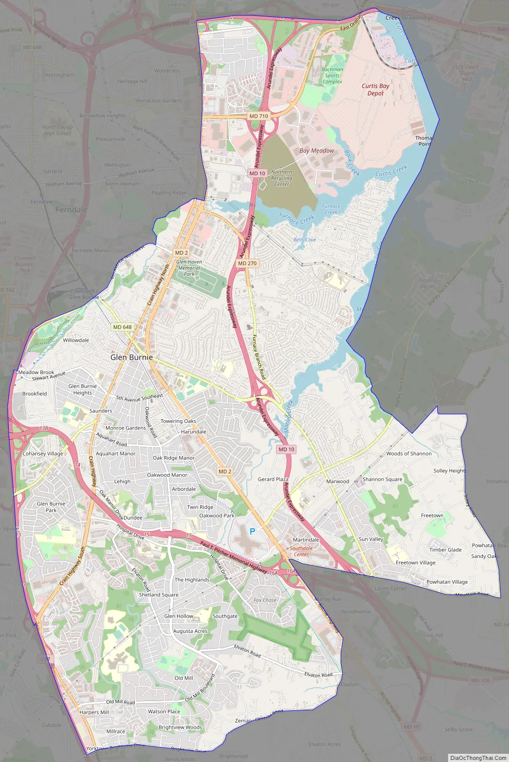
Glen Burnie Road Map
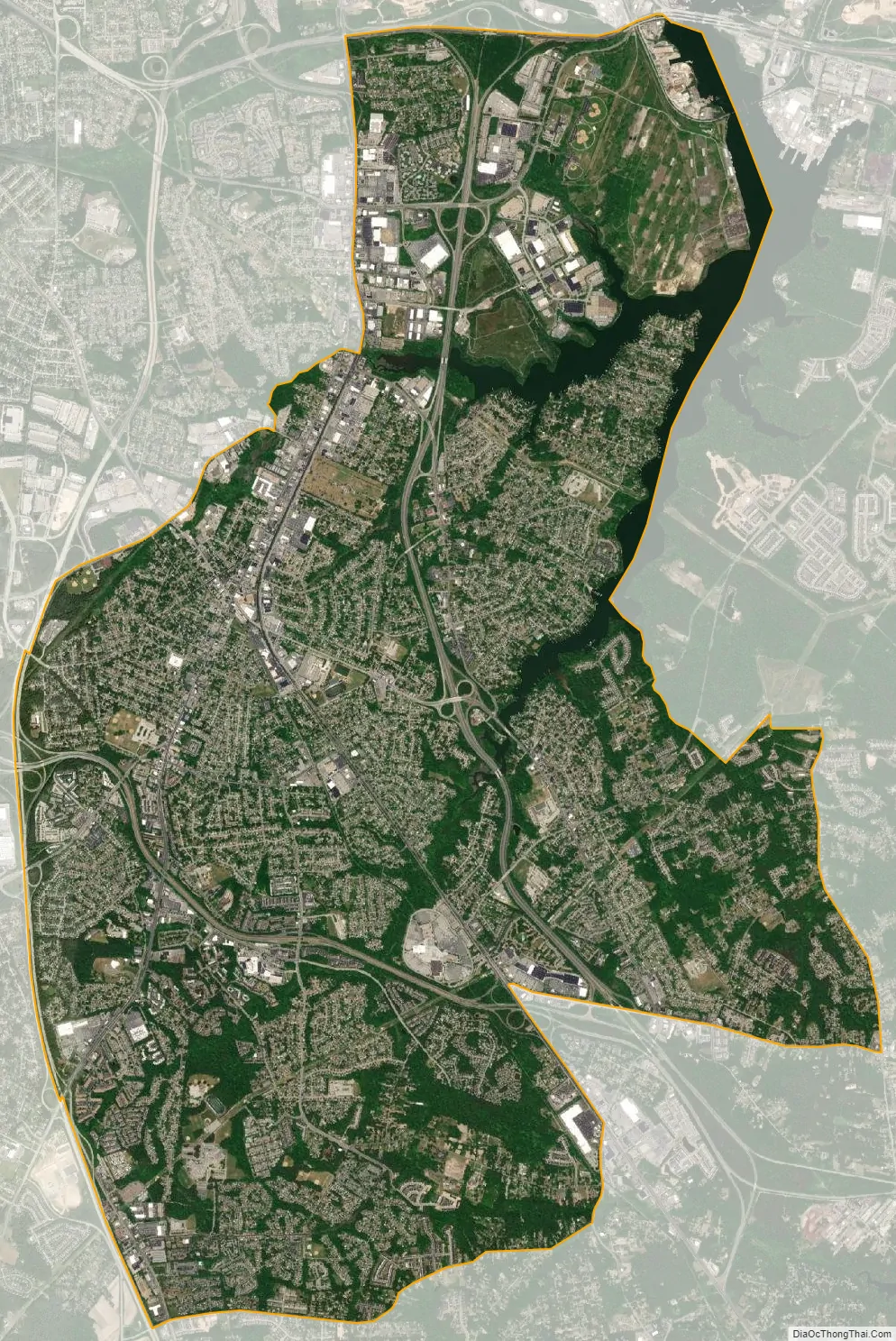
Glen Burnie city Satellite Map
Geography
Glen Burnie is a suburb of Baltimore. It is located at 39°9′36″N 76°36′38″W / 39.16000°N 76.61056°W / 39.16000; -76.61056 (39.159982, −76.610588). The intersection of Central Avenue and Crain Highway forms the boundaries of the NW, SW, NE & SE postal quadrants in the community’s center.
According to the United States Census Bureau, the CDP has a total area of 18.0 square miles (46.7 km), of which 17.3 square miles (44.9 km) is land and 0.69 square miles (1.8 km), or 3.95%, is water.
Climate
The climate in this area is characterized by hot, humid summers and generally mild to cool winters. According to the Köppen Climate Classification system, Glen Burnie has a humid subtropical climate, abbreviated “Cfa” on climate maps.
See also
Map of Maryland State and its subdivision: Map of other states:- Alabama
- Alaska
- Arizona
- Arkansas
- California
- Colorado
- Connecticut
- Delaware
- District of Columbia
- Florida
- Georgia
- Hawaii
- Idaho
- Illinois
- Indiana
- Iowa
- Kansas
- Kentucky
- Louisiana
- Maine
- Maryland
- Massachusetts
- Michigan
- Minnesota
- Mississippi
- Missouri
- Montana
- Nebraska
- Nevada
- New Hampshire
- New Jersey
- New Mexico
- New York
- North Carolina
- North Dakota
- Ohio
- Oklahoma
- Oregon
- Pennsylvania
- Rhode Island
- South Carolina
- South Dakota
- Tennessee
- Texas
- Utah
- Vermont
- Virginia
- Washington
- West Virginia
- Wisconsin
- Wyoming


