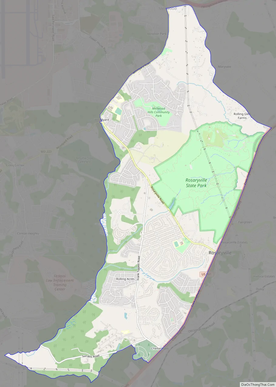
Rosaryville is an unincorporated area and census-designated place (CDP) in Prince George’s County, Maryland, United States, located south of Cinton and Upper Marlboro beside U.S. Route 301. Per the 2020 census, the population was 11,548. including housing developments and rural open space. It was named for a local Roman Catholic church. Close to Rosaryville are the Marlton housing development, Maryland Veterans Cemetery, the Southern Maryland Farmers Market, and Rosaryville State Park.
| Name: | Rosaryville CDP |
|---|---|
| LSAD Code: | 57 |
| LSAD Description: | CDP (suffix) |
| State: | Maryland |
| County: | Prince George’s County |
| Elevation: | 223 ft (68 m) |
| Total Area: | 9.20 sq mi (23.82 km²) |
| Land Area: | 9.18 sq mi (23.78 km²) |
| Water Area: | 0.01 sq mi (0.04 km²) |
| Total Population: | 11,548 |
| Population Density: | 1,257.54/sq mi (485.55/km²) |
| Area code: | 301, 240 |
| FIPS code: | 2468300 |
| GNISfeature ID: | 0597990 |
Online Interactive Map
Click on ![]() to view map in "full screen" mode.
to view map in "full screen" mode.
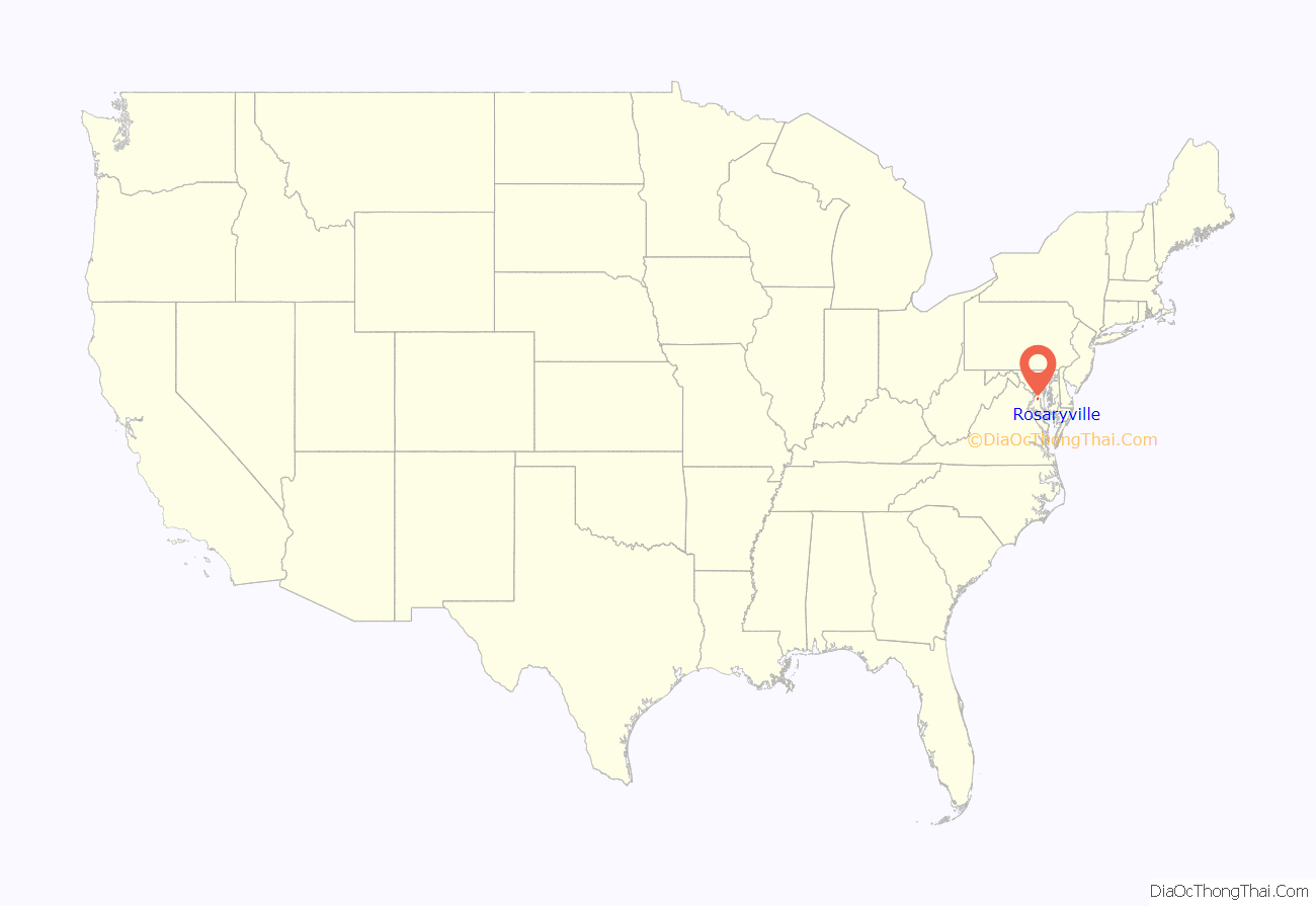
Rosaryville location map. Where is Rosaryville CDP?

History
His Lordship’s Kindness was listed on the National Register of Historic Places and as a National Historic Landmark in 1970.
Rosaryville Road Map
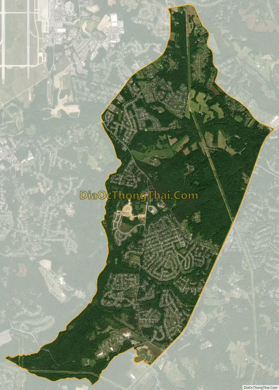
Rosaryville city Satellite Map
Geography
Rosaryville is located at 38°46′4″N 76°50′8″W / 38.76778°N 76.83556°W / 38.76778; -76.83556 (38.767664, −76.835568).
According to the United States Census Bureau, the CDP has a total area of 9.2 square miles (23.8 km), of which 0.02 square miles (0.04 km), or 0.18%, is water.
See also
Map of Maryland State and its subdivision: Map of other states:- Alabama
- Alaska
- Arizona
- Arkansas
- California
- Colorado
- Connecticut
- Delaware
- District of Columbia
- Florida
- Georgia
- Hawaii
- Idaho
- Illinois
- Indiana
- Iowa
- Kansas
- Kentucky
- Louisiana
- Maine
- Maryland
- Massachusetts
- Michigan
- Minnesota
- Mississippi
- Missouri
- Montana
- Nebraska
- Nevada
- New Hampshire
- New Jersey
- New Mexico
- New York
- North Carolina
- North Dakota
- Ohio
- Oklahoma
- Oregon
- Pennsylvania
- Rhode Island
- South Carolina
- South Dakota
- Tennessee
- Texas
- Utah
- Vermont
- Virginia
- Washington
- West Virginia
- Wisconsin
- Wyoming


