Seabrook is an unincorporated community and census-designated place (CDP) in Prince George’s County, Maryland, United States, located approximately 12 miles (19 km) east of Washington, D.C.. Per the 2020 census, the population was 19,627. Prior to 2010, Seabrook was part of the Lanham-Seabrook census-designated place.
| Name: | Seabrook CDP |
|---|---|
| LSAD Code: | 57 |
| LSAD Description: | CDP (suffix) |
| State: | Maryland |
| County: | Prince George’s County |
| Total Area: | 3.08 sq mi (7.97 km²) |
| Land Area: | 3.08 sq mi (7.97 km²) |
| Water Area: | 0.00 sq mi (0.00 km²) |
| Total Population: | 19,627 |
| Population Density: | 6,378.62/sq mi (2,462.65/km²) |
| FIPS code: | 2470775 |
| GNISfeature ID: | 598065 |
Online Interactive Map
Click on ![]() to view map in "full screen" mode.
to view map in "full screen" mode.
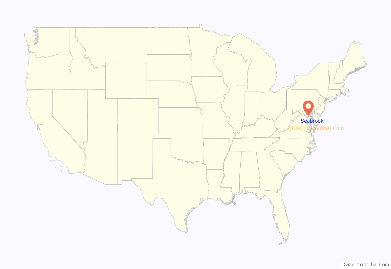
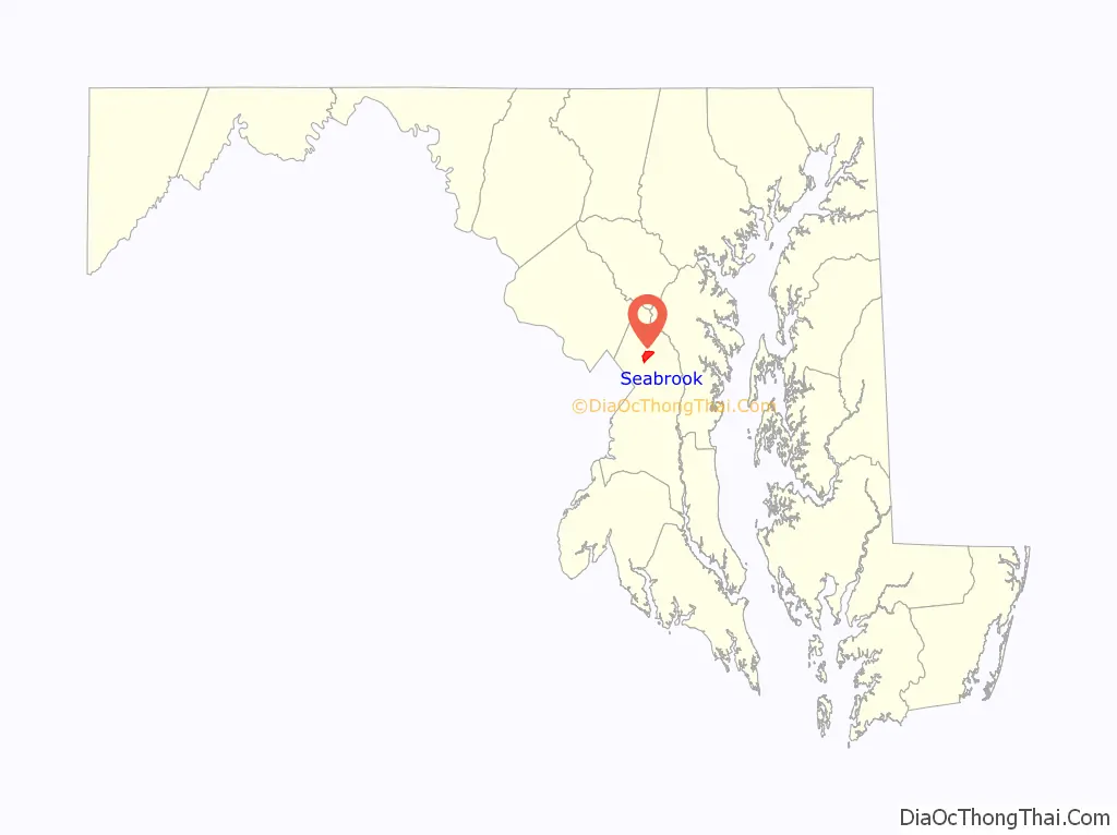
Seabrook location map. Where is Seabrook CDP?
History
A school was built in Seabrook in 1895.
The community developed in direct relationship with the Washington Branch of the Baltimore and Potomac Railroad. The railroad’s main branch into Washington opened in July 1872, with stations established at Glenn Dale, Seabrook, and Lanham, among others. Thomas Seabrook, an engineer for the railroad, purchased 500 acres (2.0 km) of land in 1871 around the location of a planned station for the purpose of creating a retreat community. By 1880, a station building and three Gothic cottages had been built, followed by commercial buildings and a schoolhouse. By 1914, the community remained small with just a few buildings located at the intersection of Seabrook Road with the railroad. By 1957, the community had grown to include approximately 185 houses along 10 streets. The streets were arranged in a grid pattern roughly parallel to the railroad line. The community extended from present-day Good Luck Road south to Annapolis Road.
Residential development continued on vacant lots within the community throughout the 20th century, while commercial development focused along the main roads. Commercial strip development is located along Annapolis Road and Lanham-Severn Road. The original railroad station and early commercial buildings are no longer extant, though the old schoolhouse and a few of the early dwellings survive.
Most of the more recently built Seabrook (some of which was originally called Seabrook Acres) is a development of red brick homes along the Lanham-Severn Road, now Maryland Route 564 in Maryland, approximately one half mile east of the Capital Beltway. Many of its homes were built in the 1950s to serve the needs of new employees at the newly established NASA Goddard Space Flight Center, which is located immediately to the north. Development of apartment complexes and other large structures has occurred during recent years of developer expansion. However, Seabrook remains a residential area with numerous single homes surrounded by green lawns shaded by century-old oak trees.
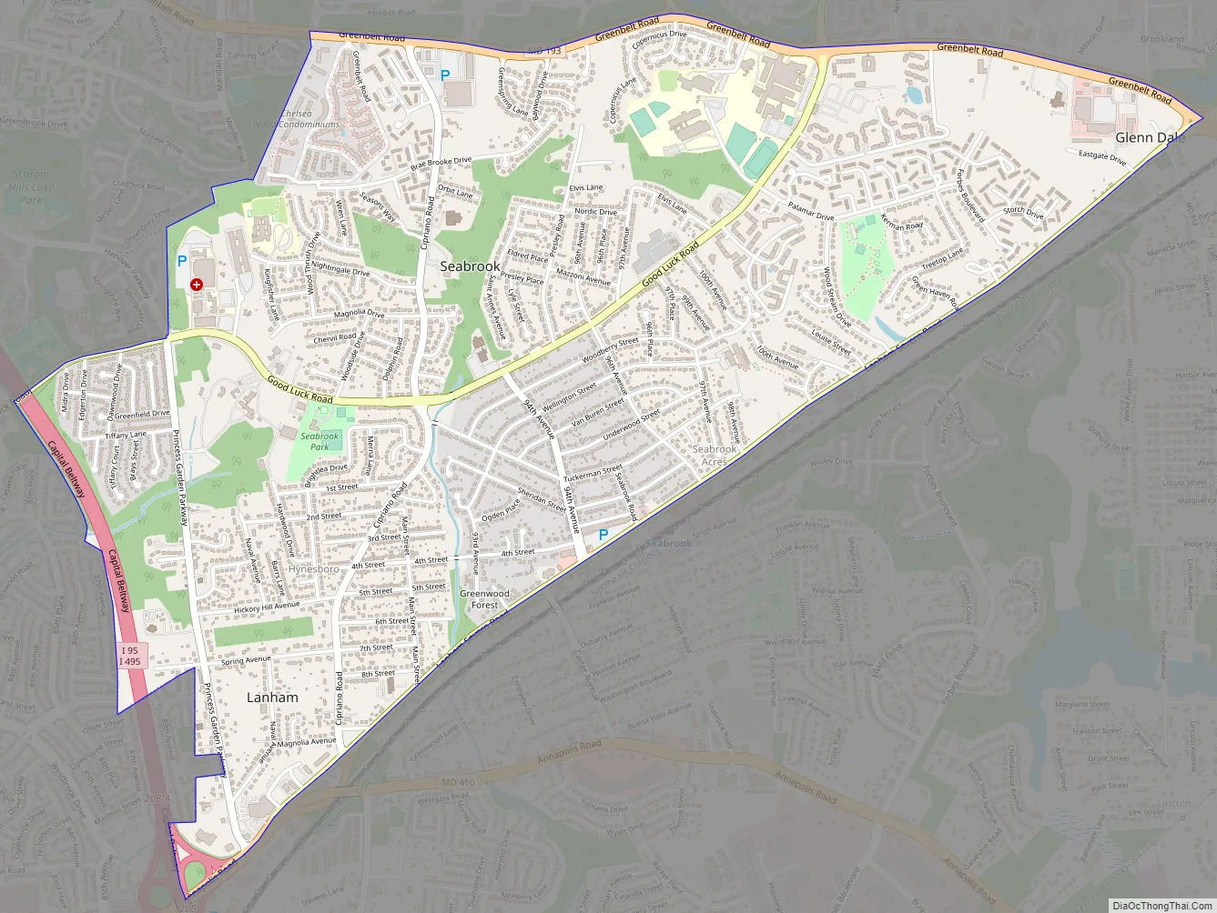
Seabrook Road Map
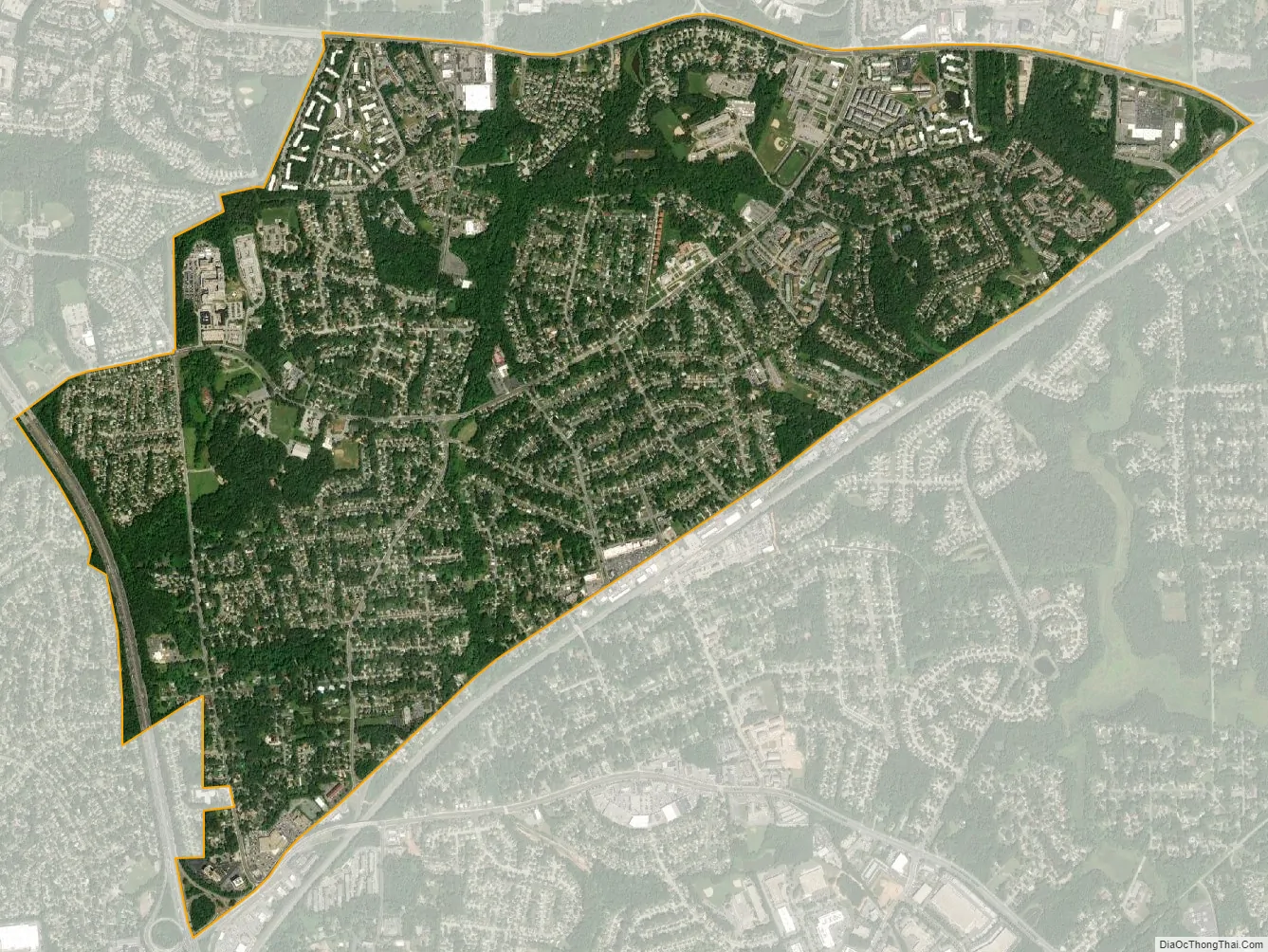
Seabrook city Satellite Map
Geography
According to the U.S. Census Bureau, the Seabrook census-designated place has a total area of 3.0 square miles (7.8 km), all land.
See also
Map of Maryland State and its subdivision: Map of other states:- Alabama
- Alaska
- Arizona
- Arkansas
- California
- Colorado
- Connecticut
- Delaware
- District of Columbia
- Florida
- Georgia
- Hawaii
- Idaho
- Illinois
- Indiana
- Iowa
- Kansas
- Kentucky
- Louisiana
- Maine
- Maryland
- Massachusetts
- Michigan
- Minnesota
- Mississippi
- Missouri
- Montana
- Nebraska
- Nevada
- New Hampshire
- New Jersey
- New Mexico
- New York
- North Carolina
- North Dakota
- Ohio
- Oklahoma
- Oregon
- Pennsylvania
- Rhode Island
- South Carolina
- South Dakota
- Tennessee
- Texas
- Utah
- Vermont
- Virginia
- Washington
- West Virginia
- Wisconsin
- Wyoming


