Como is a town in Panola County, Mississippi, which borders the Mississippi Delta and is in the northern part of the state, known as hill country. The population was 1,279 as of the 2010 census.
| Name: | Como town |
|---|---|
| LSAD Code: | 43 |
| LSAD Description: | town (suffix) |
| State: | Mississippi |
| County: | Panola County |
| Elevation: | 358 ft (109 m) |
| Total Area: | 1.90 sq mi (4.92 km²) |
| Land Area: | 1.89 sq mi (4.89 km²) |
| Water Area: | 0.01 sq mi (0.02 km²) |
| Total Population: | 1,118 |
| Population Density: | 591.85/sq mi (228.53/km²) |
| ZIP code: | 38619 |
| Area code: | 662 |
| FIPS code: | 2815500 |
| GNISfeature ID: | 0668729 |
| Website: | como.panolams.com |
Online Interactive Map
Click on ![]() to view map in "full screen" mode.
to view map in "full screen" mode.
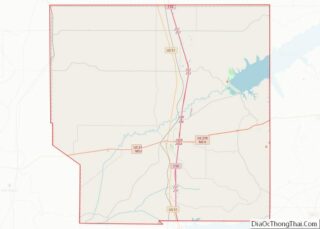
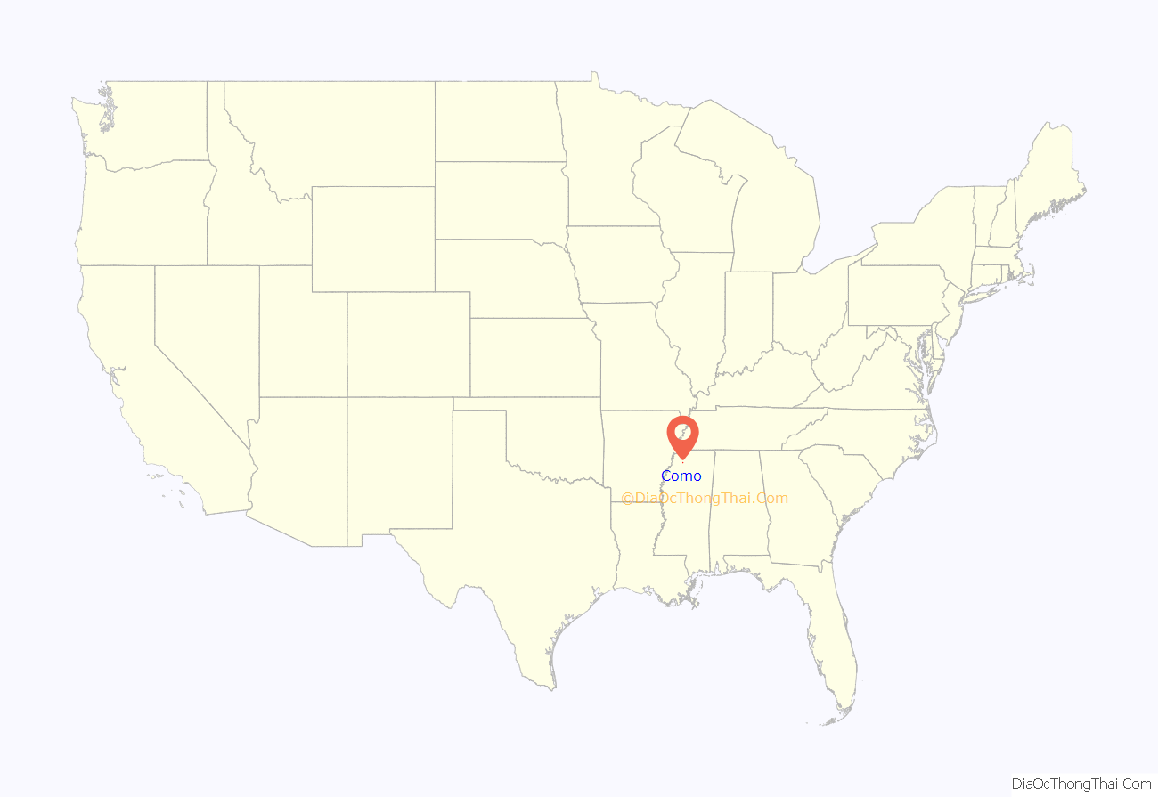
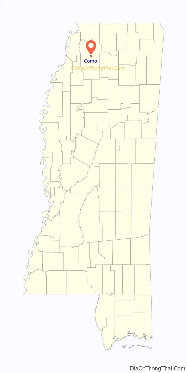
Como location map. Where is Como town?
History
In a 2007 article about the area, Wayne Drash, a CNN.com senior producer, described Como as “a hard-hit rural community.”
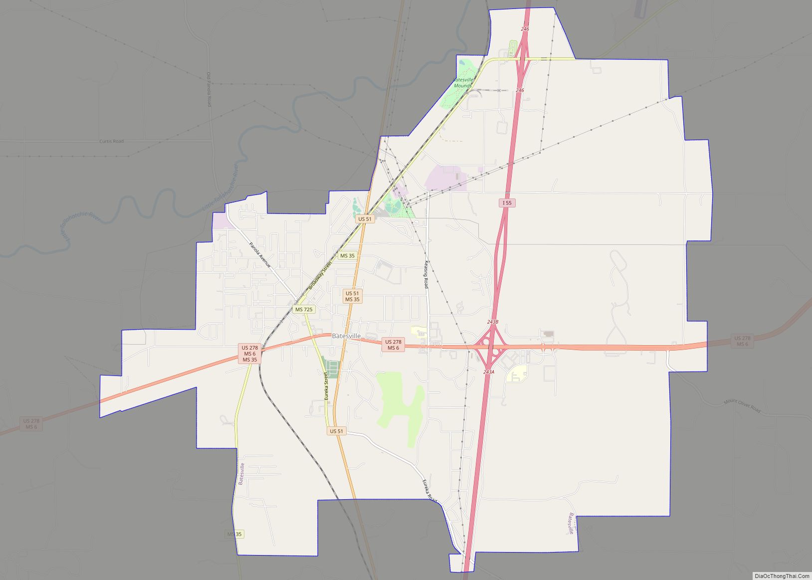
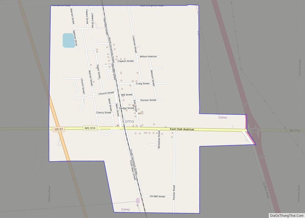
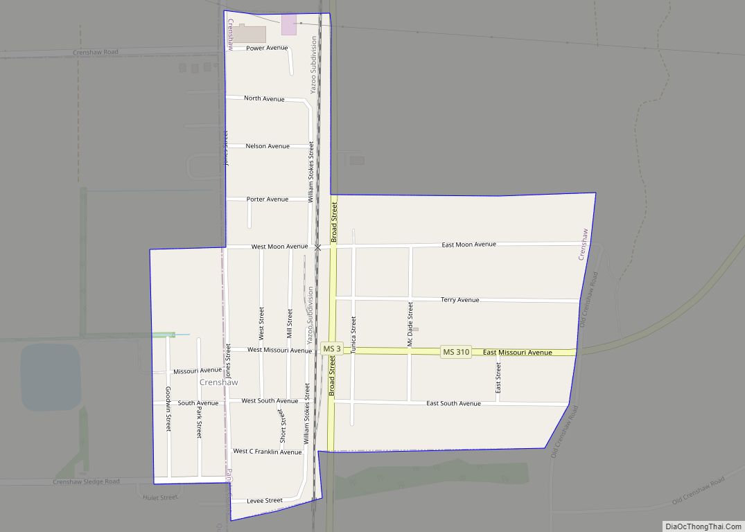
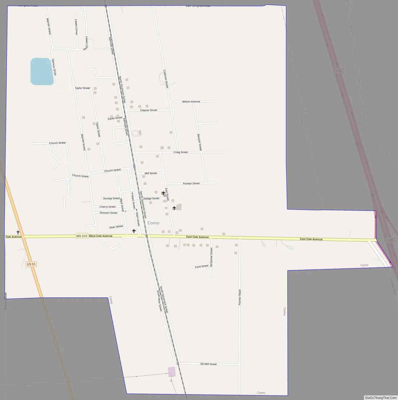
Como Road Map
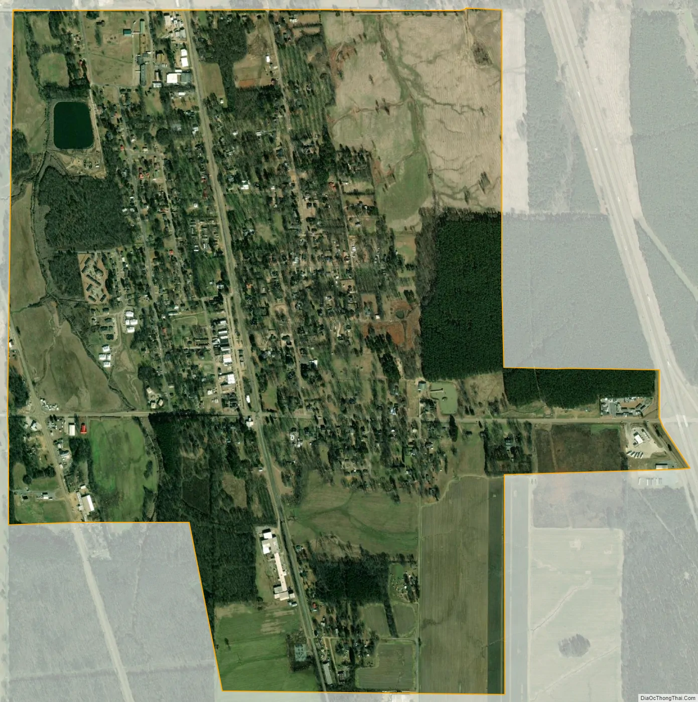
Como city Satellite Map
Geography
According to the United States Census Bureau, the town has a total area of 1.9 square miles (4.9 km), of which 1.9 square miles (4.9 km) is land and 0.53% is water.
It is 45 miles (72 km) south of Memphis, Tennessee.
See also
Map of Mississippi State and its subdivision:- Adams
- Alcorn
- Amite
- Attala
- Benton
- Bolivar
- Calhoun
- Carroll
- Chickasaw
- Choctaw
- Claiborne
- Clarke
- Clay
- Coahoma
- Copiah
- Covington
- Desoto
- Forrest
- Franklin
- George
- Greene
- Grenada
- Hancock
- Harrison
- Hinds
- Holmes
- Humphreys
- Issaquena
- Itawamba
- Jackson
- Jasper
- Jefferson
- Jefferson Davis
- Jones
- Kemper
- Lafayette
- Lamar
- Lauderdale
- Lawrence
- Leake
- Lee
- Leflore
- Lincoln
- Lowndes
- Madison
- Marion
- Marshall
- Monroe
- Montgomery
- Neshoba
- Newton
- Noxubee
- Oktibbeha
- Panola
- Pearl River
- Perry
- Pike
- Pontotoc
- Prentiss
- Quitman
- Rankin
- Scott
- Sharkey
- Simpson
- Smith
- Stone
- Sunflower
- Tallahatchie
- Tate
- Tippah
- Tishomingo
- Tunica
- Union
- Walthall
- Warren
- Washington
- Wayne
- Webster
- Wilkinson
- Winston
- Yalobusha
- Yazoo
- Alabama
- Alaska
- Arizona
- Arkansas
- California
- Colorado
- Connecticut
- Delaware
- District of Columbia
- Florida
- Georgia
- Hawaii
- Idaho
- Illinois
- Indiana
- Iowa
- Kansas
- Kentucky
- Louisiana
- Maine
- Maryland
- Massachusetts
- Michigan
- Minnesota
- Mississippi
- Missouri
- Montana
- Nebraska
- Nevada
- New Hampshire
- New Jersey
- New Mexico
- New York
- North Carolina
- North Dakota
- Ohio
- Oklahoma
- Oregon
- Pennsylvania
- Rhode Island
- South Carolina
- South Dakota
- Tennessee
- Texas
- Utah
- Vermont
- Virginia
- Washington
- West Virginia
- Wisconsin
- Wyoming