Kilmichael is a town in Montgomery County, Mississippi, United States. Per the 2020 Census, the population was 639.
| Name: | Kilmichael town |
|---|---|
| LSAD Code: | 43 |
| LSAD Description: | town (suffix) |
| State: | Mississippi |
| County: | Montgomery County |
| Elevation: | 361 ft (110 m) |
| Total Area: | 2.94 sq mi (7.62 km²) |
| Land Area: | 2.94 sq mi (7.61 km²) |
| Water Area: | 0.00 sq mi (0.01 km²) |
| Total Population: | 639 |
| Population Density: | 217.42/sq mi (83.96/km²) |
| ZIP code: | 39747 |
| Area code: | 662 |
| FIPS code: | 2837560 |
| GNISfeature ID: | 0672122 |
| Website: | kilmichaelms.com |
Online Interactive Map
Click on ![]() to view map in "full screen" mode.
to view map in "full screen" mode.
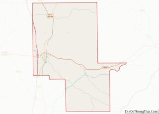
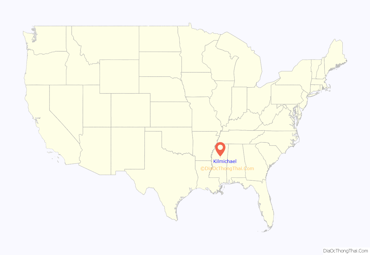
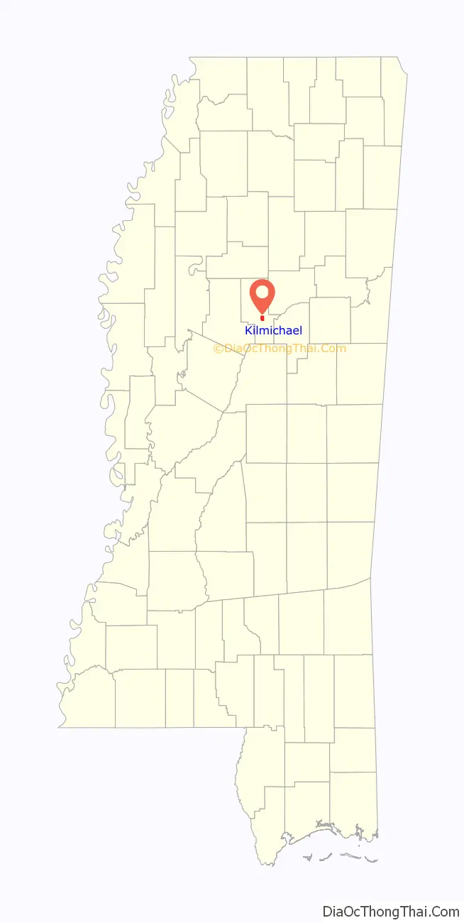
Kilmichael location map. Where is Kilmichael town?
History
The population in 1900 was 227. The Bank of Kilmichael was established in 1904.
In 2001, the all-white board of aldermen cancelled town elections after citing a need for more time to implement election changes. Allegedly, the elections were delayed in order to avoid electing black politicians. The Justice Department intervened under the Voting Rights Act and forced a special election, in which Kilmichael elected its first black mayor and three black aldermen.
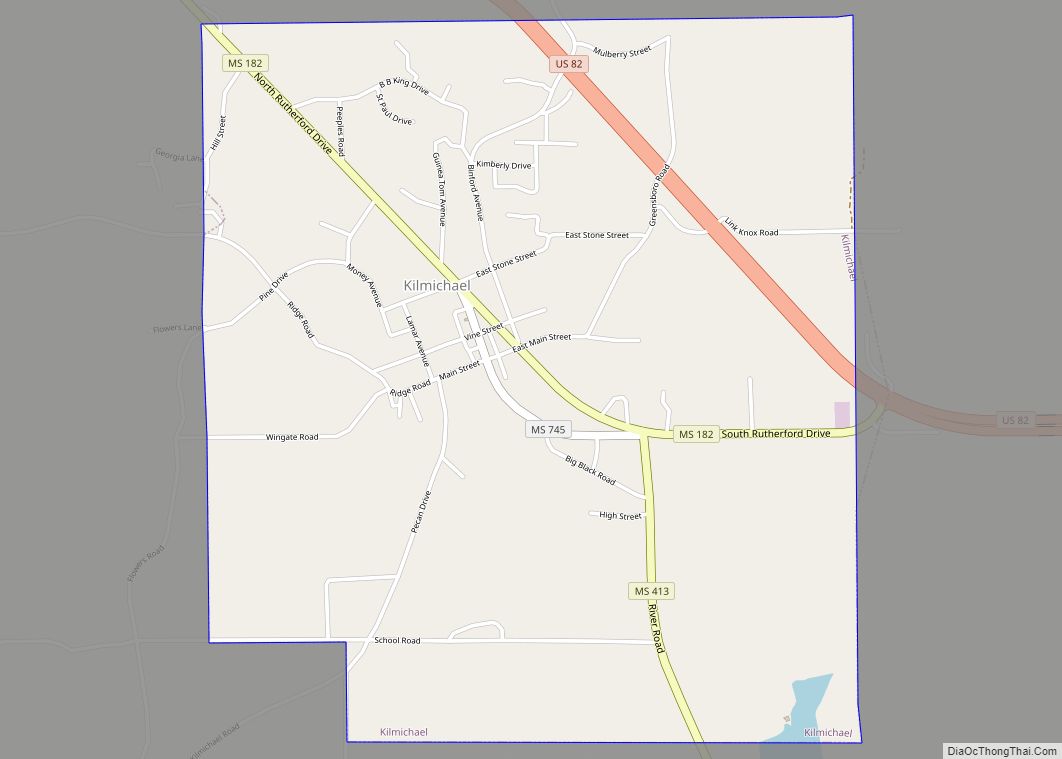
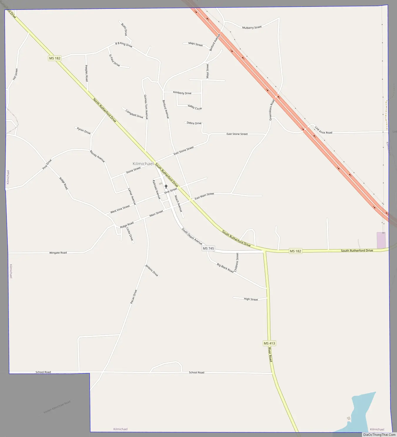
Kilmichael Road Map
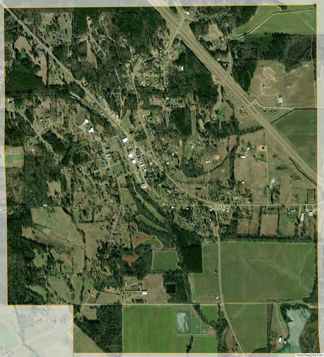
Kilmichael city Satellite Map
Geography
According to the United States Census Bureau, the town has a total area of 2.8 square miles (7.3 km), of which 2.8 square miles (7.3 km) is land and 0.36% is water.
See also
Map of Mississippi State and its subdivision:- Adams
- Alcorn
- Amite
- Attala
- Benton
- Bolivar
- Calhoun
- Carroll
- Chickasaw
- Choctaw
- Claiborne
- Clarke
- Clay
- Coahoma
- Copiah
- Covington
- Desoto
- Forrest
- Franklin
- George
- Greene
- Grenada
- Hancock
- Harrison
- Hinds
- Holmes
- Humphreys
- Issaquena
- Itawamba
- Jackson
- Jasper
- Jefferson
- Jefferson Davis
- Jones
- Kemper
- Lafayette
- Lamar
- Lauderdale
- Lawrence
- Leake
- Lee
- Leflore
- Lincoln
- Lowndes
- Madison
- Marion
- Marshall
- Monroe
- Montgomery
- Neshoba
- Newton
- Noxubee
- Oktibbeha
- Panola
- Pearl River
- Perry
- Pike
- Pontotoc
- Prentiss
- Quitman
- Rankin
- Scott
- Sharkey
- Simpson
- Smith
- Stone
- Sunflower
- Tallahatchie
- Tate
- Tippah
- Tishomingo
- Tunica
- Union
- Walthall
- Warren
- Washington
- Wayne
- Webster
- Wilkinson
- Winston
- Yalobusha
- Yazoo
- Alabama
- Alaska
- Arizona
- Arkansas
- California
- Colorado
- Connecticut
- Delaware
- District of Columbia
- Florida
- Georgia
- Hawaii
- Idaho
- Illinois
- Indiana
- Iowa
- Kansas
- Kentucky
- Louisiana
- Maine
- Maryland
- Massachusetts
- Michigan
- Minnesota
- Mississippi
- Missouri
- Montana
- Nebraska
- Nevada
- New Hampshire
- New Jersey
- New Mexico
- New York
- North Carolina
- North Dakota
- Ohio
- Oklahoma
- Oregon
- Pennsylvania
- Rhode Island
- South Carolina
- South Dakota
- Tennessee
- Texas
- Utah
- Vermont
- Virginia
- Washington
- West Virginia
- Wisconsin
- Wyoming