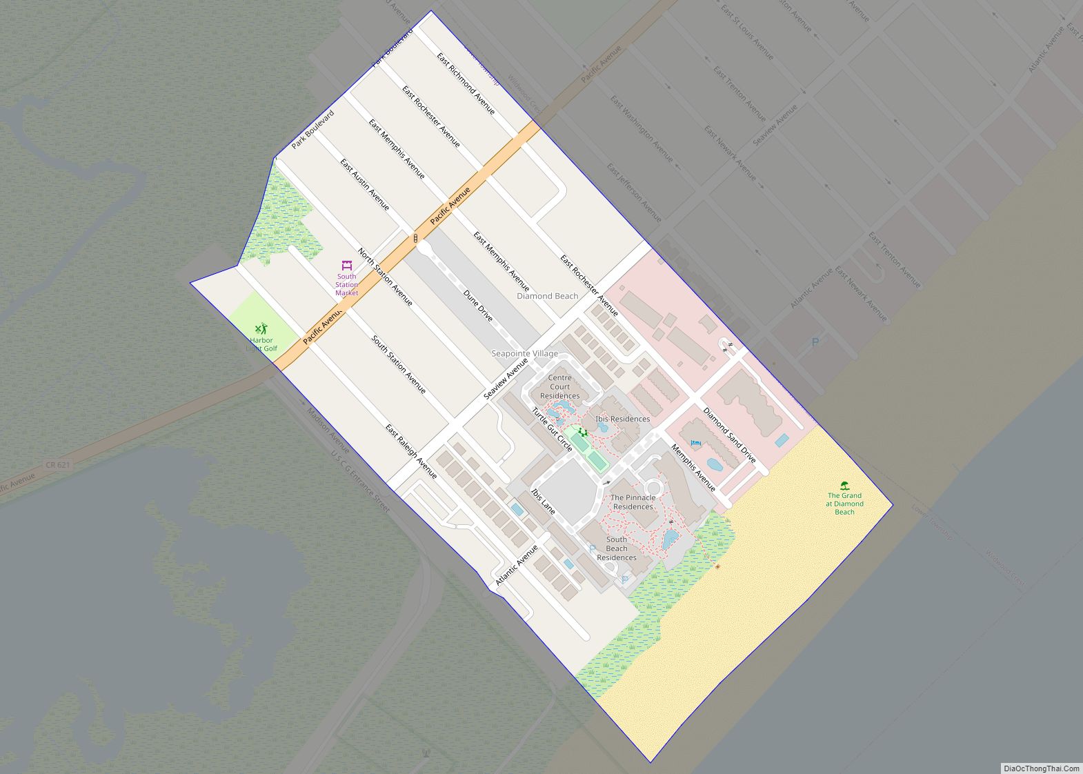
Diamond Beach is an unincorporated community and census-designated place (CDP) located within Lower Township in Cape May County, New Jersey, United States. The CDP, and all of Cape May County, is part of the Ocean City metropolitan statistical area, and is part of the Philadelphia–Wilmington–Camden, PA-NJ-DE–MD combined statistical area, also known as the Delaware Valley or Philadelphia metropolitan area. As of the United States 2020 Census, the CDP’s population was 203, an increase of 67 from the 2010 census count of 136.
| Name: | Diamond Beach CDP |
|---|---|
| LSAD Code: | 57 |
| LSAD Description: | CDP (suffix) |
| State: | New Jersey |
| County: | Cape May County |
| Elevation: | 7 ft (2 m) |
| Total Area: | 0.23 sq mi (0.59 km²) |
| Land Area: | 0.23 sq mi (0.59 km²) |
| Water Area: | 0.00 sq mi (0.00 km²) 0.00% |
| Total Population: | 203 |
| Population Density: | 898.23/sq mi (346.80/km²) |
| Area code: | 609 |
| FIPS code: | 3417815 |
| GNISfeature ID: | 02389406 |
Online Interactive Map
Click on ![]() to view map in "full screen" mode.
to view map in "full screen" mode.
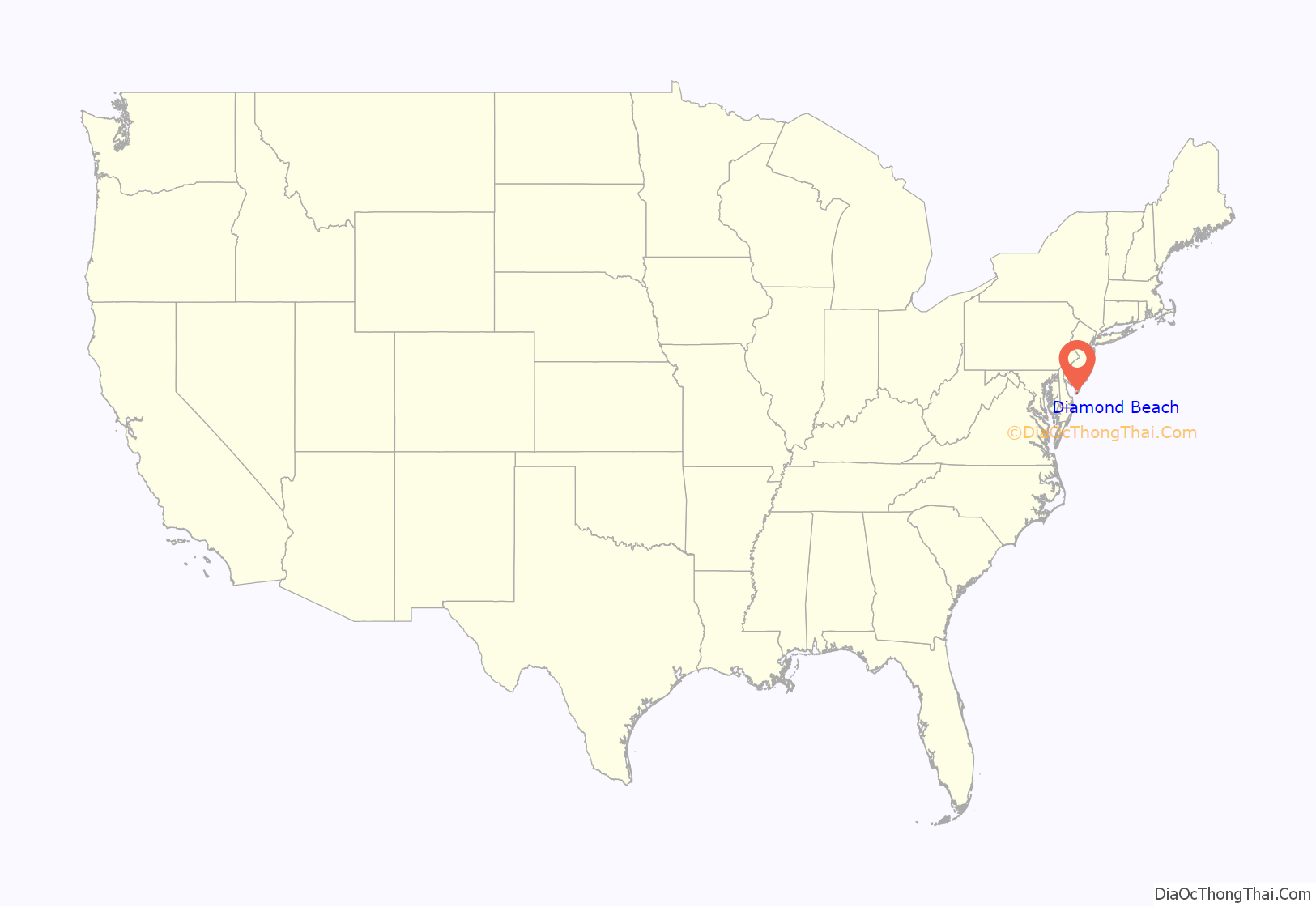
Diamond Beach location map. Where is Diamond Beach CDP?
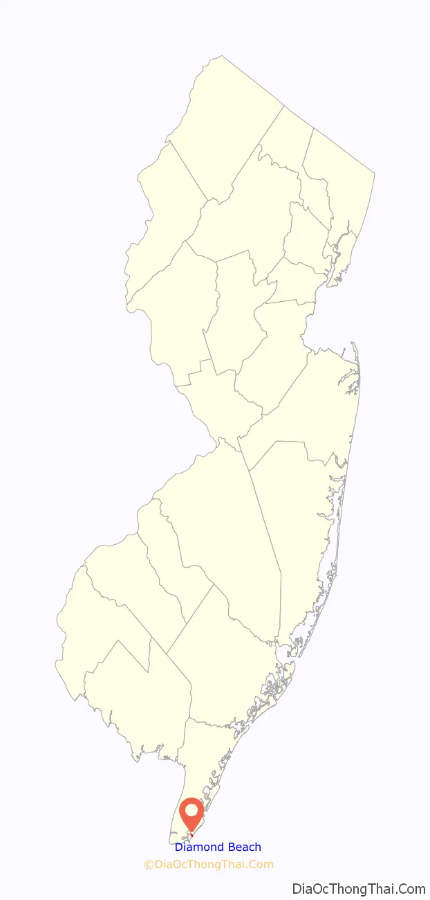
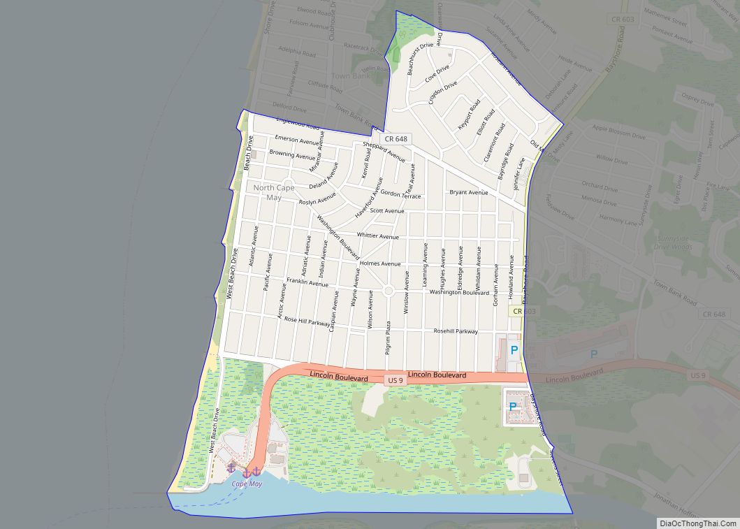
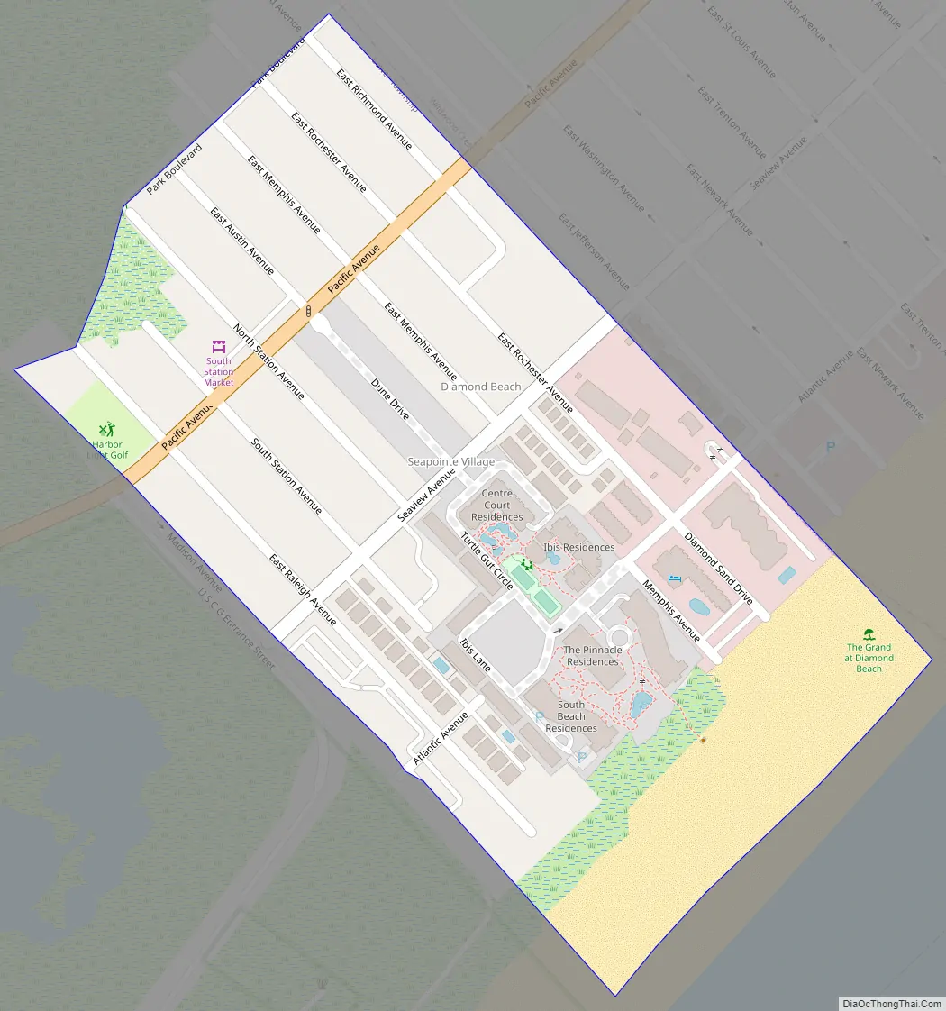
Diamond Beach Road Map
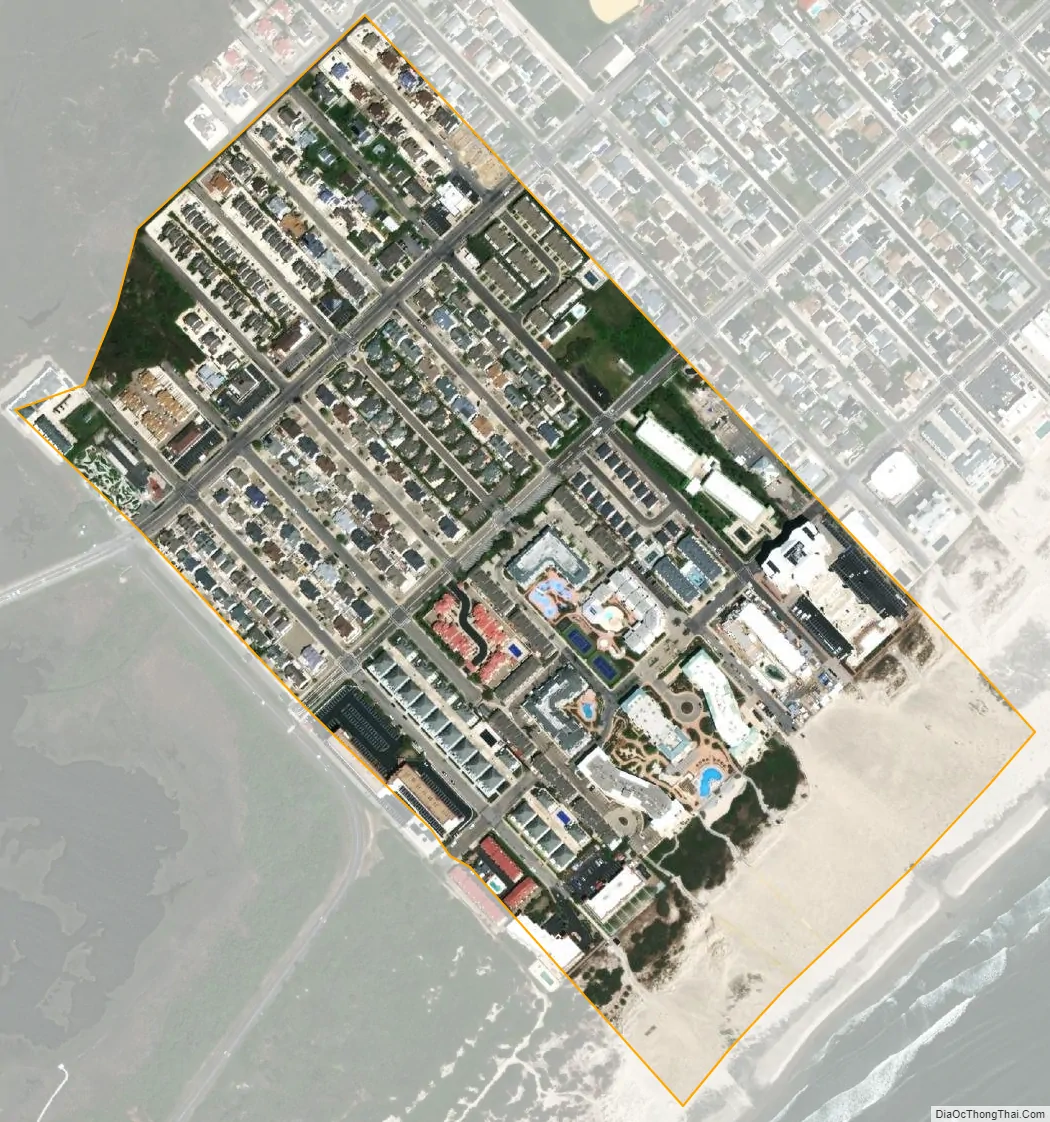
Diamond Beach city Satellite Map
Geography
According to the United States Census Bureau, Diamond Beach had a total area of 0.157 square miles (0.406 km), all of which was land.
Diamond Beach is home to many upscale townhouses and Seapointe Village, site of a police substation that opened in 2013.
See also
Map of New Jersey State and its subdivision: Map of other states:- Alabama
- Alaska
- Arizona
- Arkansas
- California
- Colorado
- Connecticut
- Delaware
- District of Columbia
- Florida
- Georgia
- Hawaii
- Idaho
- Illinois
- Indiana
- Iowa
- Kansas
- Kentucky
- Louisiana
- Maine
- Maryland
- Massachusetts
- Michigan
- Minnesota
- Mississippi
- Missouri
- Montana
- Nebraska
- Nevada
- New Hampshire
- New Jersey
- New Mexico
- New York
- North Carolina
- North Dakota
- Ohio
- Oklahoma
- Oregon
- Pennsylvania
- Rhode Island
- South Carolina
- South Dakota
- Tennessee
- Texas
- Utah
- Vermont
- Virginia
- Washington
- West Virginia
- Wisconsin
- Wyoming