Montvale is a borough in northern Bergen County, in the U.S. state of New Jersey, bordering the state of New York. The borough is part of the New York City metropolitan area. As of the 2020 United States census, the borough’s population was 8,436, an increase of 592 (+7.5%) from the 2010 census count of 7,844, which in turn reflected an increase of 810 (+11.5%) from the 7,034 counted at the 2000 census.
| Name: | Montvale borough |
|---|---|
| LSAD Code: | 21 |
| LSAD Description: | borough (suffix) |
| State: | New Jersey |
| County: | Bergen County |
| Incorporated: | August 31, 1894 |
| Elevation: | 338 ft (103 m) |
| Total Area: | 4.03 sq mi (10.45 km²) |
| Land Area: | 4.02 sq mi (10.42 km²) |
| Water Area: | 0.01 sq mi (0.03 km²) 0.25% |
| Total Population: | 8,436 |
| Population Density: | 2,096.9/sq mi (809.6/km²) |
| ZIP code: | 07645 |
| Area code: | 201 |
| FIPS code: | 3447610 |
| GNISfeature ID: | 0885306 |
| Website: | www.montvale.org |
Online Interactive Map
Click on ![]() to view map in "full screen" mode.
to view map in "full screen" mode.
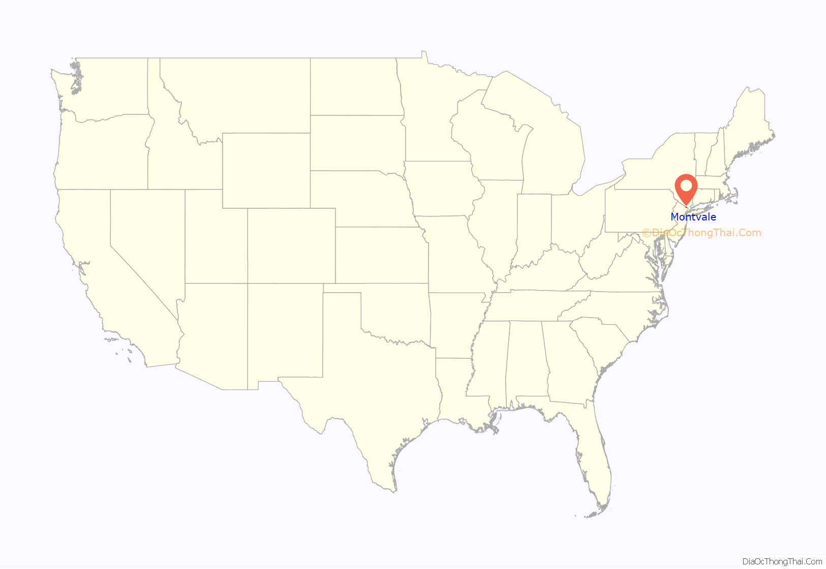
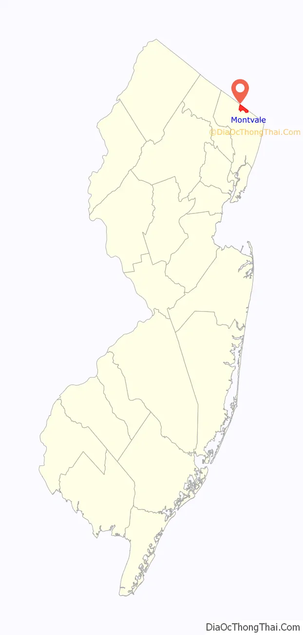
Montvale location map. Where is Montvale borough?
History
Montvale was incorporated as a borough on August 31, 1894, from portions of Orvil Township and Washington Township. The borough was formed during the “Boroughitis” phenomenon then sweeping through Bergen County, in which 26 boroughs were formed in the county in 1894 alone. On February 15, 1896, Montvale acquired part of Orvil Township. In 1906, Montvale added further land from Orvil and Washington townships, and in 1912, Montvale added territory from Upper Saddle River. On May 20, 1959, portions of Montvale were passed to River Vale, and on December 9 and 14, 1965, territories were exchanged between Montvale and Upper Saddle River. The borough’s name is derived from its topography.
Montvale is nicknamed “The Pride of the Pascack Valley”.
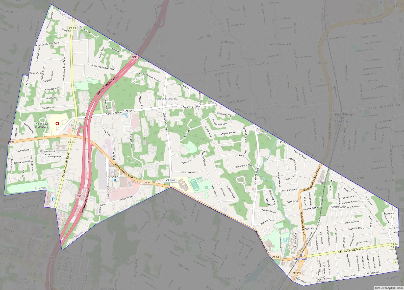
Montvale Road Map
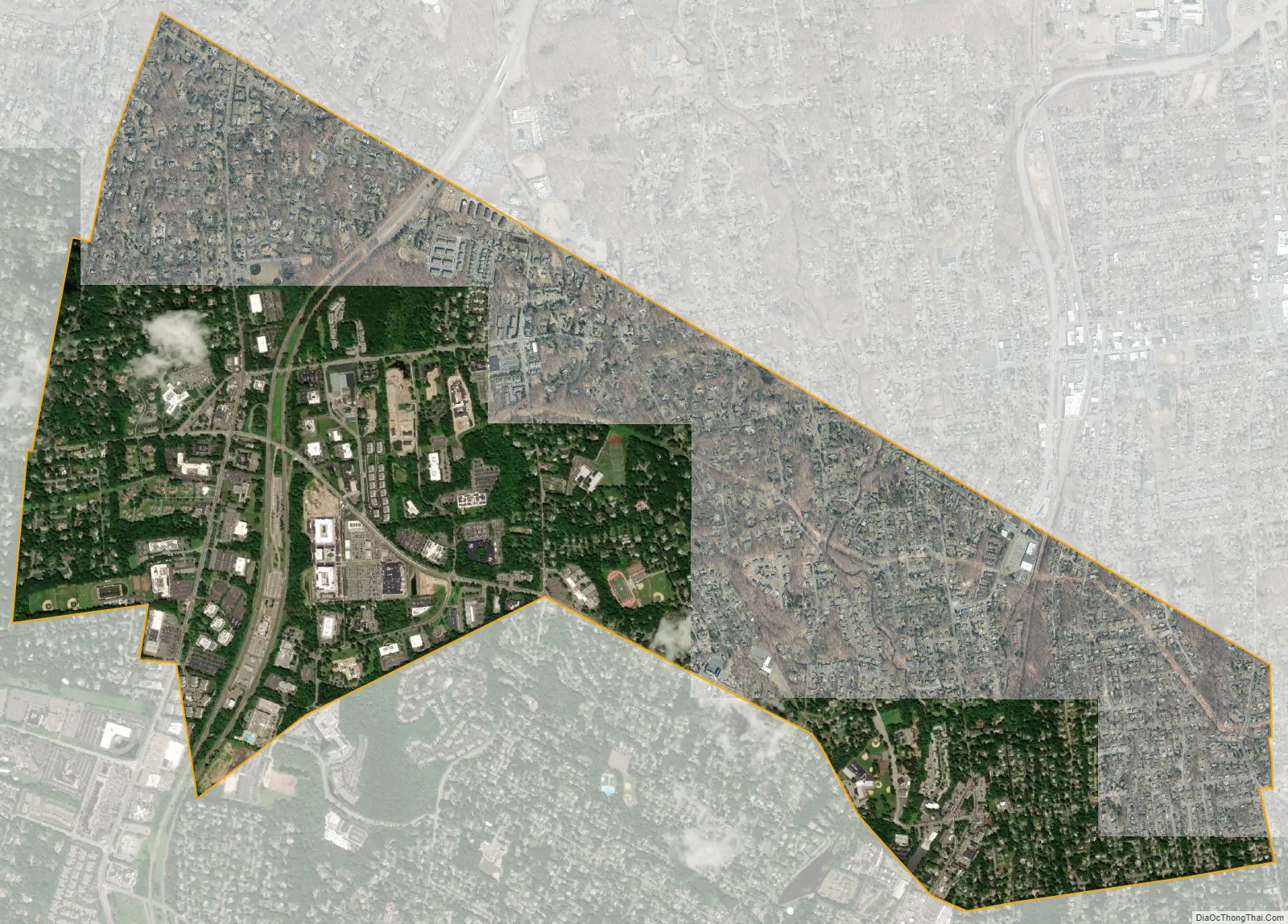
Montvale city Satellite Map
Geography
According to the U.S. Census Bureau, the borough had a total area of 4.03 square miles (10.45 km), including 4.02 square miles (10.42 km) of land and 0.01 square miles (0.03 km) of water (0.25%).
The borough borders six neighboring municipalities: Park Ridge, River Vale, Upper Saddle River and Woodcliff Lake in Bergen County; and both Pearl River (in the Town of Orangetown) and Chestnut Ridge (in the Town of Ramapo) in Rockland County, New York.
Unincorporated communities, localities and place names located partially or completely within the township include Chestnut Ridge.
Montvale is served by the Garden State Parkway at exits 171 and 172, as well as the New York State Thruway in Chestnut Ridge.
See also
Map of New Jersey State and its subdivision: Map of other states:- Alabama
- Alaska
- Arizona
- Arkansas
- California
- Colorado
- Connecticut
- Delaware
- District of Columbia
- Florida
- Georgia
- Hawaii
- Idaho
- Illinois
- Indiana
- Iowa
- Kansas
- Kentucky
- Louisiana
- Maine
- Maryland
- Massachusetts
- Michigan
- Minnesota
- Mississippi
- Missouri
- Montana
- Nebraska
- Nevada
- New Hampshire
- New Jersey
- New Mexico
- New York
- North Carolina
- North Dakota
- Ohio
- Oklahoma
- Oregon
- Pennsylvania
- Rhode Island
- South Carolina
- South Dakota
- Tennessee
- Texas
- Utah
- Vermont
- Virginia
- Washington
- West Virginia
- Wisconsin
- Wyoming


