Wanaque (/ˈwɒnəkjuː, wəˈnɑːki/) is a borough in Passaic County, in the U.S. state of New Jersey. As of the 2020 United States census, the borough’s population was 11,317, an increase of 201 (+1.8%) from the 2010 census count of 11,116, which in turn reflected an increase of 850 (+8.3%) from the 10,266 counted in the 2000 census.
| Name: | Wanaque borough |
|---|---|
| LSAD Code: | 21 |
| LSAD Description: | borough (suffix) |
| State: | New Jersey |
| County: | Passaic County |
| Incorporated: | March 22, 1918 |
| Elevation: | 220 ft (70 m) |
| Total Area: | 9.32 sq mi (24.15 km²) |
| Land Area: | 8.06 sq mi (20.88 km²) |
| Water Area: | 1.26 sq mi (3.26 km²) 13.50% |
| Total Population: | 11,317 |
| Population Density: | 1,403.0/sq mi (541.7/km²) |
| ZIP code: | 07420 – Haskell 07465 – Wanaque |
| Area code: | 973 Exchanges: 248, 616, 831, 835, 839 |
| FIPS code: | 3476730 |
| GNISfeature ID: | 0885431 |
| Website: | www.wanaqueborough.com |
Online Interactive Map
Click on ![]() to view map in "full screen" mode.
to view map in "full screen" mode.
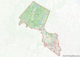
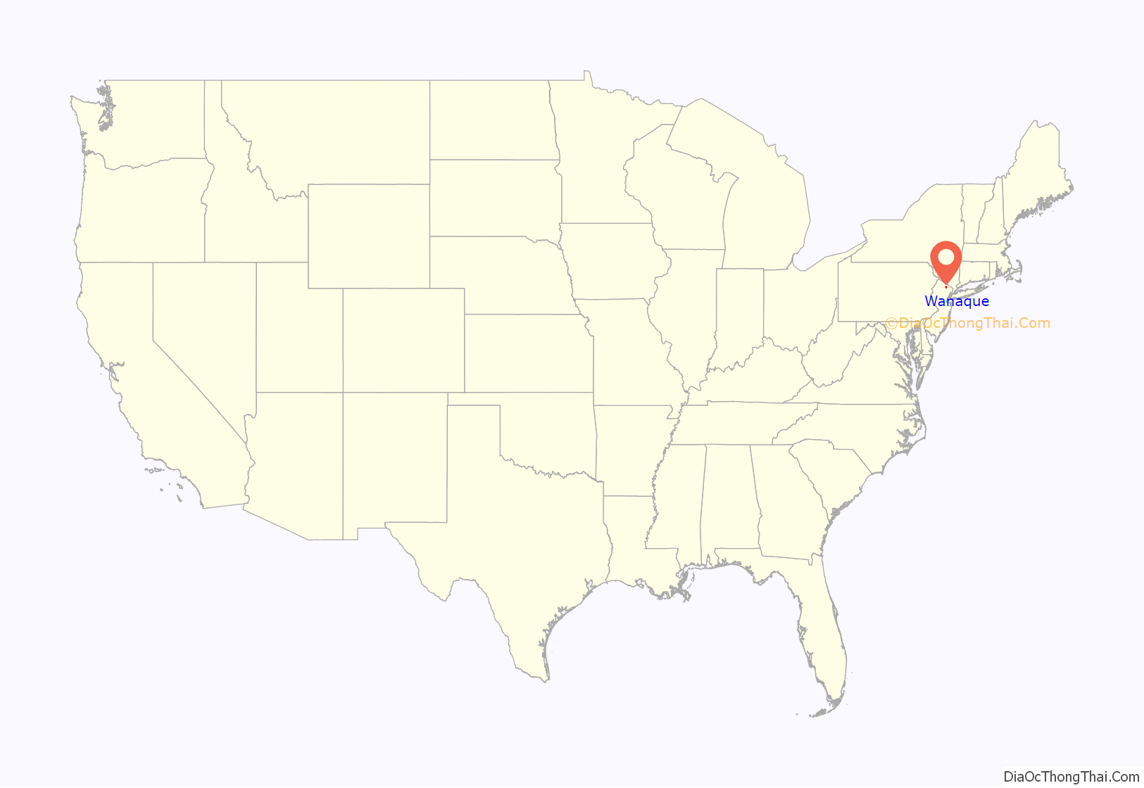
Wanaque location map. Where is Wanaque borough?

History
Wanaque was incorporated as an independent borough on February 23, 1918, when Pompton Township was split up into three boroughs, along with Bloomingdale and Ringwood, and affirmed by a referendum held on March 22, 1918. The borough’s name Wanaque (original pronunciation ‘Wa Na Kee’) is thought to have been derived from a Lenni Lenape Native American word meaning “land of sassafras”.
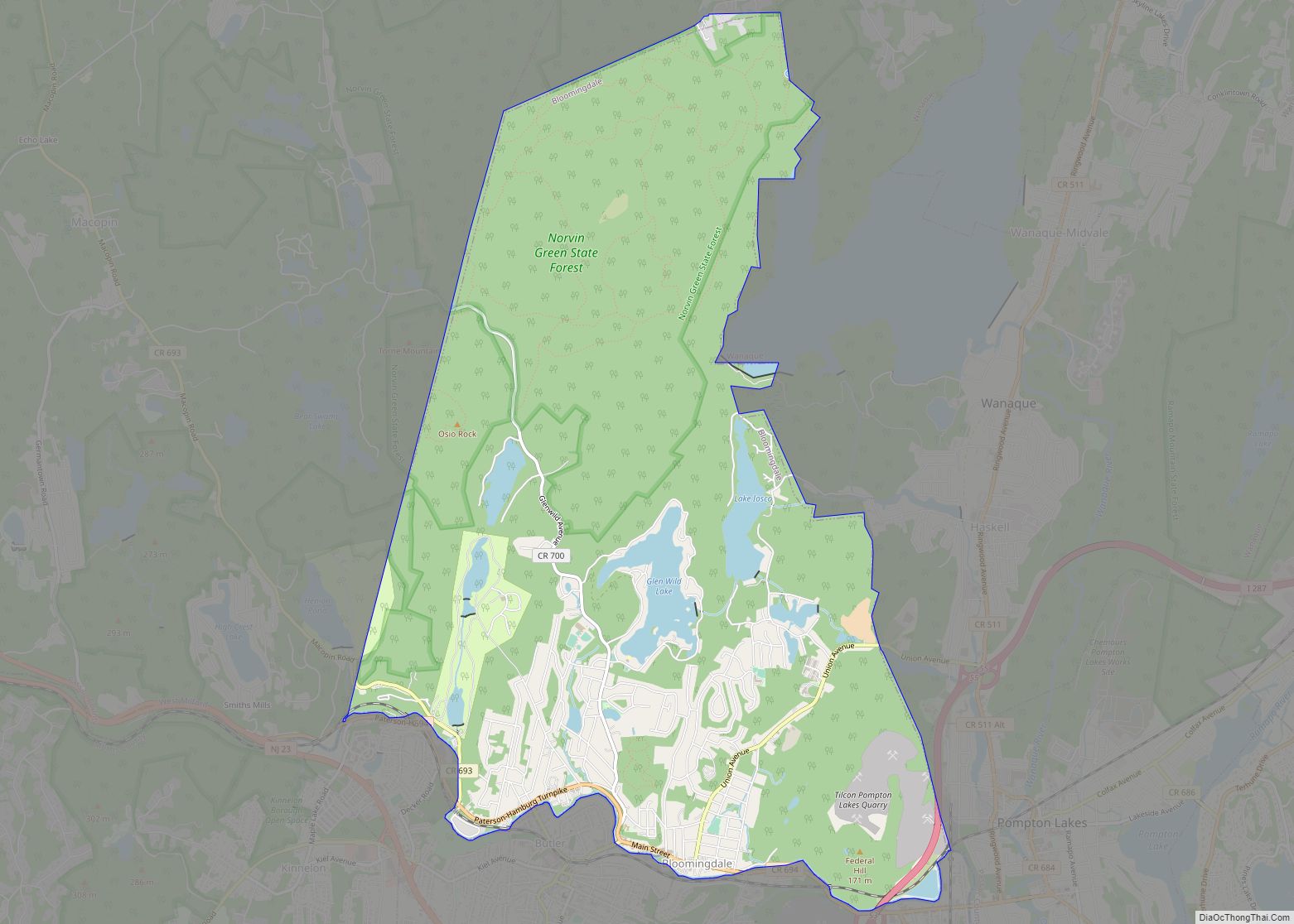
Wanaque Road Map

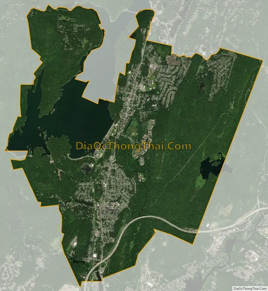
Wanaque city Satellite Map
Geography
According to the United States Census Bureau, the borough had a total area of 9.33 square miles (24.15 km), including 8.07 square miles (20.89 km) of land and 1.26 square miles (3.26 km) of water (13.50%).
Unincorporated communities, localities and place names located partially or completely within the borough include Haskell, Lake Inez, Lake Washington, Meadow Brook Lake, Midvale, Ramapo Lake, Rotten Pond, Stephens Lake and Upper Midvale.
Both Wanaque (formerly Midvale) and Haskell have their own ZIP Codes and are served by separate post offices.
The borough borders the municipalities of Bloomingdale, Pompton Lakes and Ringwood in Passaic County; and Oakland in Bergen County.
See also
Map of New Jersey State and its subdivision: Map of other states:- Alabama
- Alaska
- Arizona
- Arkansas
- California
- Colorado
- Connecticut
- Delaware
- District of Columbia
- Florida
- Georgia
- Hawaii
- Idaho
- Illinois
- Indiana
- Iowa
- Kansas
- Kentucky
- Louisiana
- Maine
- Maryland
- Massachusetts
- Michigan
- Minnesota
- Mississippi
- Missouri
- Montana
- Nebraska
- Nevada
- New Hampshire
- New Jersey
- New Mexico
- New York
- North Carolina
- North Dakota
- Ohio
- Oklahoma
- Oregon
- Pennsylvania
- Rhode Island
- South Carolina
- South Dakota
- Tennessee
- Texas
- Utah
- Vermont
- Virginia
- Washington
- West Virginia
- Wisconsin
- Wyoming