Aumsville is a city in Marion County, Oregon, United States. The population was 4,234 at the 2020 census. It is part of the Salem Metropolitan Statistical Area.
| Name: | Aumsville city |
|---|---|
| LSAD Code: | 25 |
| LSAD Description: | city (suffix) |
| State: | Oregon |
| County: | Marion County |
| Incorporated: | August 3, 1911 |
| Elevation: | 366 ft (112 m) |
| Total Area: | 1.13 sq mi (2.92 km²) |
| Land Area: | 1.13 sq mi (2.92 km²) |
| Water Area: | 0.00 sq mi (0.00 km²) |
| Total Population: | 4,234 |
| Population Density: | 3,750.22/sq mi (1,448.20/km²) |
| ZIP code: | 97325 |
| FIPS code: | 4103250 |
| GNISfeature ID: | 1117091 |
| Website: | www.aumsville.us |
Online Interactive Map
Click on ![]() to view map in "full screen" mode.
to view map in "full screen" mode.
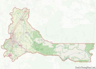
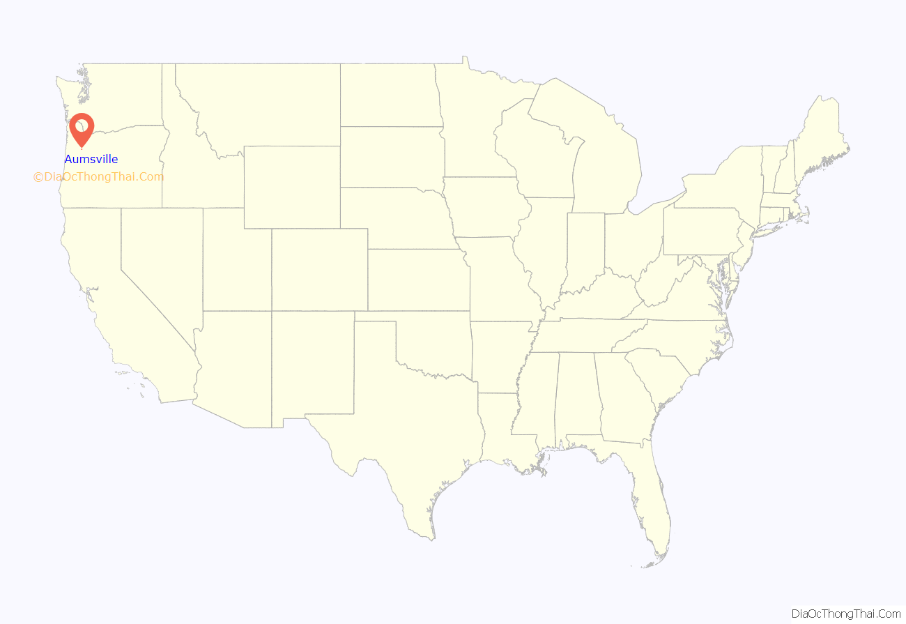
Aumsville location map. Where is Aumsville city?
History
Aumsville is on the site of the pioneer farm of Henry L. Turner, who named the settlement for his son-in-law, Amos M. Davis, more familiarly known as “Aumus”, who had died on December 23, 1863. Aumsville was incorporated on August 3, 1911.
In 1893 the “Old Wooden School” was built between Main Street and Church Street, and operated until it was replaced in 1922 by Amos Davis School, which eventually closed in 1972.
On December 14, 2010, an EF2 tornado touched down in the center of Aumsville. The winds destroyed homes and caused substantial damage to businesses and City Hall.
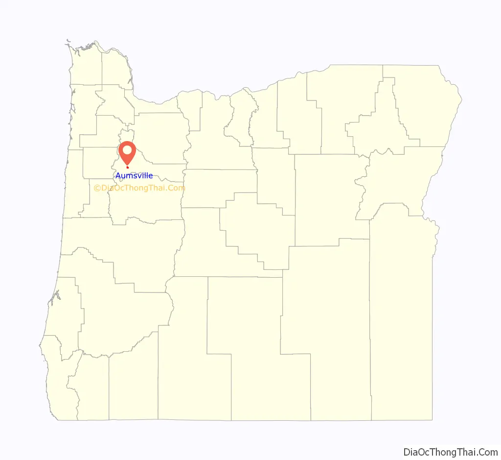
Aumsville Road Map
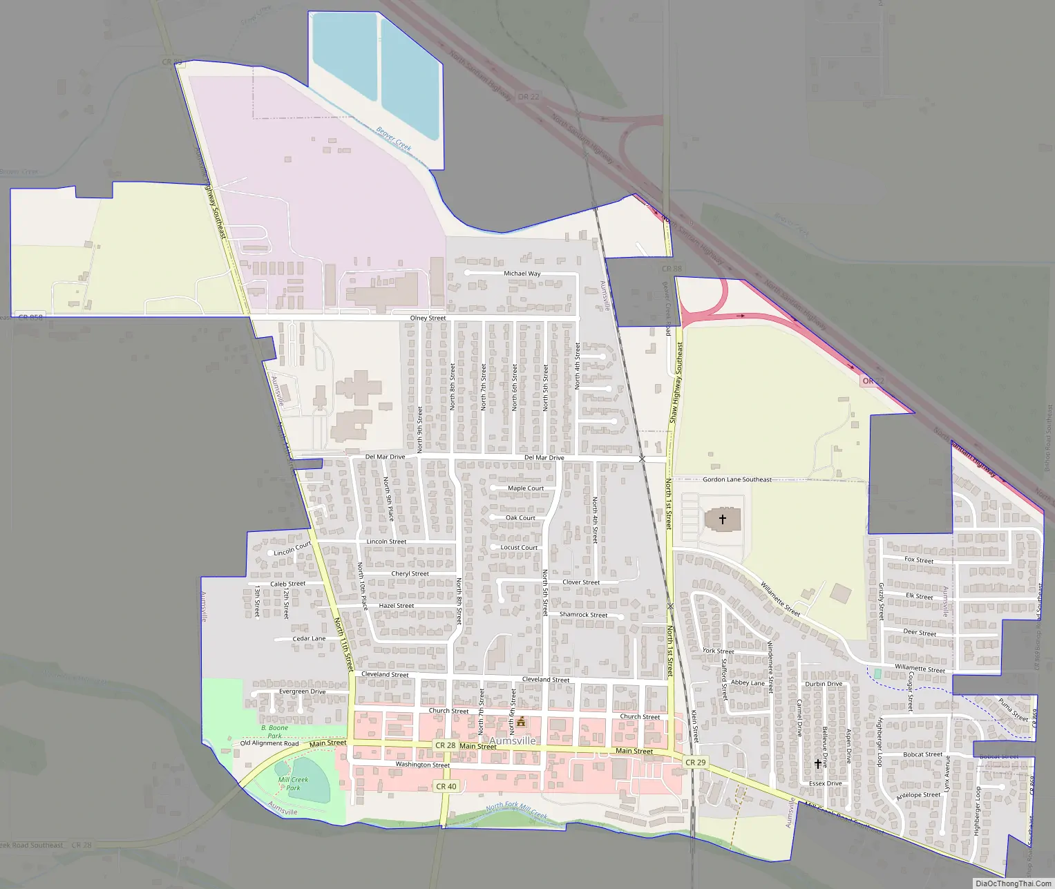
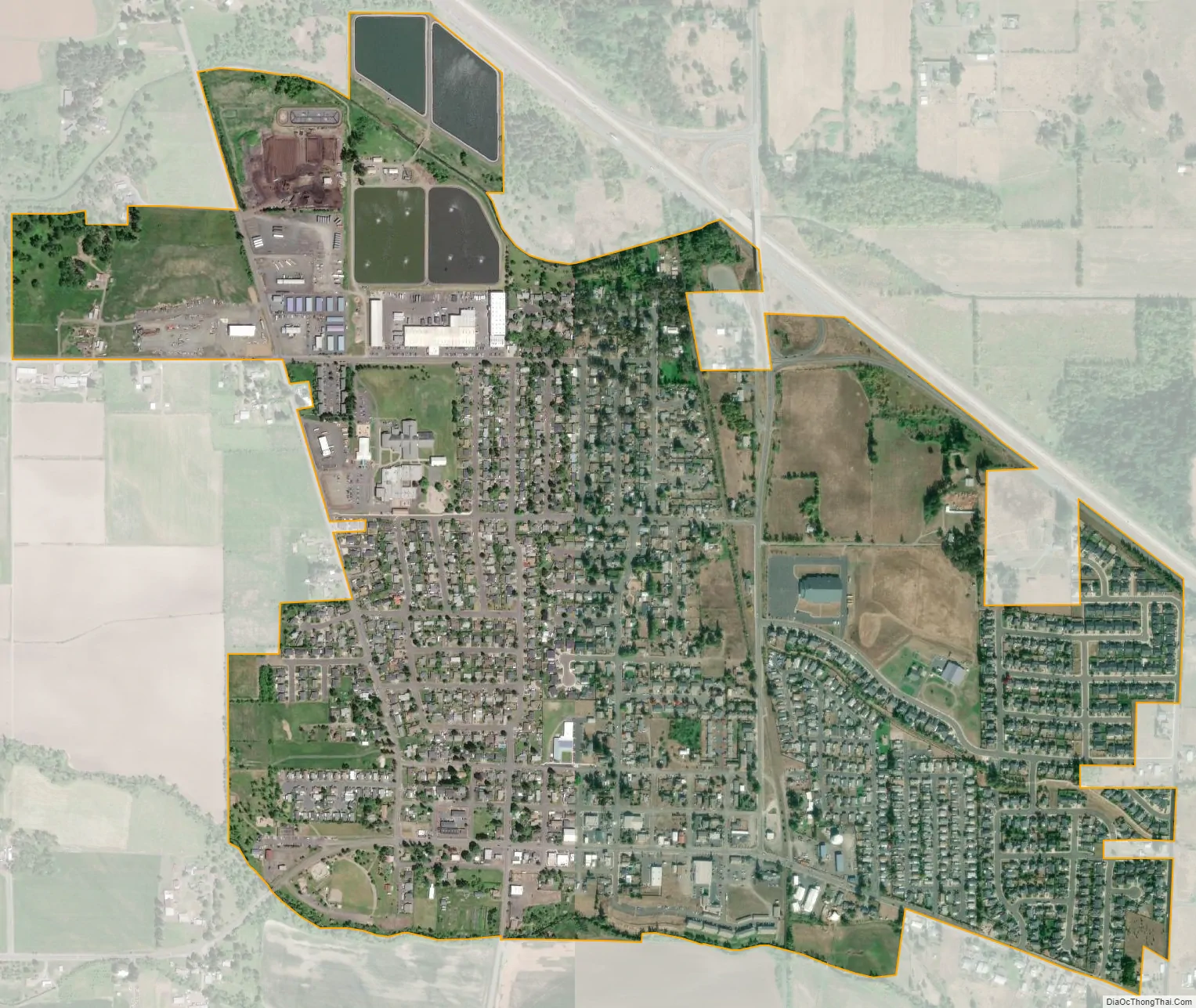
Aumsville city Satellite Map
Geography
According to the United States Census Bureau, the city has a total area of 1.02 square miles (2.64 km), all of it land.
See also
Map of Oregon State and its subdivision: Map of other states:- Alabama
- Alaska
- Arizona
- Arkansas
- California
- Colorado
- Connecticut
- Delaware
- District of Columbia
- Florida
- Georgia
- Hawaii
- Idaho
- Illinois
- Indiana
- Iowa
- Kansas
- Kentucky
- Louisiana
- Maine
- Maryland
- Massachusetts
- Michigan
- Minnesota
- Mississippi
- Missouri
- Montana
- Nebraska
- Nevada
- New Hampshire
- New Jersey
- New Mexico
- New York
- North Carolina
- North Dakota
- Ohio
- Oklahoma
- Oregon
- Pennsylvania
- Rhode Island
- South Carolina
- South Dakota
- Tennessee
- Texas
- Utah
- Vermont
- Virginia
- Washington
- West Virginia
- Wisconsin
- Wyoming