Barlow is a city in Clackamas County, Oregon, United States. The population was 133 at the 2020 census. The mayor of Barlow is Michael Lundsten, as of the most recent election in 2018.
| Name: | Barlow city |
|---|---|
| LSAD Code: | 25 |
| LSAD Description: | city (suffix) |
| State: | Oregon |
| County: | Clackamas County |
| Incorporated: | 1903 |
| Elevation: | 101 ft (31 m) |
| Total Area: | 0.05 sq mi (0.14 km²) |
| Land Area: | 0.05 sq mi (0.14 km²) |
| Water Area: | 0.00 sq mi (0.00 km²) |
| Total Population: | 133 |
| Population Density: | 2,557.69/sq mi (985.18/km²) |
| ZIP code: | 97013 |
| Area code: | 503 |
| FIPS code: | 4104000 |
| GNISfeature ID: | 1166611 |
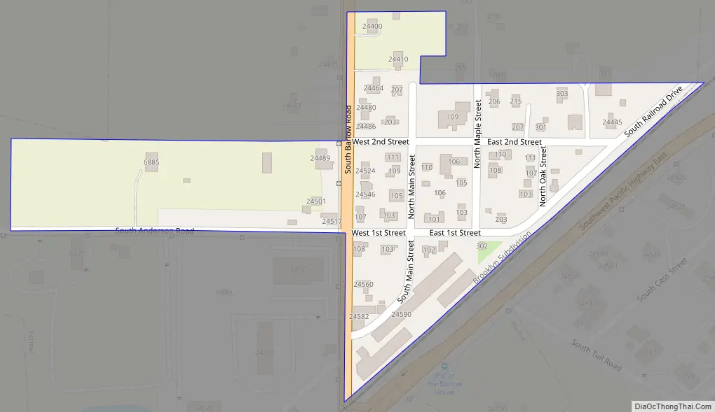
Online Interactive Map
Click on ![]() to view map in "full screen" mode.
to view map in "full screen" mode.
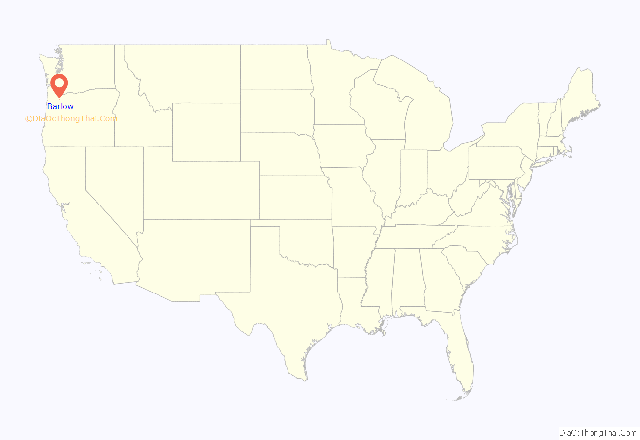
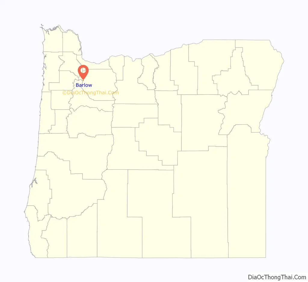
Barlow location map. Where is Barlow city?
History
Barlow is named for William Barlow, the son of Samuel K. Barlow (developer of the Barlow Road). Samuel bought the donation land claim in which Barlow is located from Thomas McKay on September 17, 1850. He later sold the land to William.
In 1870, the railroad was built through Barlow. The station was originally named Barlows (for William, not Samuel). As of 2003, the main line of the Union Pacific Railroad still ran through Barlow.
The post office at Barlow was opened on February 7, 1871. It closed on January 3, 1975.
Barlow Road Map
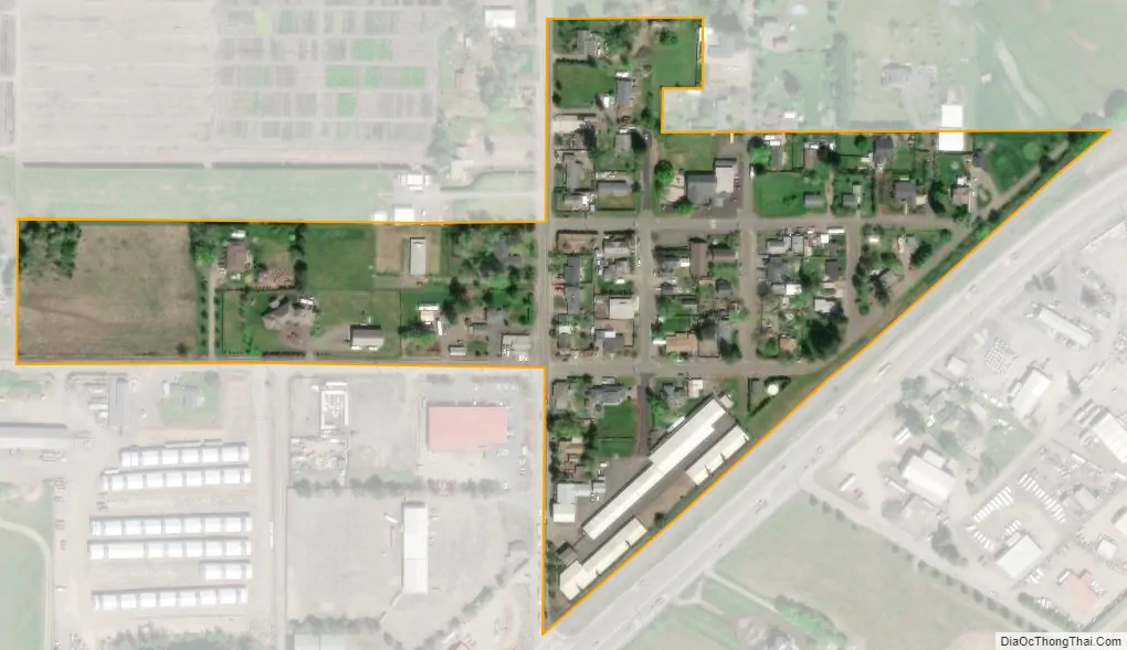
Barlow city Satellite Map
Geography
According to the United States Census Bureau, the city has a total area of 0.05 square miles (0.13 km), all of it land.
See also
Map of Oregon State and its subdivision: Map of other states:- Alabama
- Alaska
- Arizona
- Arkansas
- California
- Colorado
- Connecticut
- Delaware
- District of Columbia
- Florida
- Georgia
- Hawaii
- Idaho
- Illinois
- Indiana
- Iowa
- Kansas
- Kentucky
- Louisiana
- Maine
- Maryland
- Massachusetts
- Michigan
- Minnesota
- Mississippi
- Missouri
- Montana
- Nebraska
- Nevada
- New Hampshire
- New Jersey
- New Mexico
- New York
- North Carolina
- North Dakota
- Ohio
- Oklahoma
- Oregon
- Pennsylvania
- Rhode Island
- South Carolina
- South Dakota
- Tennessee
- Texas
- Utah
- Vermont
- Virginia
- Washington
- West Virginia
- Wisconsin
- Wyoming