Butteville is a census-designated place and unincorporated community in Marion County, Oregon, United States. For statistical purposes, the United States Census Bureau has defined Butteville as a census-designated place (CDP). The census definition of the area may not precisely correspond to local understanding of the area with the same name. As of the 2020 census the population was 273. It is part of the Salem Metropolitan Statistical Area.
| Name: | Butteville CDP |
|---|---|
| LSAD Code: | 57 |
| LSAD Description: | CDP (suffix) |
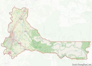
| State: | Oregon |
| County: | Marion County |
| Elevation: | 138 ft (42 m) |
| Total Area: | 1.11 sq mi (2.89 km²) |
| Land Area: | 1.05 sq mi (2.72 km²) |
| Water Area: | 0.07 sq mi (0.17 km²) |
| Total Population: | 273 |
| Population Density: | 260.25/sq mi (100.43/km²) |
| ZIP code: | 97002 |
| Area code: | 503 |
| FIPS code: | 4110100 |
| GNISfeature ID: | 1158152 |
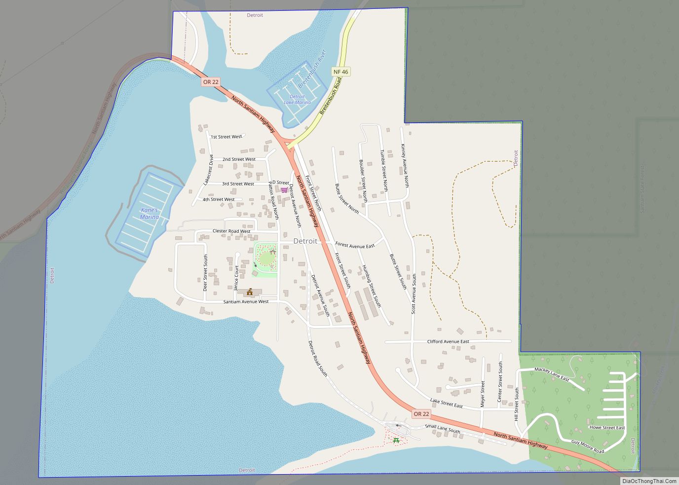
Online Interactive Map
Click on ![]() to view map in "full screen" mode.
to view map in "full screen" mode.
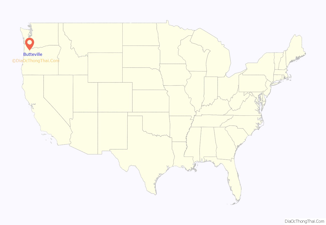
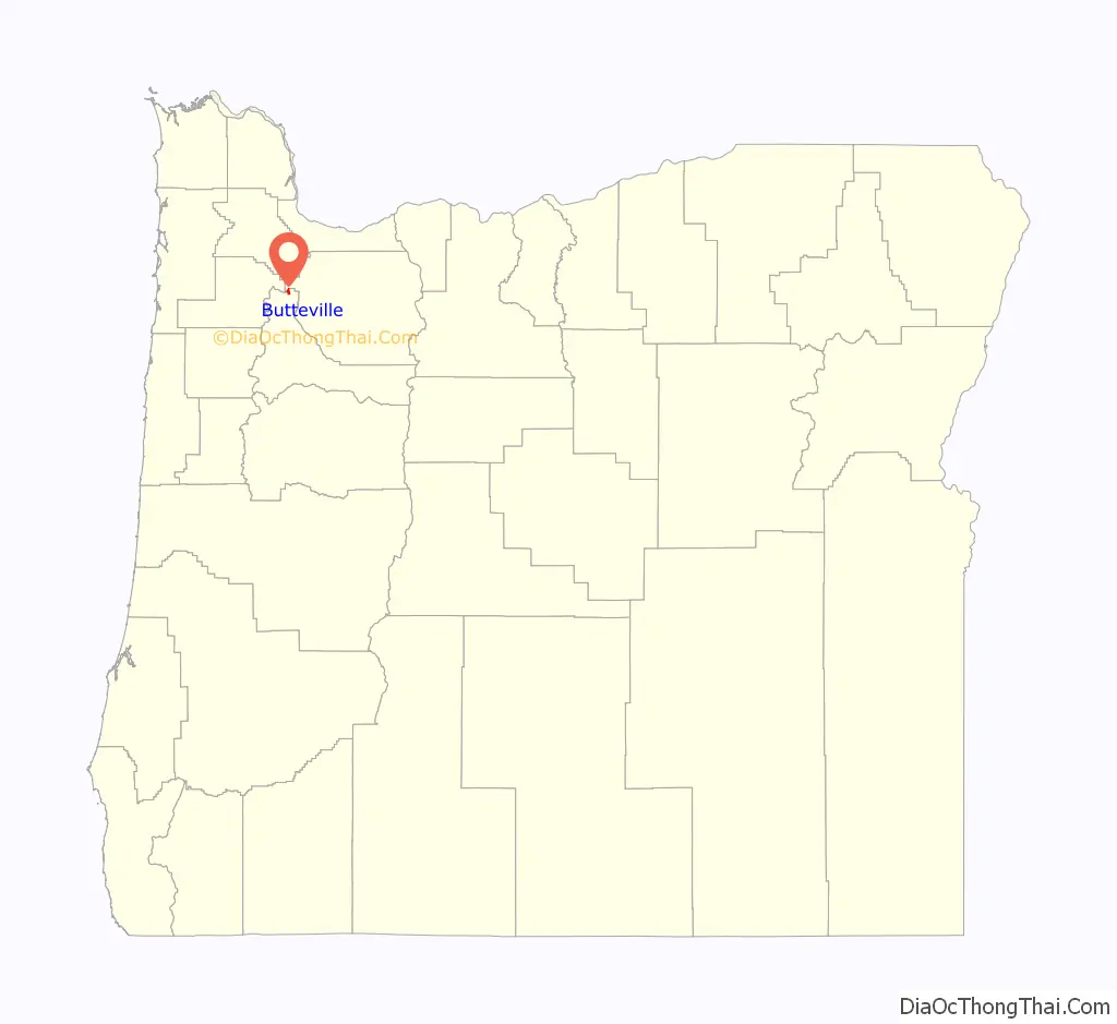
Butteville location map. Where is Butteville CDP?
History
Butteville was founded in the 1840s by members of the Methodist Mission. Butteville was once served by steamboats running on the Willamette River. Butteville saw the peak of its economy in the 1850s, as it competed with neighboring Champoeg, Oregon for shipping business from the surrounding French Prairie. Most of Butteville’s early residents were French-Canadian.
Butteville Road Map
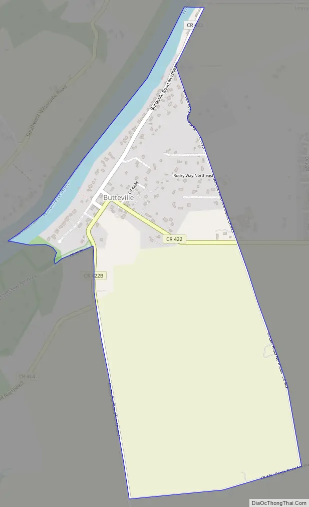
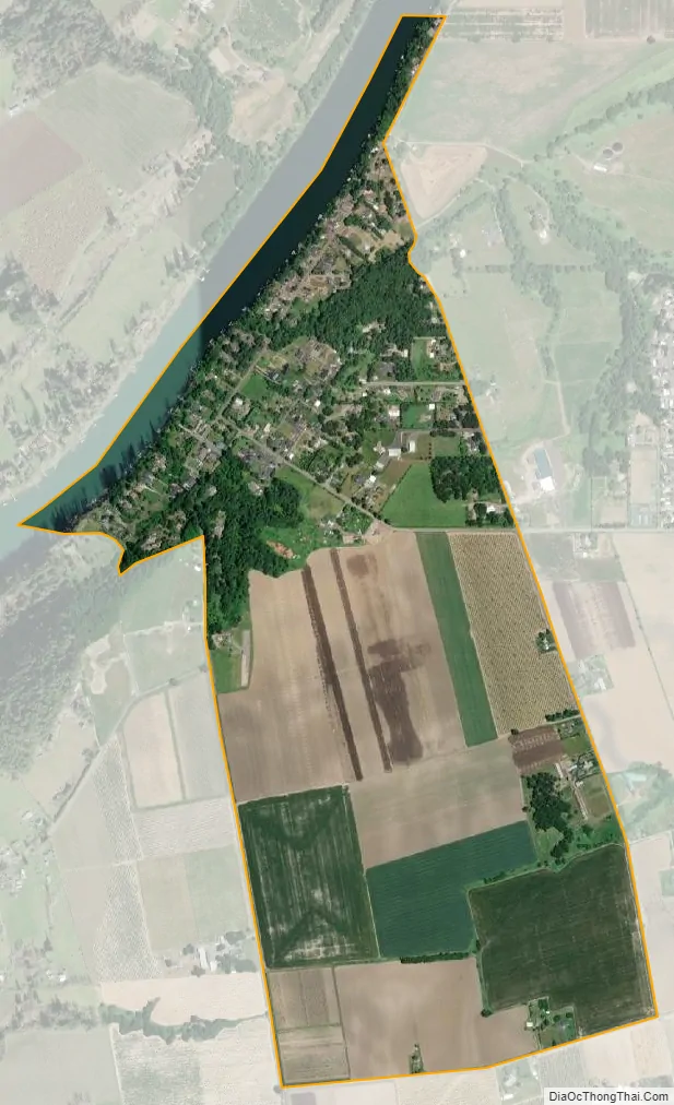
Butteville city Satellite Map
Geography
According to the United States Census Bureau, the CDP has a total area of 1.1 square miles (2.8 km), of which, 1.0 square mile (2.6 km) of it is land and 0.1 square miles (0.26 km) of it (6.31%) is water.
See also
Map of Oregon State and its subdivision: Map of other states:- Alabama
- Alaska
- Arizona
- Arkansas
- California
- Colorado
- Connecticut
- Delaware
- District of Columbia
- Florida
- Georgia
- Hawaii
- Idaho
- Illinois
- Indiana
- Iowa
- Kansas
- Kentucky
- Louisiana
- Maine
- Maryland
- Massachusetts
- Michigan
- Minnesota
- Mississippi
- Missouri
- Montana
- Nebraska
- Nevada
- New Hampshire
- New Jersey
- New Mexico
- New York
- North Carolina
- North Dakota
- Ohio
- Oklahoma
- Oregon
- Pennsylvania
- Rhode Island
- South Carolina
- South Dakota
- Tennessee
- Texas
- Utah
- Vermont
- Virginia
- Washington
- West Virginia
- Wisconsin
- Wyoming