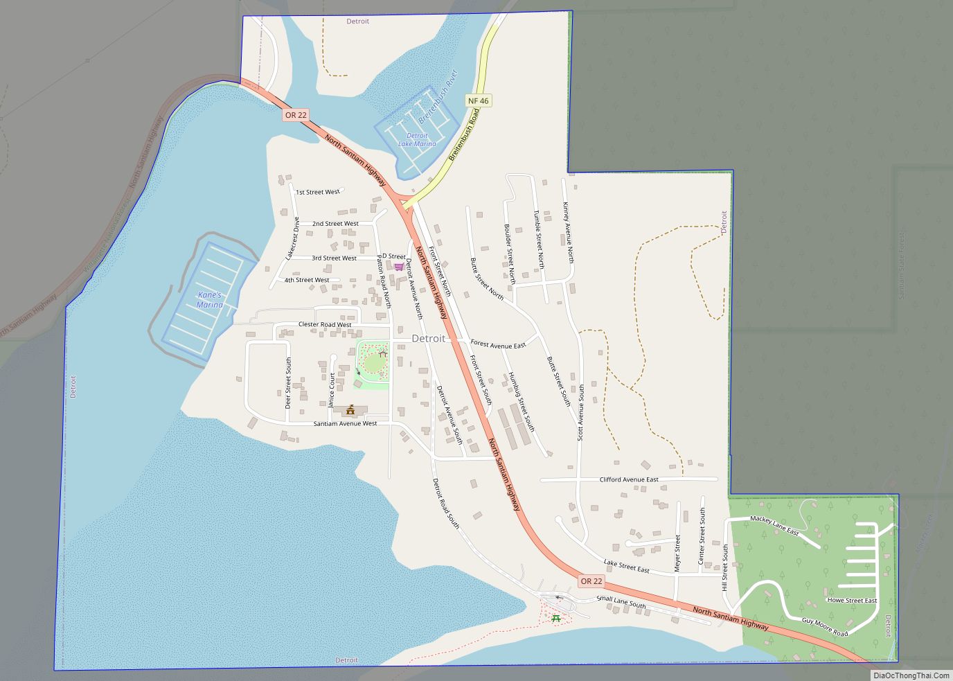
Detroit is a city in Marion County, Oregon, United States. It was named for Detroit, Michigan, in the 1890s because of the large number of people from Michigan in the community. The population was 203 at the 2020 census. It is part of the Salem Metropolitan Statistical Area.
| Name: | Detroit city |
|---|---|
| LSAD Code: | 25 |
| LSAD Description: | city (suffix) |
| State: | Oregon |
| County: | Marion County |
| Incorporated: | 1952 |
| Elevation: | 1,595 ft (486.16 m) |
| Total Area: | 0.95 sq mi (2.47 km²) |
| Land Area: | 0.59 sq mi (1.52 km²) |
| Water Area: | 0.37 sq mi (0.95 km²) |
| Total Population: | 203 |
| Population Density: | 346.42/sq mi (133.71/km²) |
| ZIP code: | 97342 |
| Area code: | 503 and 971 |
| FIPS code: | 4119100 |
| GNISfeature ID: | 1140929 |
Online Interactive Map
Click on ![]() to view map in "full screen" mode.
to view map in "full screen" mode.
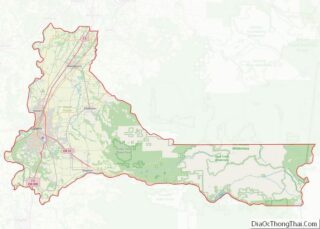
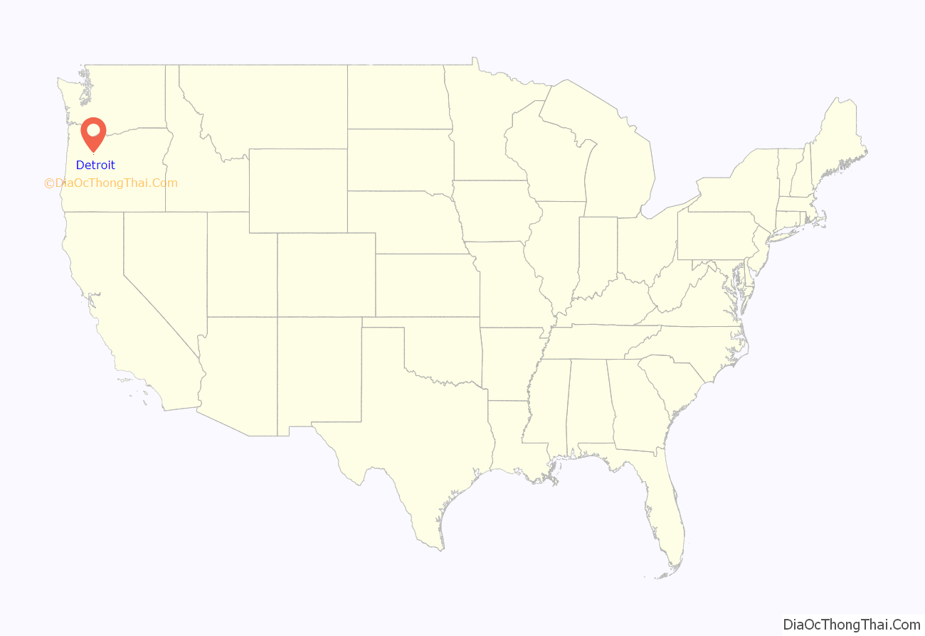
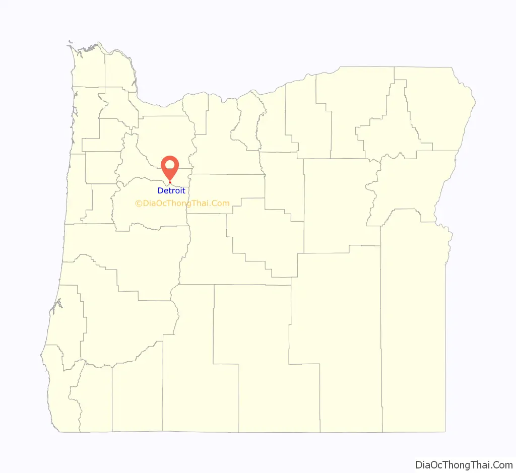
Detroit location map. Where is Detroit city?
History
The original townsite of Detroit was inundated in the summer of 1952 when the Corps of Engineers finished Detroit Dam on the Santiam River. The community was relocated about 1⁄2 mile (0.80 km) northwest of the original site, on Route 22, and was incorporated as a city the same year.
Construction on the concrete Detroit Dam began on April 1, 1949 as part of the U.S. Army Corps of Engineers’ Willamette Valley Project. The completed dam was dedicated by former Oregon Governor Douglas McKay and the U. S. Secretary of the Interior on June 10, 1953. In addition to flood control, the dam benefited navigation, irrigation, electric power production, stream purification and recreation.
Located near Detroit Lake and Detroit Lake State Park, Detroit’s economy is dependent on tourism. The community suffered from a drought in 2001, when Detroit Lake was little more than the Santiam River through the summer.
In 2010, by a vote of 47–37, citizens in Detroit voted down a ballot measure that would have changed the city’s name to Detroit Lake, the name of the neighboring reservoir and one of the most visited summer sites in Oregon. The proposal was put forth by Doug DeGeorge, a builder and motel owner who resides in Arizona and wanted to disassociate the town from Detroit, Michigan, and its close ties to “crime, corruption, failing schools, and a shaky auto industry”. DeGeorge was not present on the day of the city council vote, but repercussions from his comments had phone lines flooded with angry calls from Michigan residents. Voters chose to keep the original name of the city, though most residents and tourists still call it Detroit Lake. Gary Brown, a city councilman in Detroit, Michigan, disagreed with the proposal, saying local residents would have made a big mistake because “the Motor City will one day return to its previous glory”.
On September 9, 2020, Detroit was mostly burned to the ground by wildfire during the Santiam Fire. Dozens of people were trapped, but managed to escape on a forest road through the active fire. A few months later, during the February 2021 winter and ice storm, the city received 26 in (66 cm) of snow—the most of any place affected by the storm.
Detroit Road Map
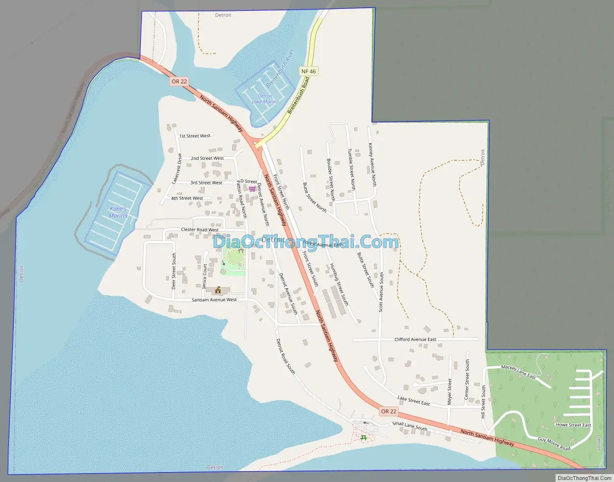
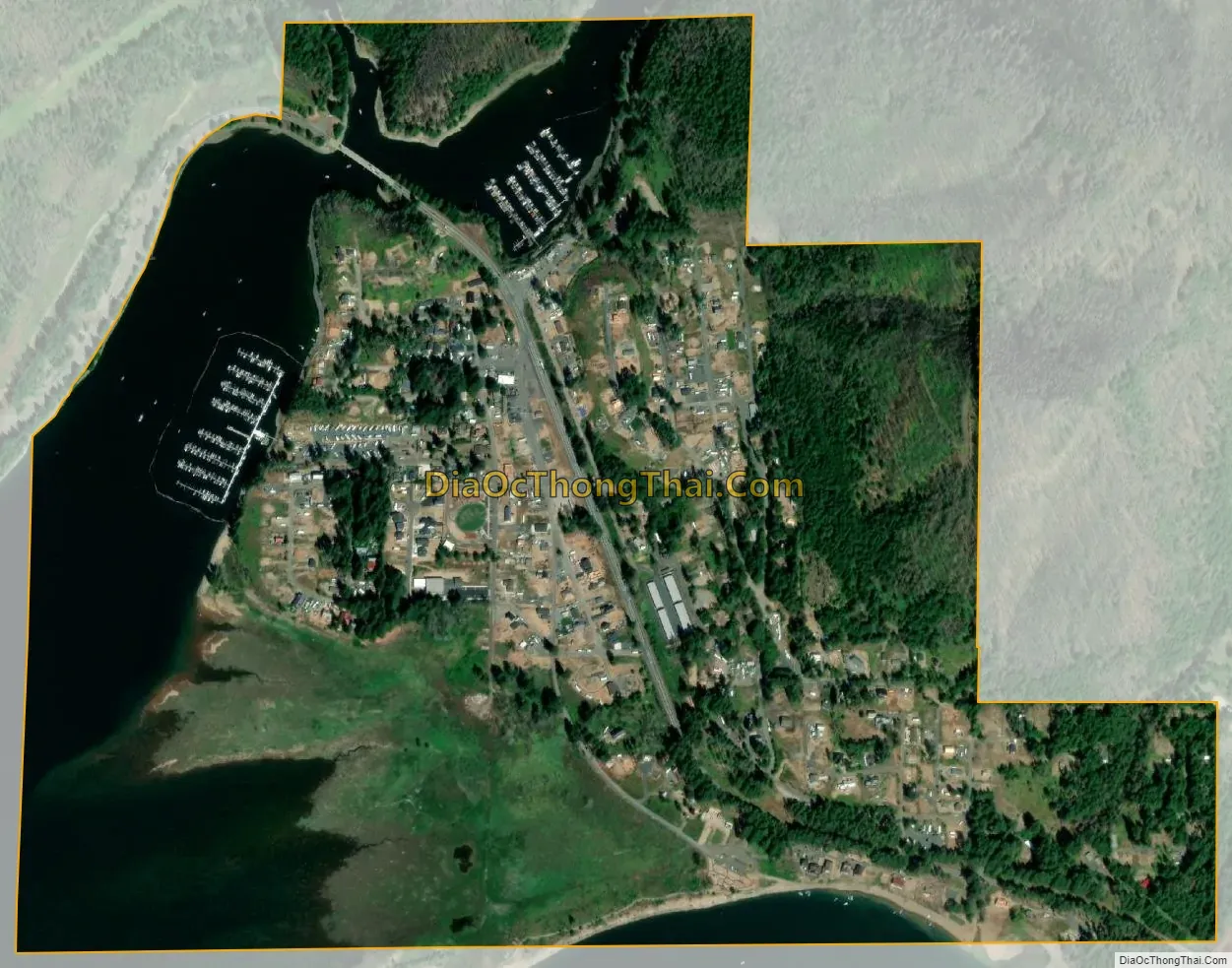
Detroit city Satellite Map
Geography
According to the United States Census Bureau, Detroit has a total area of 0.96 square miles (2.49 km), of which 0.59 square miles (1.53 km) is land and 0.37 square miles (0.96 km) is water.
Climate
This region experiences warm (but not hot) and dry summers, with no average monthly temperatures above 71.6 °F (22.0 °C). According to the Köppen Climate Classification system, Detroit has a warm-summer Mediterranean climate, abbreviated “Csb” on climate maps.
See also
Map of Oregon State and its subdivision: Map of other states:- Alabama
- Alaska
- Arizona
- Arkansas
- California
- Colorado
- Connecticut
- Delaware
- District of Columbia
- Florida
- Georgia
- Hawaii
- Idaho
- Illinois
- Indiana
- Iowa
- Kansas
- Kentucky
- Louisiana
- Maine
- Maryland
- Massachusetts
- Michigan
- Minnesota
- Mississippi
- Missouri
- Montana
- Nebraska
- Nevada
- New Hampshire
- New Jersey
- New Mexico
- New York
- North Carolina
- North Dakota
- Ohio
- Oklahoma
- Oregon
- Pennsylvania
- Rhode Island
- South Carolina
- South Dakota
- Tennessee
- Texas
- Utah
- Vermont
- Virginia
- Washington
- West Virginia
- Wisconsin
- Wyoming