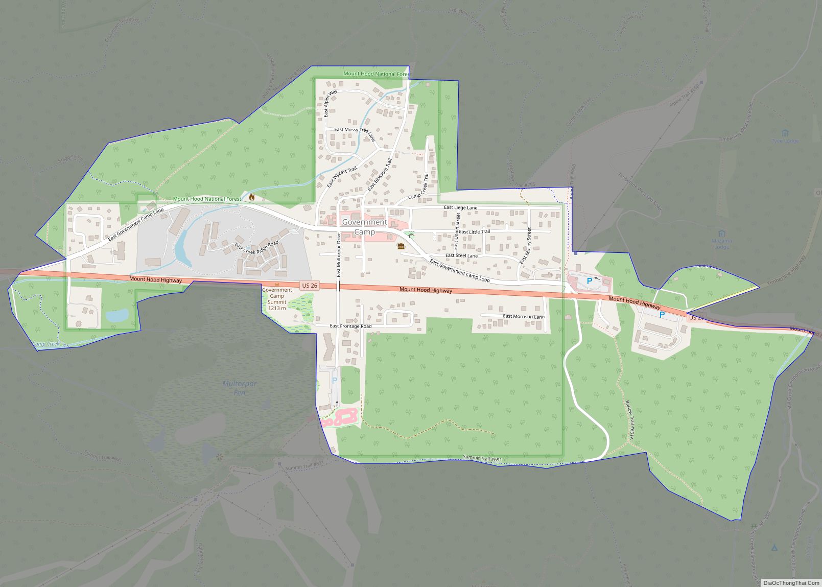
Government Camp is an unincorporated community and census-designated place located in Clackamas County, Oregon, United States, on the base of Mount Hood and north of Tom Dick and Harry Mountain. It is the only town within 5 miles (8 km) of Mount Hood and therefore is the de facto “mountain town” or “ski town”. It is the gateway to several ski resorts, with the most popular being Timberline Lodge and Mount Hood Skibowl. Government Camp also has its own, smaller ski resort, Summit Pass.
The community is located within the Mount Hood Corridor on U.S. Route 26 (the Mount Hood Highway), near its intersection with Oregon Route 35 and the Barlow Pass summit of the Cascade Range. As of the 2010 census, the community had a population of 193. The government’s 2016 estimate indicated a population of 121 persons.
| Name: | Government Camp CDP |
|---|---|
| LSAD Code: | 57 |
| LSAD Description: | CDP (suffix) |
| State: | Oregon |
| County: | Clackamas County |
| Elevation: | 3,914 ft (1,193 m) |
| Total Area: | 0.75 sq mi (1.94 km²) |
| Land Area: | 0.75 sq mi (1.94 km²) |
| Water Area: | 0.00 sq mi (0.00 km²) |
| Total Population: | 179 |
| Population Density: | 239.63/sq mi (92.46/km²) |
| ZIP code: | 97028 |
| FIPS code: | 4130250 |
| GNISfeature ID: | 1162594 |
Online Interactive Map
Click on ![]() to view map in "full screen" mode.
to view map in "full screen" mode.
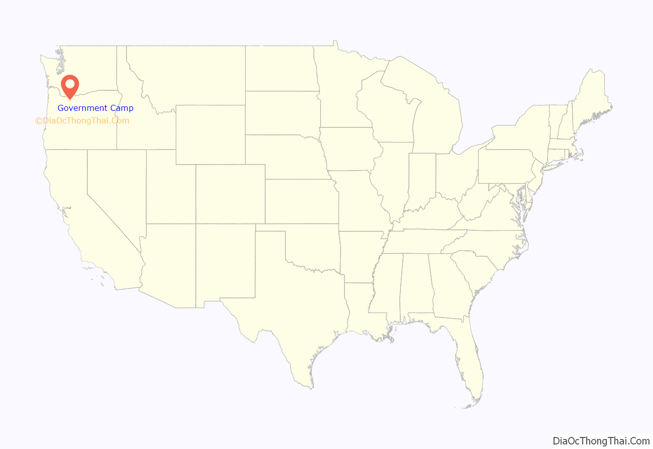
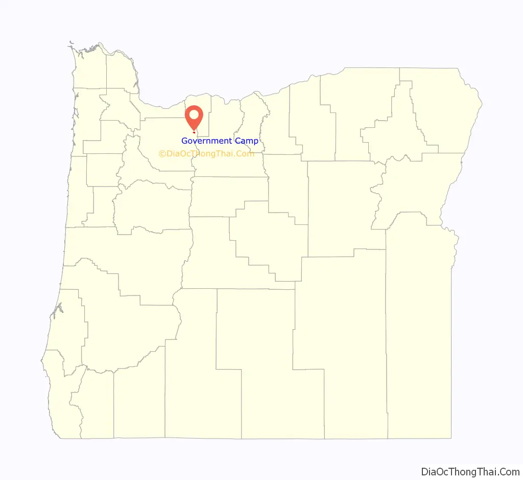
Government Camp location map. Where is Government Camp CDP?
History
Government Camp was given its name by settlers traveling the Barlow Road, who discovered several wagons abandoned there by the Regiment of Mounted Riflemen. A sign in front of the town’s post office states, “Formerly a camp on the old Barlow Road, the village was named in 1849 when U.S Cavalry troops were forced to abandon wagons and supplies here.”
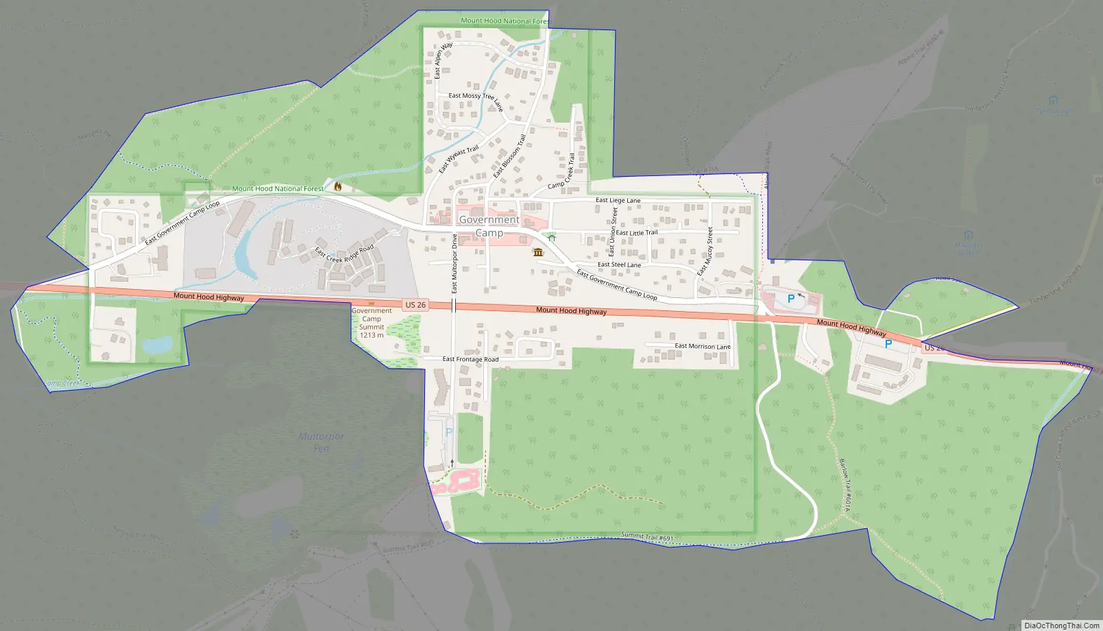
Government Camp Road Map
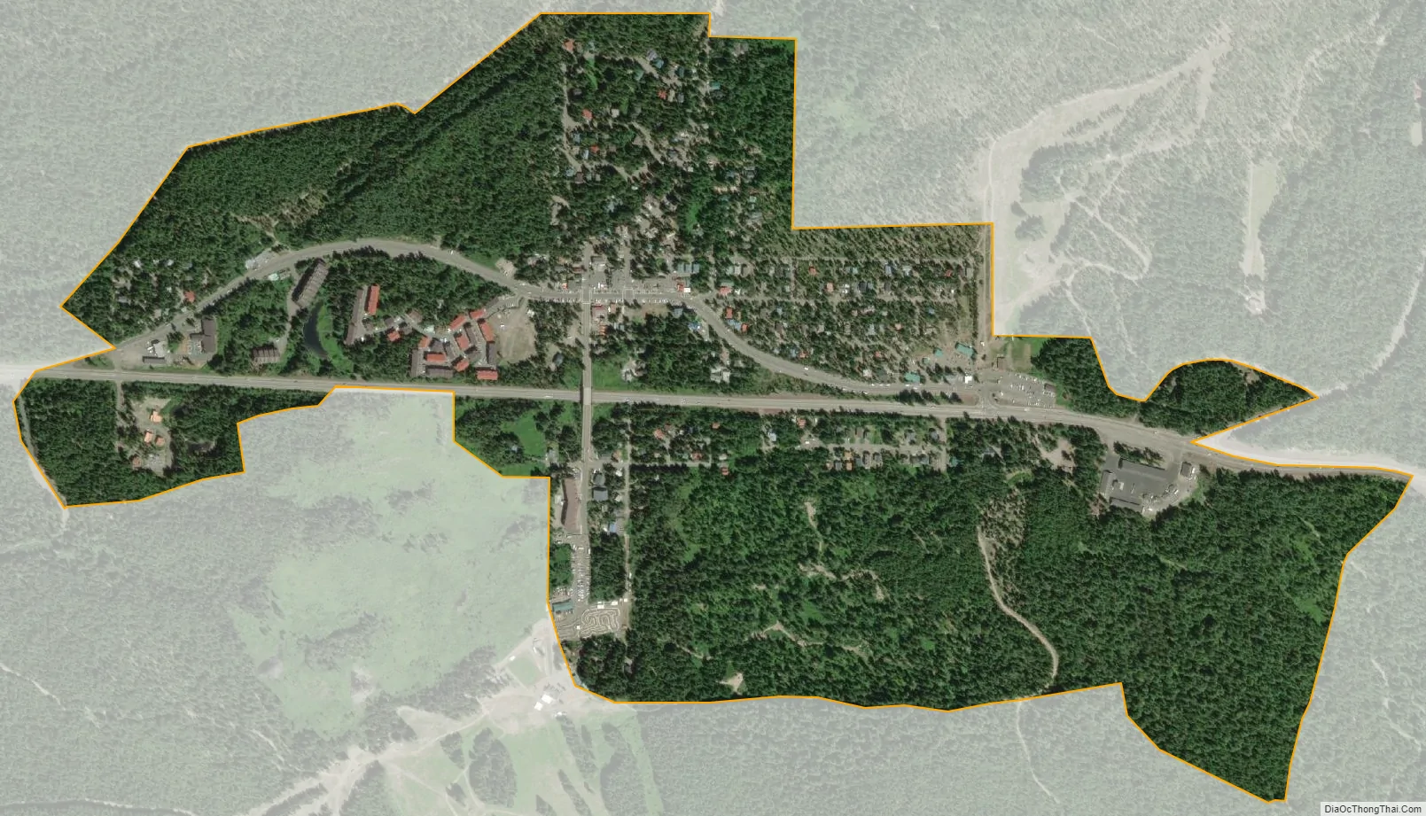
Government Camp city Satellite Map
See also
Map of Oregon State and its subdivision: Map of other states:- Alabama
- Alaska
- Arizona
- Arkansas
- California
- Colorado
- Connecticut
- Delaware
- District of Columbia
- Florida
- Georgia
- Hawaii
- Idaho
- Illinois
- Indiana
- Iowa
- Kansas
- Kentucky
- Louisiana
- Maine
- Maryland
- Massachusetts
- Michigan
- Minnesota
- Mississippi
- Missouri
- Montana
- Nebraska
- Nevada
- New Hampshire
- New Jersey
- New Mexico
- New York
- North Carolina
- North Dakota
- Ohio
- Oklahoma
- Oregon
- Pennsylvania
- Rhode Island
- South Carolina
- South Dakota
- Tennessee
- Texas
- Utah
- Vermont
- Virginia
- Washington
- West Virginia
- Wisconsin
- Wyoming