Pacific City is a census-designated place (CDP) and unincorporated community in Tillamook County, Oregon, United States. The population was 1,076 at the 2019 census. Pacific City’s main attraction is the Cape Kiwanda State Natural Area.
| Name: | Pacific City CDP |
|---|---|
| LSAD Code: | 57 |
| LSAD Description: | CDP (suffix) |
| State: | Oregon |
| County: | Tillamook County |
| Elevation: | 13 ft (4 m) |
| Total Area: | 3.83 sq mi (9.91 km²) |
| Land Area: | 3.72 sq mi (9.63 km²) |
| Water Area: | 0.11 sq mi (0.28 km²) |
| Total Population: | 1,109 |
| Population Density: | 298.28/sq mi (115.15/km²) |
| ZIP code: | 97135 |
| Area code: | 503 |
| FIPS code: | 4156150 |
| GNISfeature ID: | 1136609 |
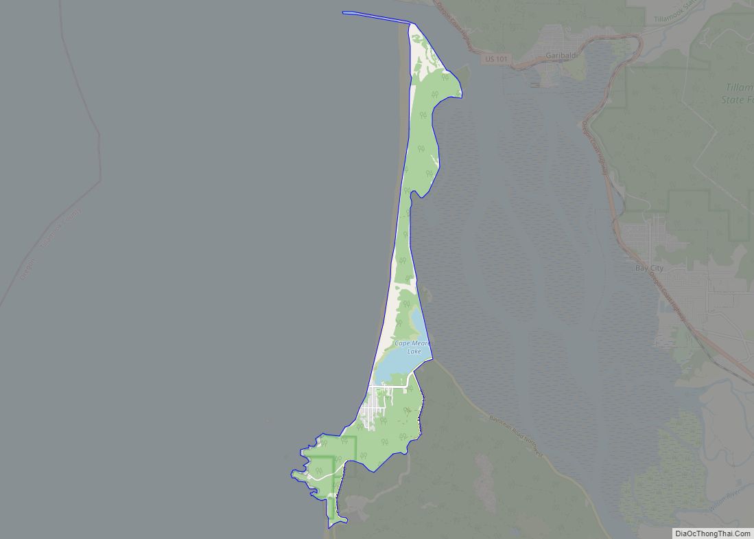
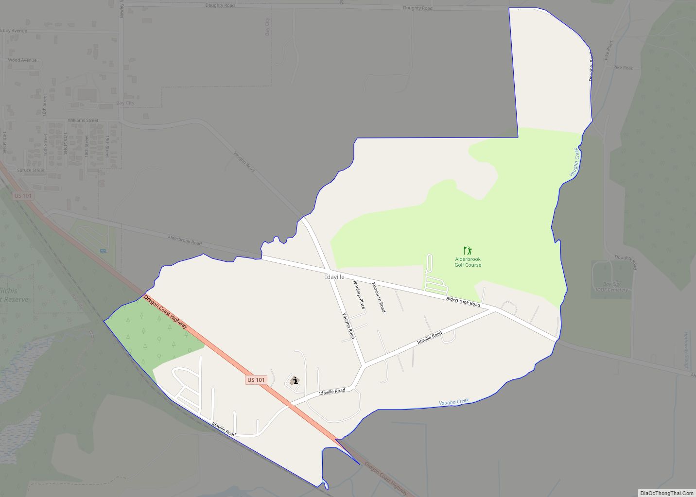
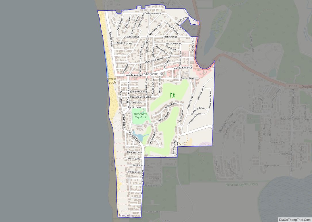
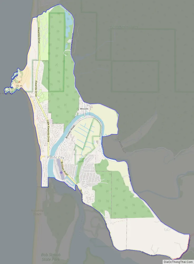
Online Interactive Map
Click on ![]() to view map in "full screen" mode.
to view map in "full screen" mode.
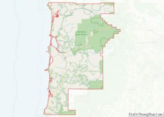
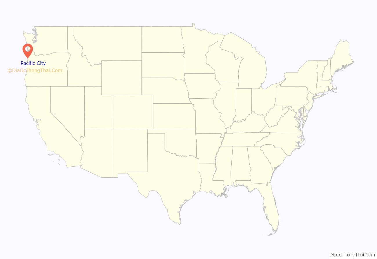
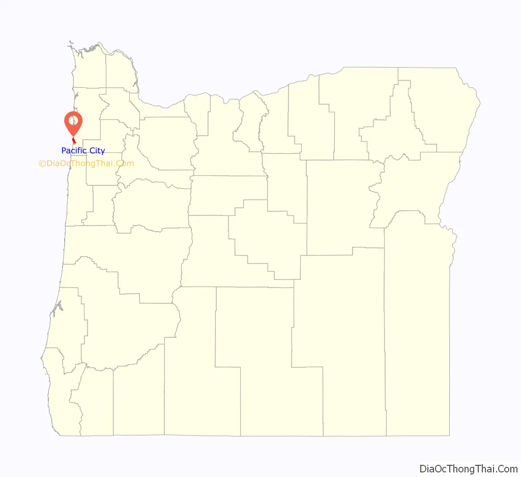
Pacific City location map. Where is Pacific City CDP?
History
In 1845, Mr. Johnson, a cook on an English ship sailing along the Columbia River, deserted and traveled down the Willamette Valley. Establishing a land claim in Champoeg, he began removing brush and that summer set off a burn to clear debris. The Champoeg Fire got out of control and spread eastward. Unfortunately, the wind then reversed direction and strengthened, blowing the blaze around the previous burn and fanning it into the dry Coast Range, where it burned in the Yamhill basin for weeks, consuming 1,500,000 acres (6,100 km) of old growth forest – the largest such area destroyed in a single forest fire in the United States. Settlers did not live west of the Coast Range, but the small tribes of Native Americans in the area, already depleted by 80% due to malaria and other epidemics from 1830 to 1841, were driven from their lands.
The Nestuggas were one such tribe, that had previously been encamped just north of Pacific City near the town of Woods. They had noticed the smoke for several weeks, but were surprised one morning as the bright flames flickered atop the crests of the surrounding hills and rushed down on them. The Nestuggas fled by canoe down the Big Nestucca River to the ocean, and took refuge on the half-mile wide bare sandspit between Nestucca Bay and the ocean. After several weeks the fires were ended by a heavy rain, but the devastation had been complete: the forests were gone, and the game found to be charred crisp or cooked in the water they had sought refuge in.
Nestucca Bay was a rich fishing area, allowing the Nestuggas to survive despite the destruction of game. However, in 1854, settlers began arriving in the Tillamook Valley, and by 1876 Chief Nestugga Bill and the 200 remaining people of the small tribe were relocated to a reservation on the Salmon and Siletz River.
Many early pioneers arrived via seagoing steamers, others arrived from across the mountains. The town of Woods established itself as a depot for the new arrivals and a source of supplies and trade for the settlers. In 1886 the Linewebber and Brown cannery was started to take advantage of the plentiful fish in Nestucca Bay, shipping 12,000 cans of salmon a year and providing an economic basis for the region until 1926, along with logging and dairy farming. The area also became a “vacation” destination for Oregon Trail pioneers from the Midwest, who had never seen the ocean.
In 1893, Thomas Malaney platted the town of Ocean Park (now Pacific City) directly across the river from Woods. When a flood in 1894 wiped out the first lots, Malaney moved the town south to higher ground. The Sea View hotel (later renamed Edmundes Hotel) was built around 1895 to serve vacationers from the Willamette Valley. Other buildings and campgrounds were established for visitors, and Ferry Street was “paved” with wooden planks for automobiles.
The town gained its modern name of Pacific City in 1909 to avoid confusion with the Washington town of Ocean Park. By 1926, overfishing from gillnetting had left the bay depleted of salmon, so commercial harvesting was stopped and fishermen switched to surf-launched dories; over time, due to commercial fishing vessels, the Dory Fleet dwindled and today only a few recreational fishermen keep the tradition alive. In the 1920s, tourism became the mainstay of the economy, lasting until the Great Depression of the 1930s. An airport was built to attract barnstormers and aviators, and other roads and bridges were opened.
Pacific City Road Map
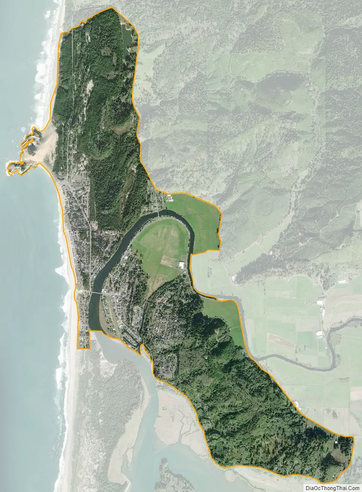
Pacific City city Satellite Map
Geography
Pacific City is located along the Pacific Ocean adjacent to Bob Straub State Park and spans the Nestucca River with about half the city’s area being behind Nestucca Bay. It is part of the Oregon Coast.
According to the United States Census Bureau, the CDP has a total area of 3.8 square miles (9.8 km), of which 3.7 square miles (9.6 km) of it is land and 0.1 square miles (0.26 km) of it (2.86%) is water. The area is located 13 feet (4.0 m) above sea-level.
See also
Map of Oregon State and its subdivision: Map of other states:- Alabama
- Alaska
- Arizona
- Arkansas
- California
- Colorado
- Connecticut
- Delaware
- District of Columbia
- Florida
- Georgia
- Hawaii
- Idaho
- Illinois
- Indiana
- Iowa
- Kansas
- Kentucky
- Louisiana
- Maine
- Maryland
- Massachusetts
- Michigan
- Minnesota
- Mississippi
- Missouri
- Montana
- Nebraska
- Nevada
- New Hampshire
- New Jersey
- New Mexico
- New York
- North Carolina
- North Dakota
- Ohio
- Oklahoma
- Oregon
- Pennsylvania
- Rhode Island
- South Carolina
- South Dakota
- Tennessee
- Texas
- Utah
- Vermont
- Virginia
- Washington
- West Virginia
- Wisconsin
- Wyoming