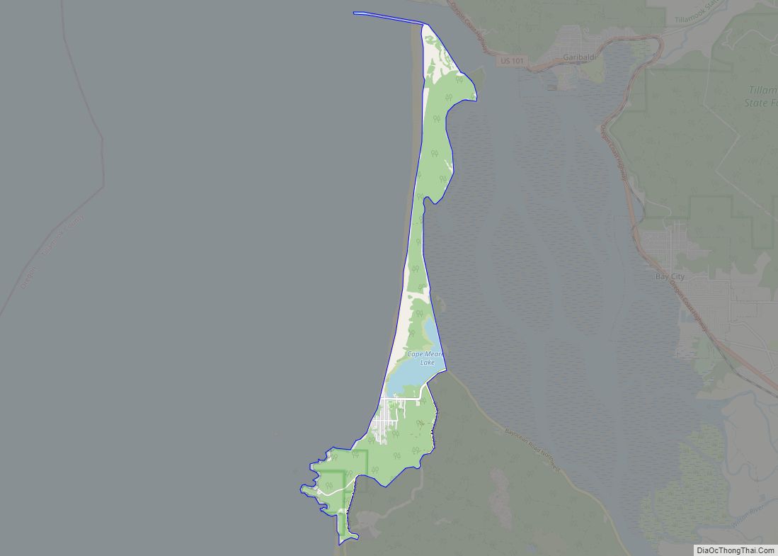
The city of Tillamook /ˈtɪləmʊk/ is the county seat of Tillamook County, Oregon, United States. The city is located on the southeast end of Tillamook Bay on the Pacific Ocean. The population was 5,231 at the 2020 census.
| Name: | Tillamook city |
|---|---|
| LSAD Code: | 25 |
| LSAD Description: | city (suffix) |
| State: | Oregon |
| County: | Tillamook County |
| Incorporated: | 1891 |
| Elevation: | 24 ft (7 m) |
| Total Area: | 1.90 sq mi (4.93 km²) |
| Land Area: | 1.90 sq mi (4.93 km²) |
| Water Area: | 0.00 sq mi (0.00 km²) |
| Total Population: | 5,204 |
| Population Density: | 2,733.19/sq mi (1,055.08/km²) |
| ZIP code: | 97141 |
| Area code: | 503 |
| FIPS code: | 4173700 |
| GNISfeature ID: | 1151220 |
| Website: | www.tillamookor.gov |
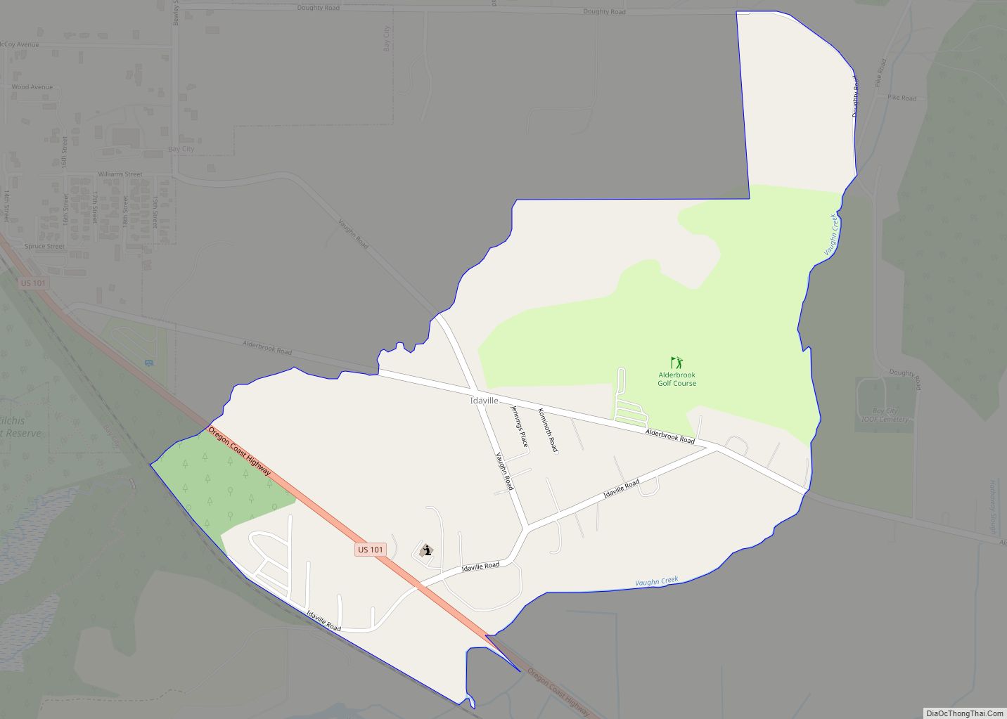
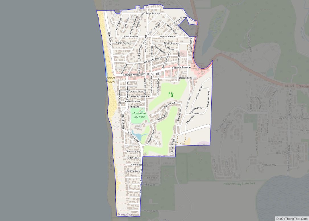
Online Interactive Map
Click on ![]() to view map in "full screen" mode.
to view map in "full screen" mode.
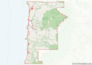
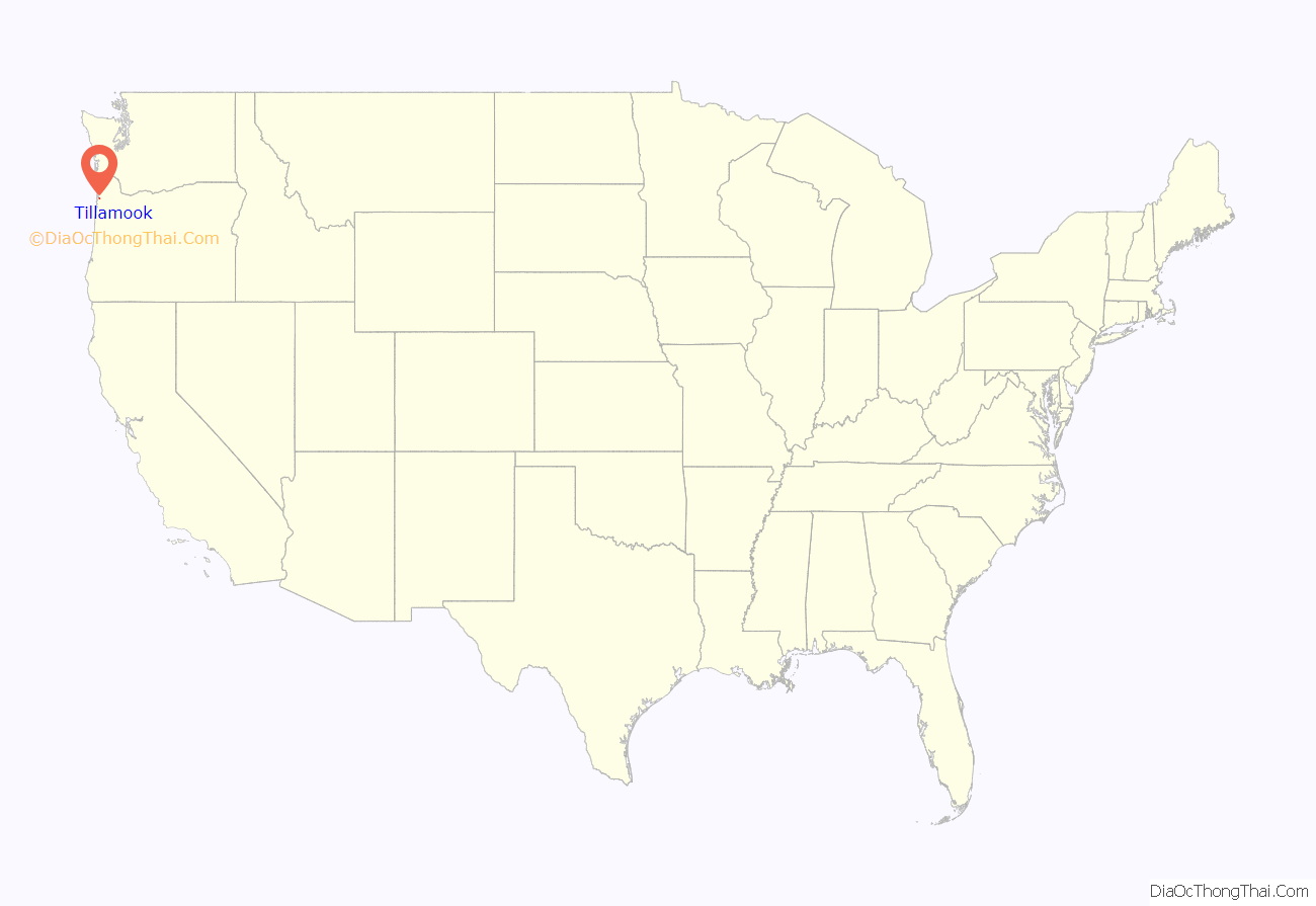
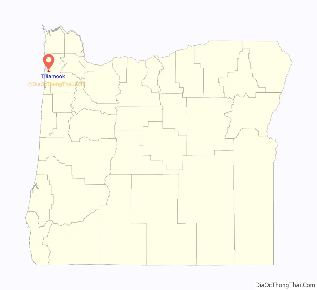
Tillamook location map. Where is Tillamook city?
History
The city is named for the Tillamook people, a Native American tribe speaking a Salishan language who lived in this area until the early 19th century. Anthropologist Franz Boas identifies the Tillamook Native Americans as the southernmost branch of the Coast Salish peoples of the Pacific Northwest. This group was separated geographically from the northern branch by tribes of Chinookan peoples who occupied territory between them. The name Tillamook, he says, is of Chinook origin, and refers to the people of a locality known as Elim or Kelim. They spoke Tillamook, a combination of two dialects. Tillamook culture differed from that of the northern Coast Salish, Boas says, and might have been influenced by tribal cultures to the south, in what is now northern California.
Captain Robert Gray first anchored in Tillamook Bay in 1788, marking the first recorded European landing on the Oregon coast. Settlers began arriving in the early 1850s, and Tillamook County was created by the Territorial legislature in 1853. In 1862, the town itself was laid out, and the first post office was opened in 1866. The town was voted to be the county seat in 1873, and Tillamook was officially incorporated as a city in 1891.
During World War II, the United States Navy operated a blimp patrol station near the town at Naval Air Station Tillamook. The station was decommissioned in 1948, and the remaining facility now houses the Tillamook Air Museum.
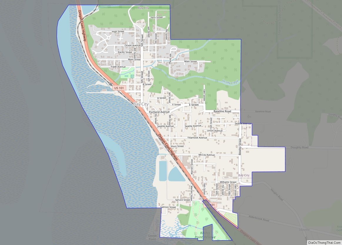
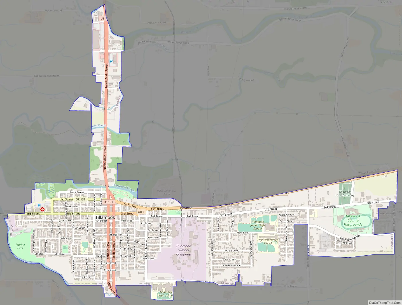
Tillamook Road Map
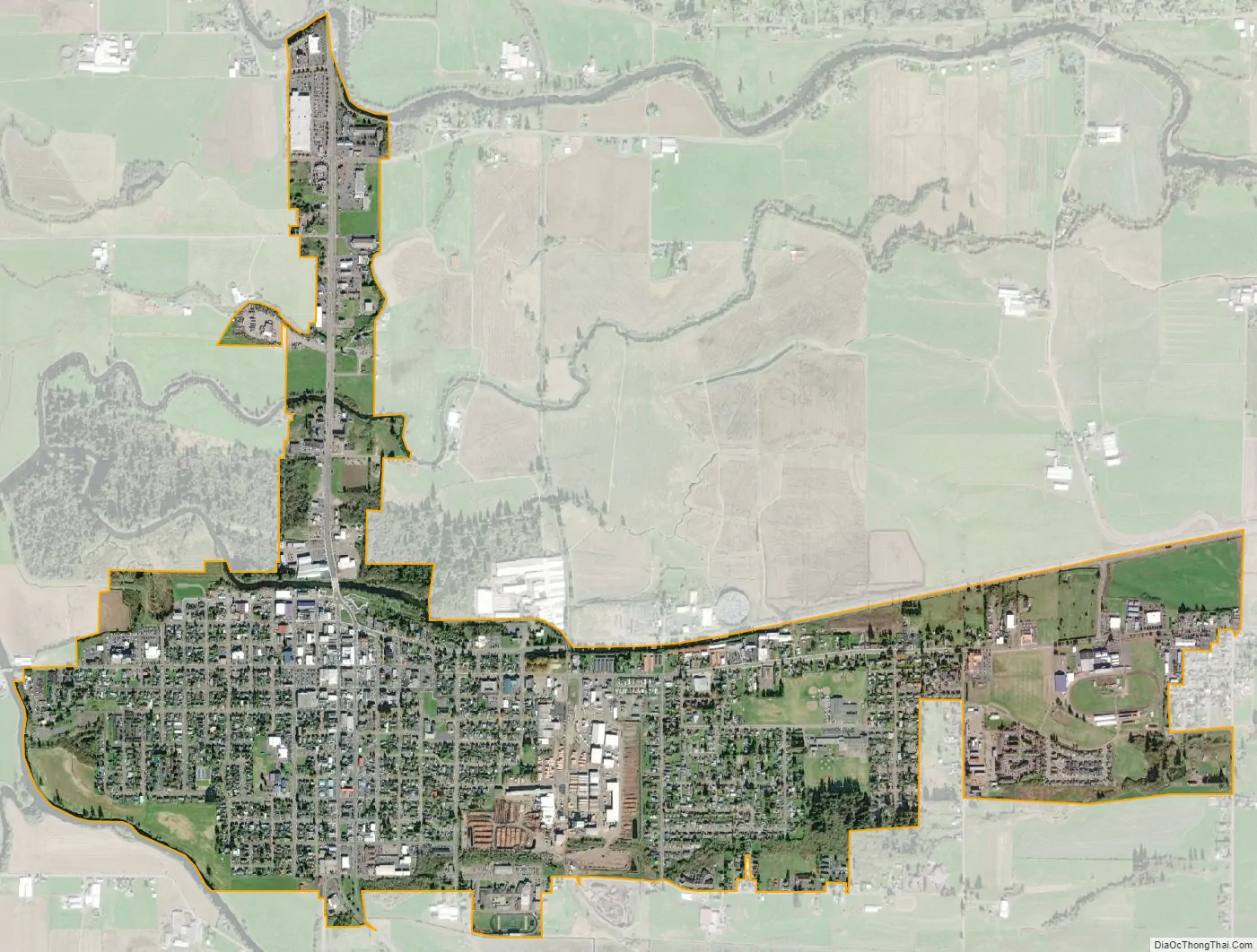
Tillamook city Satellite Map
Geography
According to the United States Census Bureau, the city has a total area of 1.7 square miles (4.40 km), all of it land. The Tillamook area is also home to five rivers, the Tillamook, Trask, Wilson, Kilchis, and the Miami just north of the city.
Climate
Tillamook has a climate that lies between the cool-summer Mediterranean climate (Csb) and the oceanic climate (Cfb). The city has a mild and wet climate with very little seasonal temperature variation due to its proximity to the Pacific Ocean. From November through April, daytime high temperatures range from the high 40s to the high 50s with abundant rainfall – including more than 13 inches (330 mm) per month in November, December, and January. Snowfall is very rare, but winter floods are a common occurrence. Between April and October, the precipitation in Tillamook is comparatively lighter than other coastal cities, but still remains much wetter than the population centers in the Willamette Valley. Tillamook’s annual precipitation averages about 88 inches (2,200 mm) compared to only 36 inches (910 mm) in Portland. Summers in Tillamook are brief and mild with average daytime temperatures in the upper 60s, although daytime temperatures can occasionally soar into the 80s and 90s for days at a time. Summer is by far the driest season in Tillamook with only 1.35 inches and 1.33 inches of rain (34 mm in either case) falling in July and August, respectively.
See also
Map of Oregon State and its subdivision: Map of other states:- Alabama
- Alaska
- Arizona
- Arkansas
- California
- Colorado
- Connecticut
- Delaware
- District of Columbia
- Florida
- Georgia
- Hawaii
- Idaho
- Illinois
- Indiana
- Iowa
- Kansas
- Kentucky
- Louisiana
- Maine
- Maryland
- Massachusetts
- Michigan
- Minnesota
- Mississippi
- Missouri
- Montana
- Nebraska
- Nevada
- New Hampshire
- New Jersey
- New Mexico
- New York
- North Carolina
- North Dakota
- Ohio
- Oklahoma
- Oregon
- Pennsylvania
- Rhode Island
- South Carolina
- South Dakota
- Tennessee
- Texas
- Utah
- Vermont
- Virginia
- Washington
- West Virginia
- Wisconsin
- Wyoming