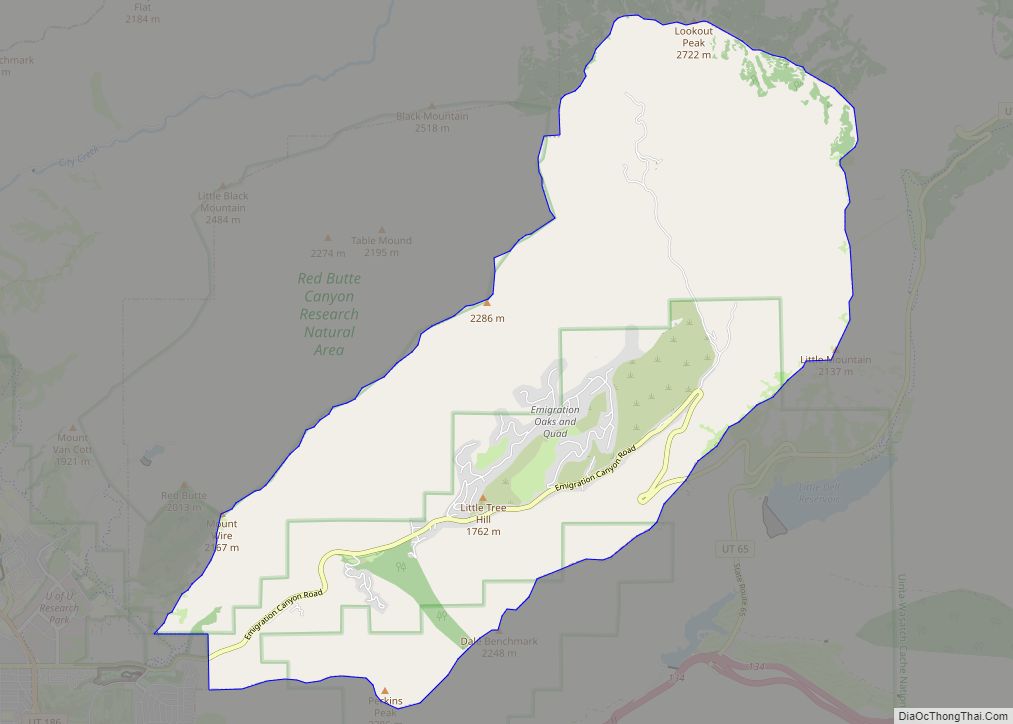
Emigration Canyon is a metro township and canyon in Salt Lake County, Utah, United States, located east of Salt Lake City in the Wasatch Range. Beginning at the southern end of the University of Utah, the canyon itself heads east and northeast between Salt Lake City and Morgan County. The boundaries of the metro township do not extend to the county line, nor do they encompass all of Emigration Canyon, as parts of it are within Salt Lake City. As of the 2020 census, the population was 1,466.
A portion of Emigration Canyon, located in This Is the Place Heritage Park, was declared a National Historic Landmark in 1961 for the canyon’s significance in the Mormon migration of the 19th century.
| Name: | Emigration Canyon metro township |
|---|---|
| LSAD Code: | 35 |
| LSAD Description: | metro township |
| State: | Utah |
| County: | Salt Lake County |
| Founded: | 1846 |
| Total Area: | 18.22 sq mi (47.19 km²) |
| Land Area: | 18.22 sq mi (47.19 km²) |
| Water Area: | 0.00 sq mi (0.00 km²) |
| Total Population: | 1,466 |
| Population Density: | 80/sq mi (31/km²) |
| FIPS code: | 4922875 |
| Website: | https://www.ecmetro.org/ |
Online Interactive Map
Click on ![]() to view map in "full screen" mode.
to view map in "full screen" mode.
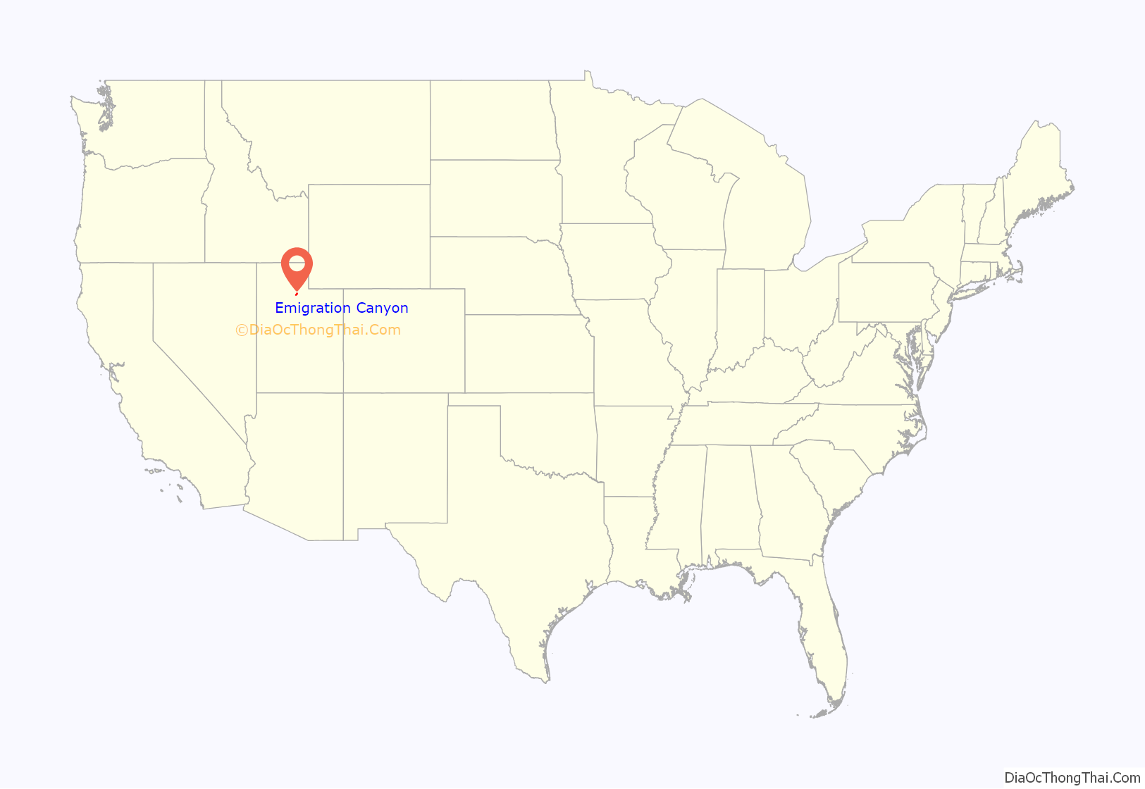
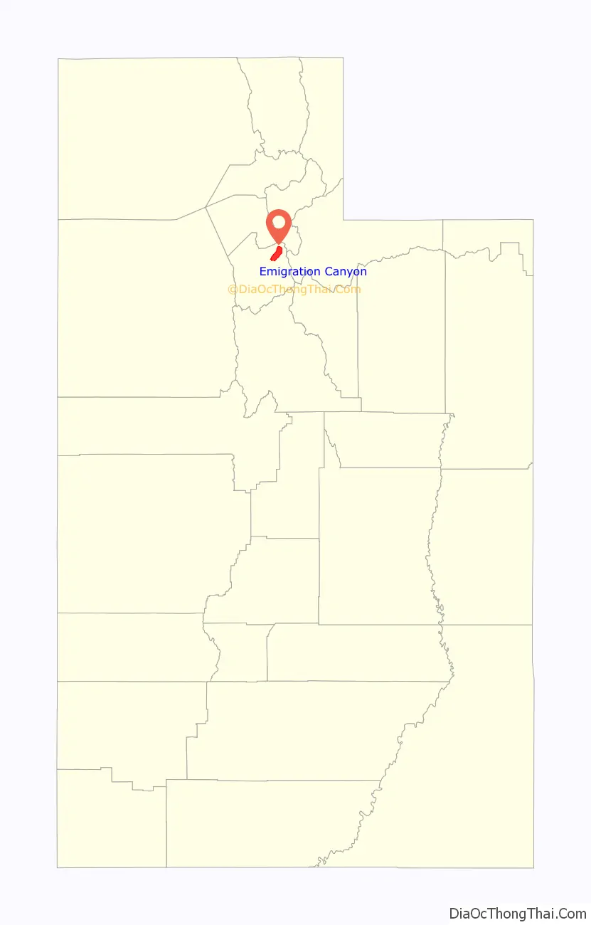
Emigration Canyon location map. Where is Emigration Canyon metro township?
History
Emigration Canyon was significant in early Utah history as the original route used by pioneers entering the area. It was part of the Hastings Cutoff route used by the Donner Party in 1846 and where the Mormon Pioneers entered the Salt Lake Valley in 1847. As Brigham Young looked over the canyon, he declared, “This is the right place. Drive on.” These words have become famous in Utah history. The event is commemorated with This Is The Place Heritage Park at the mouth of the canyon. Throughout Emigration Canyon, there are several historic markers designating camps, trail markers, and milestones where the Mormon Pioneers passed while on their way to the Salt Lake Valley. One example of these milestones is called Lost Creek Camp.
The township of Emigration Canyon was formed on January 8, 1997.
In 2015, the township’s residents voted to incorporate and become a metro township.
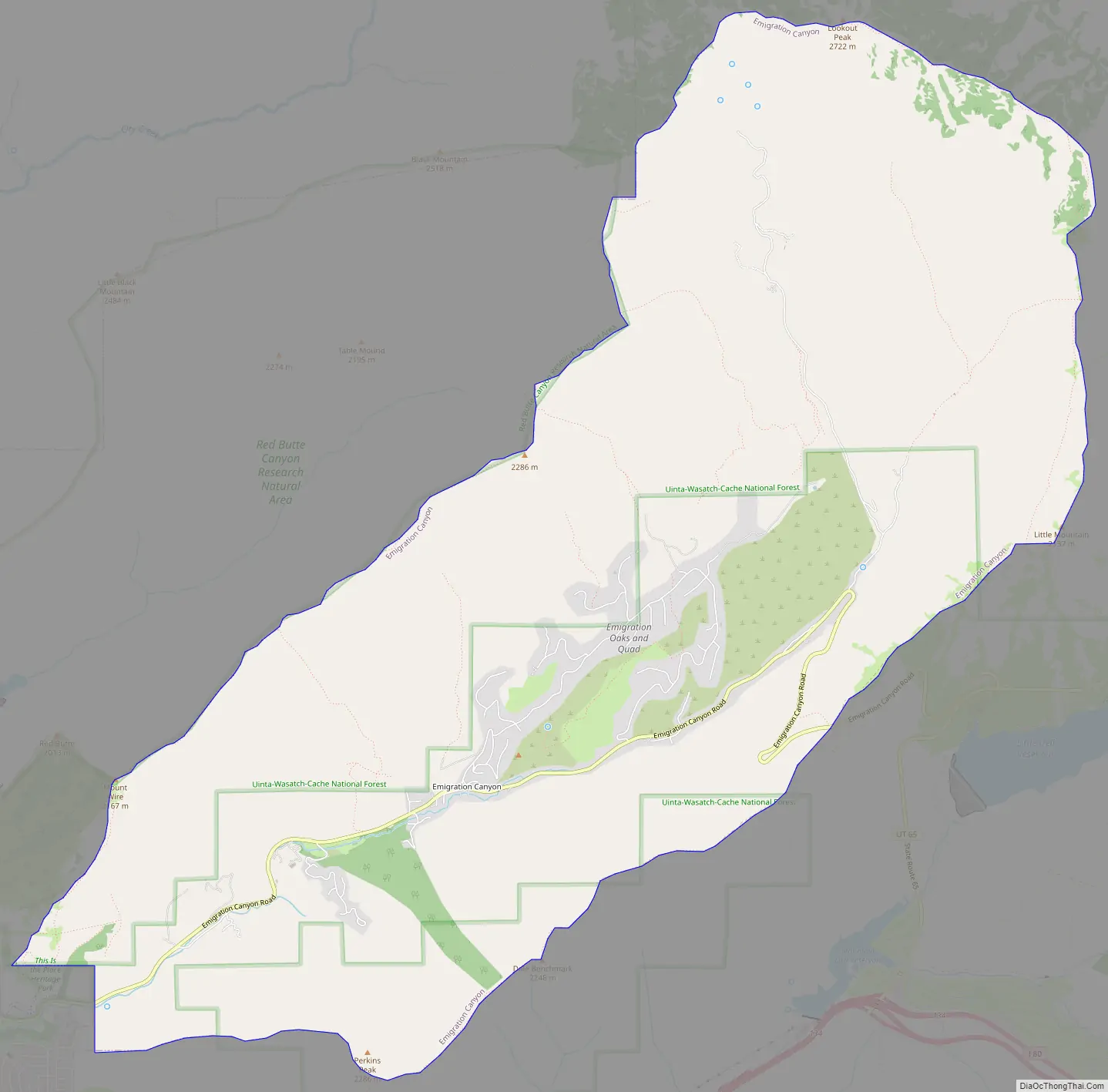
Emigration Canyon Road Map
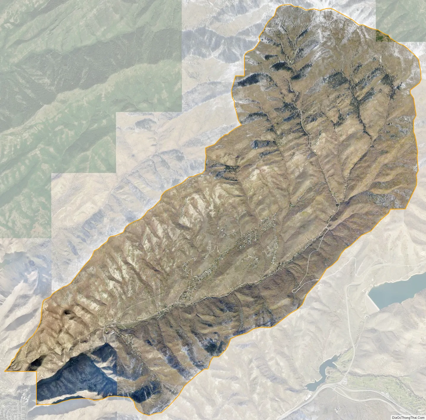
Emigration Canyon city Satellite Map
See also
Map of Utah State and its subdivision: Map of other states:- Alabama
- Alaska
- Arizona
- Arkansas
- California
- Colorado
- Connecticut
- Delaware
- District of Columbia
- Florida
- Georgia
- Hawaii
- Idaho
- Illinois
- Indiana
- Iowa
- Kansas
- Kentucky
- Louisiana
- Maine
- Maryland
- Massachusetts
- Michigan
- Minnesota
- Mississippi
- Missouri
- Montana
- Nebraska
- Nevada
- New Hampshire
- New Jersey
- New Mexico
- New York
- North Carolina
- North Dakota
- Ohio
- Oklahoma
- Oregon
- Pennsylvania
- Rhode Island
- South Carolina
- South Dakota
- Tennessee
- Texas
- Utah
- Vermont
- Virginia
- Washington
- West Virginia
- Wisconsin
- Wyoming