Cottonwood Heights is a city located in Salt Lake County, Utah, United States, along the east bench of the Salt Lake Valley. It lies south of the cities of Holladay and Murray, east of Midvale, and north of Sandy within the Salt Lake City, Utah Metropolitan Statistical Area. Originally a census-designated place (CDP), following a successful referendum in May 2004, the city was incorporated on January 14, 2005. The population, as of the 2010 census, was 33,433. This is a significant increase over the CDP’s 2000 census count of 27,569.
The corporate offices of Dyno Nobel, the defunct Fusion-io, Extra Space Storage, Breeze Airways, and JetBlue are located in the city.
In 2007, Money magazine rated Cottonwood Heights at #100 on their Best Places to Live list.
| Name: | Cottonwood Heights city |
|---|---|
| LSAD Code: | 25 |
| LSAD Description: | city (suffix) |
| State: | Utah |
| County: | Salt Lake County |
| Incorporated: | January 14, 2005 |
| Elevation: | 4,823 ft (1,470 m) |
| Total Area: | 9.23 sq mi (23.91 km²) |
| Land Area: | 9.23 sq mi (23.91 km²) |
| Water Area: | 0.00 sq mi (0.00 km²) |
| Total Population: | 33,433 |
| Population Density: | 3,666.63/sq mi (1,415.66/km²) |
| Area code: | 385, 801 |
| FIPS code: | 4916270 |
| GNISfeature ID: | 1440025 |
| Website: | cottonwoodheights.utah.gov |
Online Interactive Map
Click on ![]() to view map in "full screen" mode.
to view map in "full screen" mode.
Cottonwood Heights location map. Where is Cottonwood Heights city?


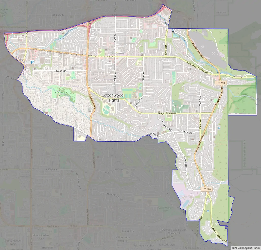
Cottonwood Heights Road Map
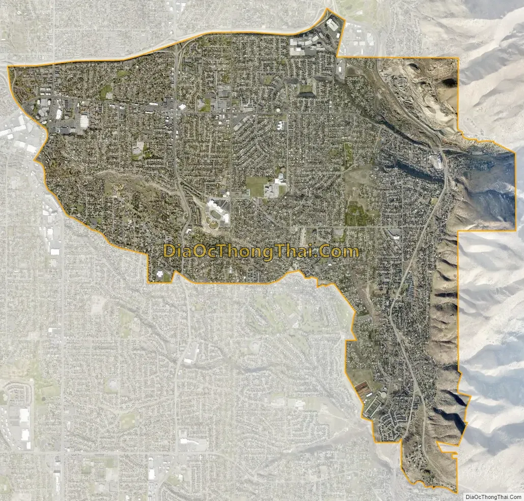
Cottonwood Heights city Satellite Map
Geography
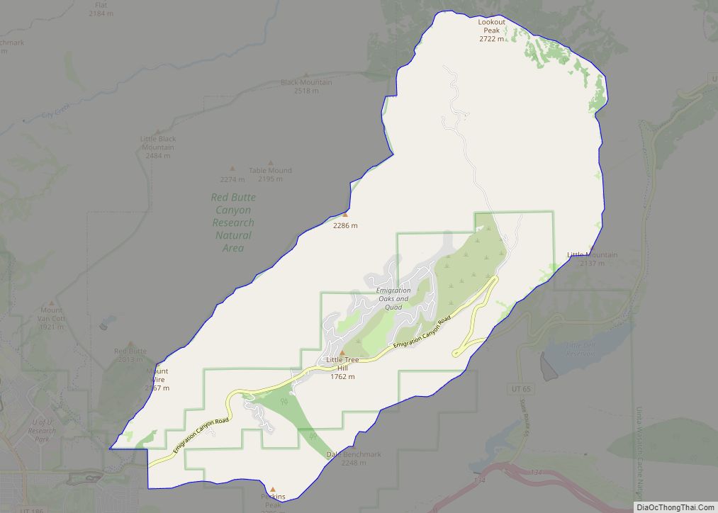
As the city’s name suggests, its geography is dominated by a high ridge separating the valleys of the Big and Little Cottonwood Creeks. At the eastern edge of the city, these valleys narrow into the Big and Little Cottonwood Canyons within the Wasatch Mountains, respectively. This is reflected by the city’s official nickname, “City between the canyons”. The ridge is covered in suburban housing, but most commercial development has been restricted to the lower-lying areas north of the ridge (along Fort Union Boulevard, in Fort Union itself, and near Big Cottonwood Creek and the “Old Mill” in the northeast corner of the city).
State Route 190 and State Route 210 run near the eastern edge of the city and provide access to the canyons; they are the only state routes that enter the city. Interstate 215 runs along the northern border of the city, and State Route 152 touches the city at a point. The city is building a multi-use trail along the full length of Big Cottonwood Creek within its borders.
Cottonwood Heights is in the Canyons School District; Brighton High School is the only public high school. Butler Middle school is the only middle school within city limits.
According to the United States Census Bureau, the CDP had a total area of 6.8 square miles (17.6 km), all land.
See also
Map of Utah State and its subdivision: Map of other states:- Alabama
- Alaska
- Arizona
- Arkansas
- California
- Colorado
- Connecticut
- Delaware
- District of Columbia
- Florida
- Georgia
- Hawaii
- Idaho
- Illinois
- Indiana
- Iowa
- Kansas
- Kentucky
- Louisiana
- Maine
- Maryland
- Massachusetts
- Michigan
- Minnesota
- Mississippi
- Missouri
- Montana
- Nebraska
- Nevada
- New Hampshire
- New Jersey
- New Mexico
- New York
- North Carolina
- North Dakota
- Ohio
- Oklahoma
- Oregon
- Pennsylvania
- Rhode Island
- South Carolina
- South Dakota
- Tennessee
- Texas
- Utah
- Vermont
- Virginia
- Washington
- West Virginia
- Wisconsin
- Wyoming