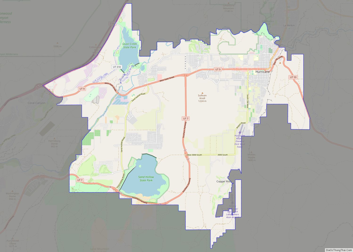
Hurricane (/ˈhɜːrɪkən/ HUR-i-kən) is a city in Washington County, Utah, United States. Its population was 20,036 as of the 2020 United States Census estimates. The Hurricane valley makes up the easternmost part of the St. George Metropolitan area and is becoming a tourist gateway town to Zion National Park. Hurricane is known for its historic peach and pecan orchards, open space, green fields and small-town charm, although like much of southwestern Utah, the Hurricane valley continues to experience significant population growth.
| Name: | Hurricane city |
|---|---|
| LSAD Code: | 25 |
| LSAD Description: | city (suffix) |
| State: | Utah |
| County: | Washington County |
| Elevation: | 3,242 ft (988 m) |
| Total Area: | 53.63 sq mi (138.90 km²) |
| Land Area: | 52.76 sq mi (136.64 km²) |
| Water Area: | 0.88 sq mi (2.27 km²) |
| Total Population: | 20,036 |
| Population Density: | 361.55/sq mi (139.60/km²) |
| ZIP code: | 84737 |
| Area code: | 435 |
| FIPS code: | 4937170 |
| GNISfeature ID: | 1428951 |
| Website: | www.cityofhurricane.com |
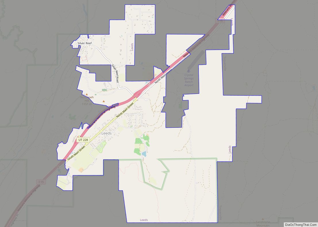
Online Interactive Map
Click on ![]() to view map in "full screen" mode.
to view map in "full screen" mode.
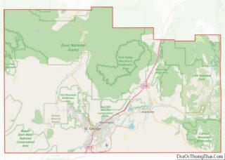
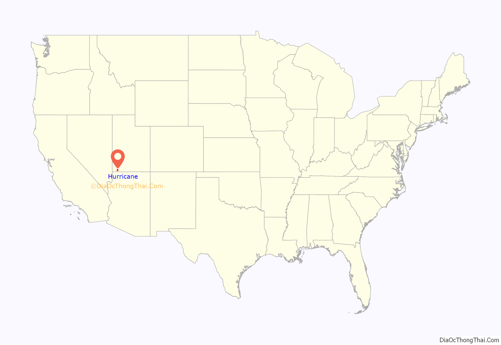
Hurricane location map. Where is Hurricane city?
History
Hurricane was first settled in 1896 and received its name after a whirlwind blew the top off a buggy in which Erastus Snow was riding. Snow exclaimed, “Well, that was a Hurricane. We’ll name this ‘Hurricane Hill’.”
Hurricane, which is pronounced “Her-ah-kun” by local residents (mimicking the accent of early Liverpudlian settlers), is in eastern Washington County. The community was settled as part of The Church of Jesus Christ of Latter-day Saints’ (LDS Church) President Brigham Young’s “Cotton Mission”, intended to establish the southern end of Utah for agricultural purposes. The town once operated a large peach and apricot orchard for the LDS Church and is historically known for growing peaches, pecans and pistachio nuts on small farms.
The 1992 St. George earthquake destroyed three houses as well as above- and below-ground utilities, causing about US$1 million in damage.
Places of interest
The town boasts multiple parks, a dog park, a city pool and large community center, several ranked golf courses, two reservoirs noted for bass fishing, boating and recreation (Sand Hollow and Quail Creek State Parks), as well as a small municipal airfield. The Hurricane Valley Heritage Park Museum is located on the corner of State Street and Main. There are several medical clinics in the area.
Hurricane Canal and Canal Trail
For approximately 80 years, the Hurricane Canal was the lifeblood of the Hurricane Valley. It was built over a period of 11 years (1893–1904), mostly by pick and shovel. Since 1985, the canal has lain empty. In 2000, special interest groups came together to preserve the canal, receiving grants and volunteering time to construct a trail to stand as a tribute to the efforts the early settlers put forth to make the canal a reality. A monument at the trailhead briefly recounts the canal story. Much of the trail, which covers a small section of the canal, is the actual west bank of the canal, which “canal riders” rode every day when the canal was in operation to ensure there were no leaks or other problems, since the bank was somewhat unstable. Two of the trail’s unique aspects are walking in the canal itself – on a steel flume across a wash and through a tunnel immediately thereafter. The trail provides excellent views of the towns of Hurricane and La Verkin throughout. The trail ends before reaching the Virgin River Gorge, approximately five miles from the canal’s former headwaters.
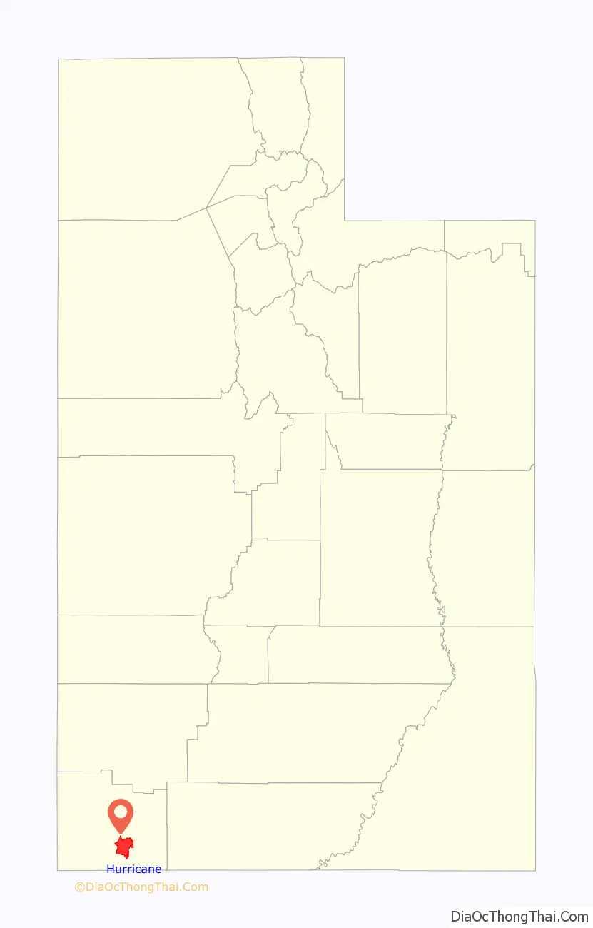
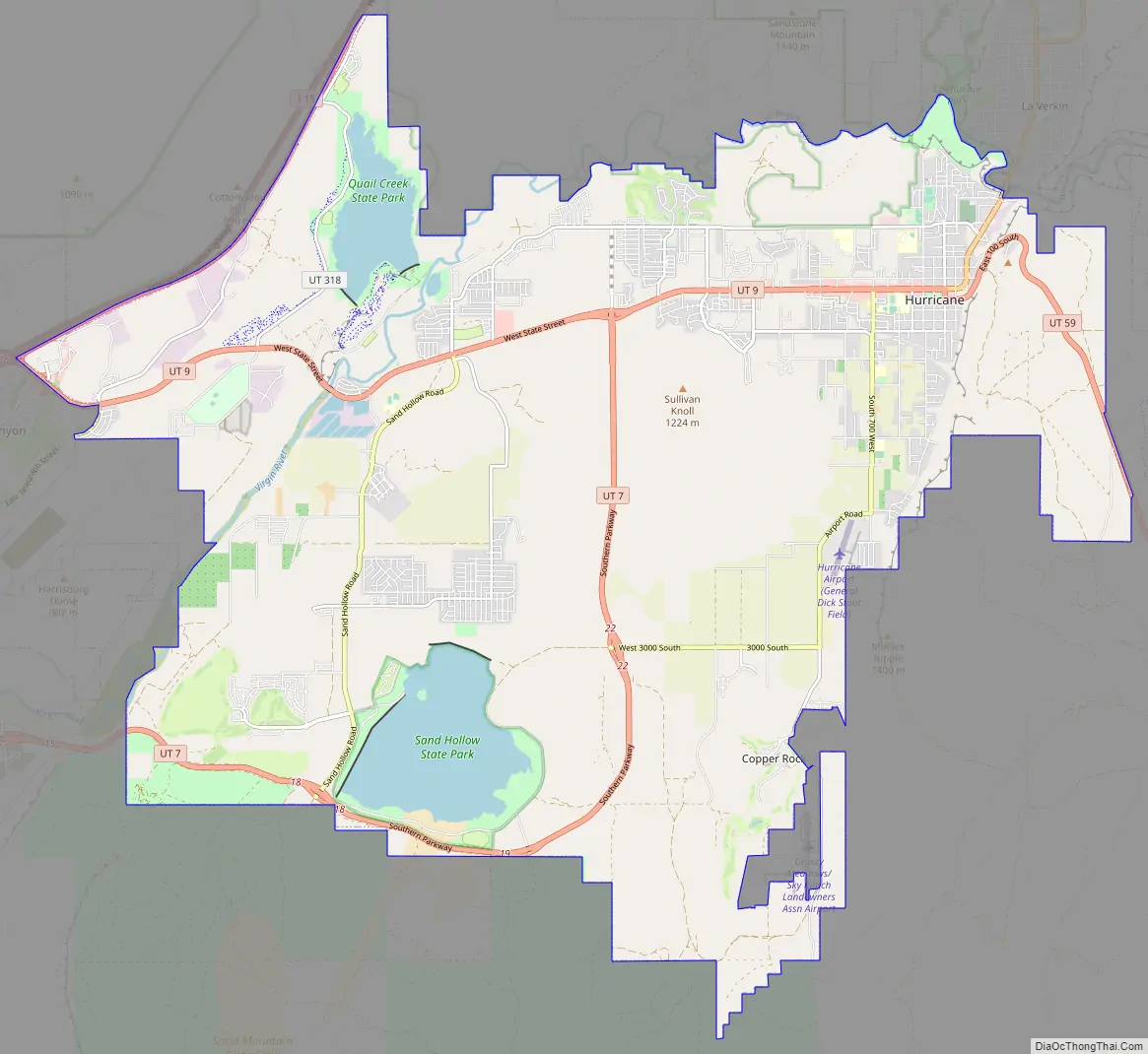
Hurricane Road Map
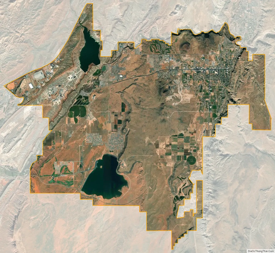
Hurricane city Satellite Map
Geography
According to the United States Census Bureau, the city has a total area of 31.5 square miles (81.7 km), of which 31.1 square miles (80.6 km) is land and 0.4 square mile (1.1 km) (1.39%) is water.
Notable geographic features
Sand Hollow State Park, which contains a 1,322 acre reservoir, multiple camping locations, and off-roading trails, is located in the south part of Hurricane. In addition to the sand beaches which are open to OHV’s, the state park provides tunnel access across Utah State Route 7 to the neighboring Sand Mountain, which houses the popular Hurricane Sand Dunes. Sand Hollow can be accessed from Utah State Route 9, via Sand Hollow Road, or from the newly renovated State Route 7.
Quail Creek State Park is home to a 600-acre reservoir and a campground. The reservoir it partially fed by Quail Creek to the north. The reservoir is a popular fishing, boating, kayaking, and paddle-boarding location. The state park can be accessed from either State Route 9 or Old Highway 91 via 5300 W/State Route 318.
The Virgin River forms nearly all of Hurricane’s north border. It travels through the city’s Confluence Park and crosses State Route 9 at both the Hurricane-La Verkin border and near Quail Creek 3 miles from Harrisburg Junction. The river indirectly provides water to Hurricane, as well as to most of Washington County.
See also
Map of Utah State and its subdivision: Map of other states:- Alabama
- Alaska
- Arizona
- Arkansas
- California
- Colorado
- Connecticut
- Delaware
- District of Columbia
- Florida
- Georgia
- Hawaii
- Idaho
- Illinois
- Indiana
- Iowa
- Kansas
- Kentucky
- Louisiana
- Maine
- Maryland
- Massachusetts
- Michigan
- Minnesota
- Mississippi
- Missouri
- Montana
- Nebraska
- Nevada
- New Hampshire
- New Jersey
- New Mexico
- New York
- North Carolina
- North Dakota
- Ohio
- Oklahoma
- Oregon
- Pennsylvania
- Rhode Island
- South Carolina
- South Dakota
- Tennessee
- Texas
- Utah
- Vermont
- Virginia
- Washington
- West Virginia
- Wisconsin
- Wyoming