Springville is a city in Utah County, Utah, United States, that is part of the Provo–Orem metropolitan area. The population was 35,268 in 2020, according to the United States Census. Springville is a bedroom community for commuters who work in the Provo–Orem and Salt Lake City metropolitan areas. Other neighboring cities include Spanish Fork and Mapleton. Springville has the nickname of “Art City” or “Hobble Creek”.
| Name: | Springville city |
|---|---|
| LSAD Code: | 25 |
| LSAD Description: | city (suffix) |
| State: | Utah |
| County: | Utah County |
| Incorporated: | April 4, 1853 |
| Elevation: | 4,577 ft (1,395 m) |
| Total Area: | 14.39 sq mi (37.28 km²) |
| Land Area: | 14.34 sq mi (37.15 km²) |
| Water Area: | 0.05 sq mi (0.13 km²) |
| Total Population: | 35,268 |
| Population Density: | 2,459.41/sq mi (949.34/km²) |
| ZIP code: | 84663 |
| Area code: | 385, 801 |
| FIPS code: | 4972280 |
| GNISfeature ID: | 1446057 |
| Website: | www.springville.org |
Online Interactive Map
Click on ![]() to view map in "full screen" mode.
to view map in "full screen" mode.
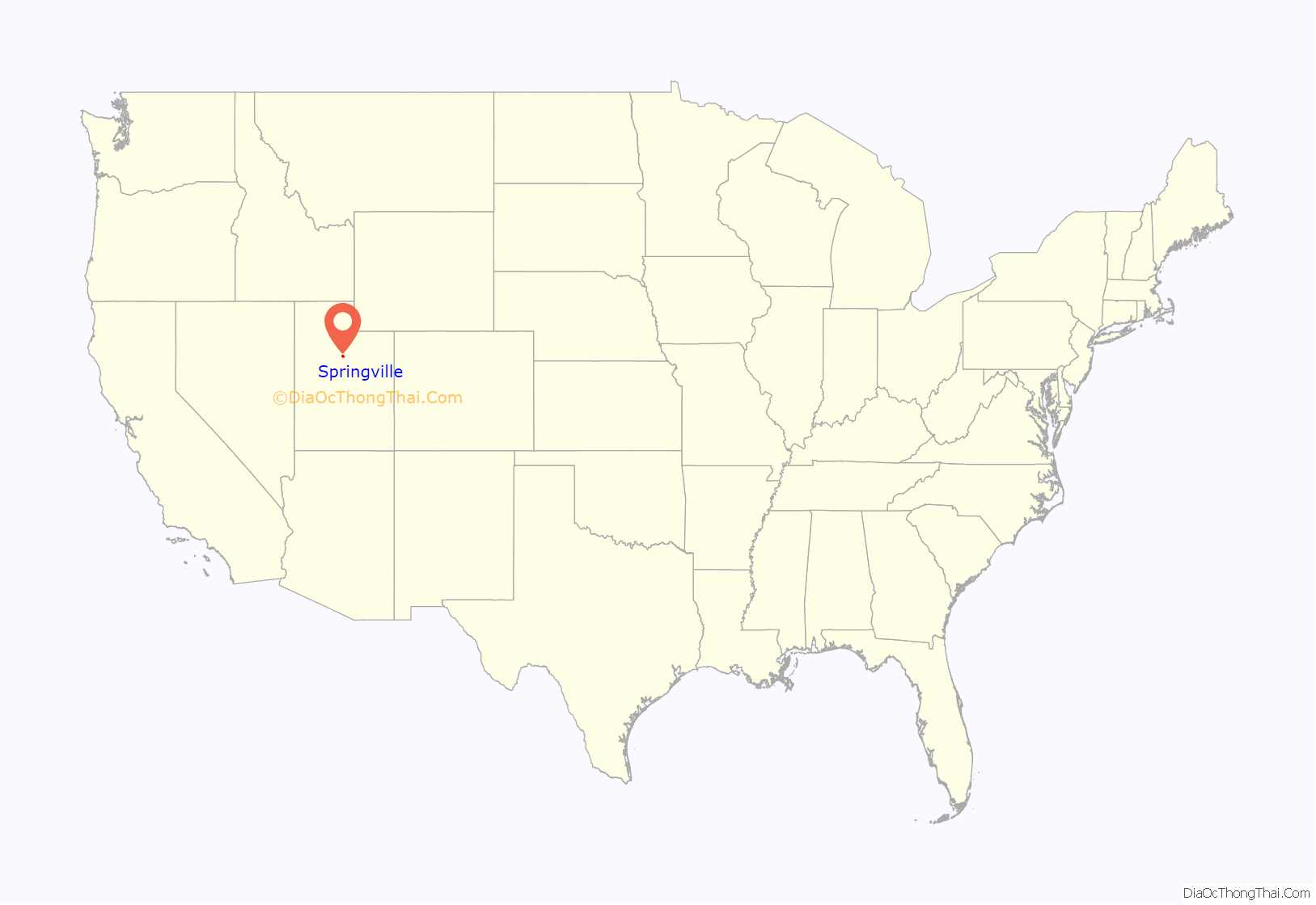
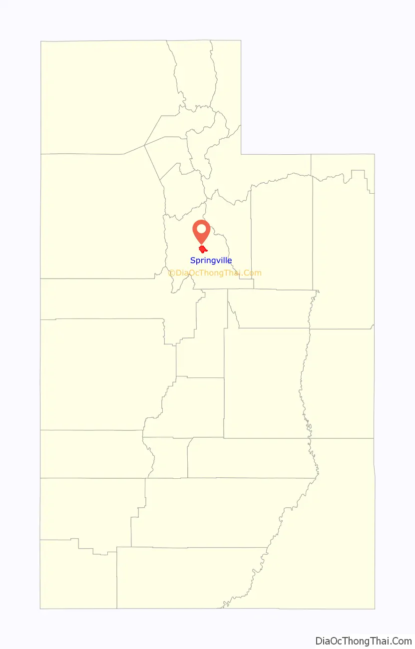
Springville location map. Where is Springville city?
History
Springville was first explored in 1776 by Father Silvestre Vélez de Escalante, a Franciscan padre. What became Springville lay along the wagon route called the Mormon Road that Mormon pioneers and 49ers traveled through southern Utah, northern Arizona, southern Nevada and Southern California. From 1855, each winter trains of freight wagons traveled on this road across the deserts between Los Angeles and Salt Lake City until the late 1860s when the railroad arrived in Utah. During the year 1849, a group of pioneers led by William Miller and James Mendenhall traveled to the Provo River area. Mendenhall and Miller explored a little further south and fell in love with what is now known as the Hobble Creek area. Springville was settled in 1850 by eight pioneer families, led by Aaron Johnson, who crossed the plains to Salt Lake Valley from the East and were directed by Brigham Young to settle 50 miles (80 km) further south.
Incorporated in February 1853, the pioneers called the city Hobble Creek because an early exploration team led by Oliver B. Huntington in February 1849 had a horse lose a pair of iron hobbles (restraints tied to the horse’s forelegs) while the team was camped next to the creek. As the town grew, the name was changed to Springville, after the Fort Springville. Fort Springville was named after the many freshwater springs in the area, particularly near the fort. The original name was not completely lost, however, as the canyon stream (and associated canyons), a local elementary school, and city-owned golf course have retained the name Hobble Creek.
Springville is known as “Art City” due to its strong development of the arts. Springville is home to the Springville Museum of Art, Utah’s oldest museum for the visual fine arts (circa 1937). The museum, housed in a historic Spanish Colonial Revival-style building, showcases collections of many well-known artists, both local and national, including collections of Utah art, a major Soviet collection, early Americana, and the European Steed collection. It was dedicated by David O. McKay as a “sanctuary of beauty and a temple of meditation.” Springville is the birthplace of noted sculptor Cyrus Dallin. The main street is dotted with bronze statues, including several from local sculptors Gary Price and Jeff Decker.
Springville is a thriving community which has experienced steady growth over the past ten years. The current population is projected to grow to more than 50,000 over the next ten years, in line with the expected future expansion of its commercial, office, retail, and industrial sectors along the city’s I-15 corridor.
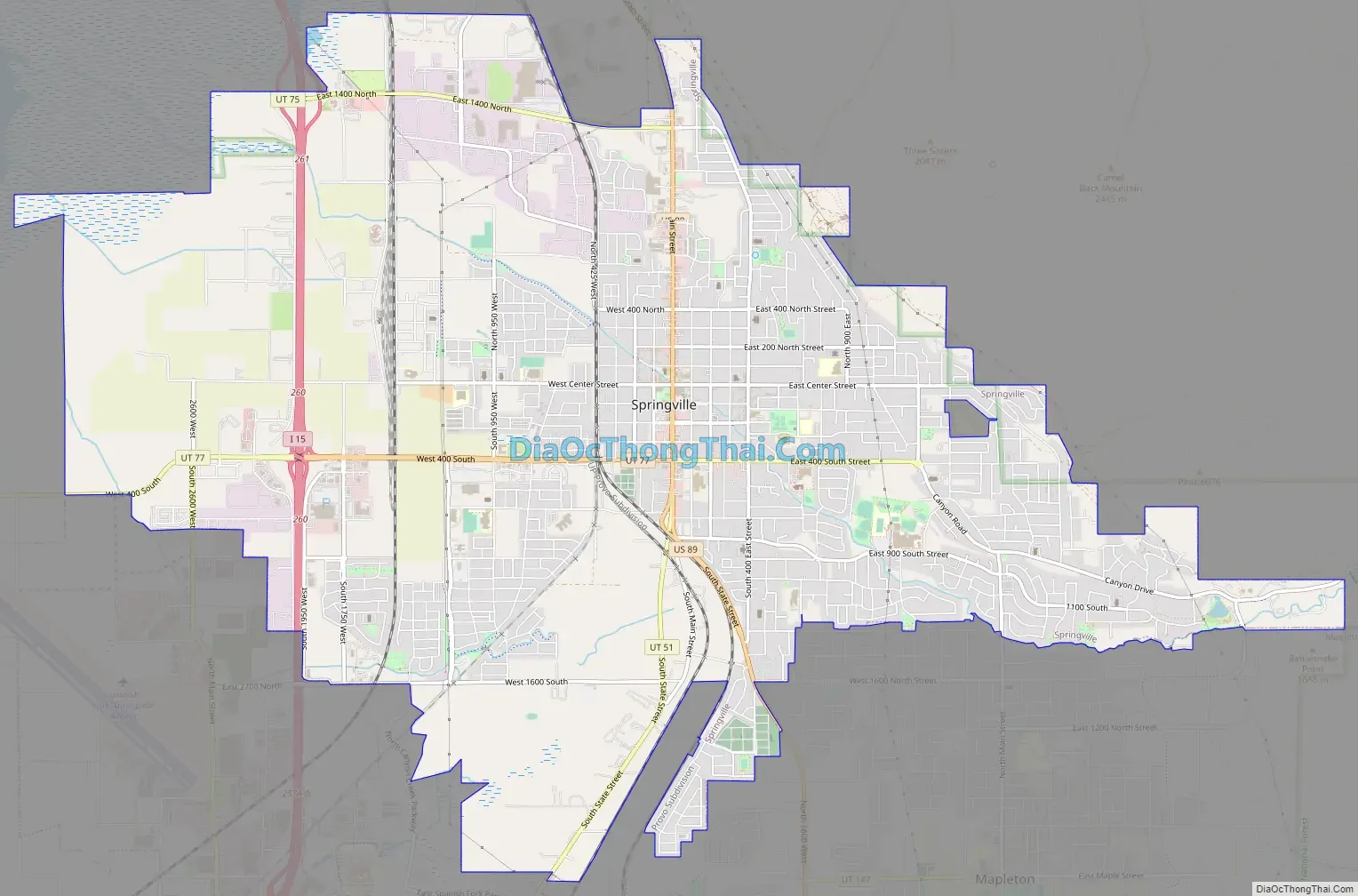
Springville Road Map
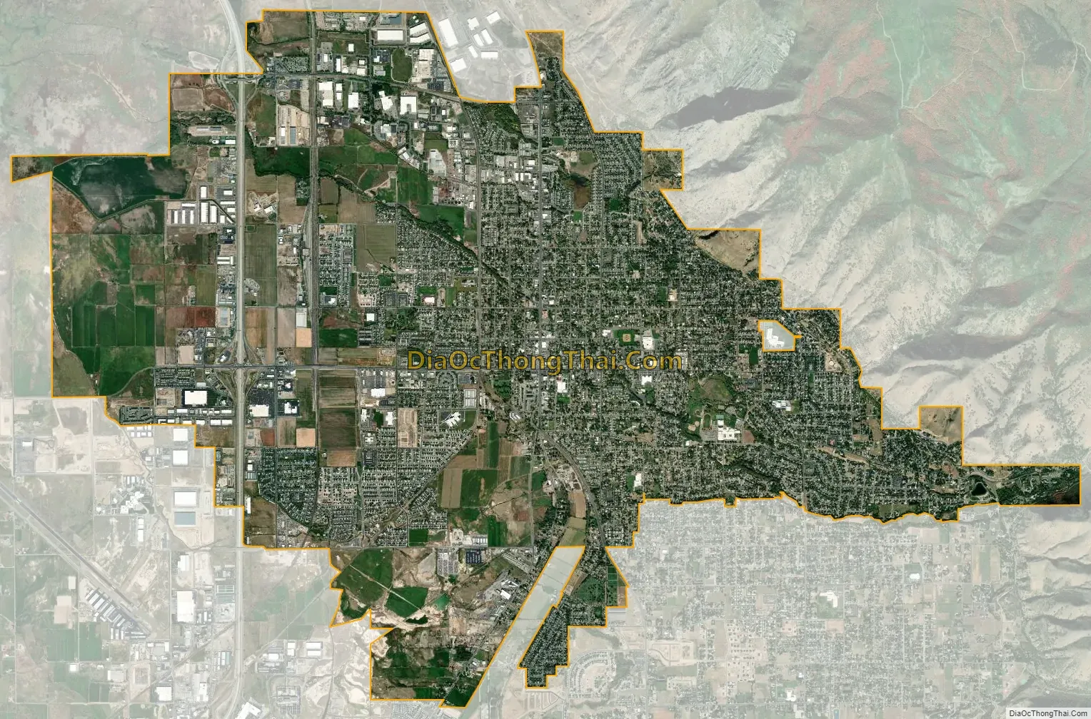
Springville city Satellite Map
Geography
According to the United States Census Bureau, the city has an area of 14.4 square miles (37.4 km), of which 14.4 square miles (37.2 km) is land and 0.04 square miles (0.1 km), or 0.34%, is water.
Springville is on the west side of the Wasatch Mountain Range and 3 miles (5 km) east of the average shoreline of Utah Lake and almost entirely east of Interstate 15. All vehicular traffic that transports goods to the north, south, east and west funnels through the interstate hub near Springville’s strategically important freeway location. A great potential with its strong connection to the arts, Springville is thriving community that has experienced steady growth over the past ten years. Its current population of 31,205 continues to increase with 4.6% annual growth.
See also
Map of Utah State and its subdivision: Map of other states:- Alabama
- Alaska
- Arizona
- Arkansas
- California
- Colorado
- Connecticut
- Delaware
- District of Columbia
- Florida
- Georgia
- Hawaii
- Idaho
- Illinois
- Indiana
- Iowa
- Kansas
- Kentucky
- Louisiana
- Maine
- Maryland
- Massachusetts
- Michigan
- Minnesota
- Mississippi
- Missouri
- Montana
- Nebraska
- Nevada
- New Hampshire
- New Jersey
- New Mexico
- New York
- North Carolina
- North Dakota
- Ohio
- Oklahoma
- Oregon
- Pennsylvania
- Rhode Island
- South Carolina
- South Dakota
- Tennessee
- Texas
- Utah
- Vermont
- Virginia
- Washington
- West Virginia
- Wisconsin
- Wyoming


