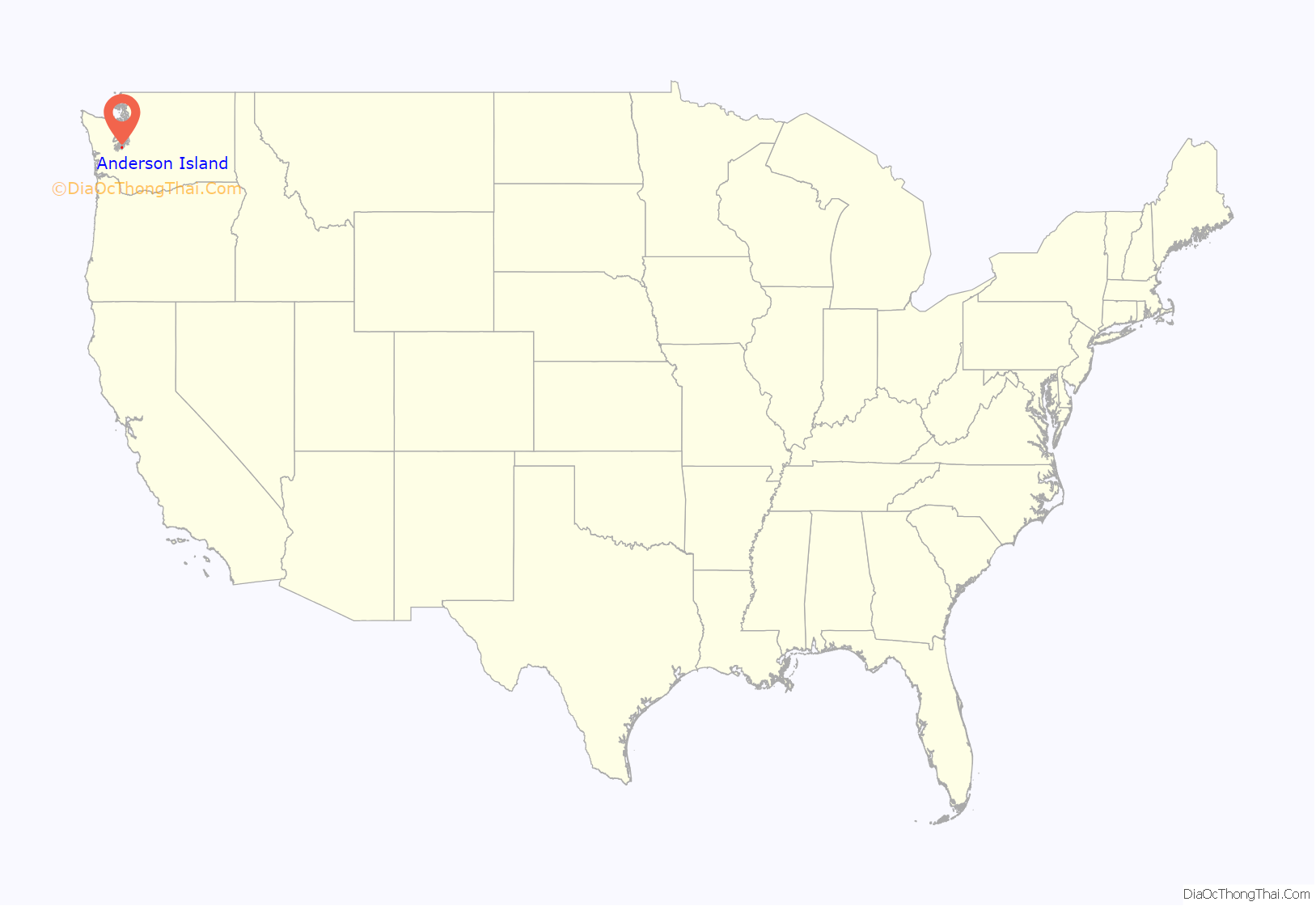
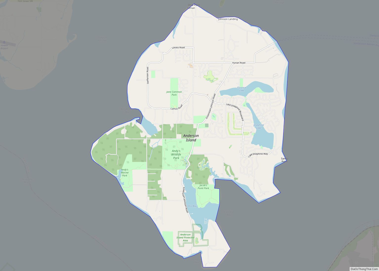
Anderson Island is the southernmost island in Puget Sound and a census-designated place of Pierce County, Washington, United States. It is accessible by boat or a 20-minute ferry ride from Steilacoom. Anderson Island is just south of McNeil Island. To the northwest, Key Peninsula is across Drayton Passage. The south basin of Puget Sound separates the island from the mainland to the southeast, while to the southwest the Nisqually Reach of Puget Sound separates the island from the mainland.
| Name: | Anderson Island CDP |
|---|---|
| LSAD Code: | 57 |
| LSAD Description: | CDP (suffix) |
| State: | Washington |
| County: | Pierce County |
| FIPS code: | 5302060 |
Online Interactive Map
Click on ![]() to view map in "full screen" mode.
to view map in "full screen" mode.
Anderson Island location map. Where is Anderson Island CDP?
History
The island was part of the territory of the Steilacoom people, a Coast Salish tribe.
The island was named in 1841 by Charles Wilkes of the United States Exploring Expedition. Given a warm reception at Fort Nisqually by Mr. Anderson and Captain McNeill, and assistance to aid his operations, Wilkes repaid their kindness by naming the two nearby islands after these two men.
In 1870, Andrew N. Christensen, a Dane, and his brother, Christian F. Christensen, were the first European settlers to stay at the island. Andrew’s wife had a strong hand in the development of the island community. Christian was the only Christensen brother to reside permanently on Anderson Island. The primary industry was the sale of wood to the wood-burning steamers that came into Amsterdam Bay. Other early industries included brick making, farming and fishing.
The only General Store on the island is run by a local resident of the island.
In 2004, National Recreational Properties, Inc. of Irvine, California purchased more than 400 vacant lots on the island, paying roughly $4,000 to $7,000 per lot. They created an infomercial and sold to out-of-state investors, mostly from California. Residents speculated that the lots would be sold for about $25,000. Eventually more than 300 lots were sold, most selling for over $40,000.
Anderson Island Road Map
Anderson Island city Satellite Map
Geography
Anderson Island has a land area of 7.75 square miles (20.1 km), and reported a population of 1,037 persons as of the 2010 census. The island has been a retirement destination since the late 1960s, with a median age of 54 years (for comparison, the median age of Washington state as a whole is 37 years). The population booms every summer to approximately 4,000. The Island is also home to a sizable population of deer.
See also
Map of Washington State and its subdivision:- Adams
- Asotin
- Benton
- Chelan
- Clallam
- Clark
- Columbia
- Cowlitz
- Douglas
- Ferry
- Franklin
- Garfield
- Grant
- Grays Harbor
- Island
- Jefferson
- King
- Kitsap
- Kittitas
- Klickitat
- Lewis
- Lincoln
- Mason
- Okanogan
- Pacific
- Pend Oreille
- Pierce
- San Juan
- Skagit
- Skamania
- Snohomish
- Spokane
- Stevens
- Thurston
- Wahkiakum
- Walla Walla
- Whatcom
- Whitman
- Yakima
- Alabama
- Alaska
- Arizona
- Arkansas
- California
- Colorado
- Connecticut
- Delaware
- District of Columbia
- Florida
- Georgia
- Hawaii
- Idaho
- Illinois
- Indiana
- Iowa
- Kansas
- Kentucky
- Louisiana
- Maine
- Maryland
- Massachusetts
- Michigan
- Minnesota
- Mississippi
- Missouri
- Montana
- Nebraska
- Nevada
- New Hampshire
- New Jersey
- New Mexico
- New York
- North Carolina
- North Dakota
- Ohio
- Oklahoma
- Oregon
- Pennsylvania
- Rhode Island
- South Carolina
- South Dakota
- Tennessee
- Texas
- Utah
- Vermont
- Virginia
- Washington
- West Virginia
- Wisconsin
- Wyoming
