Irvine (/ˈɜːrvaɪn/) is a master-planned city in southern Orange County, California, United States, in the Los Angeles metropolitan area. The Irvine Company started developing the area in the 1960s and the city was formally incorporated on December 28, 1971. The 66-square-mile (170 km) city had a population of 307,670 at the 2020 census.
A number of corporations, particularly in the technology and semiconductor sectors, have their national or international headquarters in Irvine. Irvine is also home to several higher education institutions including the University of California, Irvine (UCI), Concordia University, Irvine Valley College, the Orange County Center of the University of Southern California (USC), and campuses of California State University Fullerton (CSUF), University of La Verne, and Pepperdine University.
| Name: | Irvine city |
|---|---|
| LSAD Code: | 25 |
| LSAD Description: | city (suffix) |
| State: | California |
| County: | Orange County |
| Incorporated: | December 28, 1971 |
| Elevation: | 56 ft (17 m) |
| Total Area: | 65.92 sq mi (170.74 km²) |
| Land Area: | 65.61 sq mi (169.94 km²) |
| Water Area: | 0.31 sq mi (0.80 km²) 0.52% |
| Total Population: | 307,670 |
| Population Density: | 4,689.1/sq mi (1,810.46/km²) |
| FIPS code: | 0636770 |
| Website: | cityofirvine.org |
Online Interactive Map
Click on ![]() to view map in "full screen" mode.
to view map in "full screen" mode.
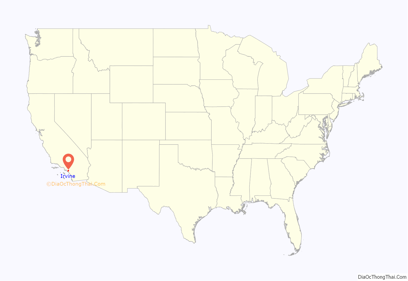
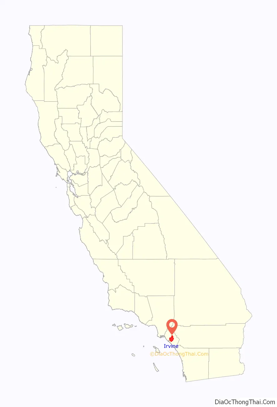
Irvine location map. Where is Irvine city?
History
The Gabrieleño indigenous group inhabited Irvine about 2,000 years ago. Gaspar de Portolà, a Spanish explorer, came to the area in 1769, which led to the establishment of forts, missions and cattle herds. The King of Spain parceled out land for missions and private use.
After Mexico’s independence from Spain in 1821, the Mexican government secularized the missions and assumed control of the lands. It began distributing the land to Mexican citizens who applied for grants. Three large Spanish/Mexican grants made up the land that later became the Irvine Ranch: Rancho Santiago de Santa Ana, Rancho San Joaquin and Rancho Lomas de Santiago.
In 1864, Jose Andres Sepulveda, owner of Rancho San Joaquin, sold 50,000 acres (200 km) to Benjamin and Thomas Flint, Llewellyn Bixby and James Irvine for $18,000 to resolve debts due to the Great Drought. In 1866, Irvine, Flint and Bixby acquired 47,000-acre (190 km) Rancho Lomas de Santiago for $7,000. After the Mexican-American war the land of Rancho Santiago de Santa Ana fell prey to tangled titles. In 1868, the ranch was divided among three claimants as part of a lawsuit: Flint, Bixby and Irvine. The ranches were devoted to sheep grazing. However, in 1870, tenant farming was permitted.
In 1878, James Irvine acquired his partners’ interests for $150,000 ($4,211,897 in 2021 dollars ). His 110,000 acres (450 km) stretched 23 miles (37 km) from the Pacific Ocean to the Santa Ana River. James Irvine died in 1886. The ranch was inherited by his son, James Irvine II, who incorporated it into the Irvine Company. James Irvine II shifted the ranch operations to field crops, olive and citrus crops.
In 1888, the Santa Fe Railroad extended its line to Fallbrook Junction, north of San Diego, and named a station along the way after James Irvine. The town that formed around this station was named Myford, after Irvine’s son, because a post office in Calaveras County already bore the family name. The town was renamed Irvine in 1914.
By 1918, 60,000 acres (240 km) of lima beans were grown on the Irvine Ranch. Two Marine Corps facilities, MCAS El Toro and MCAS Tustin, were built during World War II on ranch land sold to the government.
James Irvine II died in 1947 at the age of 80. His son, Myford, assumed the presidency of the Irvine Company. He began opening small sections of the Irvine Ranch to urban development.
The Irvine Ranch played host to the Boy Scouts of America’s 1953 National Scout Jamboree. Jamboree Road, a major street which now stretches from Newport Beach to the city of Orange, was named in honor of this event. David Sills, then a young Boy Scout from Peoria, Illinois, was among the attendees at the 1953 Jamboree. Sills came back to Irvine as an adult and went on to serve four terms as the city’s mayor.
Myford Irvine died in 1959. The same year, the University of California asked the Irvine Company for 1,000 acres (4 km) for a new university campus. The Irvine Company sold the requested land for $1 and later the state purchased an additional 500 acres (2.0 km).
William Pereira, the university’s consulting architect, and the Irvine Company planners drew up master plans for a city of 50,000 people surrounding the new university. The plan called for industrial, residential and recreational areas, commercial centers and greenbelts. The new community was to be named Irvine; the old agricultural town of Irvine, where the railroad station and post office were located, was renamed East Irvine. The first phases of the villages of Turtle Rock, University Park, Westpark (then called Culverdale), El Camino Real, and Walnut were completed by 1970.
On December 28, 1971, the residents of these communities voted to incorporate a substantially larger city than the one envisioned by the Pereira plan. By January 1999, Irvine had a population of 134,000 and a total area of 43 square miles (111 km).
In the 1970s, the mayor was Bill Vardoulis.
After the Fall of Saigon in 1975, a large influx of Vietnamese refugees settled in nearby Fountain Valley, especially in the late 1970s and throughout the 80s, forming a large percentage of Asian Americans in the city.
In late 2003, after a ten-year-long legal battle, Irvine annexed the former El Toro Marine Corps Air Station. This added 7.3 square miles (19 km) of land to the city and blocked an initiative championed by Newport Beach residents to replace John Wayne Airport with a new airport at El Toro. Most of this land has become part of the Orange County Great Park.
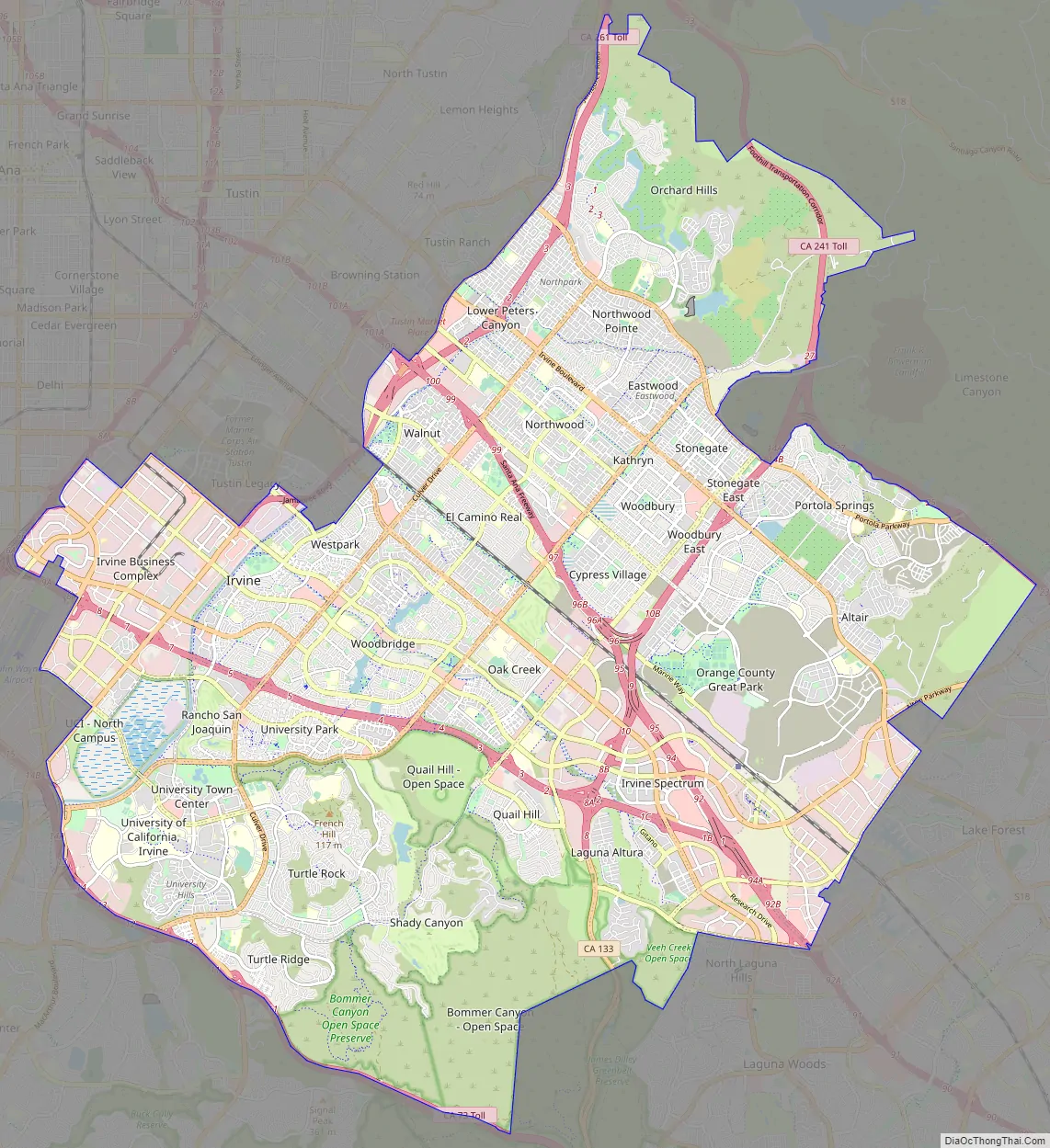
Irvine Road Map
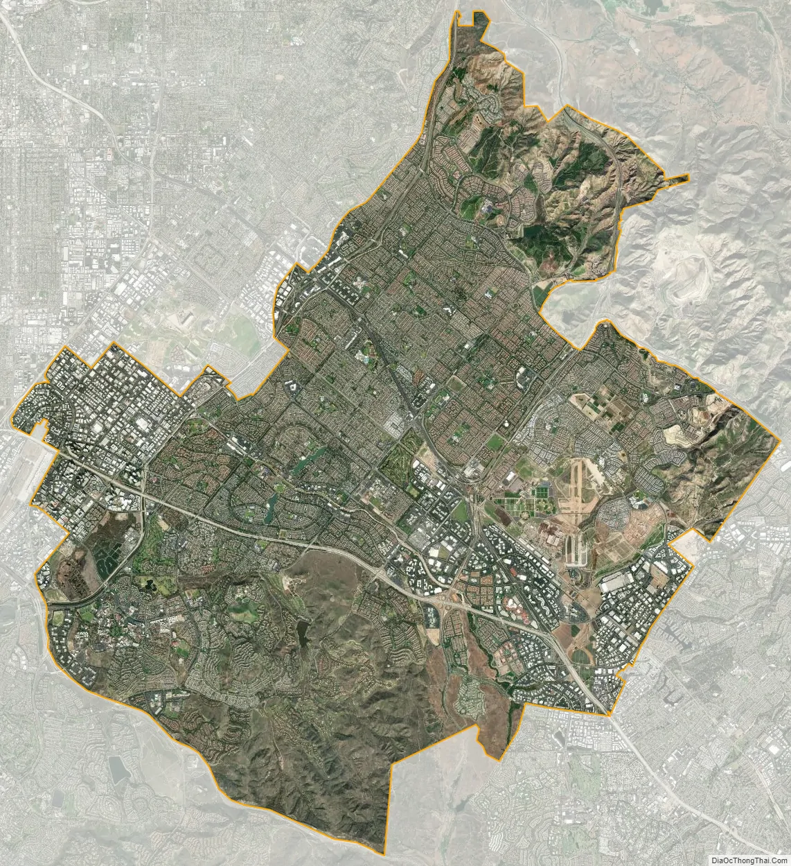
Irvine city Satellite Map
Geography
Irvine borders Tustin to the north, Santa Ana to the northwest, Lake Forest to the east and southeast, Laguna Hills and Laguna Woods to the south, Costa Mesa to the west, and Newport Beach to the southwest. Irvine also shares a small border with Orange to the north on open lands by the SR 261.
San Diego Creek, which flows northwest into Upper Newport Bay, is the primary watercourse draining the city. Its largest tributary is Peters Canyon Wash. Most of Irvine is in a broad, flat valley between Loma Ridge in the north and San Joaquin Hills in the south. In the extreme northern and southern areas, however, are several hills, plateaus and canyons.
Planned city
Los Angeles architect William Pereira and Irvine Company employee Raymond Watson designed Irvine’s layout beginning in the late 1950s, which is nominally divided into townships called “villages”, separated by six-lane streets. Each township contains houses of similar design, along with commercial centers, religious institutions, and schools. Commercial districts are checker-boarded in a periphery around the central townships.
Pereira originally envisioned a circular plan with numerous artificial lakes and the university in the center. When the Irvine Company refused to relinquish valuable farmland in the flat central region of the ranch for this plan, the university site was moved to the base of the southern coastal hills. The design that ended up being used was based on the shape of a necklace (with the villages strung along two parallel main streets, which terminate at University of California, Irvine (UCI), the “pendant”). Residential areas are now bordered by two commercial districts, the Irvine Business Complex to the west (part of the South Coast Plaza–John Wayne Airport edge city) and Irvine Spectrum to the east. Traces of the original circular design are still visible in the layout of the UCI campus and the two artificial lakes at the center of Woodbridge, one of the central villages.
All streets have landscaping allowances. Rights-of-way for powerlines also serve as bicycle corridors, parks, and greenbelts to tie together ecological preserves. The city irrigates the greenery with reclaimed water. The homeowners’ associations which govern some village neighborhoods exercise varying degrees of control on the appearances of homes. In more restrictive areas, houses’ roofing, paint colors, and landscaping are regulated. Older parts of the Village of Northwood that were developed beginning in the early 1970s independently of the Irvine Company, have the distinction of being a larger village that is not under the purview of a homeowners’ association. As a result, homeowners in the older Northwood areas do not pay a monthly village association fee; its neighborhoods are generally not as uniform in appearance as those in other villages, such as Westpark and Woodbridge. However, the more tightly regulated villages generally offer more amenities, such as members-only swimming pools, tennis courts, pickleball courts and parks.
In addition to association dues, homeowners in villages developed in the 1980s and later may be levied a Mello-Roos special tax, which came about in the post-Proposition 13 era. For homeowners in these areas, the association dues coupled with the Mello-Roos special tax may add significantly to the cost of living in the city.
Each of the villages was initially planned to have a distinct architectural theme.
- El Camino Glen
- College Park
- The Colony
- Columbus Grove
- Cypress Village
- Deerfield (mixed styles)
- East Irvine
- El Camino Real (Spanish/Neo-Eclectic)
- Greentree
- Irvine Groves
- Harvard Square
- Heritage Fields
- Laguna Altura
- Lambert Ranch
- Northpark (French Country, Formal French, Italian Country, Formal Italian, Monterey and Spanish Colonial)
- Northpark Square (Spanish Mission)
- Northwood (Bungalow, Craftsman)
- Oak Creek (mixed styles)
- Old Towne Irvine
- Orangetree
- Orchard Hills (Rural Craftsman/Spanish/Tuscan)
- Park Lane
- Parkcrest
- Parkside
- Pavilion Park
- Portola Springs (Spanish/Tuscan)
- Planning Area 40 (Future Village)
- Quail Hill (Spanish/Tuscan)
- Racquet Club
- The Ranch
- Rancho San Joaquin (Shed style)
- Rosegate (Spanish/Tuscan)
- San Marino (Spanish/Tuscan)
- Stonegate (Spanish)
- Shady Canyon (Tuscan Ranch)
- Turtle Ridge (Tuscan)
- Turtle Rock (mixed styles)
- University Hills
- University Park (California Modern)
- University Town Center (mixed styles)
- Walnut (Prairie Style)
- West Irvine (California Modern)
- Westpark (Italian Riviera/Mediterranean)
- The Willows
- Windwood
- Woodbridge (Atlantic Coast)
- Woodbury (Tuscan/Spanish/French)
- Woodbury East (Spanish)
Business and commercial areas
- Irvine Business Complex
- Irvine Spectrum (Contemporary/Moroccan)
- Old Town Irvine
Climate
Late spring and early summer in Irvine is subject to the June Gloom phenomenon widespread in southern California, with overcast mornings and occasional drizzle. Late summer and autumn are warm and mostly dry, with occasional bouts of humid weather extending from Pacific hurricanes off the west coast of Mexico. Winters are mild, with most winters having no frost, and can be hot and dry when the Santa Ana winds blow. Irvine has a Mediterranean climate wherein precipitation occurs predominantly during the winter months. Because Irvine is close to the coast, different parts of Irvine have different microclimates; for instance, the June Gloom effect is stronger in the southern parts of Irvine, closer to the Pacific Ocean.
It can occasionally snow in the Santa Ana Mountains to the northeast of Irvine. Snow within the lower-lying parts of Irvine is very rare, but the area received three inches of snow in January 1949. A tornado touched down in Irvine in 1991, an event that happens in Orange County more generally approximately once every five years.
See also
Map of California State and its subdivision:- Alameda
- Alpine
- Amador
- Butte
- Calaveras
- Colusa
- Contra Costa
- Del Norte
- El Dorado
- Fresno
- Glenn
- Humboldt
- Imperial
- Inyo
- Kern
- Kings
- Lake
- Lassen
- Los Angeles
- Madera
- Marin
- Mariposa
- Mendocino
- Merced
- Modoc
- Mono
- Monterey
- Napa
- Nevada
- Orange
- Placer
- Plumas
- Riverside
- Sacramento
- San Benito
- San Bernardino
- San Diego
- San Francisco
- San Joaquin
- San Luis Obispo
- San Mateo
- Santa Barbara
- Santa Clara
- Santa Cruz
- Shasta
- Sierra
- Siskiyou
- Solano
- Sonoma
- Stanislaus
- Sutter
- Tehama
- Trinity
- Tulare
- Tuolumne
- Ventura
- Yolo
- Yuba
- Alabama
- Alaska
- Arizona
- Arkansas
- California
- Colorado
- Connecticut
- Delaware
- District of Columbia
- Florida
- Georgia
- Hawaii
- Idaho
- Illinois
- Indiana
- Iowa
- Kansas
- Kentucky
- Louisiana
- Maine
- Maryland
- Massachusetts
- Michigan
- Minnesota
- Mississippi
- Missouri
- Montana
- Nebraska
- Nevada
- New Hampshire
- New Jersey
- New Mexico
- New York
- North Carolina
- North Dakota
- Ohio
- Oklahoma
- Oregon
- Pennsylvania
- Rhode Island
- South Carolina
- South Dakota
- Tennessee
- Texas
- Utah
- Vermont
- Virginia
- Washington
- West Virginia
- Wisconsin
- Wyoming


