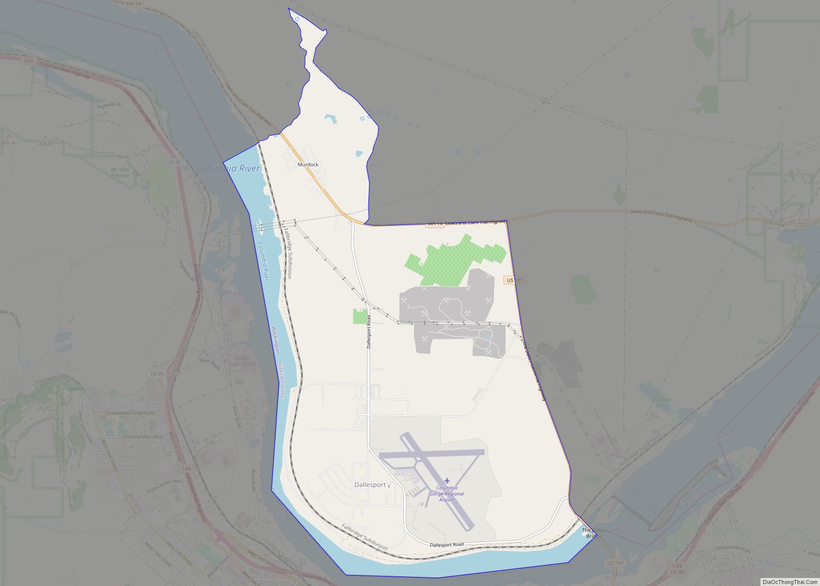
Dallesport is an unincorporated community and census-designated place (CDP) in Klickitat County, Washington, United States. The population was 1,328 at the 2020 census.
| Name: | Dallesport CDP |
|---|---|
| LSAD Code: | 57 |
| LSAD Description: | CDP (suffix) |
| State: | Washington |
| County: | Klickitat County |
| Elevation: | 213 ft (65 m) |
| Total Area: | 7.55 sq mi (19.55 km²) |
| Land Area: | 6.73 sq mi (17.44 km²) |
| Water Area: | 0.81 sq mi (2.11 km²) |
| Total Population: | 1,328 |
| Population Density: | 178/sq mi (68.9/km²) |
| ZIP code: | 98617 |
| Area code: | 509 |
| FIPS code: | 5316550 |
| GNISfeature ID: | 1512134 |
Online Interactive Map
Click on ![]() to view map in "full screen" mode.
to view map in "full screen" mode.
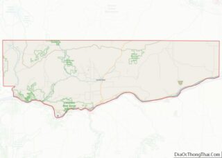
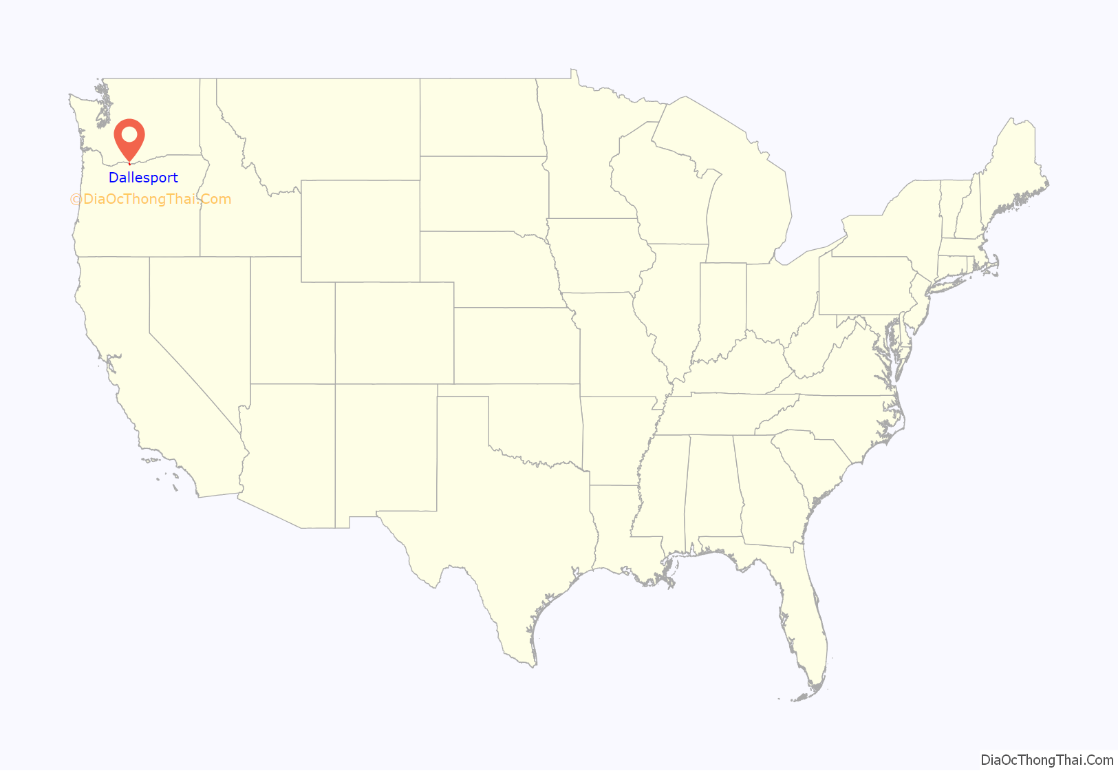
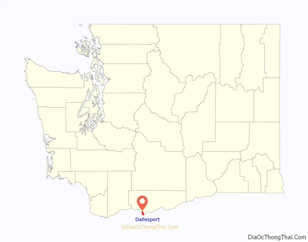
Dallesport location map. Where is Dallesport CDP?
History
The location was traditionally a site of the Wishram tribe (called “Echeloots” by Lewis and Clark), who lived on the north bank of the Columbia River about 10 miles (16 km) in both directions from The Dalles, Oregon. Although the Wishrams were included in the Treaty of Yakima, they resisted removal to the Yakama Reservation. Indian burials from Memaloose Island in the Columbia were removed to the Wish-ham Cemetery near Dallesport prior to the filling of Lake Celilo. The loss of their traditional fishing grounds at Celilo Falls during the construction of The Dalles Dam in March 1957 dealt both a spiritual and an economic blow to the tribe.
Originally called “Rockport” or “Rockland Flats”, Dallesport was the site of the first ferry crossing in the area, beginning in 1854. Rockland Flats was the original seat of Clickitat County (the name of the county was spelled with a “C” until an official name change in 1869), and remained so until 1878. Riverboat traffic moved up and down the river, but could not pass the falls at the Dalles and Celilo Falls. Portage was originally via a 19-mile-long (31 km) wagon road circumventing the falls. The Oregon Portage Railroad allowed passage of goods and travelers by rail beginning in 1863, but shippers chafed at the monopoly. In 1905, Congress approved an 8.5-mile (13.7 km) canal with locks on the north shore to bypass the falls. The Dalles-Celilo Canal opened May 5, 1915. The canal incorporated five locks with a total 90-foot (27 m) lift. The canal remained in use until it was flooded by the Dalles Dam in 1957.
The idea of a bridge crossing at this location was broached beginning in the late 19th century, but was not approved until 1947. The Dalles Bridge remained unbuilt until Congress approved the Dalles Dam in 1951. The bridge was opened December 18, 1953.
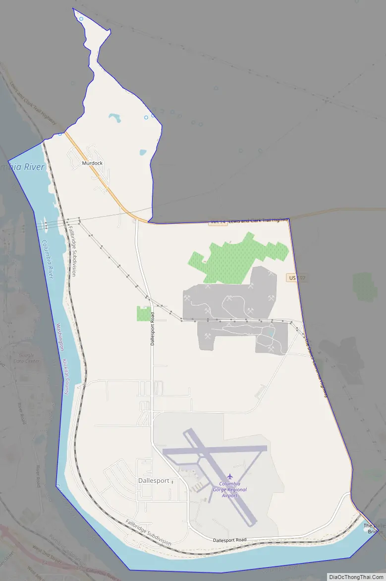
Dallesport Road Map
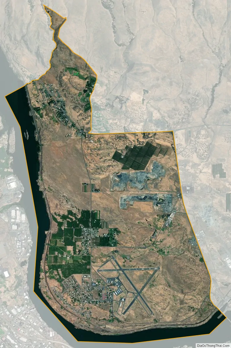
Dallesport city Satellite Map
Geography
Dallesport is located in southwestern Klickitat County at 45°37′42″N 121°10′49″W / 45.62833°N 121.18028°W / 45.62833; -121.18028 (45.628331, -121.180400). It sits on the north shore of the Columbia River and is bordered to the south, across the river, by The Dalles, Oregon.
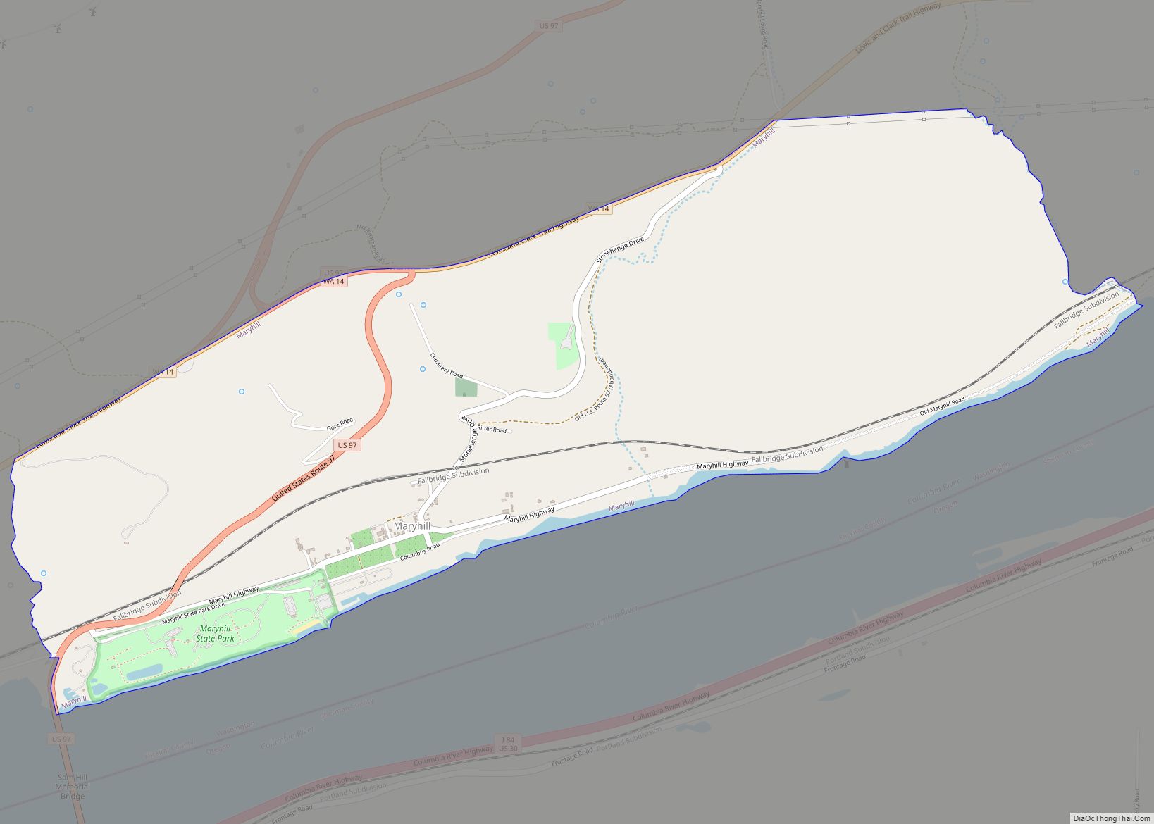
Washington State Route 14 forms the northern edge of the Dallesport CDP and leads east (upriver) 17 miles (27 km) to Maryhill and west (downriver) the same distance to White Salmon. U.S. Route 197 forms the eastern edge of the CDP and has its northern terminus at SR 14. US 197 leads south across the Dalles Bridge into Oregon and runs 63 miles (101 km) to U.S. Route 97 south of Maupin.
Columbia Gorge Regional Airport is in the southeast part of the CDP, between the settled part of Dallesport and US 197.
According to the United States Census Bureau, the CDP has a total area of 7.6 square miles (19.6 km), of which 6.7 square miles (17.4 km) are land and 0.81 square miles (2.1 km), or 10.81%, are water within the Columbia River.
Climate
This region experiences warm (but not hot) and dry summers, with no average monthly temperatures above 71.6 °F.
According to the Köppen Climate Classification system, Dallesport has a warm-summer Mediterranean climate, abbreviated “Csb” on climate maps.
On June 28, 2021, Dallesport’s high temperature of 118 °F (48 °C) tied the all-time Washington State heat record.
See also
Map of Washington State and its subdivision:- Adams
- Asotin
- Benton
- Chelan
- Clallam
- Clark
- Columbia
- Cowlitz
- Douglas
- Ferry
- Franklin
- Garfield
- Grant
- Grays Harbor
- Island
- Jefferson
- King
- Kitsap
- Kittitas
- Klickitat
- Lewis
- Lincoln
- Mason
- Okanogan
- Pacific
- Pend Oreille
- Pierce
- San Juan
- Skagit
- Skamania
- Snohomish
- Spokane
- Stevens
- Thurston
- Wahkiakum
- Walla Walla
- Whatcom
- Whitman
- Yakima
- Alabama
- Alaska
- Arizona
- Arkansas
- California
- Colorado
- Connecticut
- Delaware
- District of Columbia
- Florida
- Georgia
- Hawaii
- Idaho
- Illinois
- Indiana
- Iowa
- Kansas
- Kentucky
- Louisiana
- Maine
- Maryland
- Massachusetts
- Michigan
- Minnesota
- Mississippi
- Missouri
- Montana
- Nebraska
- Nevada
- New Hampshire
- New Jersey
- New Mexico
- New York
- North Carolina
- North Dakota
- Ohio
- Oklahoma
- Oregon
- Pennsylvania
- Rhode Island
- South Carolina
- South Dakota
- Tennessee
- Texas
- Utah
- Vermont
- Virginia
- Washington
- West Virginia
- Wisconsin
- Wyoming