White Salmon is a city in Klickitat County, Washington, United States. It is located in the Columbia River Gorge. The population was 2,193 at the 2000 census and increased 1.4% to 2,224 at the 2010 census.
| Name: | White Salmon city |
|---|---|
| LSAD Code: | 25 |
| LSAD Description: | city (suffix) |
| State: | Washington |
| County: | Klickitat County |
| Elevation: | 623 ft (190 m) |
| Total Area: | 1.54 sq mi (3.98 km²) |
| Land Area: | 1.54 sq mi (3.98 km²) |
| Water Area: | 0.00 sq mi (0.00 km²) |
| Total Population: | 2,224 |
| Population Density: | 1,749.67/sq mi (675.34/km²) |
| ZIP code: | 98672 |
| Area code: | 509 |
| FIPS code: | 5378330 |
| GNISfeature ID: | 1512803 |
Online Interactive Map
Click on ![]() to view map in "full screen" mode.
to view map in "full screen" mode.
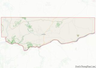
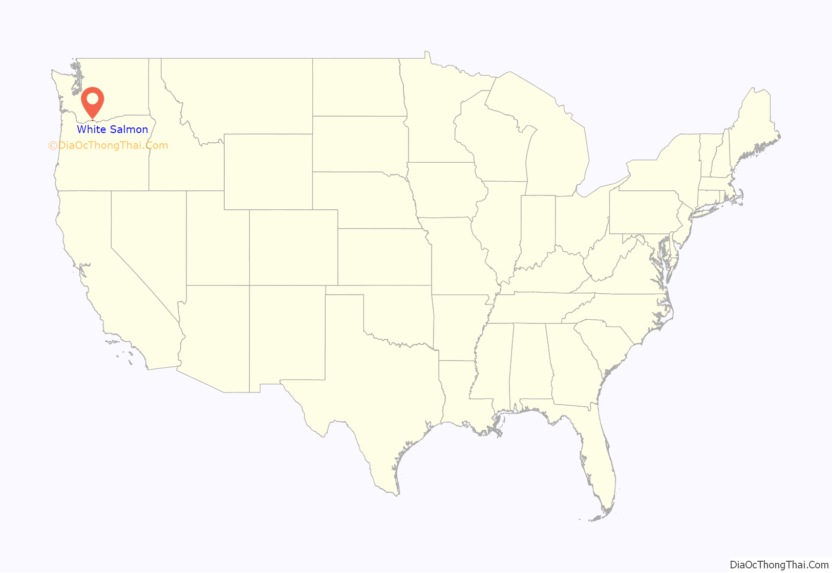
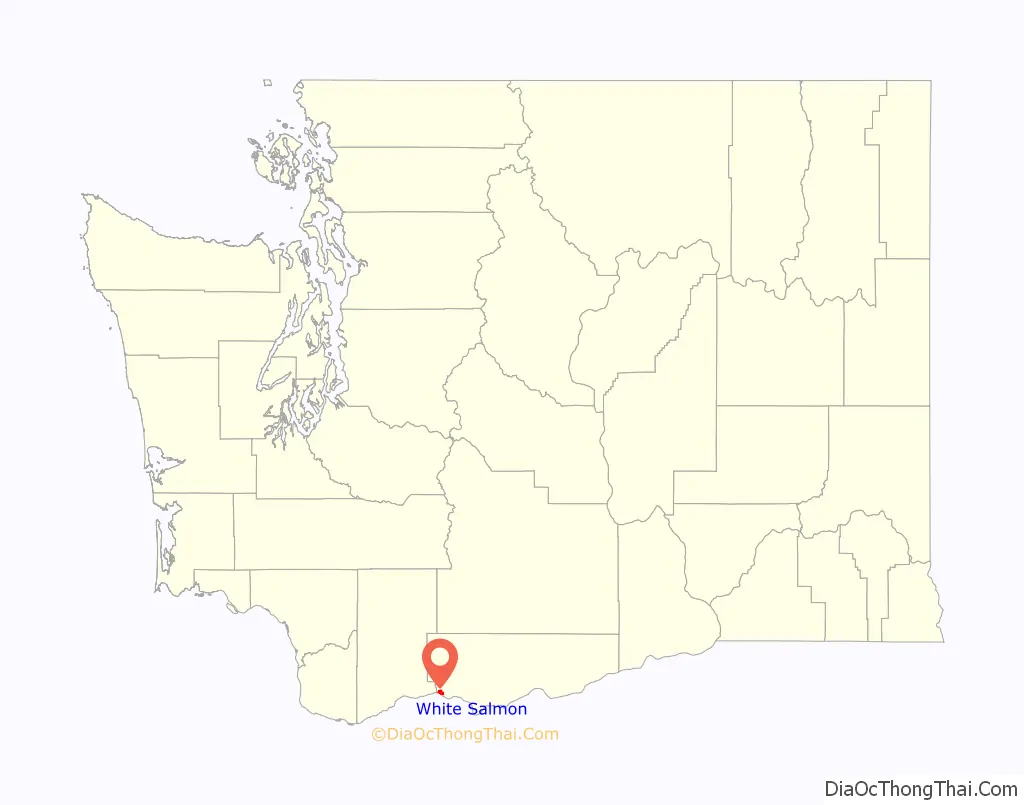
White Salmon location map. Where is White Salmon city?
History
White Salmon was first settled in 1852 by Erastus Joslyn and his wife. White Salmon was officially incorporated on June 3, 1907.
White Salmon was part of the home of the Klickitat Tribe, now a part of the Yakama Confederated Nations. The Klickitat Tribe sold some land to the Joslyns. They were generally Native advocates for the time. The area was thrown open on October 31, 1858 for white settlement after the Klickitat and Yakama lost the fight for their homelands in the Yakama War. Within the same year, the region was very rapidly and heavily settled by white immigrants making land claims. The Klickitat were forced to relocate to the Yakama Reservation.
White Salmon was named after the White Salmon, a now-extinct species of salmon that lived in the Columbia River and surrounding area.
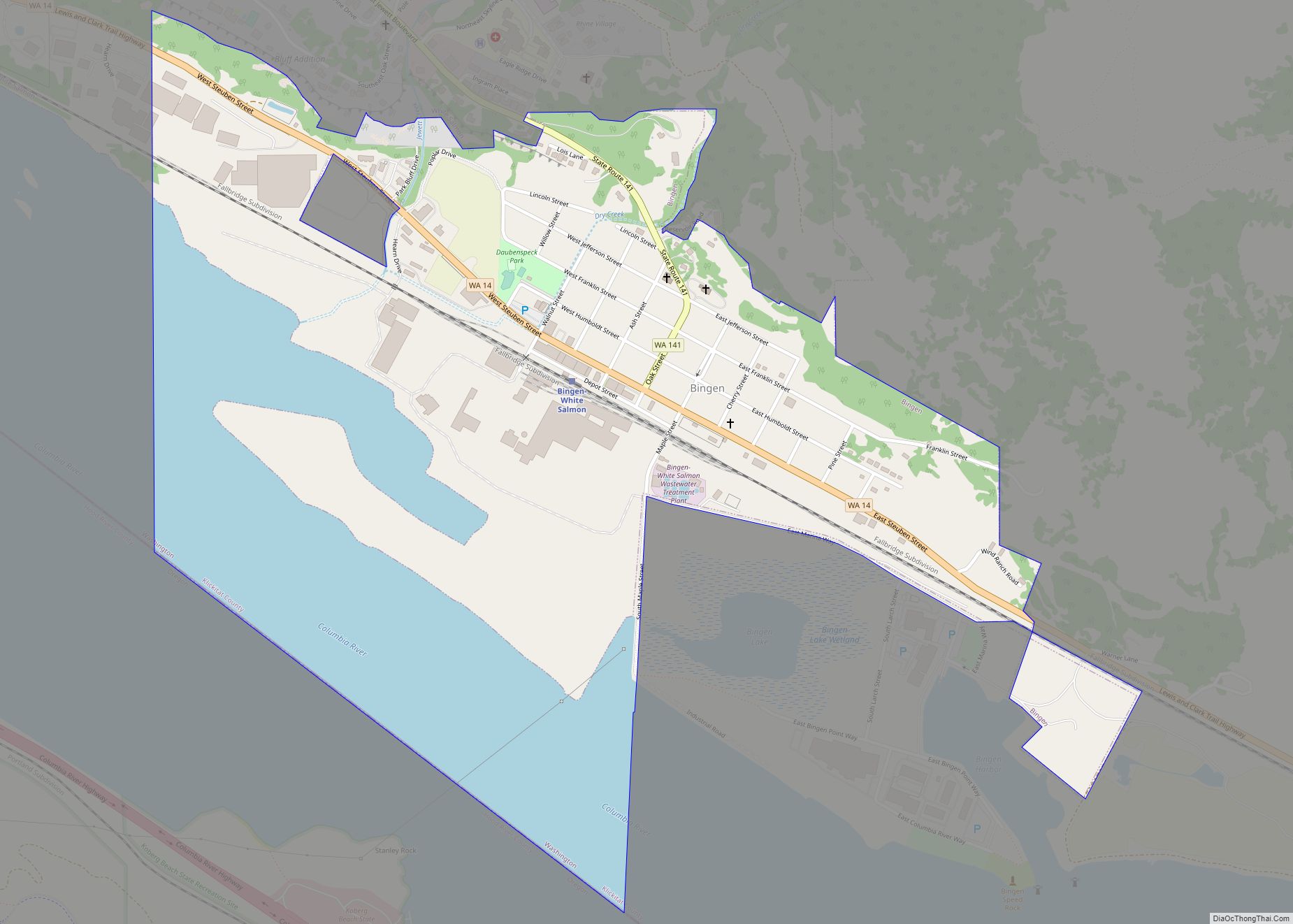
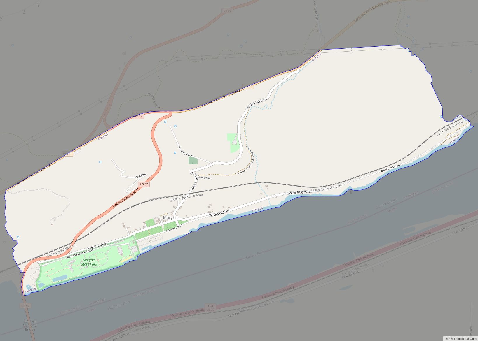
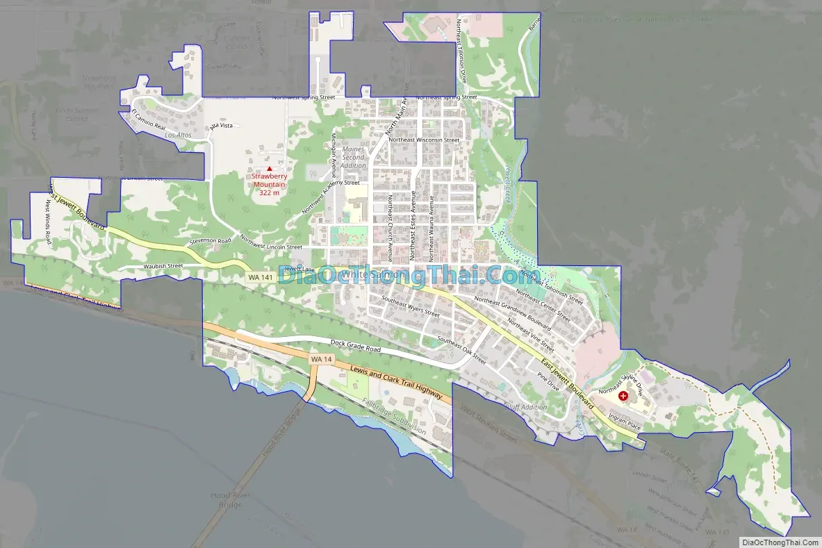
White Salmon Road Map
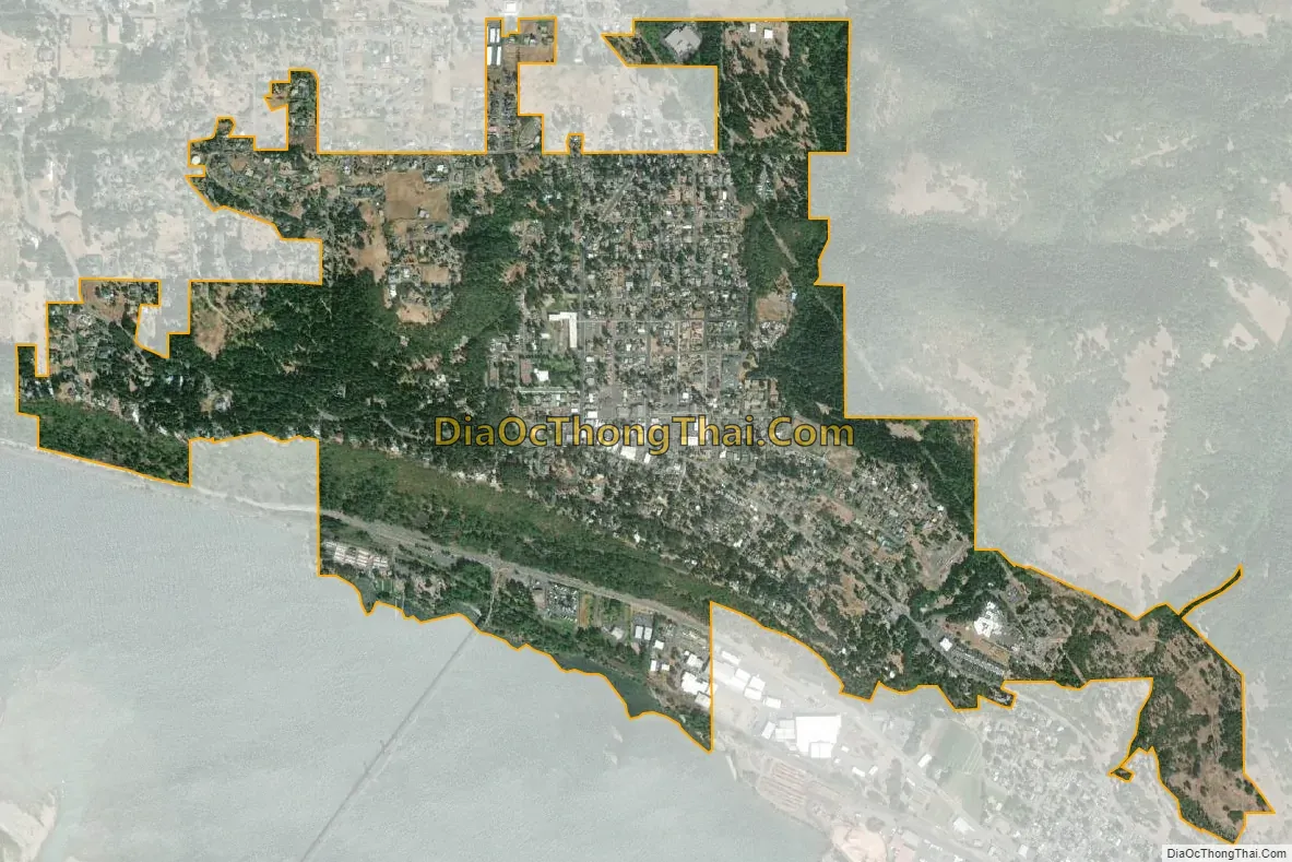
White Salmon city Satellite Map
Geography
White Salmon is located at 45°43′44″N 121°29′1″W / 45.72889°N 121.48361°W / 45.72889; -121.48361 (45.728792, -121.483557).
According to the United States Census Bureau, the city has a total area of 1.22 square miles (3.16 km), all of it land.
The city is located opposite Hood River, Oregon on the Columbia River.
See also
Map of Washington State and its subdivision:- Adams
- Asotin
- Benton
- Chelan
- Clallam
- Clark
- Columbia
- Cowlitz
- Douglas
- Ferry
- Franklin
- Garfield
- Grant
- Grays Harbor
- Island
- Jefferson
- King
- Kitsap
- Kittitas
- Klickitat
- Lewis
- Lincoln
- Mason
- Okanogan
- Pacific
- Pend Oreille
- Pierce
- San Juan
- Skagit
- Skamania
- Snohomish
- Spokane
- Stevens
- Thurston
- Wahkiakum
- Walla Walla
- Whatcom
- Whitman
- Yakima
- Alabama
- Alaska
- Arizona
- Arkansas
- California
- Colorado
- Connecticut
- Delaware
- District of Columbia
- Florida
- Georgia
- Hawaii
- Idaho
- Illinois
- Indiana
- Iowa
- Kansas
- Kentucky
- Louisiana
- Maine
- Maryland
- Massachusetts
- Michigan
- Minnesota
- Mississippi
- Missouri
- Montana
- Nebraska
- Nevada
- New Hampshire
- New Jersey
- New Mexico
- New York
- North Carolina
- North Dakota
- Ohio
- Oklahoma
- Oregon
- Pennsylvania
- Rhode Island
- South Carolina
- South Dakota
- Tennessee
- Texas
- Utah
- Vermont
- Virginia
- Washington
- West Virginia
- Wisconsin
- Wyoming