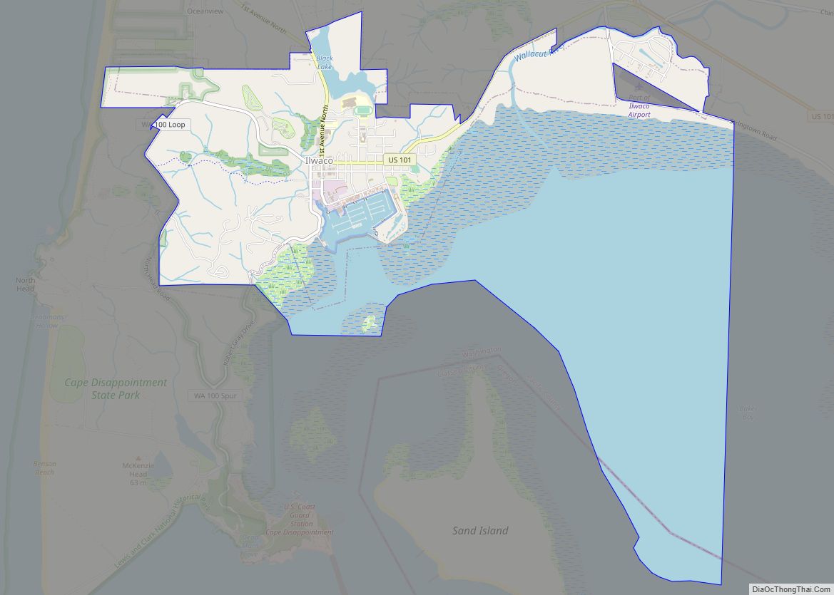
Ilwaco (/ɪlˈwɑːkoʊ/ il-WAH-koh) is a city in Pacific County, Washington, United States. The population was 936 at the 2010 census. Founded in 1890, the city was home to the Ilwaco Railway and Navigation Company along the Long Beach Peninsula, with its core economy based on logging and timber rafting. The city is located on the southern edge of the Long Beach Peninsula, on Baker Bay on the north side of the Columbia River where it meets the Pacific Ocean. It is near the city of Astoria, Oregon, which lies to the southeast on the southern bank of the Columbia.
| Name: | Ilwaco city |
|---|---|
| LSAD Code: | 25 |
| LSAD Description: | city (suffix) |
| State: | Washington |
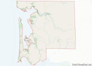
| County: | Pacific County |
| Elevation: | 23 ft (7 m) |
| Total Area: | 5.78 sq mi (14.97 km²) |
| Land Area: | 2.07 sq mi (5.35 km²) |
| Water Area: | 3.71 sq mi (9.61 km²) |
| Total Population: | 936 |
| Population Density: | 479.44/sq mi (185.14/km²) |
| ZIP code: | 98624 |
| Area code: | 360 |
| FIPS code: | 5333000 |
| GNISfeature ID: | 1521144 |
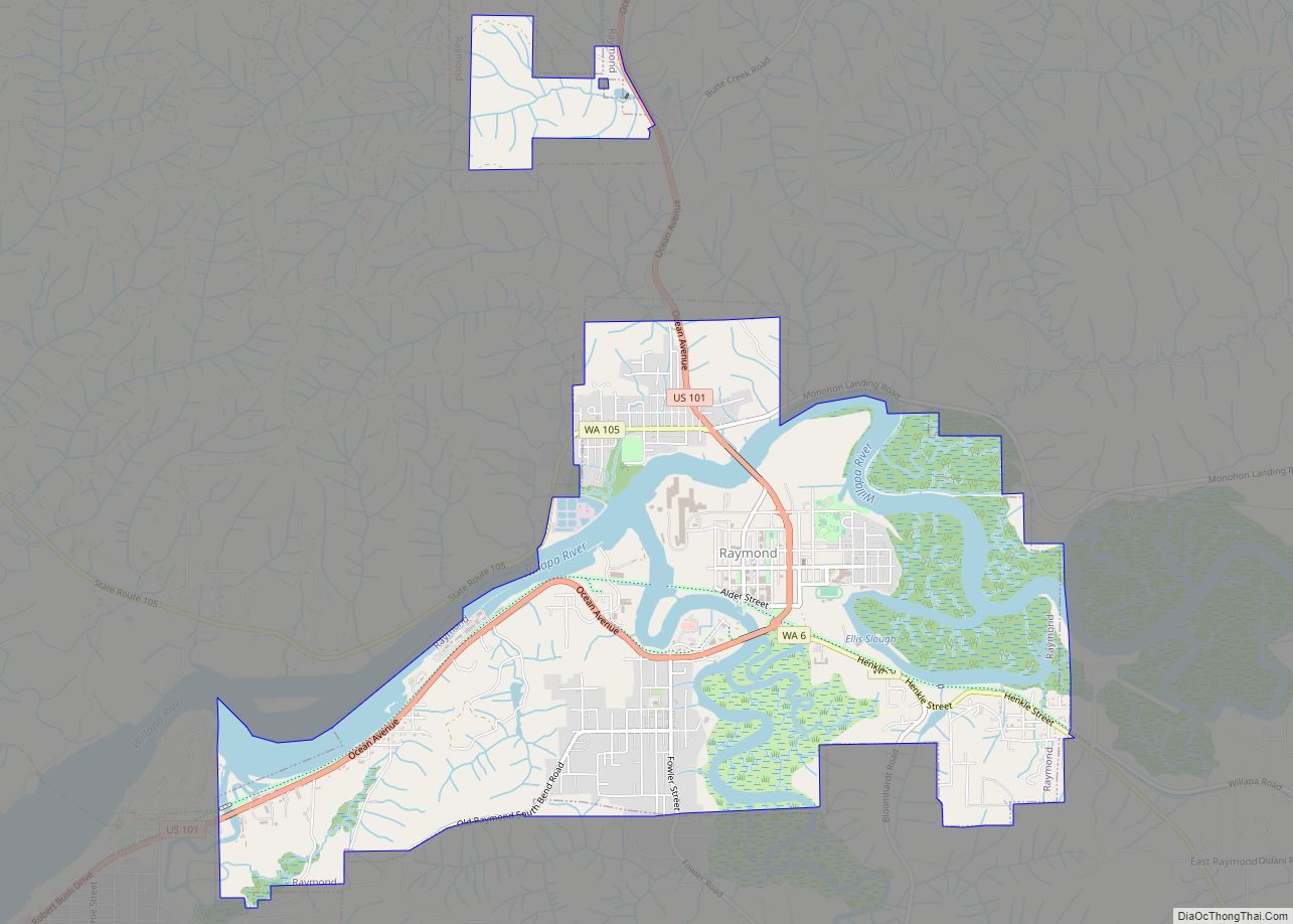
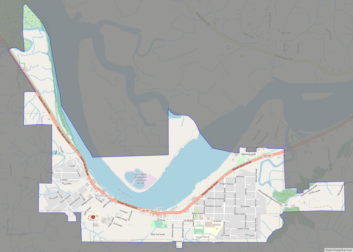
Online Interactive Map
Click on ![]() to view map in "full screen" mode.
to view map in "full screen" mode.
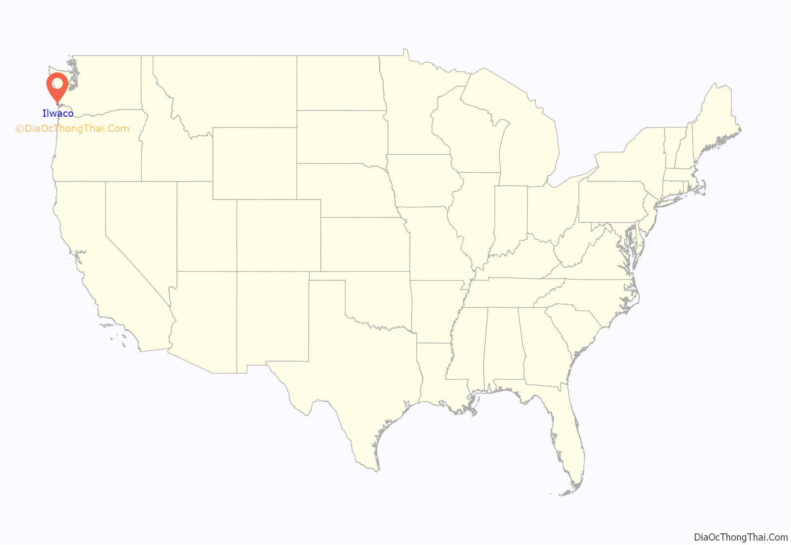
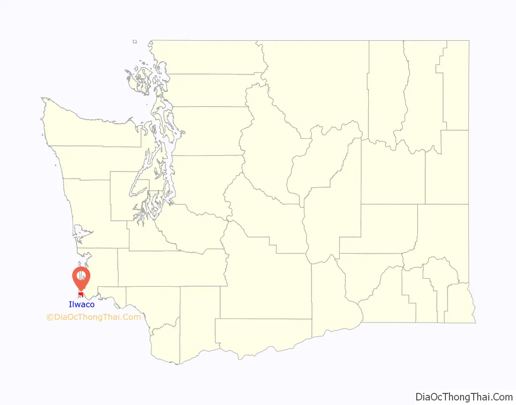
Ilwaco location map. Where is Ilwaco city?
History
Ilwaco was first settled by Henry Feister in 1851, and was named for the Lower Chinook leader Elwahko Jim, whose indigenous name was [ʔɪlwəkʷo], the son in law of Chief Comcomly. Ilwaco was officially incorporated on December 16, 1890. A narrow gauge railway, Ilwaco Railway and Navigation Company, ran for over thirty years. Similarly to the nearby city of Astoria, Oregon, and the surrounding communities, Ilwaco historically had a significant population of Finnish immigrants.
The railroad ran north up First Street in Ilwaco. A published photo shows the railroad’s Ilwaco facilities, including a gallows turntable and elevated watering trough, were located on the southwest corner of the intersection of First and Spruce streets. The depot was built nearby on Spruce Street. A siding was built for the Ilwaco Mill and Lumber Company. A published photo shows the passenger depot on the west side of First Street, at a point 14.8 miles (23.8 km) from the Ilwaco Depot to Nahcotta. The Ilwaco freight depot was in a different building. The freight depot survived to modern times, and has been relocated to become part of the Columbia Pacific Heritage Museum.
The train ran out on the dock in Ilwaco. Floating logs were stored behind log booms on the west side of the Ilwaco dock. At some point after 1890, First Street had been covered with wooden planks, and remained so until 1916, when it was paved over. By 1915, a published photo shows many more businesses along First Street.
In addition to the city’s logging industry, it has had a history as a cranberry producer, with cranberry bogs located immediately north of its downtown.
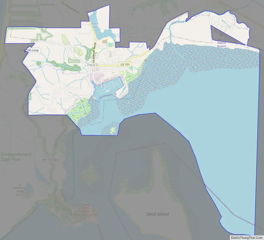
Ilwaco Road Map
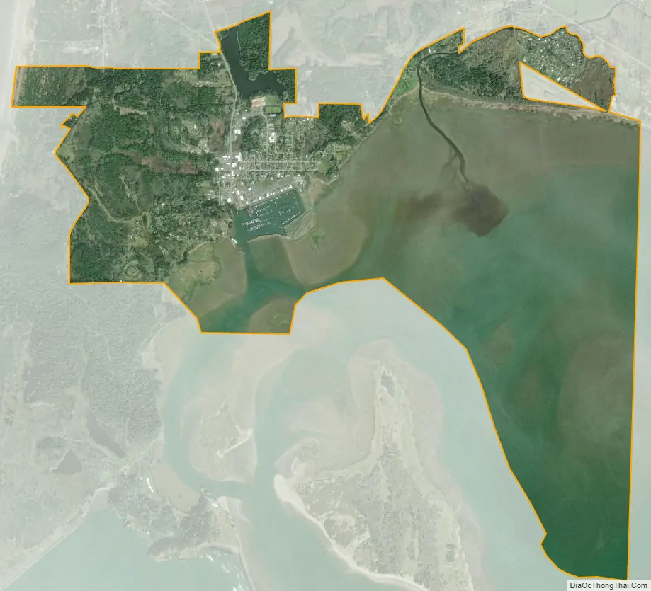
Ilwaco city Satellite Map
Geography
Ilwaco is located at 46°18′45″N 124°1′47″W / 46.31250°N 124.02972°W / 46.31250; -124.02972 (46.312541, -124.029688) on the Long Beach Peninsula.
According to the United States Census Bureau, the city has a total area of 5.93 square miles (15.36 km), of which 2.10 square miles (5.44 km) is land and 3.83 square miles (9.92 km) is water.
Climate
This region experiences warm (but not hot) and dry summers, with no average monthly temperatures above 71.6 °F. According to the Köppen Climate Classification system, Ilwaco has a warm-summer Mediterranean climate, abbreviated “Csb” on climate maps.
See also
Map of Washington State and its subdivision:- Adams
- Asotin
- Benton
- Chelan
- Clallam
- Clark
- Columbia
- Cowlitz
- Douglas
- Ferry
- Franklin
- Garfield
- Grant
- Grays Harbor
- Island
- Jefferson
- King
- Kitsap
- Kittitas
- Klickitat
- Lewis
- Lincoln
- Mason
- Okanogan
- Pacific
- Pend Oreille
- Pierce
- San Juan
- Skagit
- Skamania
- Snohomish
- Spokane
- Stevens
- Thurston
- Wahkiakum
- Walla Walla
- Whatcom
- Whitman
- Yakima
- Alabama
- Alaska
- Arizona
- Arkansas
- California
- Colorado
- Connecticut
- Delaware
- District of Columbia
- Florida
- Georgia
- Hawaii
- Idaho
- Illinois
- Indiana
- Iowa
- Kansas
- Kentucky
- Louisiana
- Maine
- Maryland
- Massachusetts
- Michigan
- Minnesota
- Mississippi
- Missouri
- Montana
- Nebraska
- Nevada
- New Hampshire
- New Jersey
- New Mexico
- New York
- North Carolina
- North Dakota
- Ohio
- Oklahoma
- Oregon
- Pennsylvania
- Rhode Island
- South Carolina
- South Dakota
- Tennessee
- Texas
- Utah
- Vermont
- Virginia
- Washington
- West Virginia
- Wisconsin
- Wyoming