Kirkland is a city in King County, Washington, United States. A suburb east of Seattle, its population was 92,175 in the 2020 U.S. census which made it the sixth largest city in the county and the twelfth largest in the state.
The city’s downtown waterfront has restaurants, art galleries, a performing arts center, public parks, beaches, and a collection of public art that includes bronze sculptures.
Kirkland was the original home of the Seattle Seahawks; the NFL team’s headquarters and training facility were located at the Lake Washington Shipyard (now Carillon Point) along Lake Washington for their first ten seasons (1976–85), then at nearby Northwest University through 2007. Warehouse chain Costco previously had its headquarters in Kirkland. While Costco is now headquartered in Issaquah, the city is the namesake of its “Kirkland Signature” store brand.
| Name: | Kirkland city |
|---|---|
| LSAD Code: | 25 |
| LSAD Description: | city (suffix) |
| State: | Washington |
| County: | King County |
| Founded: | 1888 |
| Incorporated: | 1905 |
| Elevation: | 14–500 ft (4–152 m) |
| Total Area: | 22.66 sq mi (58.69 km²) |
| Land Area: | 17.81 sq mi (46.12 km²) |
| Water Area: | 4.86 sq mi (12.58 km²) |
| Total Population: | 92,175 |
| Population Density: | 5,223.52/sq mi (2,016.80/km²) |
| ZIP code: | 98033, 98034, 98083 |
| Area code: | 425 |
| FIPS code: | 5335940 |
| GNISfeature ID: | 1512352 |
| Website: | www.kirklandwa.gov |
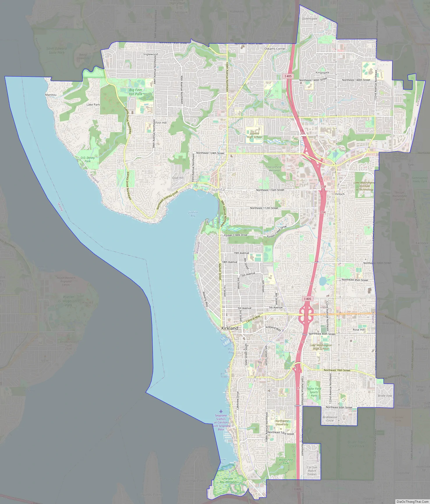
Online Interactive Map
Click on ![]() to view map in "full screen" mode.
to view map in "full screen" mode.
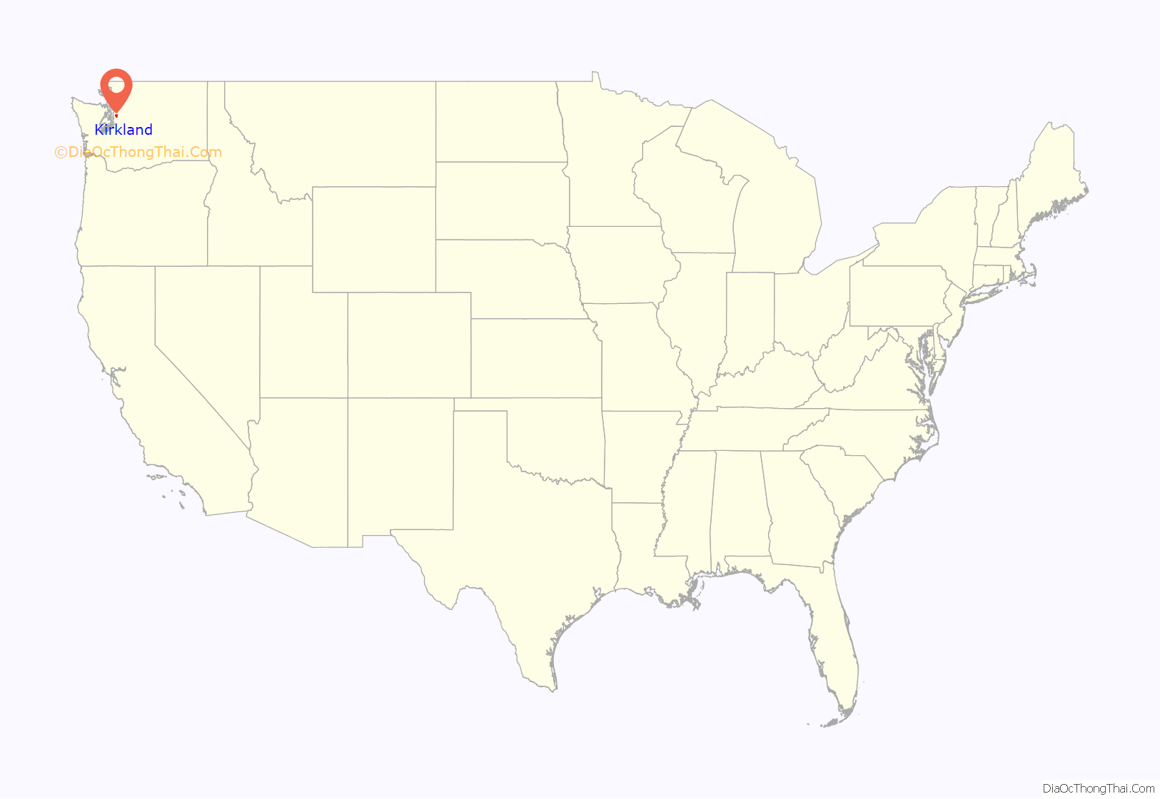
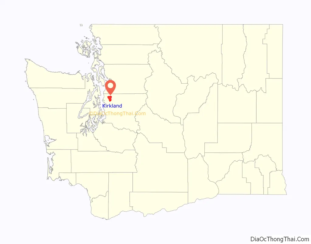
Kirkland location map. Where is Kirkland city?
History
The land around Lake Washington to the east of Seattle was first settled by Native Americans of the Duwamish people also known as the “Tahb-tah-byook”. Many lived between Yarrow Bay and Juanita Bay. The area had wildlife to live off of including waterfowl. Disease such as small pox eliminated a majority of the local indigenous population with the development around Lake Washington, including lowering the water level for the Ship Canal in 1916 left the remaining population to decline further.
English settlers arrived in the late 1860s, when the McGregor and Popham families built homesteads in what is now the Houghton neighborhood. Four miles (6 km) to the north people also settled near what is now called Juanita Bay, a favored campsite of the Natives because a wild potato, “wapato”, thrived there. The Curtis family arrived in the area in the 1870s, followed by the French family in 1872. The Forbes family homesteaded what is now Juanita Beach Park in 1876, and settled on Rose Hill in 1877. Gradually, additional people settled in the area, and by the end of the 1880s a small number of logging, farming and boat-building communities were established.
In 1886, Peter Kirk, a British-born enterprising businessman seeking to expand the family’s Moss Bay steel production company, moved to Washington after hearing that iron deposits had been discovered in the Cascade Range. Other necessary components such as limestone, needed in steel smelting, were readily available in the area. Further yet, a small number of coal mines (a required fuel source for steel mills) had recently been established nearby in Newcastle and train lines were already under construction. Plans were also underway to build the Lake Washington Ship Canal.
Kirk realized that if a town were built near the water it would be a virtual freshwater port to the sea, as well as help support any prospective mill. At the time, however, Kirk was not a U.S. citizen and could not purchase any land. Leigh S. J. Hunt, then owner of the Seattle Post-Intelligencer, offered to partner with Kirk and buy the necessary real estate.
Under their new venture, the Kirkland Land and Development Company, Kirk and Hunt purchased thousands of acres of land in what is now Kirkland’s downtown in July 1888. Kirk and his associates started the construction of a new steel mill soon after, named the Moss Bay Iron and Steel Company of America. After founding the city of Kirkland in 1888, officially one of the earliest on the Eastside at the time, Kirk’s vision of a “Pittsburgh of the West” was beginning to take form. Construction soon commenced on several substantial brick homes and business blocks that would house and serve the steel mill employees.
However, the Seattle, Lake Shore and Eastern Railway, which had recently been purchased by Tacoma-based Northern Pacific, had now refused to construct a rail line to the lake. This would, after all, have a negative impact on Tacoma, which was furiously competing with Seattle as the dominant Puget Sound seaport. The ensuing financial issues and numerous obstacles took a toll on Kirk, who was running out of investors. Hunt was also in debt from the purchase of land.
Nevertheless, the plans continued and the steel mill was eventually completed in late 1892 on Rose Hill (a full 2 miles (3 km) from the lake’s shore). Financial issues arose and due to the Panic of 1893 the mill subsequently closed without ever producing any steel. In spite of everything, Kirk was determined not to give up on his namesake town, and Kirkland was finally incorporated in 1905 with a population of approximately 532. A final attempt at a steel mill in Kirkland was planned by James A. Moore in 1906. His Northwestern Iron & Steel Company paid $250,000 in cash for a 1,500-acre (6.1 km) site, but the mill never materialized. This came at the heels of the Pacific Steel Company, incorporated earlier in 1906 by J.F. Duthie, William Calvert and L.S. Cragin. This company soon amounted to nothing.
In 1900, the Curtis family made a living operating a ferry-construction business on Lake Washington. Along with Captain John Anderson, the Curtises were among the first to run ferries in the area. Leschi, first operated on December 27, 1913, was the original wooden ferry to transport automobiles and people between the Eastside and Madison Park until her retirement in 1950. The ferry operations ran nearly continuously for 18 hours each day. The construction of the first Lake Washington floating bridge in 1940, however, made ferry service unprofitable and eventually led to its cancellation. Subsequent years saw wool milling and warship building become the major industries.
The first woolen mill in the state of Washington was built in Kirkland in 1892. The mill was the primary supplier of wool products for the Alaska Gold Rush prospectors and for the U.S. military during World War I. By 1917, after the completion of the Lake Washington Ship Canal, the construction of ocean-going vessels had become a major business. By 1940, the thriving Lake Washington Shipyard had constructed more than 25 warships during World War II for the U.S. Navy, on what is now Carillon Point.
Annexations
Since the incorporation of Kirkland in 1905, the city has grown to approximately 12 times its original geographic boundaries, nearly doubling in size during the 1940s and 1960s.
Kirkland consolidated with the neighboring town of Houghton on July 31, 1968, to form one city of 13,500. It annexed the neighborhood of Totem Lake in 1974, and the neighborhoods of South Juanita, North Rose Hill, and South Rose Hill in 1988, which were the largest annexations undertaken in Washington in nearly two decades. This added a further 16,119 people to Kirkland’s population and was responsible for 76 percent of Kirkland’s population increase between 1980 and 1990.
On November 3, 2009, responding to a county initiative to encourage cities to annex or incorporate many of the unincorporated areas within the county, as well as a state sales tax incentive intended to ease the process, three previously unincorporated districts north of the city—Finn Hill, North Juanita, and Kingsgate—voted on whether to annex to Kirkland. The measure failed by seven votes to reach the 60% margin, which was required because the measure included accepting a share of the city’s voter-approved debt. However, since the affirmative vote was over 50%, the city council could and did vote to accept the annexation, without the assumption of debt.
The annexation added 33,000 residents (combined total population of around 80,000) and nearly 7 square miles (18 km) to Kirkland on June 1, 2011. For a 10-year period from 2011 to 2021, the city was eligible and filed annually for a special Annexation State Sales Tax Credit (ASTC) from the State of Washington to bridge the millions of dollars deficit in providing municipal services in the annexation area. The ASTC expired in 2021.
Kirkland Road Map
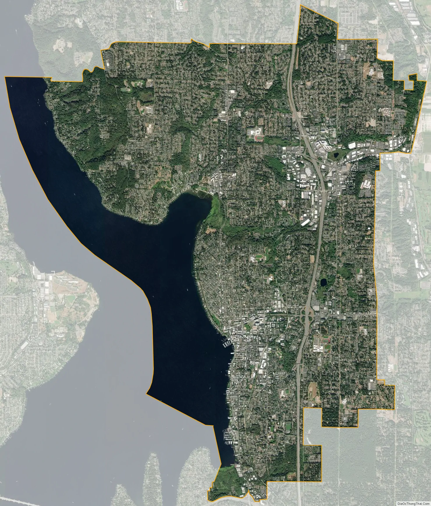
Kirkland city Satellite Map
Geography
Kirkland is bordered to the west by Lake Washington, to the east by Redmond, to the south by Bellevue, and to the north by Kenmore, Woodinville, and Bothell.
Kirkland is accessible via Interstate 405, which connects it with other Eastside cities, including Bellevue, Renton, and Bothell. Seattle, which is across Lake Washington to the west of Kirkland, as well as Redmond to the east, are both accessible through State Route 520.
According to the United States Census Bureau, the city has a total area of 17.83 square miles (46.18 km), of which 17.818 square miles (46.15 km) are land and 0.012 square miles (0.03 km) are water. The elevation varies from 14 to 500 feet (150 m) above sea level.
Climate
Kirkland’s average temperature is 52 °F (11.1 °C), and the average annual precipitation 36.27 inches (921 mm). The highest temperature was recorded as 109 °F (42.8 °C) on June 28, 2021. The lowest temperature was recorded as −5 °F (−20.6 °C) in January 1950.
See also
Map of Washington State and its subdivision:- Adams
- Asotin
- Benton
- Chelan
- Clallam
- Clark
- Columbia
- Cowlitz
- Douglas
- Ferry
- Franklin
- Garfield
- Grant
- Grays Harbor
- Island
- Jefferson
- King
- Kitsap
- Kittitas
- Klickitat
- Lewis
- Lincoln
- Mason
- Okanogan
- Pacific
- Pend Oreille
- Pierce
- San Juan
- Skagit
- Skamania
- Snohomish
- Spokane
- Stevens
- Thurston
- Wahkiakum
- Walla Walla
- Whatcom
- Whitman
- Yakima
- Alabama
- Alaska
- Arizona
- Arkansas
- California
- Colorado
- Connecticut
- Delaware
- District of Columbia
- Florida
- Georgia
- Hawaii
- Idaho
- Illinois
- Indiana
- Iowa
- Kansas
- Kentucky
- Louisiana
- Maine
- Maryland
- Massachusetts
- Michigan
- Minnesota
- Mississippi
- Missouri
- Montana
- Nebraska
- Nevada
- New Hampshire
- New Jersey
- New Mexico
- New York
- North Carolina
- North Dakota
- Ohio
- Oklahoma
- Oregon
- Pennsylvania
- Rhode Island
- South Carolina
- South Dakota
- Tennessee
- Texas
- Utah
- Vermont
- Virginia
- Washington
- West Virginia
- Wisconsin
- Wyoming


