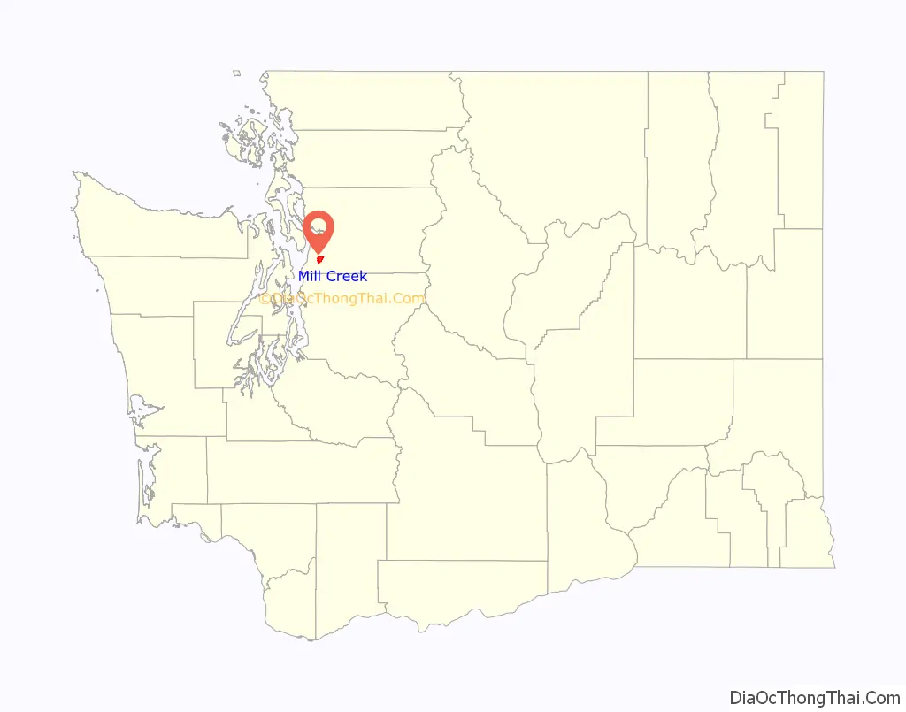
Mill Creek is a city in Snohomish County, Washington, United States. It is located between the cities of Everett and Lynnwood, approximately 20 miles (32 km) northeast of Seattle. The city has a population of 20,926 as of the 2020 census. The city lies along State Route 527 and North Creek, a tributary of the Sammamish River, on the east side of Interstate 5.
The city is one of the wealthiest suburbs in the Seattle metropolitan area and was originally a planned community conceived in the 1970s. The planned development was centered around a country club and golf course, with other development occurring nearby in later phases. It was incorporated as a city in 1983, shortly after the completion of the first phase of development, and underwent major population growth due to continued suburban development and annexation of nearby areas. The city’s downtown area is centered around the Mill Creek Town Center, a mixed-use lifestyle center and retail complex that opened in 2004.
| Name: | Mill Creek city |
|---|---|
| LSAD Code: | 25 |
| LSAD Description: | city (suffix) |
| State: | Washington |
| County: | Snohomish County |
| Incorporated: | September 30, 1983 |
| Elevation: | 377 ft (115 m) |
| Total Area: | 4.66 sq mi (12.06 km²) |
| Land Area: | 4.64 sq mi (12.03 km²) |
| Water Area: | 0.01 sq mi (0.04 km²) |
| Total Population: | 20,926 |
| Population Density: | 4,499.78/sq mi (1,737.55/km²) |
| ZIP code: | 98012, 98082 |
| Area code: | 425 |
| FIPS code: | 5345865 |
| GNISfeature ID: | 1534566 |
| Website: | cityofmillcreek.com |
Online Interactive Map
Click on ![]() to view map in "full screen" mode.
to view map in "full screen" mode.
Mill Creek location map. Where is Mill Creek city?

History
Development
The Mill Creek area was originally settled in the early 20th century by various farming families, from whom several local placenames are now derived. After the construction of the Bothell–Everett Highway in 1913 as part of the Pacific Highway, two junctions at Murphy’s Corner and Wintermute’s Corner gained small stores and gas stations to serve visitors. In 1931, Doctor Manch N. Garhart acquired 800 acres (320 ha) in the area and used it to grow Gravenstein apples and Bartlett pears while also raising cattle. The Garhart property, named Lake Dell Farm for a small reservoir built by local families, was later sold in 1967 to real estate developers after the market for local lumber and fruits had declined.
The Garhart property, along with several neighboring farms, were optioned by various real estate developers in the 1960s and 1970s as a potential master planned community due to its proximity to the recently completed Interstate 5. It would be the first modern planned city in Washington state, following in the footsteps of earlier planned cities like Longview, built in 1918. The community, named “Olympus”, was planned to include 3,300 acres (1,300 ha) in its first phase with 1,300 acres (530 ha) for homes, an industrial park, a shopping center, and a golf course. After a local recession in the early 1970s, the development project was sold in 1973 to Tokyu Land Development and designed by a subsidiary of the Obayashi Corporation named United Development. The development was renamed “Mill Creek”, beating out the Chinook Jargon word “Klahanie”, although there had never been a mill in the vicinity and a waterway of that name was not present in the area until the 2000 renaming of Smokehouse Creek.
Mill Creek’s master plan was submitted to the county council in January 1974. A homeowners association was established in December 1974 with funding from United Development to manage the area’s security patrol, street maintenance, and other tasks. The initial plan included consist of 4,600 homes, with eventual plans to house 12,000 people, a 260-acre (110 ha) park, and an 18-hole golf course. Construction began in early 1975 on the golf course and adjoining country club, while the first homes were under construction by the following year. The first set of homes were designed to resemble country residences, with large floorplans and prominent use of wood furnishings, and sold for an average of $65,000 (equivalent to $310,000 in 2021 dollars). Tokyu Land Development later re-used these home designs for the domestic market in Japan, where they were sold under the “Mill Creek” brand in the 1990s. The final phase of the original Mill Creek development, consisting of 33 condominiums, was completed in late 2003.
Incorporation and annexations
A majority of the first phase’s 1,767 homes and condominiums were completed by early 1983, when an incorporation petition was submitted by residents after reaching the population threshold of 3,000 needed for cityhood. At the time, the homeowners association and county government had already provided much of the area’s infrastructure and maintenance requirements, but local residents resisted attempts to raise property tax assessments. Mill Creek was officially incorporated as a city on September 30, 1983, ten days after a vote of residents passed, and encompassed 1.92 square miles (5.0 km). Mill Creek was the first new city to be incorporated in Snohomish County since Brier in 1965 and the newest in the state since Ocean Shores in 1970.
In the years following incorporation, Mill Creek reduced its property tax rates and formed its own police department, library, postal address, and land-use board. The city’s telephone system was split between three long-distance calling areas by GTE until the state utilities and transportation commission approved a consolidated calling area for toll-free service. Sid Hanson, the chairman of the incorporation committee, was elected as the city’s first mayor and served a single term until declining to run for re-election in 1987. The city government’s offices moved four times by the end of the decade, between various leased buildings that all served as temporary city halls. A separate post office serving the city was promised at the time of incorporation, but was not opened until 1994.
The city attempted its first annexations in 1986, but an advisory vote of existing residents rejected one proposal and the city council deferred action on another. Mill Creek approved its first annexation, an 88-acre (36 ha) parcel southeast of the main development, in July 1987, while the nearby city of Everett began its own annexations of areas to the north of Mill Creek. In 1989, the city proposed a major annexation of 350 acres (140 ha), a 25 percent increase in size, to add undeveloped commercial parcels on the west side of the Bothell–Everett Highway. The western annexation was initially opposed by the county government, but was approved alongside four other annexations after Mill Creek agreed to share costs for road improvements to handle additional traffic demand.
Everett attempted to annex the entire Murphy’s Corner area in the late 1980s, but was forced to split the neighborhood at 132nd Street with Mill Creek after a decision by the state court of appeals and additional arbitration by boundary review boards. The Henry M. Jackson High School was opened in 1994 and is located on the Mill Creek side of Murphy’s Corner, which was annexed the following year. A private high school, Archbishop Murphy High School, was opened in 1999 on a 22-acre (8.9 ha) campus in northeastern Mill Creek. The 553-acre (224 ha) Thomas Lake area in the northeastern corner of the city, bordered to the north by 132nd Street and east by Seattle Hill Road, was annexed in 2005 and added 2,200 residents to the city’s population. The annexations of other developed subdivisions, lacking the original development’s upscale image, created a divide between residents on the issue of further growth. Residents in several potential annexation targets preferred to be left alone by Mill Creek, due to its “snobbish” reputation, which faded as new neighborhoods were absorbed into the city.
21st century
In the late 1980s, Mill Creek drafted a comprehensive plan that would transform its newly-annexed commercial area into a mixed-use downtown area to support the growing city. The 23-acre (9.3 ha) downtown development would include a large public park, shopping areas, recreational facilities, multi-use trails, and office buildings. After difficulty in finding a suitable developer, the Mill Creek Town Center began construction in 2001 and the first phase opened three years later. The second phase was completed in 2007, with 26 retail buildings, a medical clinic, condominiums, and a downtown plaza.
The Bothell–Everett Highway (now State Route 527) remained a two-lane rural highway through Mill Creek until the start of an expansion and improvement program in the 1990s. It was widened to four lanes with a center turn lane, and also gained bicycle lanes, sidewalks, and new landscaping features. The section through Mill Creek, from 164th Street to 132nd Street, was completed in 2006 and required the construction of retaining walls and detention ponds due to the limited space for the road. The project also included new bus stops that were later upgraded with the opening of the Swift Green Line bus rapid transit system in March 2019.
The city government began planning for a second urban village, to be located in newly-annexed areas at the northeast edge of the city, in 2007. The retail and residential development, named the East Gateway, would have been located on 52 acres (21 ha) along 132nd Street, and was originally slated to be anchored by a Wal-Mart until the company scrapped plans after protests from local residents. The eastern half of the development began construction in 2012 and will encompass 210 apartments, 104 townhouses, office space, and retail. Development of the remaining western half was approved in 2019 and branded as “The Farm at Mill Creek”, consisting of 354 apartments, retail space, workforce housing units, and office space. It will be anchored by the first suburban Amazon Go in the state, and a hotel.
Mill Creek Road Map

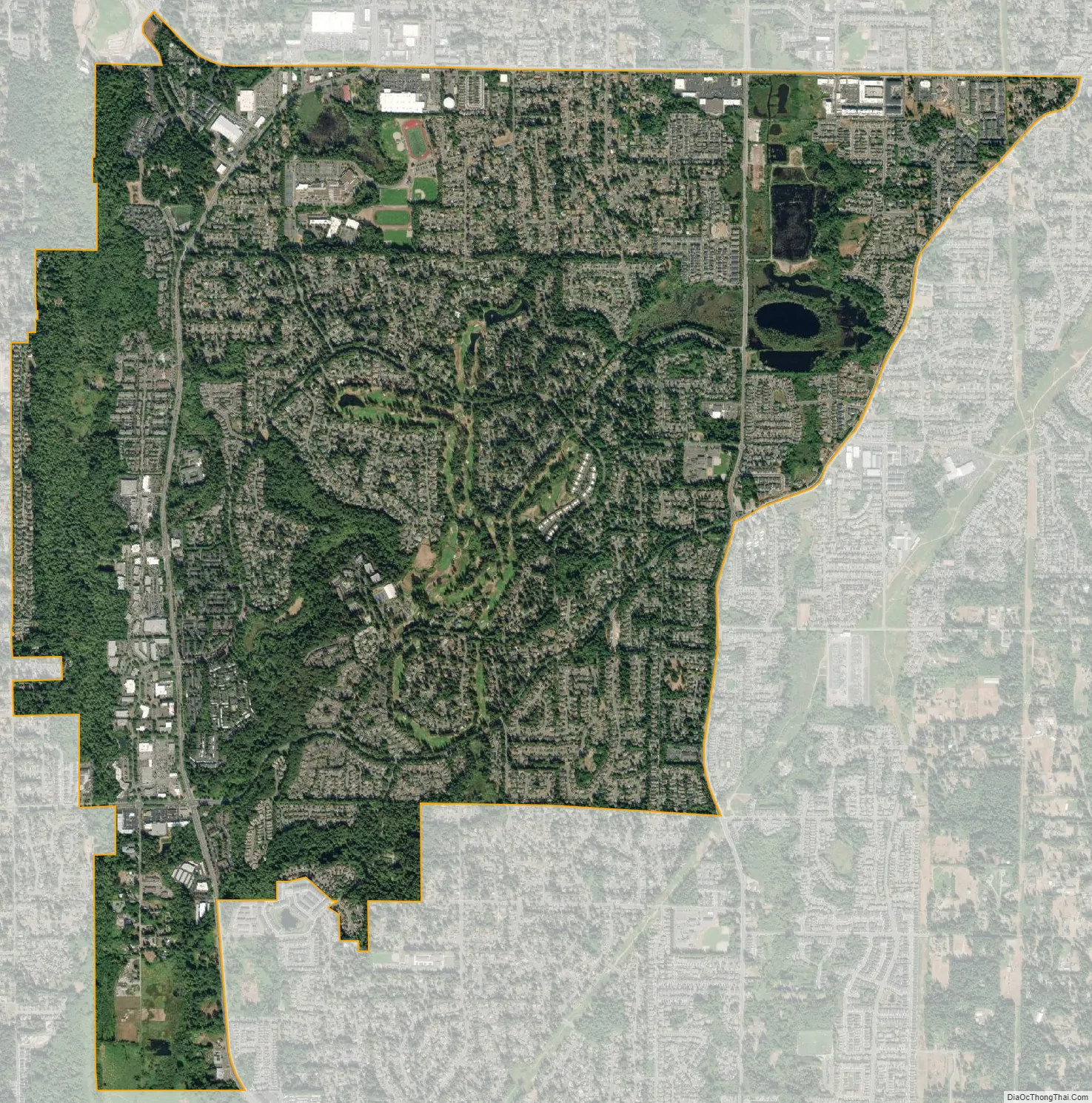
Mill Creek city Satellite Map
Geography
The city of Mill Creek has a total area of 4.69 square miles (12.15 km) according to the United States Census Bureau. The city limits of Mill Creek are generally defined to the west by North Creek, to the north by 132nd Street Southeast (part of State Route 96) and Everett, to the east by Seattle Hill Road and 35th Avenue Southeast, and to the south by 163rd Street Southeast and North Creek County Park. The city is surrounded by a larger urban growth area that encompasses unincorporated land, including the communities of Martha Lake, Mill Creek East and Silver Firs, with an population of 68,746 people in 2020. The urban growth area extends west to Interstate 5, including an overlapping claim with Lynnwood and south to 196th Street Southeast at the north end of the Bothell claim.
Several creeks flow through the city, including North Creek (a tributary of the Sammamish River), Penny Creek, and Nickel Creek. A minor stream known as Smokehouse Creek was renamed to Mill Creek in 2001, retroactively giving the city a geographic namesake. The center of Mill Creek lies along State Route 527, between two protected wetlands along North Creek and Penny Creek. The original plat of Mill Creek, located east of State Route 527, consists of 21 neighborhood subdivisions that are named for various types of trees.
See also
Map of Washington State and its subdivision:- Adams
- Asotin
- Benton
- Chelan
- Clallam
- Clark
- Columbia
- Cowlitz
- Douglas
- Ferry
- Franklin
- Garfield
- Grant
- Grays Harbor
- Island
- Jefferson
- King
- Kitsap
- Kittitas
- Klickitat
- Lewis
- Lincoln
- Mason
- Okanogan
- Pacific
- Pend Oreille
- Pierce
- San Juan
- Skagit
- Skamania
- Snohomish
- Spokane
- Stevens
- Thurston
- Wahkiakum
- Walla Walla
- Whatcom
- Whitman
- Yakima
- Alabama
- Alaska
- Arizona
- Arkansas
- California
- Colorado
- Connecticut
- Delaware
- District of Columbia
- Florida
- Georgia
- Hawaii
- Idaho
- Illinois
- Indiana
- Iowa
- Kansas
- Kentucky
- Louisiana
- Maine
- Maryland
- Massachusetts
- Michigan
- Minnesota
- Mississippi
- Missouri
- Montana
- Nebraska
- Nevada
- New Hampshire
- New Jersey
- New Mexico
- New York
- North Carolina
- North Dakota
- Ohio
- Oklahoma
- Oregon
- Pennsylvania
- Rhode Island
- South Carolina
- South Dakota
- Tennessee
- Texas
- Utah
- Vermont
- Virginia
- Washington
- West Virginia
- Wisconsin
- Wyoming


