Mineral is an unincorporated community and census-designated place (CDP) in Lewis County, Washington, on State Route 7 near the Pierce/Lewis county line. Mineral originally began as a logging camp and mining town. Prospectors searching the area for gold instead found coal and arsenic. By the early 1920s, the mines closed, and with a devastating fire to the town’s largest sawmill, Mineral began to turn to tourism as its main industry, primarily through recreational fishing on Mineral Lake.
The Mineral Log Lodge, built in 1906, was listed to the National Register of Historic Places in 1975.
| Name: | Mineral CDP |
|---|---|
| LSAD Code: | 57 |
| LSAD Description: | CDP (suffix) |
| State: | Washington |
| County: | Lewis County |
| Elevation: | 1,470 ft (448 m) |
| Total Area: | 0.66 sq mi (1.72 km²) |
| Land Area: | 0.66 sq mi (1.72 km²) |
| Water Area: | 0.0 sq mi (0.0 km²) |
| Total Population: | 202 |
| Population Density: | 304/sq mi (117.2/km²) |
| ZIP code: | 98355 |
| Area code: | 360 |
| FIPS code: | 5346090 |
| GNISfeature ID: | 1523205 |
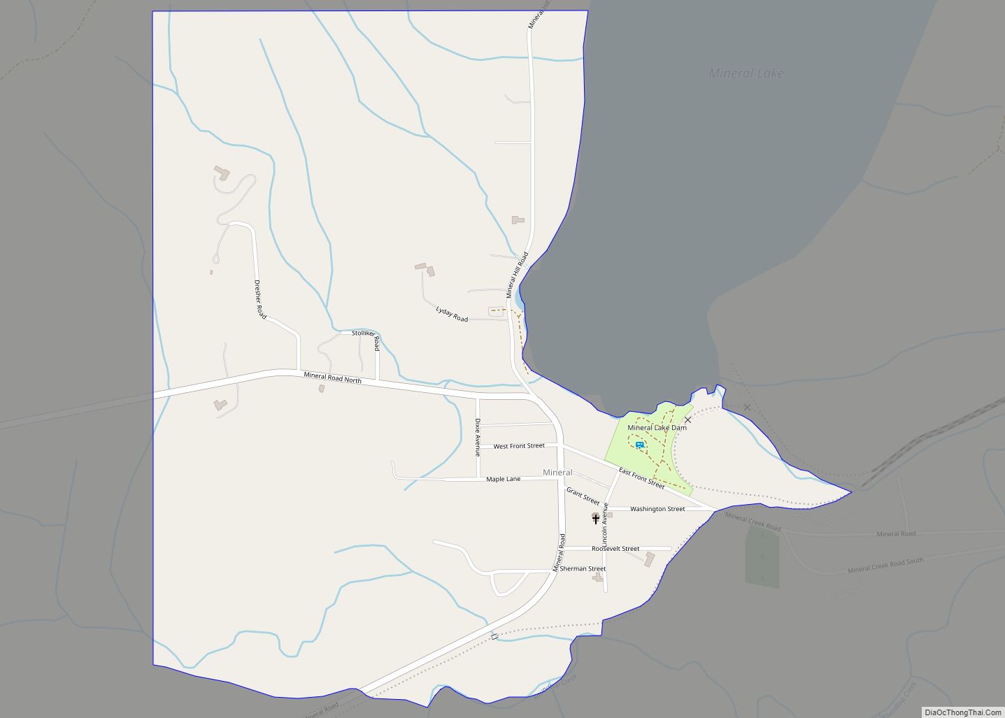
Online Interactive Map
Click on ![]() to view map in "full screen" mode.
to view map in "full screen" mode.
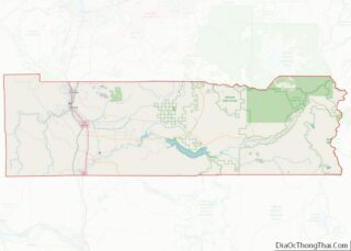
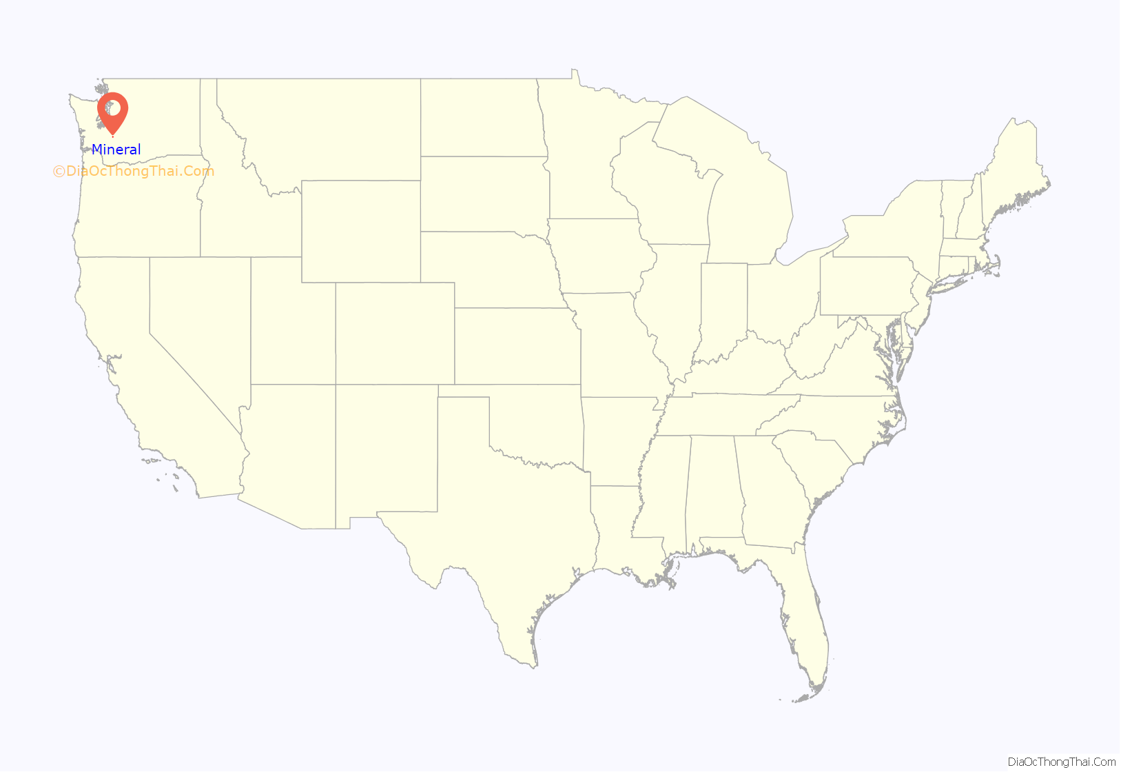
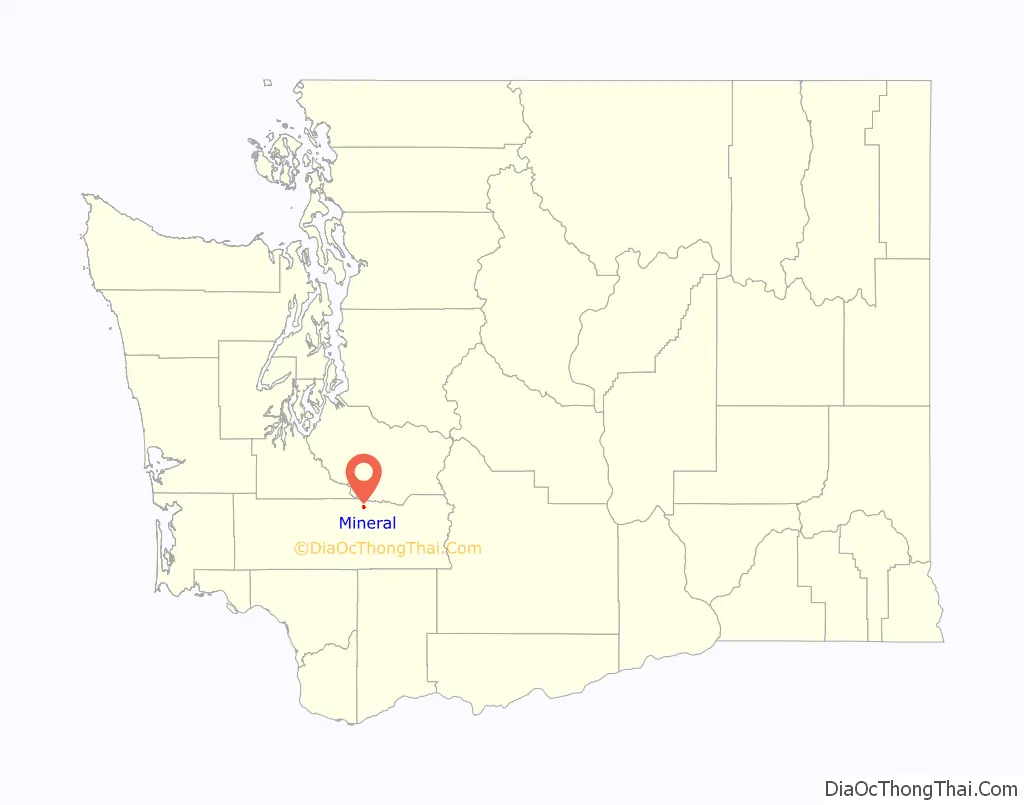
Mineral location map. Where is Mineral CDP?
History
The town was founded no later than 1897 on the shore of Mineral Lake, adopting the name from the lake and the veins of ruby of arsenic in the region. The area would be referred to as Mineral City and Mineral Creek in its early days. The lake was once known as “Goldsboro Lake”.
Primarily a timber community, arsenic mines would open and the population peaked at 1,000 residents by the 1920s, with a flourishing downtown district. However, mining efforts would cease due to more efficient methods being available to obtain the mineral, and the largest mill, owned by the Mineral Lake Lumber Company, would be destroyed by fire in 1922 and never rebuilt. The town would shrink in size and would become a “bedroom community”.
In 1985, Mineral was the location of the Mineral, Washington murders, one of the most famous unsolved murder cases in the United States.
Over 500 acres were purchased by the YMCA of Greater Seattle in 2021, with support from the Nisqually Indian Tribe, to create a campground north of Mineral on the lake. Future plans may include acquisition of up to 1600 more acres in several phases over the coming decades.
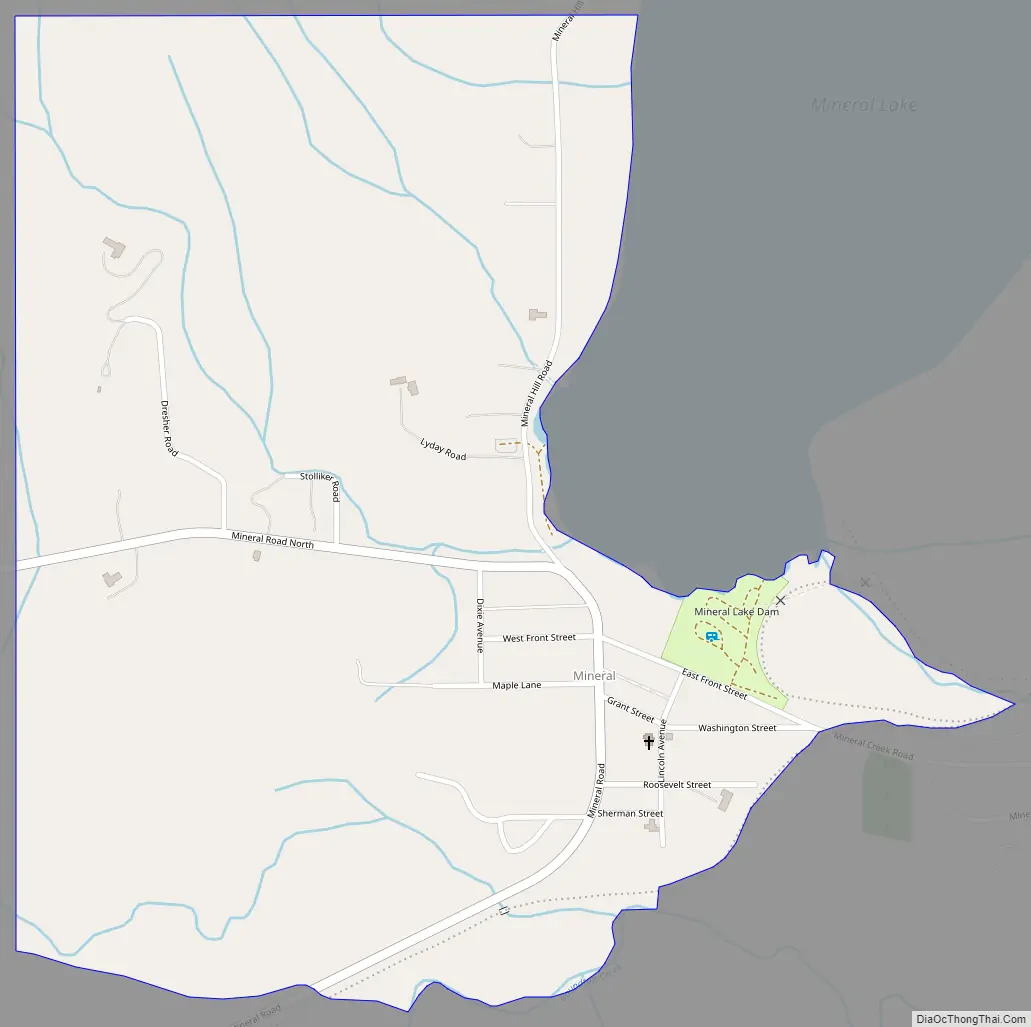
Mineral Road Map
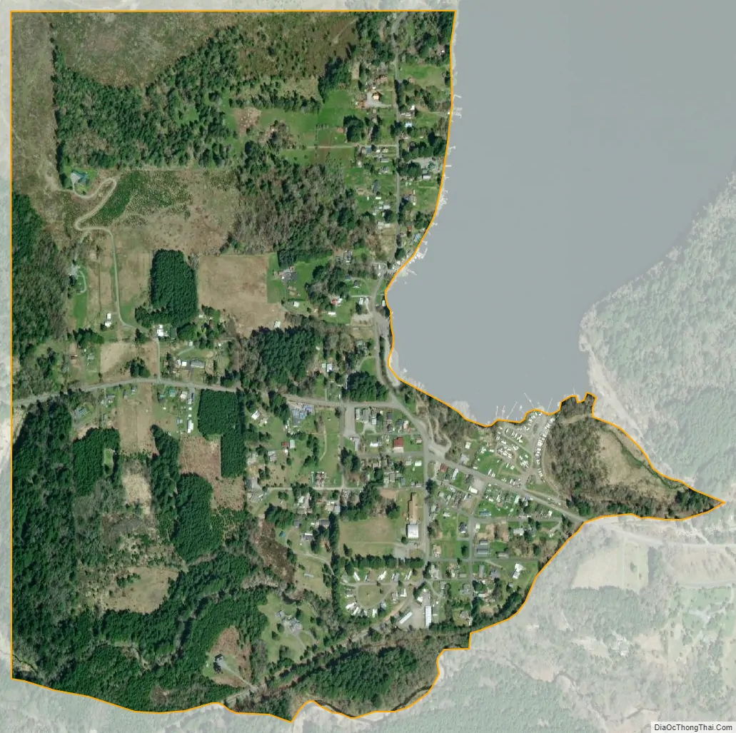
Mineral city Satellite Map
Geography
Mineral is in northeastern Lewis County, 3 miles (5 km) south of the Pierce County line. The community sits at the southern end of Mineral Lake, 4 miles (6 km) south of Elbe and 12 miles (19 km) north of Morton. It is 1.5 miles (2.4 km) east of State Route 7.
According to the U.S. Census Bureau, the Mineral CDP has an area of 0.66 square miles (1.7 km), all of it recorded as land. Water from Mineral Lake flows north down Mineral Creek to the Nisqually River, which reaches Puget Sound northeast of Olympia.
See also
Map of Washington State and its subdivision:- Adams
- Asotin
- Benton
- Chelan
- Clallam
- Clark
- Columbia
- Cowlitz
- Douglas
- Ferry
- Franklin
- Garfield
- Grant
- Grays Harbor
- Island
- Jefferson
- King
- Kitsap
- Kittitas
- Klickitat
- Lewis
- Lincoln
- Mason
- Okanogan
- Pacific
- Pend Oreille
- Pierce
- San Juan
- Skagit
- Skamania
- Snohomish
- Spokane
- Stevens
- Thurston
- Wahkiakum
- Walla Walla
- Whatcom
- Whitman
- Yakima
- Alabama
- Alaska
- Arizona
- Arkansas
- California
- Colorado
- Connecticut
- Delaware
- District of Columbia
- Florida
- Georgia
- Hawaii
- Idaho
- Illinois
- Indiana
- Iowa
- Kansas
- Kentucky
- Louisiana
- Maine
- Maryland
- Massachusetts
- Michigan
- Minnesota
- Mississippi
- Missouri
- Montana
- Nebraska
- Nevada
- New Hampshire
- New Jersey
- New Mexico
- New York
- North Carolina
- North Dakota
- Ohio
- Oklahoma
- Oregon
- Pennsylvania
- Rhode Island
- South Carolina
- South Dakota
- Tennessee
- Texas
- Utah
- Vermont
- Virginia
- Washington
- West Virginia
- Wisconsin
- Wyoming