Puyallup (/pjuːˈæləp/ (listen) pew-AL-əp or /pjuːˈɔːləp/ pew-AWL-əp) is a city in Pierce County, Washington, United States, located about 10 miles (16 km) southeast of Tacoma and 35 miles (56 km) south of Seattle. It had a population of 42,973 at the 2020 census. The city’s name comes from the Puyallup Tribe of Native Americans and means “the generous people”. Puyallup is also home to the Washington State Fair, the state’s largest fair.
| Name: | Puyallup city |
|---|---|
| LSAD Code: | 25 |
| LSAD Description: | city (suffix) |
| State: | Washington |
| County: | Pierce County |
| Elevation: | 46 ft (14 m) |
| Total Area: | 14.24 sq mi (36.89 km²) |
| Land Area: | 14.13 sq mi (36.61 km²) |
| Water Area: | 0.11 sq mi (0.28 km²) |
| Total Population: | 42,973 |
| Population Density: | 2,996.89/sq mi (1,157.07/km²) |
| ZIP code: | 98371-98375 |
| Area code: | 253 |
| FIPS code: | 5356695 |
| GNISfeature ID: | 1533368 |
| Website: | cityofpuyallup.org |
Online Interactive Map
Click on ![]() to view map in "full screen" mode.
to view map in "full screen" mode.
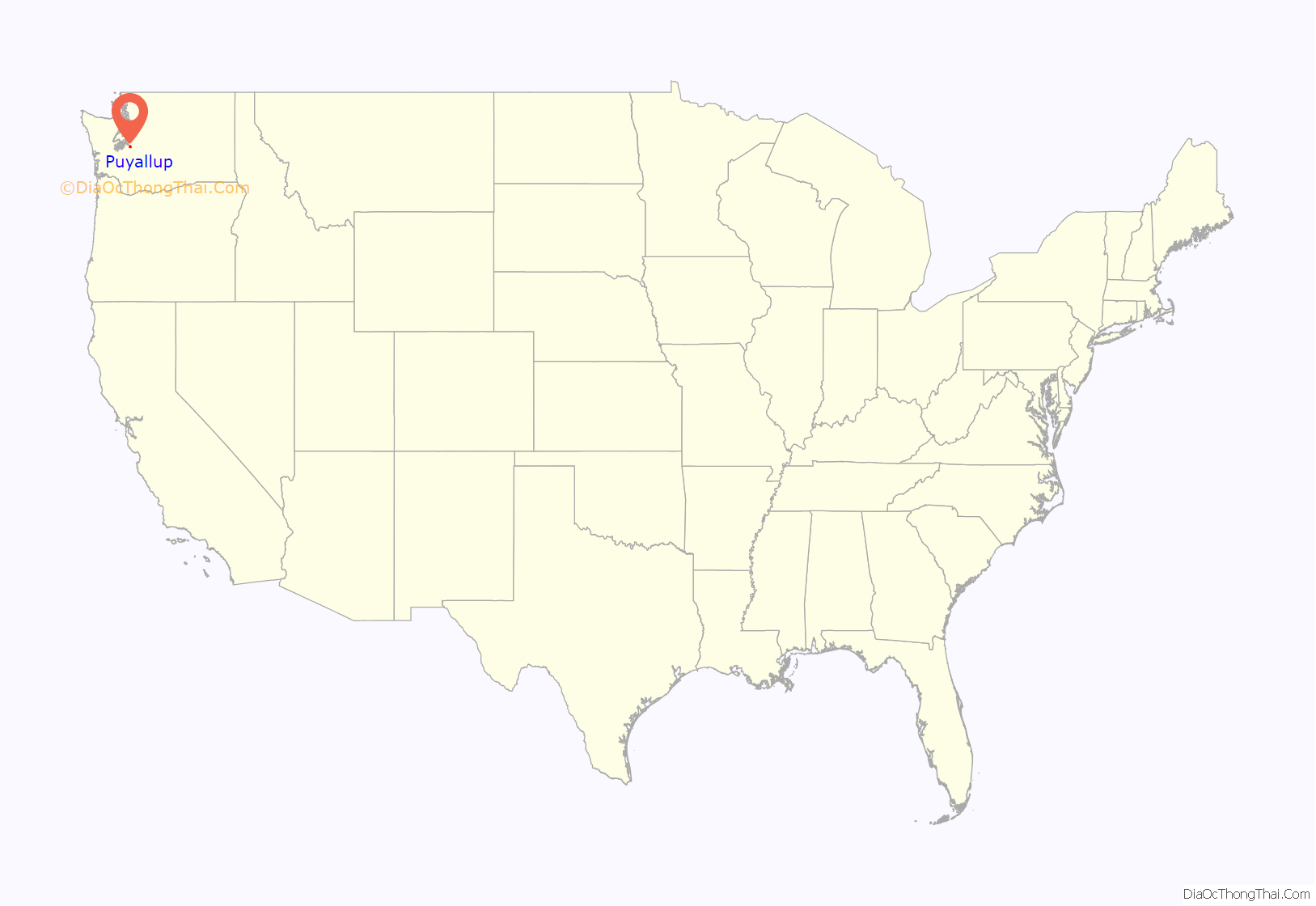
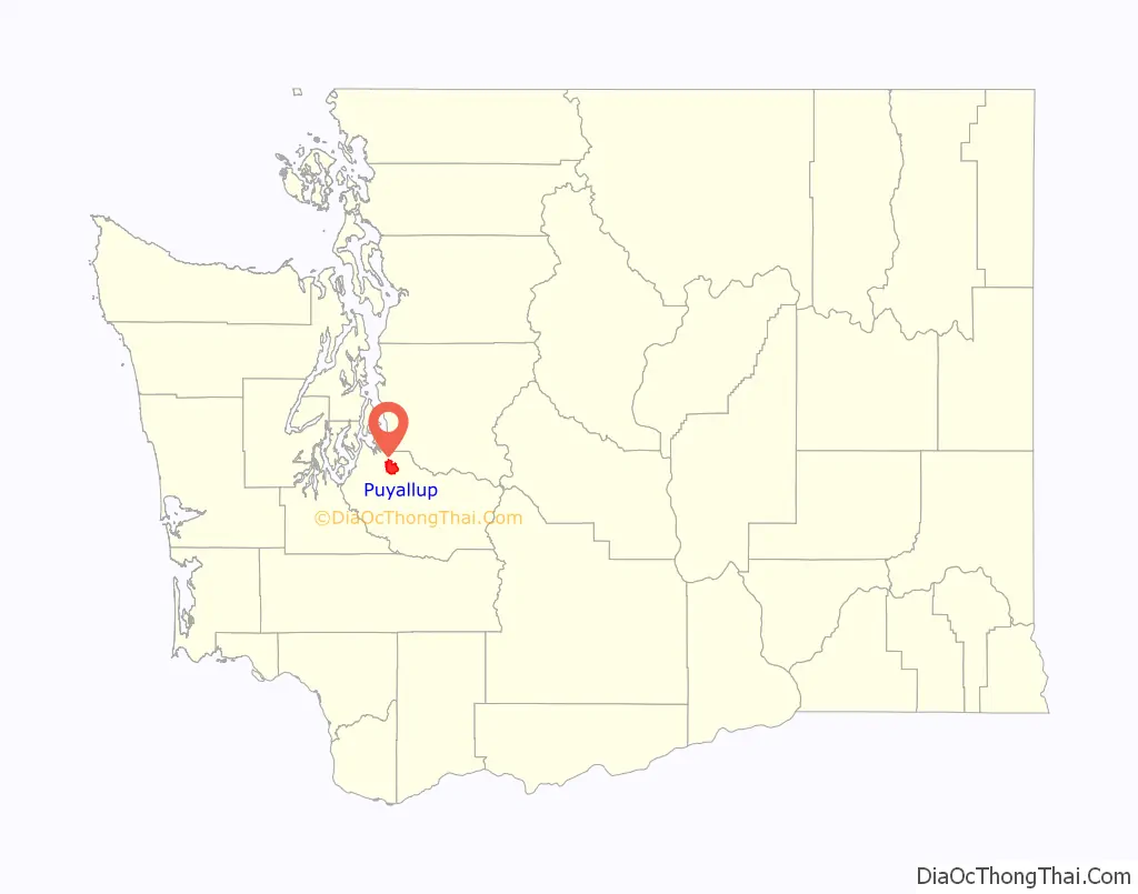
Puyallup location map. Where is Puyallup city?
History
The Puyallup Valley was originally inhabited by the Puyallup people, known in their language as the spuyaləpabš, meaning “generous and welcoming behavior to all people (friends and strangers) who enter our lands.” The first white settlers in the region were part of the first wagon train to cross the Cascade Range at Naches Pass in 1853.
Native Americans numbered about 2,000 in what is now the Puyallup Valley in the 1830s and 1840s. The first European settlers arrived in the 1850s. In 1877, Ezra Meeker platted a townsite and named it Puyallup after the local Puyallup Indian tribes, 11 years after departing from Indiana. The town grew rapidly throughout the 1880s, in large part thanks to Meeker’s hop farm, which brought in millions of dollars to Puyallup, leading to it eventually being incorporated in 1890, with Ezra Meeker as its first mayor. The turn of the 20th century brought change to the valley with the growth of nearby Tacoma and the interurban rail lines. The Western Washington Fairgrounds were developed giving local farmers a place to exhibit their crops and livestock. During the early part of World War II due to Executive Order 9066, the fairgrounds were part of Camp Harmony, a temporary Japanese American internment camp for more than 7,000 detainees, most of whom were American citizens. Subsequently, they were moved to the Minidoka relocation center near Twin Falls, Idaho.
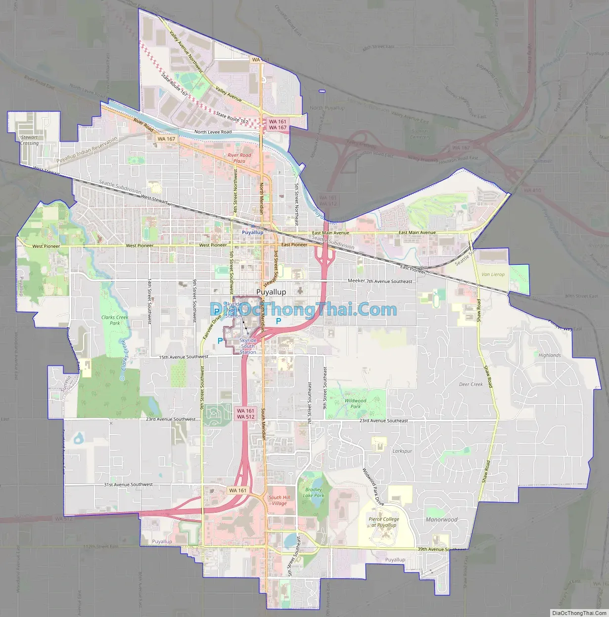
Puyallup Road Map
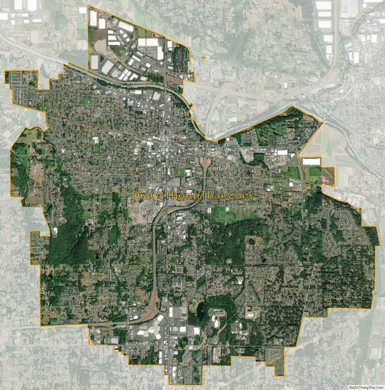
Puyallup city Satellite Map
Geography
Puyallup is approximately 10 miles (16 km) southeast of Tacoma and 35 miles (56 km) south of Seattle. It is situated along the Puyallup River, which flows from Mount Rainier to Commencement Bay in Tacoma.
According to the United States Census Bureau, the city has a total area of 14.04 square miles (36.36 km), of which 13.93 square miles (36.08 km) is land and 0.11 square miles (0.28 km) is water, mainly consisting of the Puyallup River estuary. As it is bordered largely by unincorporated Pierce County, the closest neighbors include the city of Sumner to the northeast, Fife and Edgewood to the north, Tacoma to the northwest, Summit and Midland to the west, South Hill, Graham and Frederickson to the south, McMillin and Orting to the southeast, and Alderton to the east.
Downtown and the valley neighborhoods of Puyallup would likely be damaged or destroyed in a moderate or large eruption of nearby Mount Rainier.
Climate
Puyallup experiences an oceanic climate (Köppen classification: Csb; Trewartha classification: Do). Winters are cool and wet, with high temperatures averaging in the mid to upper 40s and lows near freezing. The surrounding hills (averaging 500 feet (150 m) above sea level) often experience the extremes of winter, with more frequent lows below freezing and greater snowfall. Snowfall is rare, and often only occurs on a few days a year, sometimes as early as November, and as late as April. Spring brings less rain and milder temperatures, with highs regularly in the mid 50s (12–14 °C), to around 60 (15 °C). Spring often records the first 70 °F (21 °C) temperature. Summers are warm and dry, with highs in the 70s most days. Many days can max out in the 80s, and occasionally the 90s. Readings above 100 °F (37.7 °C) are very rare; on July 29, 2009, during a prolonged period of hot weather, Puyallup recorded a temperature of 105 °F (40.5 °C), the warmest since records have been kept. Summer thunderstorms happen occasionally, but are often isolated and rarely (if ever) severe. Storms often roll off the Cascades and into the surrounding areas; they are usually a result of warm moist air from monsoons in the southwestern United States. Summer is warmest in July and August, and occasionally September. By October and the fall season, temperatures start to drop and precipitation increases.
See also
Map of Washington State and its subdivision:- Adams
- Asotin
- Benton
- Chelan
- Clallam
- Clark
- Columbia
- Cowlitz
- Douglas
- Ferry
- Franklin
- Garfield
- Grant
- Grays Harbor
- Island
- Jefferson
- King
- Kitsap
- Kittitas
- Klickitat
- Lewis
- Lincoln
- Mason
- Okanogan
- Pacific
- Pend Oreille
- Pierce
- San Juan
- Skagit
- Skamania
- Snohomish
- Spokane
- Stevens
- Thurston
- Wahkiakum
- Walla Walla
- Whatcom
- Whitman
- Yakima
- Alabama
- Alaska
- Arizona
- Arkansas
- California
- Colorado
- Connecticut
- Delaware
- District of Columbia
- Florida
- Georgia
- Hawaii
- Idaho
- Illinois
- Indiana
- Iowa
- Kansas
- Kentucky
- Louisiana
- Maine
- Maryland
- Massachusetts
- Michigan
- Minnesota
- Mississippi
- Missouri
- Montana
- Nebraska
- Nevada
- New Hampshire
- New Jersey
- New Mexico
- New York
- North Carolina
- North Dakota
- Ohio
- Oklahoma
- Oregon
- Pennsylvania
- Rhode Island
- South Carolina
- South Dakota
- Tennessee
- Texas
- Utah
- Vermont
- Virginia
- Washington
- West Virginia
- Wisconsin
- Wyoming


