Ridgefield is a city in northern Clark County, Washington, United States. The population was 10,319 at the time of the 2020 census, up from 4,763 in 2010, making it the fastest growing city in the state of Washington.
Located within the Portland metropolitan area, Ridgefield is notable for the significant Native American history and connection to the Lewis and Clark Expedition. It is also the headquarters of the Ridgefield National Wildlife Refuge, a primary reserve for migrating waterfowl on the Pacific Flyway, and the home of the Ridgefield High School “Spudders” (reflecting the area’s potato-farming heritage).
| Name: | Ridgefield city |
|---|---|
| LSAD Code: | 25 |
| LSAD Description: | city (suffix) |
| State: | Washington |
| County: | Clark County |
| Elevation: | 112 ft (34 m) |
| Total Area: | 7.42 sq mi (19.21 km²) |
| Land Area: | 7.34 sq mi (19.02 km²) |
| Water Area: | 0.07 sq mi (0.19 km²) |
| Total Population: | 10,319 |
| Population Density: | 1,405.86/sq mi (542.53/km²) |
| ZIP code: | 98642 |
| Area code: | 360, 564 |
| FIPS code: | 5358410 |
| GNISfeature ID: | 1512604 |
| Website: | ridgefieldwa.us |
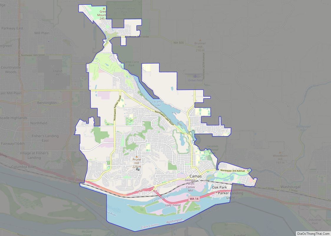
Online Interactive Map
Click on ![]() to view map in "full screen" mode.
to view map in "full screen" mode.
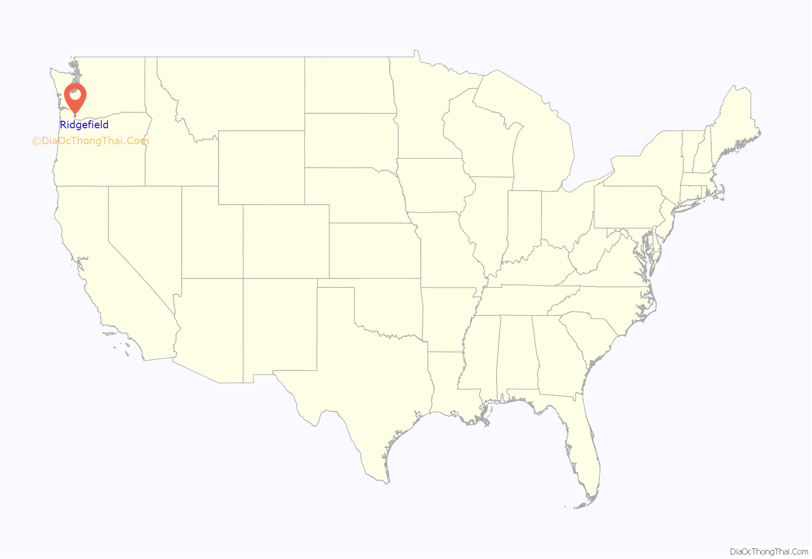
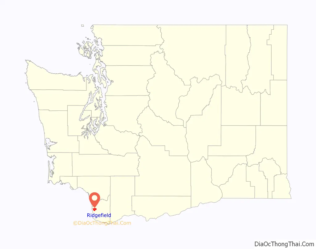
Ridgefield location map. Where is Ridgefield city?
History
The area has important ties to the Lewis and Clark Expedition of 1804–1806, being close to the Chinookan town of Cathlapotle, then a settlement of 700–800 people, with at least 14 substantial plank houses. The community’s ties to the Chinookan people was commemorated by the construction of a replica of a Cathlapotle plank house at the nearby Ridgefield National Wildlife Refuge, which was dedicated March 29, 2005.
The town was formerly known as Union Ridge, named by the many Union veterans among the first large wave of settlers after the Civil War and was renamed Ridgefield in 1890. The town’s original name is preserved in the name of Union Ridge Elementary School.
Ridgefield was an important trading center as early as the 1860s with its key location near the mouth of the Columbia River, and the city was officially incorporated on August 26, 1909. U-Haul, an American equipment rental company, had its start in Ridgefield in 1945.
Ridgefield Road Map
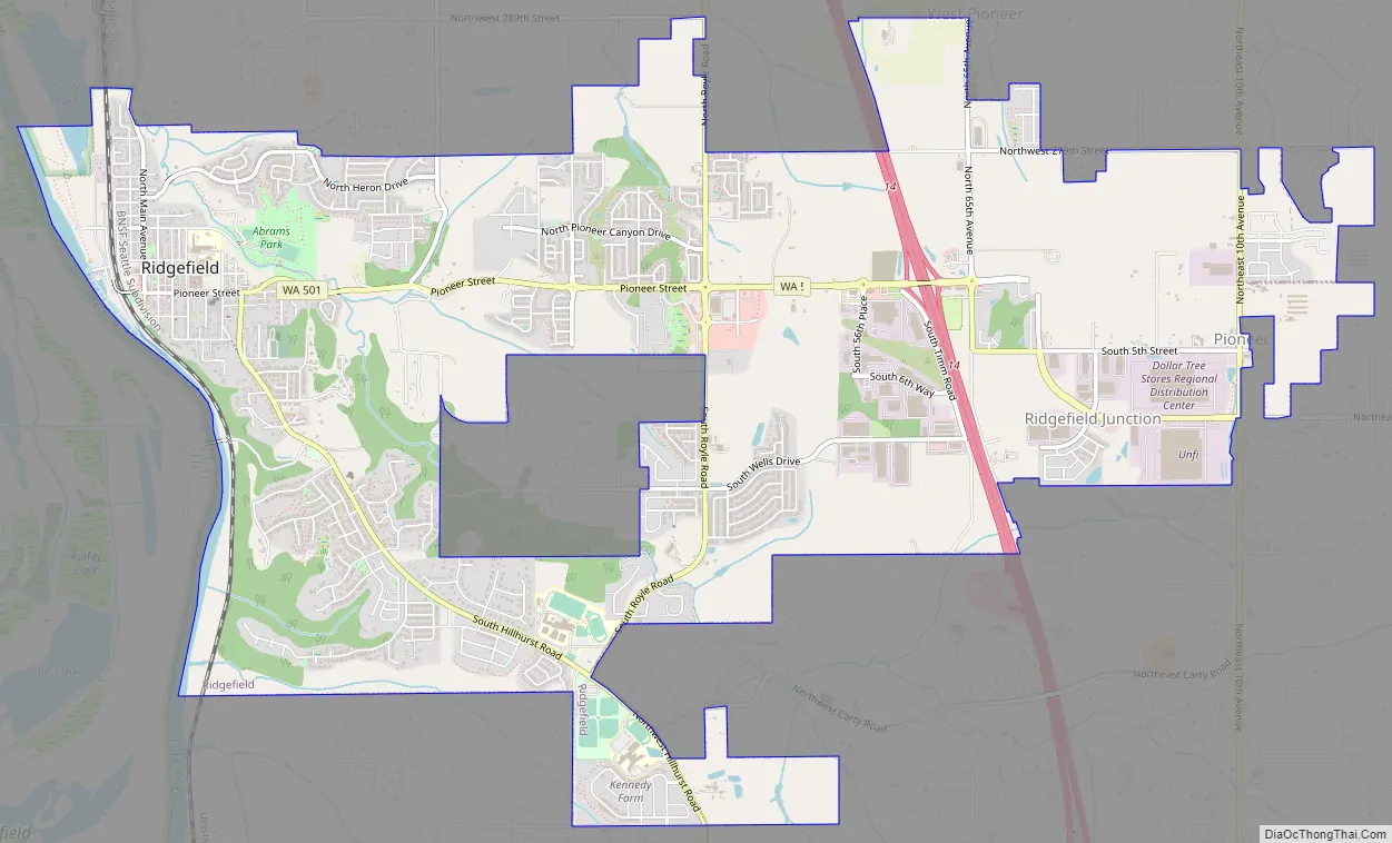
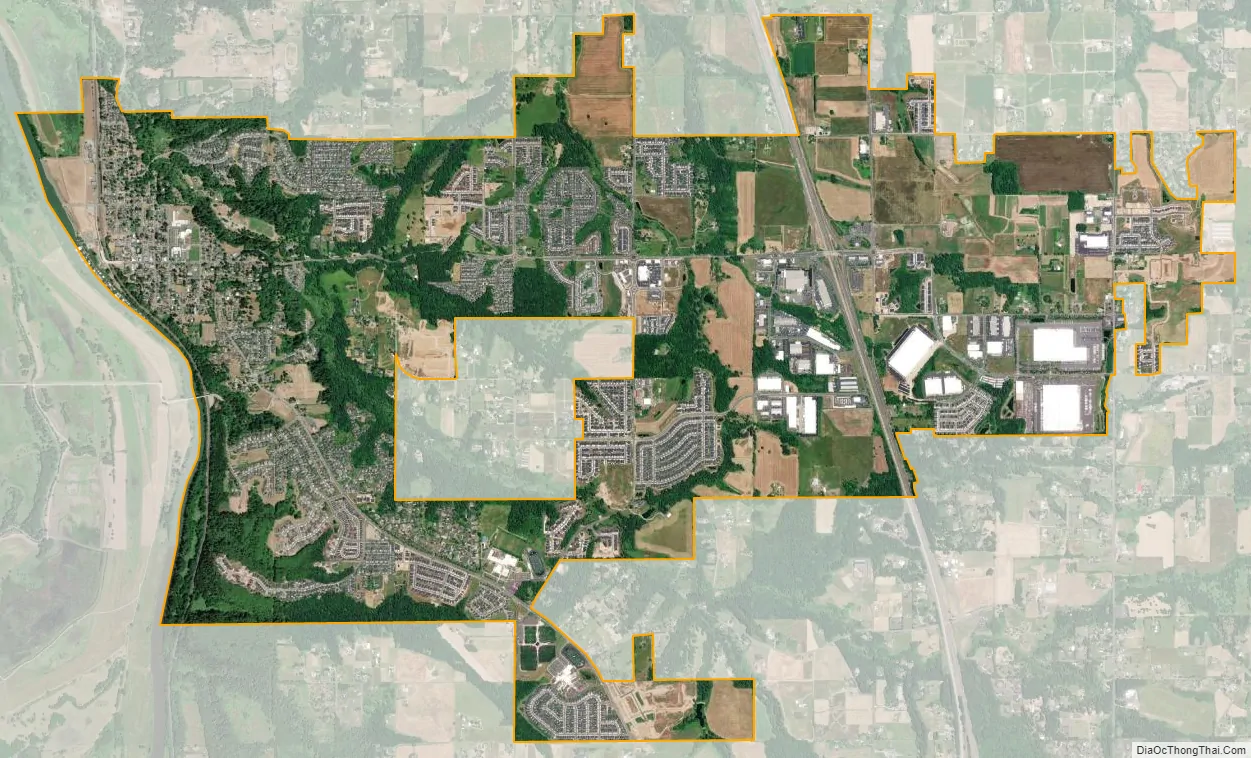
Ridgefield city Satellite Map
Geography
According to the United States Census Bureau, the city has a total area of 7.18 square miles (18.60 km), of which 7.08 square miles (18.34 km) is land and 0.10 square miles (0.26 km) is water.
Parks in Ridgefield include Abrams Park, Community Park, Davis Park, and Overlook Park. The Ridgefield Veterans Memorial is adjacent to Community Park.
See also
Map of Washington State and its subdivision:- Adams
- Asotin
- Benton
- Chelan
- Clallam
- Clark
- Columbia
- Cowlitz
- Douglas
- Ferry
- Franklin
- Garfield
- Grant
- Grays Harbor
- Island
- Jefferson
- King
- Kitsap
- Kittitas
- Klickitat
- Lewis
- Lincoln
- Mason
- Okanogan
- Pacific
- Pend Oreille
- Pierce
- San Juan
- Skagit
- Skamania
- Snohomish
- Spokane
- Stevens
- Thurston
- Wahkiakum
- Walla Walla
- Whatcom
- Whitman
- Yakima
- Alabama
- Alaska
- Arizona
- Arkansas
- California
- Colorado
- Connecticut
- Delaware
- District of Columbia
- Florida
- Georgia
- Hawaii
- Idaho
- Illinois
- Indiana
- Iowa
- Kansas
- Kentucky
- Louisiana
- Maine
- Maryland
- Massachusetts
- Michigan
- Minnesota
- Mississippi
- Missouri
- Montana
- Nebraska
- Nevada
- New Hampshire
- New Jersey
- New Mexico
- New York
- North Carolina
- North Dakota
- Ohio
- Oklahoma
- Oregon
- Pennsylvania
- Rhode Island
- South Carolina
- South Dakota
- Tennessee
- Texas
- Utah
- Vermont
- Virginia
- Washington
- West Virginia
- Wisconsin
- Wyoming