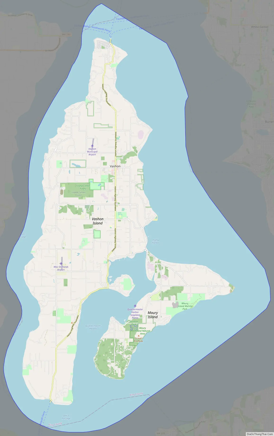
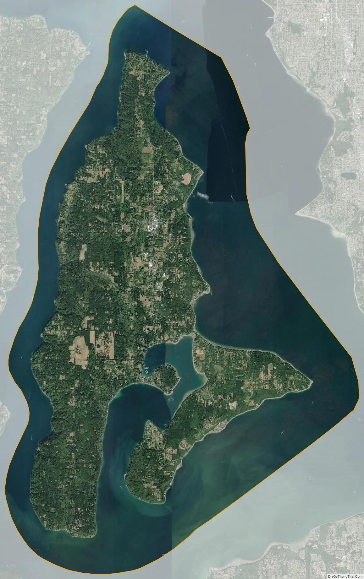
Vashon is a census-designated place (CDP) in King County, Washington, United States. It covers an island alternately called Vashon Island or Vashon–Maury Island, the largest island in Puget Sound south of Admiralty Inlet. The population was 10,624 at the 2010 census and the size is 36.9 square miles (95.6 km).
The island is connected to West Seattle and the Kitsap Peninsula to the north and Tacoma to the south via the Washington State Ferries system, as well as to Downtown Seattle via the King County Water Taxi. The island has resisted the construction of a fixed bridge to preserve its relative isolation and rural character. Vashon Island is also known for its annual strawberry festival, sheepdog trials, and agriculture.
| Name: | Vashon CDP |
|---|---|
| LSAD Code: | 57 |
| LSAD Description: | CDP (suffix) |
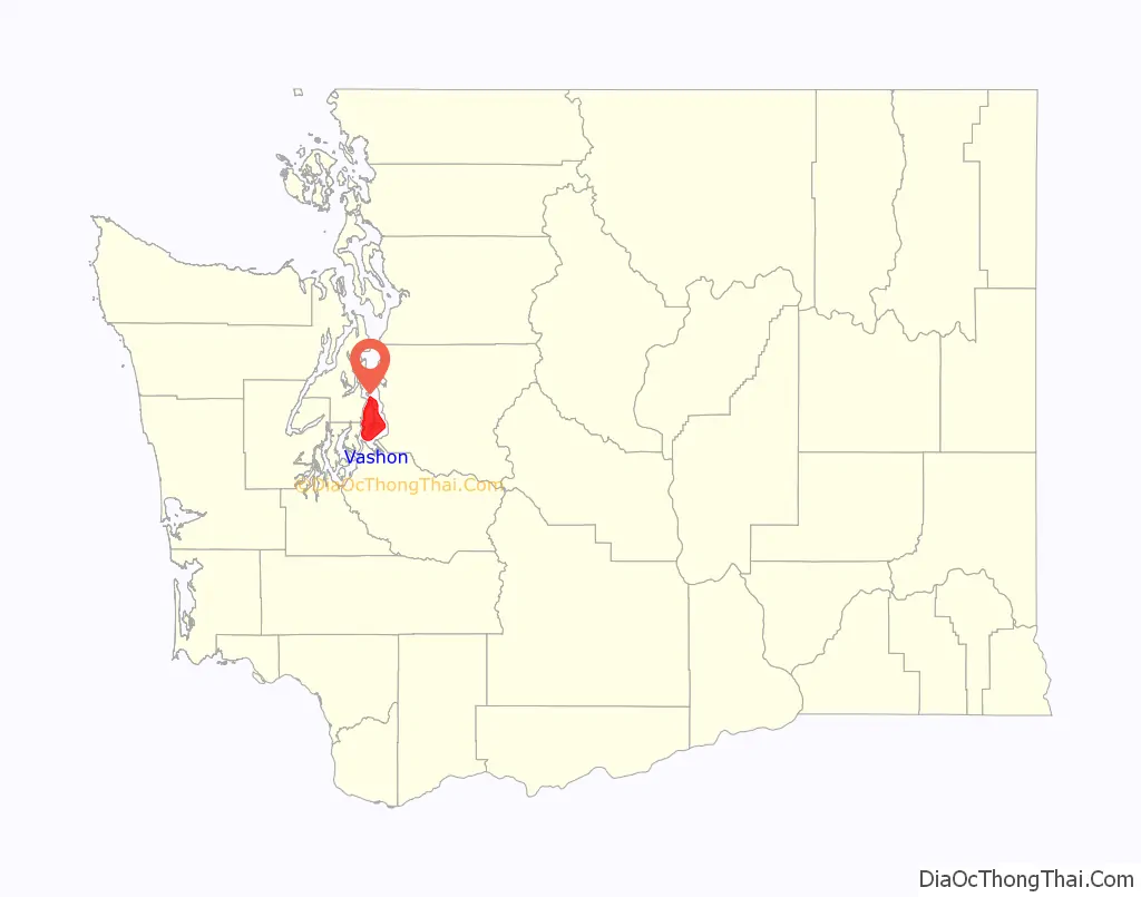
| State: | Washington |
| County: | King County |
| Elevation: | 381 ft (116 m) |
| Total Area: | 80.8 sq mi (209.3 km²) |
| Land Area: | 36.9 sq mi (95.6 km²) |
| Water Area: | 43.9 sq mi (113.6 km²) |
| Total Population: | 10,624 |
| Population Density: | 288/sq mi (111.1/km²) |
| Area code: | 206 |
| FIPS code: | 5374305 |
| GNISfeature ID: | 1512758 |
Online Interactive Map
Click on ![]() to view map in "full screen" mode.
to view map in "full screen" mode.
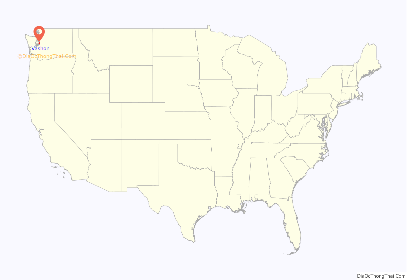
Vashon location map. Where is Vashon CDP?
History
Vashon Island sits in the midpoint of southern Puget Sound, between Seattle and Tacoma, Washington. In the nearby Pacific Ocean, roughly 170 miles (270 km) west of Vashon Island, lies the 700-mile (1,130 km) tectonic boundary known as the Cascadia Subduction Zone, and as such, Vashon Island is one of many areas at risk for earthquakes or related natural disasters. The Cascadia Subduction Zone last saw a major rupture in 1700, but the potential of the zone could cause one of the worst natural disasters in the history of North America.
Native American inhabitants
Up until the late 1700s, Vashon and Maury Islands were inhabited solely by American Indians, and there is evidence of human activity on Vashon Island dating back 10,000 to 12,000 years. Historical data from the era when the first Native Americans settled Vashon–Maury Island is limited. Some of the Native peoples known to have lived on Vashon Island were the Marpole culture from about 7,000 years ago, the Salish about 1,000 years ago, and the Sqababsh (known in Chinook Wawa as the S’Homamish) starting about 500 years ago, the latter of which established 5 known major village sites. The Tulalip Indians is another tribe that populated the villages along the shores of both islands. Fishing was abundant in the cold saltwater of the central Puget Sound basin, helping Native American tribes to thrive. Moreover, the many waterways and inlets provided easy travel by way of canoe.
Euramerican settlement
The first non–Native American to explore and the first to chart this island was Captain George Vancouver, during his surveys of the Puget Sound area with the British Royal Navy. The island was named on May 28, 1792, by Vancouver after his friend James Vashon of the Royal Navy. Starting in 1824, different explorer and settler groups stayed on Vashon Island.
Maury Island, immediately to the southeast of Vashon, was named in 1841 by then Lt. Charles Wilkes in honor of William Lewis Maury, an officer in the United States Exploring Expedition. Maury was naturally separated from Vashon by a narrow passage, until local landowners decided to build an earth bridge, or isthmus, linking them together in 1916, thus creating the hamlet of Portage. Therefore, the two-piece isle was renamed Vashon-Maury Island. Between the two sections, it covers nearly 37 square miles (96 km).
The first logging on the island began in 1852. By 1855–1856, the S’Homamish people were interned at Fox Island. European-Americans settled Vashon Island between 1865 and 1890. During that time the main economies on the island were fishing and logging.
In 1890, Japanese Americans started growing strawberries for sale. Denichiro Mukai came to the island in 1910 and became renowned for barreling fresh strawberries using a special method that concentrated flavor and moisture in the fruit and permitted long-distance shipping. In time, Mukai designed and built his own home and elaborate garden and then constructed a sturdy timber framed barreling plant. During the peak years, ice cream, jam and preserve makers across the West were customers of Mukai, relishing the oak barrels for their lingering flavor and mythologizing about the island of strawberry fields. This became an important part of the island economy during the next 50 years, until the Japanese American population was forcibly relocated into internment camps as a response to Japanese/American tension caused by WWII.
In 1892, Vashon College opened in the Burton section of Vashon. During its operation, it was one of the leading colleges in the area. It burned down in 1910.
Vashon Road Map
Vashon city Satellite Map
Geography
According to the United States Census Bureau, the Vashon CDP has a total area of 80.8 square miles (209.3 km), of which 36.9 square miles (95.6 km) comprise the island and 43.9 square miles (113.6 km) are the waters of Puget Sound surrounding the island.
To the west Vashon Island is separated from the Kitsap Peninsula by the Colvos Passage. The Dalco Passage separates Vashon Island from Tacoma to the south. Neighborhoods of Vashon Island include Magnolia Beach, which had a post office from 1908 to 1953, and Raeco, with a post office from 1907 to 1911.
Climate
This region experiences warm (but not hot) and dry summers, with no average monthly temperatures above 71.6 °F (22.0 °C). According to the Köppen Climate Classification system, Vashon has a warm-summer Mediterranean climate, abbreviated “Csb” on climate maps.
See also
Map of Washington State and its subdivision:- Adams
- Asotin
- Benton
- Chelan
- Clallam
- Clark
- Columbia
- Cowlitz
- Douglas
- Ferry
- Franklin
- Garfield
- Grant
- Grays Harbor
- Island
- Jefferson
- King
- Kitsap
- Kittitas
- Klickitat
- Lewis
- Lincoln
- Mason
- Okanogan
- Pacific
- Pend Oreille
- Pierce
- San Juan
- Skagit
- Skamania
- Snohomish
- Spokane
- Stevens
- Thurston
- Wahkiakum
- Walla Walla
- Whatcom
- Whitman
- Yakima
- Alabama
- Alaska
- Arizona
- Arkansas
- California
- Colorado
- Connecticut
- Delaware
- District of Columbia
- Florida
- Georgia
- Hawaii
- Idaho
- Illinois
- Indiana
- Iowa
- Kansas
- Kentucky
- Louisiana
- Maine
- Maryland
- Massachusetts
- Michigan
- Minnesota
- Mississippi
- Missouri
- Montana
- Nebraska
- Nevada
- New Hampshire
- New Jersey
- New Mexico
- New York
- North Carolina
- North Dakota
- Ohio
- Oklahoma
- Oregon
- Pennsylvania
- Rhode Island
- South Carolina
- South Dakota
- Tennessee
- Texas
- Utah
- Vermont
- Virginia
- Washington
- West Virginia
- Wisconsin
- Wyoming


