The city of Hood River is the seat of Hood River County, Oregon, United States. It is a port on the Columbia River, and is named for the nearby Hood River. As of the 2020 census, the city population was 8,313. It is the only city in Oregon where public consumption of alcohol on sidewalks or parks is totally unrestricted.
| Name: | Hood River city |
|---|---|
| LSAD Code: | 25 |
| LSAD Description: | city (suffix) |
| State: | Oregon |
| County: | Hood River County |
| Incorporated: | 1895 |
| Elevation: | 160 ft (50 m) |
| Total Area: | 3.40 sq mi (8.80 km²) |
| Land Area: | 2.60 sq mi (6.72 km²) |
| Water Area: | 0.80 sq mi (2.07 km²) |
| Total Population: | 8,313 |
| Population Density: | 3,202.23/sq mi (1,236.16/km²) |
| ZIP code: | 97031 |
| Area code: | 458 and 541 |
| FIPS code: | 4134900 |
| GNISfeature ID: | 1136388 |
| Website: | www.cityofhoodriver.gov/ |
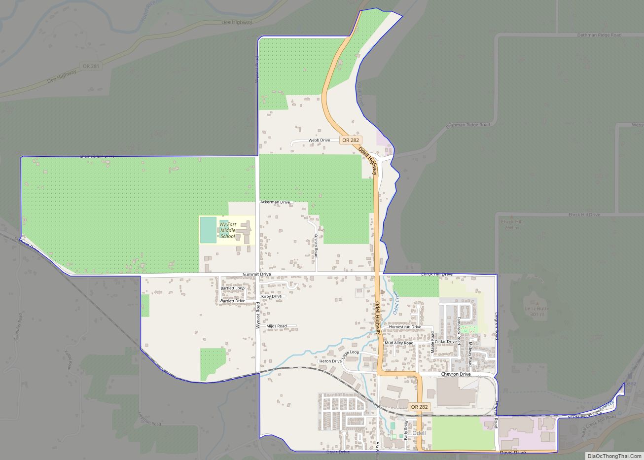
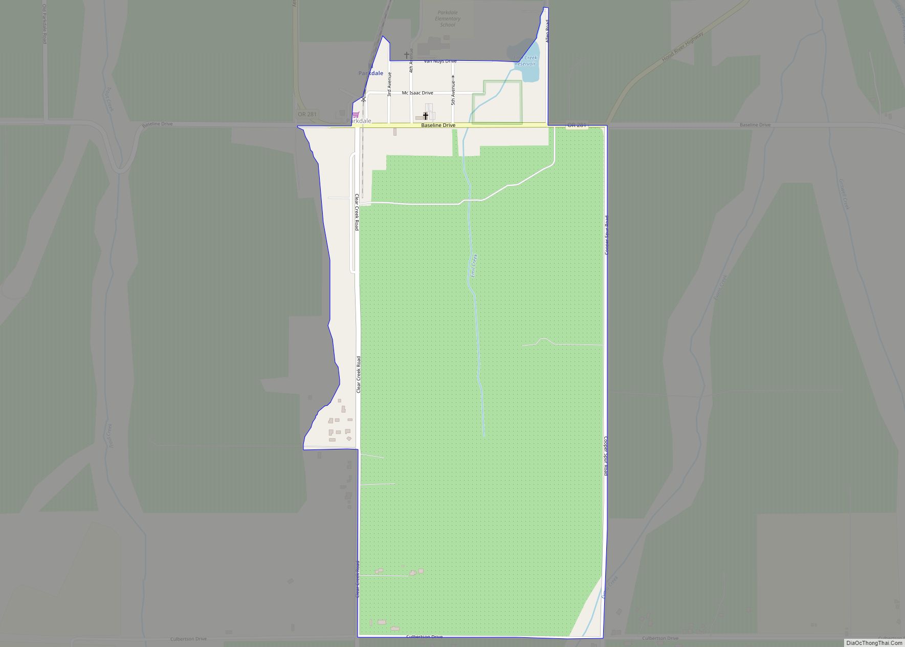
Online Interactive Map
Click on ![]() to view map in "full screen" mode.
to view map in "full screen" mode.
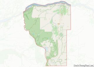
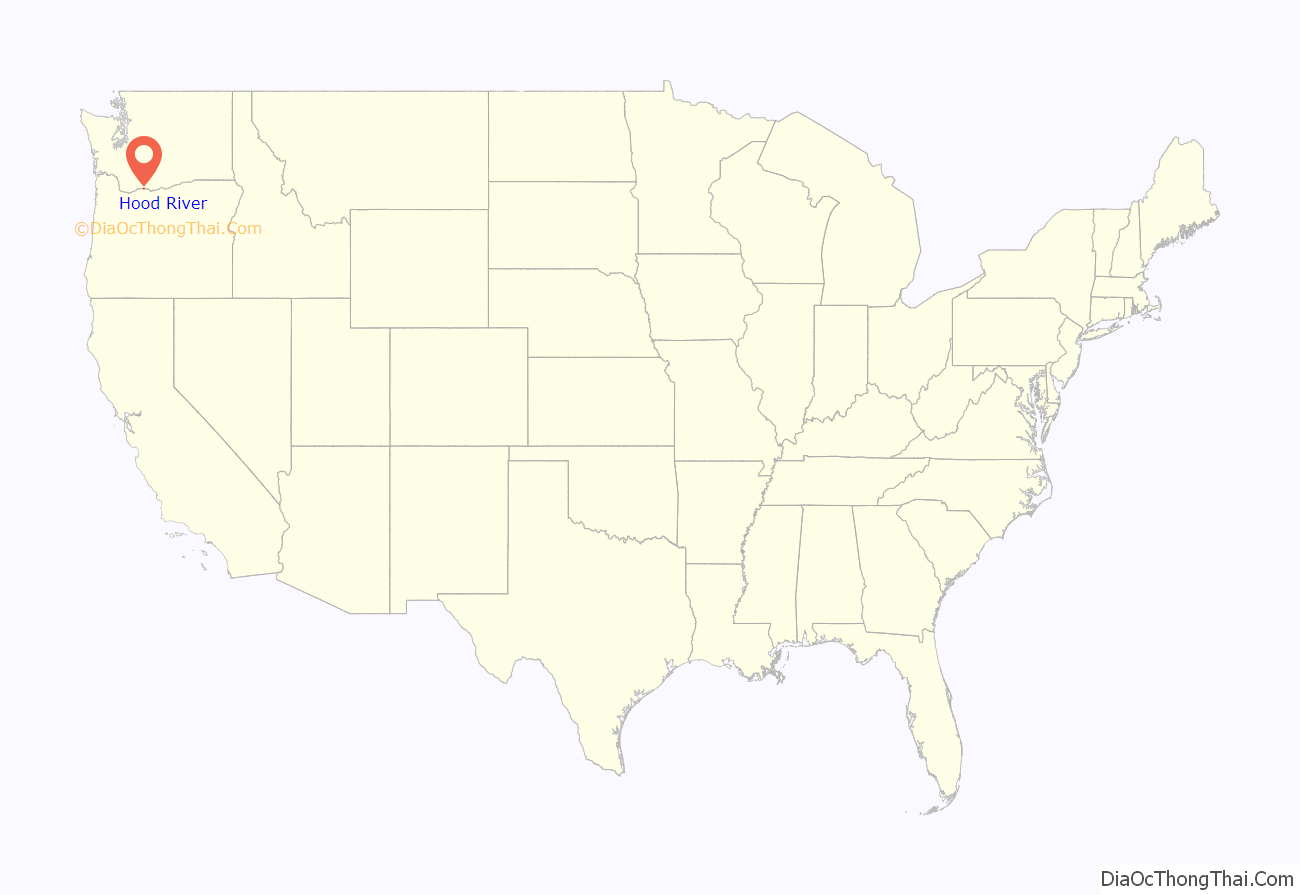
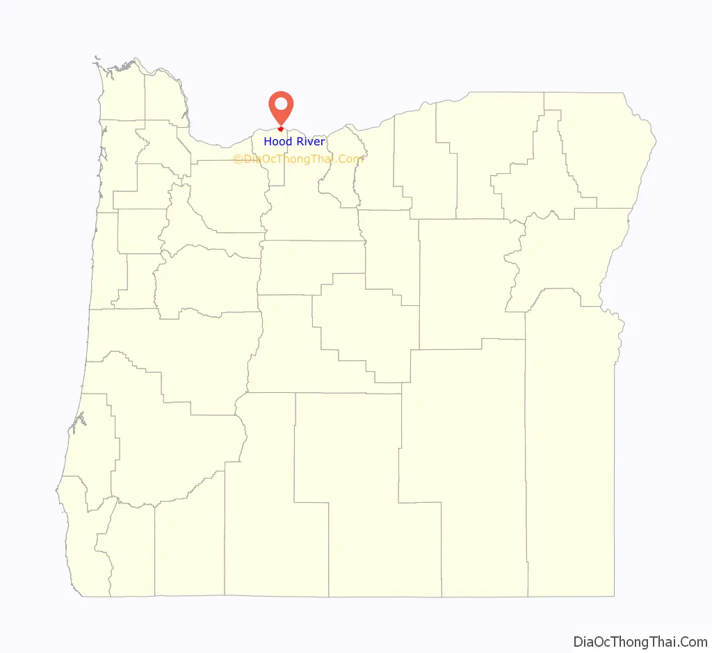
Hood River location map. Where is Hood River city?
History
Hood River (originally called Dog River) post office was established (named by Mary Coe) at the site of the present city on September 30, 1868, and the city itself was incorporated in 1895. Originally, the city was part of Wasco County, but it became the seat of Hood River County when the county was first established in 1908.
The Hood River Incident
The Hood River incident involved the removal of sixteen Nisei servicemen’s names from the county “roll of honor” in Hood River, Oregon, by the local American Legion Post 22. The incident, on November 29, 1944, was part of a string of anti-Japanese actions taken in an attempt to prevent removed Japanese Americans from returning to the area after their release from internment by the United States federal government. National outrage against the community heightened five weeks later when a local Japanese American serviceman died after completing a heroic mission in the Philippines. Under great pressure, the local American Legion post restored Nisei names to the wall of the county courthouse on April 29, 1945.
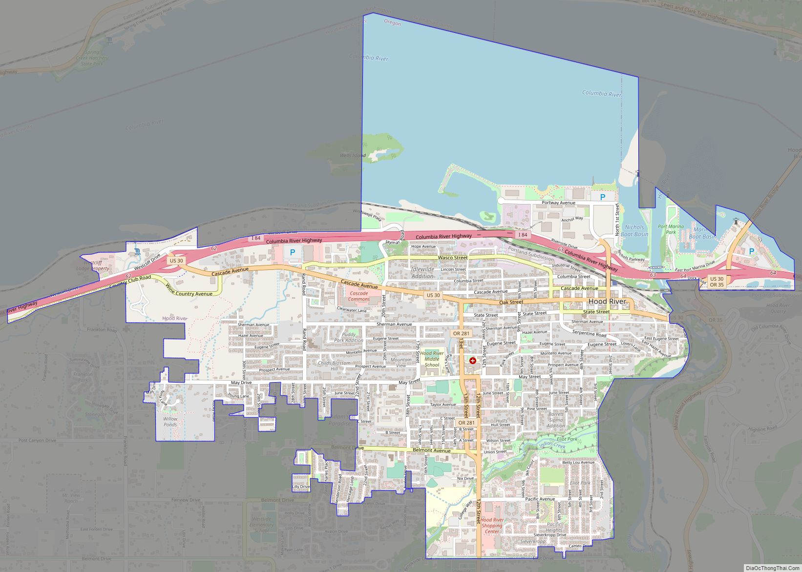
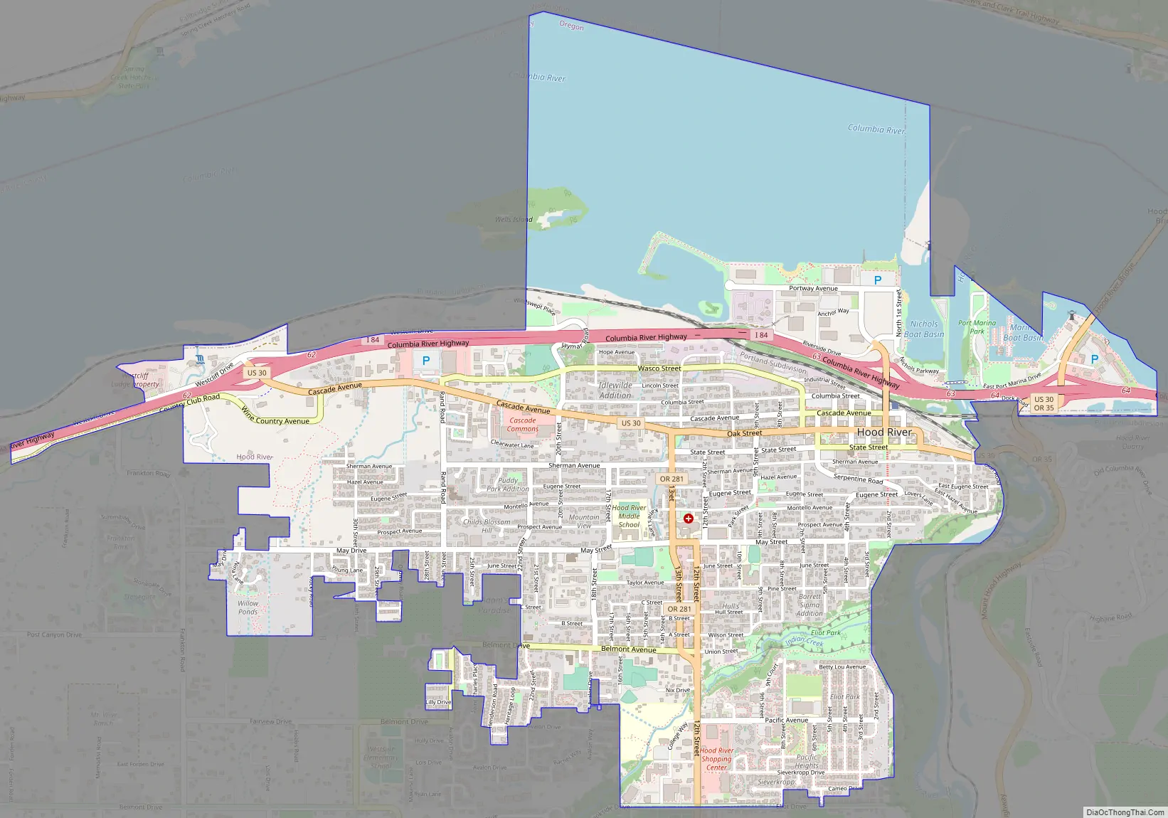
Hood River Road Map
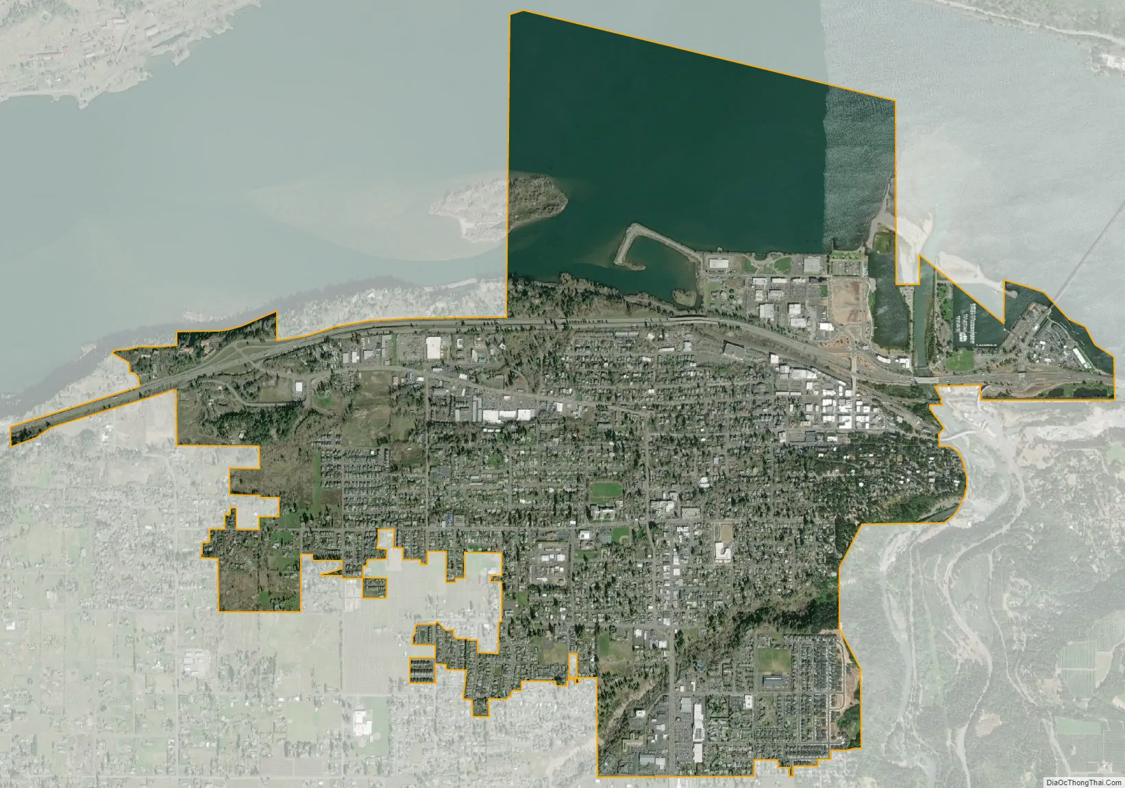
Hood River city Satellite Map
Geography
Hood River is at the confluence of the Hood River and the Columbia River in the heart of the Columbia River Gorge. The city is about 30 miles (48 km) north of Mount Hood, the tallest peak in the state. It is across the Columbia River from White Salmon, Washington. South of the city is the Hood River Valley, known for its production of apples, pears, and cherries.
According to the United States Census Bureau, the city has a total area of 3.35 square miles (8.68 km), of which 2.55 square miles (6.60 km) is land and 0.80 square miles (2.07 km) is water.
Climate
Located at the transition zone between wet temperate rainforest to the west, and dry shrub-steppe desert to the east, Hood River has a moderate climate with rainy winters and warm summers (Köppen: Csb), although rainfall there is somewhat less than Portland and other nearby areas in the Willamette Valley. Hood River averages around 30 inches (760 mm) of precipitation a year, while Cascade Locks, 20 miles (32 km) west, receives over 75 inches (1,900 mm), and The Dalles, 20 miles (32 km) east, less than 15 inches (380 mm). The area is known for its consistently high winds channeling down the Columbia River Gorge.
Temperatures for the year as a whole are slightly cooler than in most other low-elevation towns in the region, especially at night because of air drainage off the surrounding mountains.
See also
Map of Oregon State and its subdivision: Map of other states:- Alabama
- Alaska
- Arizona
- Arkansas
- California
- Colorado
- Connecticut
- Delaware
- District of Columbia
- Florida
- Georgia
- Hawaii
- Idaho
- Illinois
- Indiana
- Iowa
- Kansas
- Kentucky
- Louisiana
- Maine
- Maryland
- Massachusetts
- Michigan
- Minnesota
- Mississippi
- Missouri
- Montana
- Nebraska
- Nevada
- New Hampshire
- New Jersey
- New Mexico
- New York
- North Carolina
- North Dakota
- Ohio
- Oklahoma
- Oregon
- Pennsylvania
- Rhode Island
- South Carolina
- South Dakota
- Tennessee
- Texas
- Utah
- Vermont
- Virginia
- Washington
- West Virginia
- Wisconsin
- Wyoming