Yelm (/jɛlm/) is a city in Thurston County, Washington, United States. Its population was 10,617 at the 2020 census. At the beginning of the 21st century, Yelm was the 10th fastest growing city in the state in regard to population.
| Name: | Yelm city |
|---|---|
| LSAD Code: | 25 |
| LSAD Description: | city (suffix) |
| State: | Washington |
| County: | Thurston County |
| Elevation: | 354 ft (108 m) |
| Total Area: | 5.72 sq mi (14.81 km²) |
| Land Area: | 5.71 sq mi (14.79 km²) |
| Water Area: | 0.01 sq mi (0.02 km²) |
| Total Population: | 10,617 |
| Population Density: | 1,655.75/sq mi (639.23/km²) |
| ZIP code: | 98597 |
| Area code: | 360 |
| FIPS code: | 5380220 |
| GNISfeature ID: | 1512817 |
| Website: | ci.yelm.wa.us |
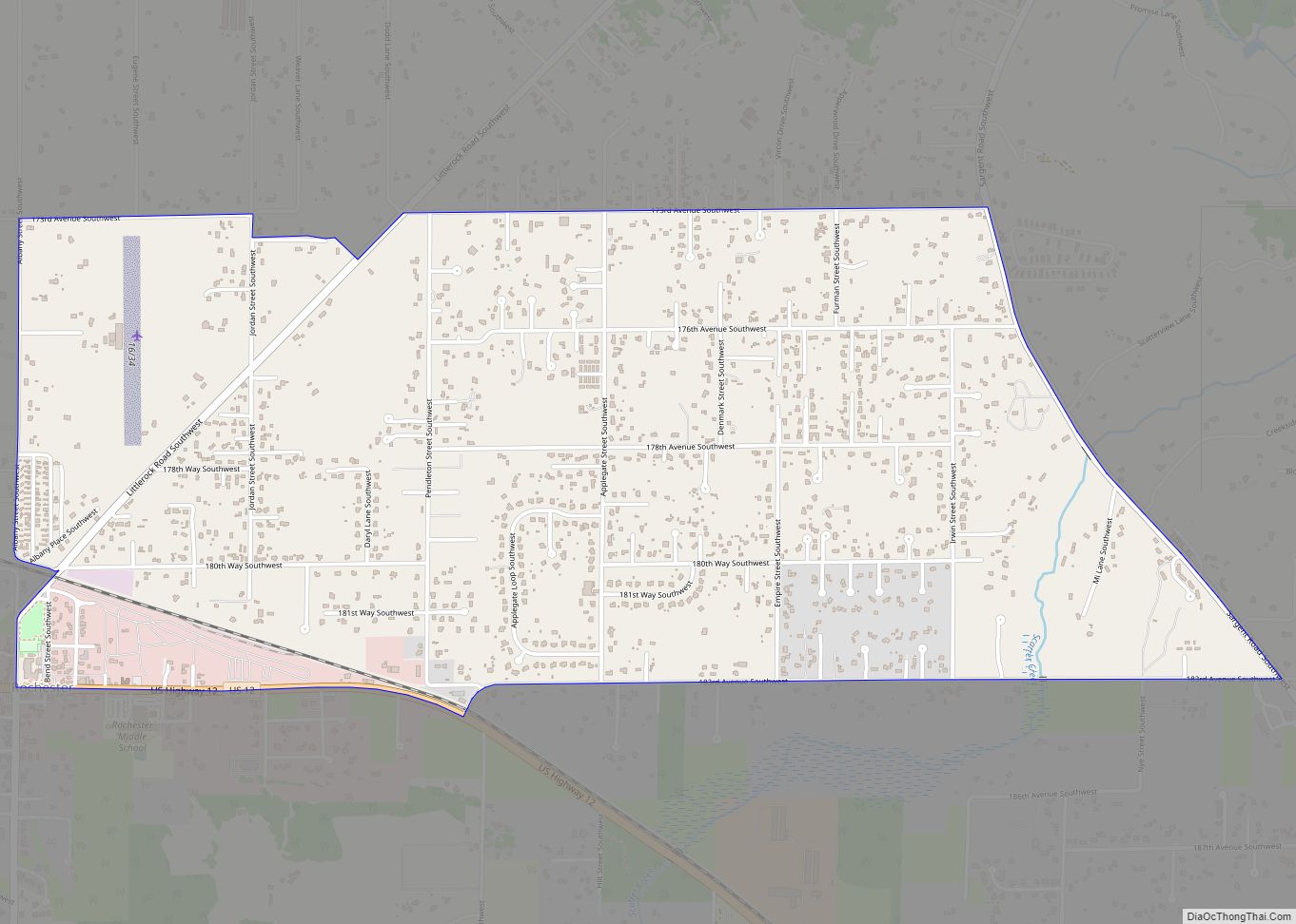
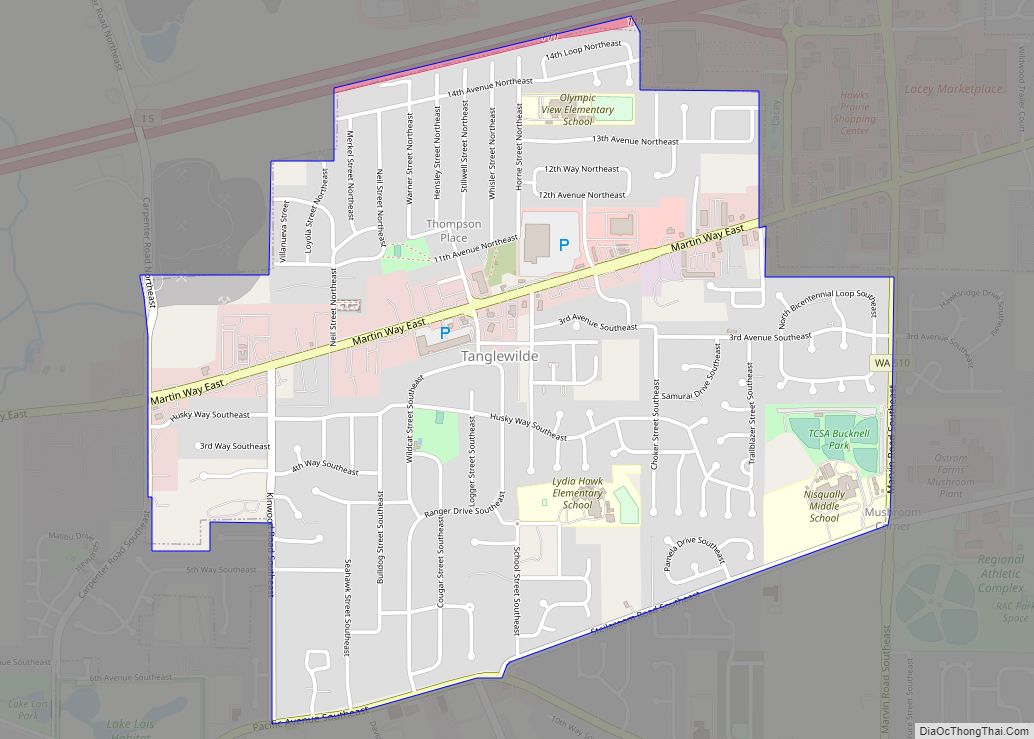
Online Interactive Map
Click on ![]() to view map in "full screen" mode.
to view map in "full screen" mode.
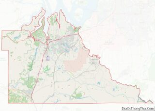
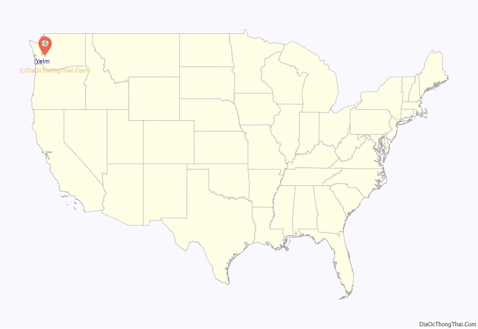
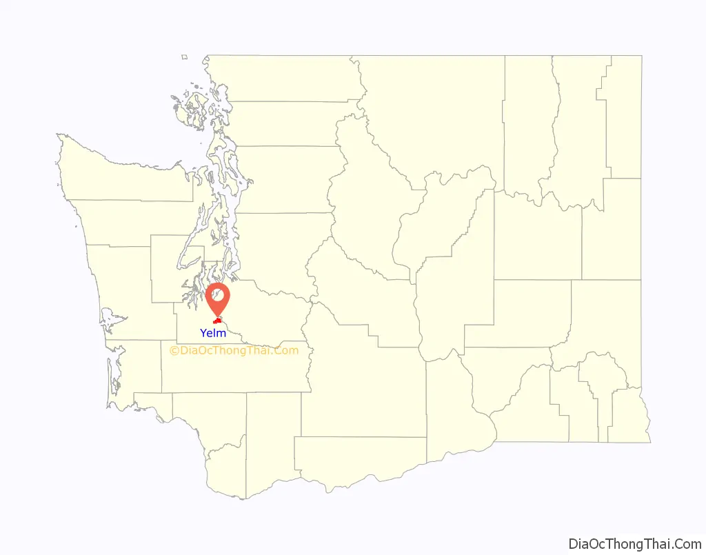
Yelm location map. Where is Yelm city?
History
The word “Yelm” is said to come from the Coast Salish word shelm or chelm, meaning “heat waves from the sun”, referring to heat mirages.
The Yelm Prairie was originally inhabited by the Nisqually and provided good pasture for their horses. The first permanent non-indigenous settlers came in 1853 to join the Hudson’s Bay Company sheep farmers who already conducted business in the area.
James Longmire, one of the first American settlers, said upon arriving in Yelm:
With the coming of the Northern Pacific Railway in 1873, Yelm began to prosper, having found an outlet for its agricultural and forestry products. Its economic base was further enhanced when an irrigation company was formed in 1916, making Yelm a center for commercial production of beans, cucumbers and berries.
Yelm was officially incorporated on December 8, 1924.
During the Great Depression, high maintenance costs and an unstructured water distribution plan bankrupted the Yelm Irrigation Company.
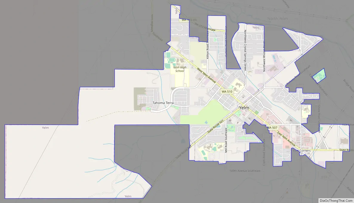
Yelm Road Map
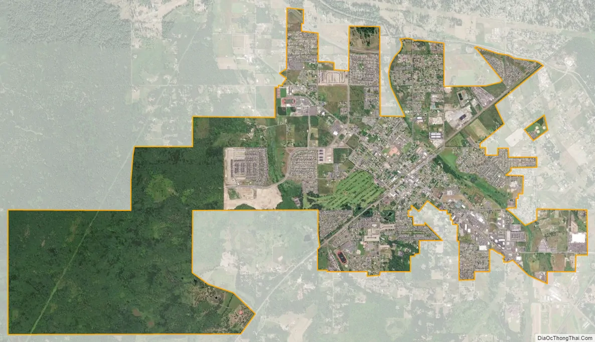
Yelm city Satellite Map
Geography
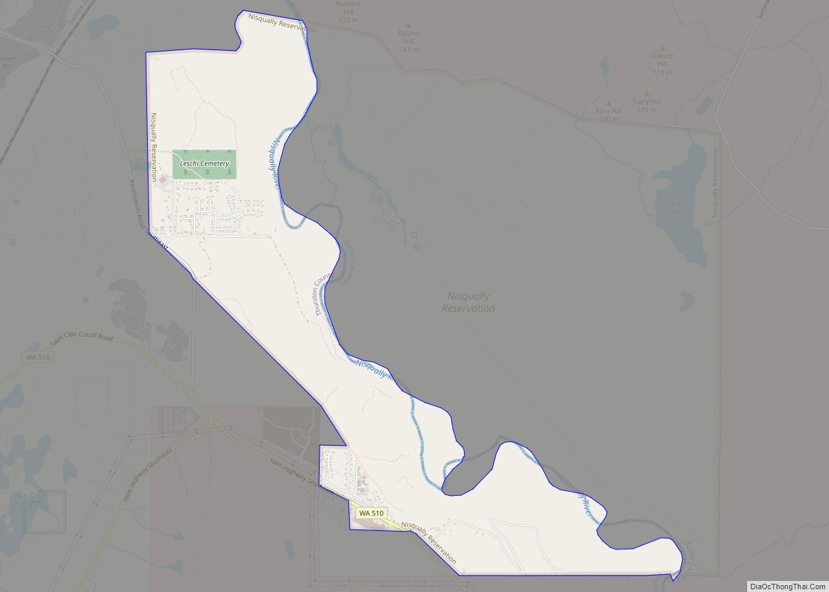
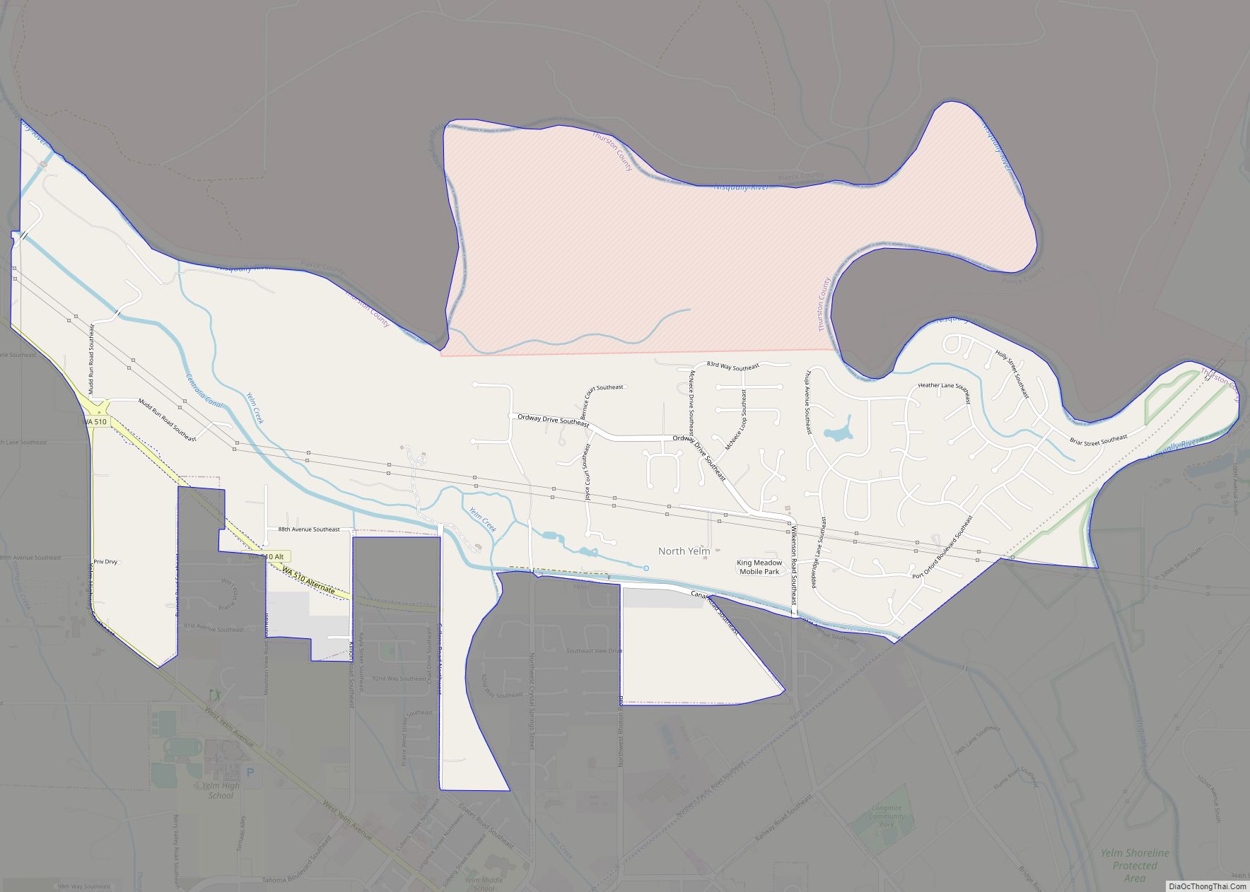
Yelm is located in southeastern Thurston County, adjacent to its border with Pierce County, along the Nisqually River. The city is near the Nisqually Indian Reservation (located to the northwest on State Route 510), and Joint Base Lewis–McChord on the northeast side of the river. Another major highway, State Route 507, connects Yelm to Centralia and Spanaway near Tacoma.
According to the United States Census Bureau, the city has a total area of 5.69 square miles (14.74 km), of which, 5.68 square miles (14.71 km) is land and 0.01 square miles (0.03 km) is water.
See also
Map of Washington State and its subdivision:- Adams
- Asotin
- Benton
- Chelan
- Clallam
- Clark
- Columbia
- Cowlitz
- Douglas
- Ferry
- Franklin
- Garfield
- Grant
- Grays Harbor
- Island
- Jefferson
- King
- Kitsap
- Kittitas
- Klickitat
- Lewis
- Lincoln
- Mason
- Okanogan
- Pacific
- Pend Oreille
- Pierce
- San Juan
- Skagit
- Skamania
- Snohomish
- Spokane
- Stevens
- Thurston
- Wahkiakum
- Walla Walla
- Whatcom
- Whitman
- Yakima
- Alabama
- Alaska
- Arizona
- Arkansas
- California
- Colorado
- Connecticut
- Delaware
- District of Columbia
- Florida
- Georgia
- Hawaii
- Idaho
- Illinois
- Indiana
- Iowa
- Kansas
- Kentucky
- Louisiana
- Maine
- Maryland
- Massachusetts
- Michigan
- Minnesota
- Mississippi
- Missouri
- Montana
- Nebraska
- Nevada
- New Hampshire
- New Jersey
- New Mexico
- New York
- North Carolina
- North Dakota
- Ohio
- Oklahoma
- Oregon
- Pennsylvania
- Rhode Island
- South Carolina
- South Dakota
- Tennessee
- Texas
- Utah
- Vermont
- Virginia
- Washington
- West Virginia
- Wisconsin
- Wyoming