Youngtown is a town in Maricopa County, Arizona, United States. As of the 2020 census, the population of the town was 7,056, up from 6,156 in 2010. It is part of the Phoenix metropolitan area.
| Name: | Youngtown town |
|---|---|
| LSAD Code: | 43 |
| LSAD Description: | town (suffix) |
| State: | Arizona |
| County: | Maricopa County |
| Elevation: | 1,132 ft (345 m) |
| Total Area: | 1.49 sq mi (3.87 km²) |
| Land Area: | 1.49 sq mi (3.85 km²) |
| Water Area: | 0.01 sq mi (0.02 km²) |
| Total Population: | 7,056 |
| Population Density: | 4,745.12/sq mi (1,832.12/km²) |
| ZIP code: | 85363 |
| Area code: | 623 |
| FIPS code: | 0485400 |
| GNISfeature ID: | 2413523 |
| Website: | www.youngtownaz.org |
Online Interactive Map
Click on ![]() to view map in "full screen" mode.
to view map in "full screen" mode.
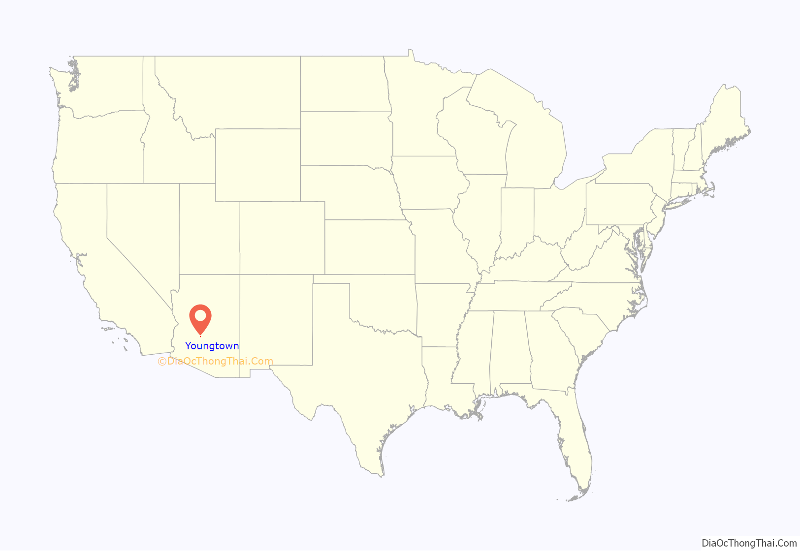
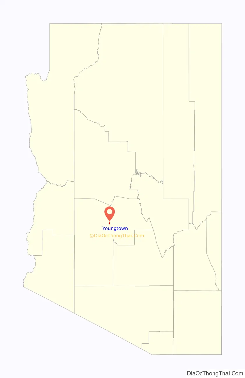
Youngtown location map. Where is Youngtown town?
History
In 1954, two developers bought 320 acres (1.3 km) of farmland and built the United States’ first planned community dedicated exclusively to retirees. Designed by Ben Schleifer, the community was ironically named Youngtown. In 1996, the town, citing its age restrictions, denied extending the stay of a 16-year-old child to live in the community. In response, Arizona Attorney General Grant Woods investigated and determined that the age ordinance was unenforceable. In response, Youngtown repealed the age restrictions in 1999.
Youngtown Road Map
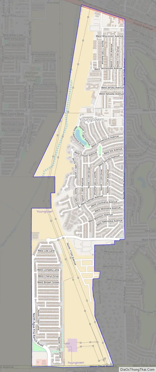
Youngtown city Satellite Map

Geography
Youngtown is located on the east bank of the Agua Fria River, just south of US 60. It is bordered on the west by El Mirage, on the south by Glendale, and on the east by the much larger retirement community of Sun City. Youngtown is 18 miles (29 km) northwest of downtown Phoenix.
According to the United States Census Bureau, the town has a total area of 1.5 square miles (3.9 km), of which 0.006 square miles (0.016 km), or 0.40%, are water.
Climate
See also
Map of Arizona State and its subdivision: Map of other states:- Alabama
- Alaska
- Arizona
- Arkansas
- California
- Colorado
- Connecticut
- Delaware
- District of Columbia
- Florida
- Georgia
- Hawaii
- Idaho
- Illinois
- Indiana
- Iowa
- Kansas
- Kentucky
- Louisiana
- Maine
- Maryland
- Massachusetts
- Michigan
- Minnesota
- Mississippi
- Missouri
- Montana
- Nebraska
- Nevada
- New Hampshire
- New Jersey
- New Mexico
- New York
- North Carolina
- North Dakota
- Ohio
- Oklahoma
- Oregon
- Pennsylvania
- Rhode Island
- South Carolina
- South Dakota
- Tennessee
- Texas
- Utah
- Vermont
- Virginia
- Washington
- West Virginia
- Wisconsin
- Wyoming


