American Falls is a city in and the county seat of Power County, Idaho. The population was 4,457 at the time of the 2010 census.
| Name: | American Falls city |
|---|---|
| LSAD Code: | 25 |
| LSAD Description: | city (suffix) |
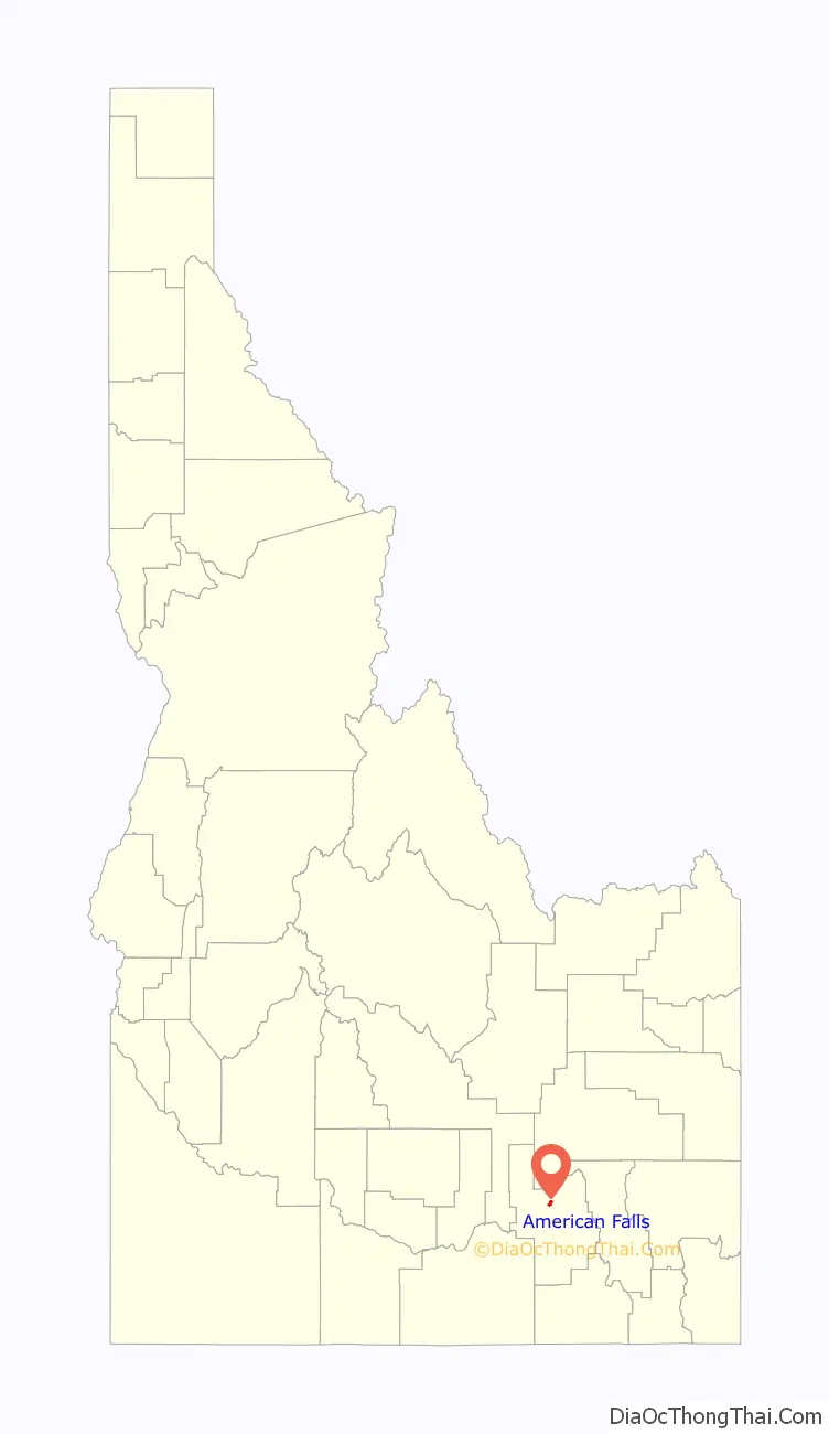
| State: | Idaho |
| County: | Power County |
| Elevation: | 4,406 ft (1,343 m) |
| Total Area: | 1.61 sq mi (4.18 km²) |
| Land Area: | 1.61 sq mi (4.18 km²) |
| Water Area: | 0.00 sq mi (0.00 km²) |
| Total Population: | 4,457 |
| Population Density: | 2,673.48/sq mi (1,032.46/km²) |
| ZIP code: | 83211 |
| FIPS code: | 1601900 |
| GNISfeature ID: | 0396035 |
| Website: | www.cityofamericanfalls.com |
Online Interactive Map
Click on ![]() to view map in "full screen" mode.
to view map in "full screen" mode.
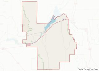
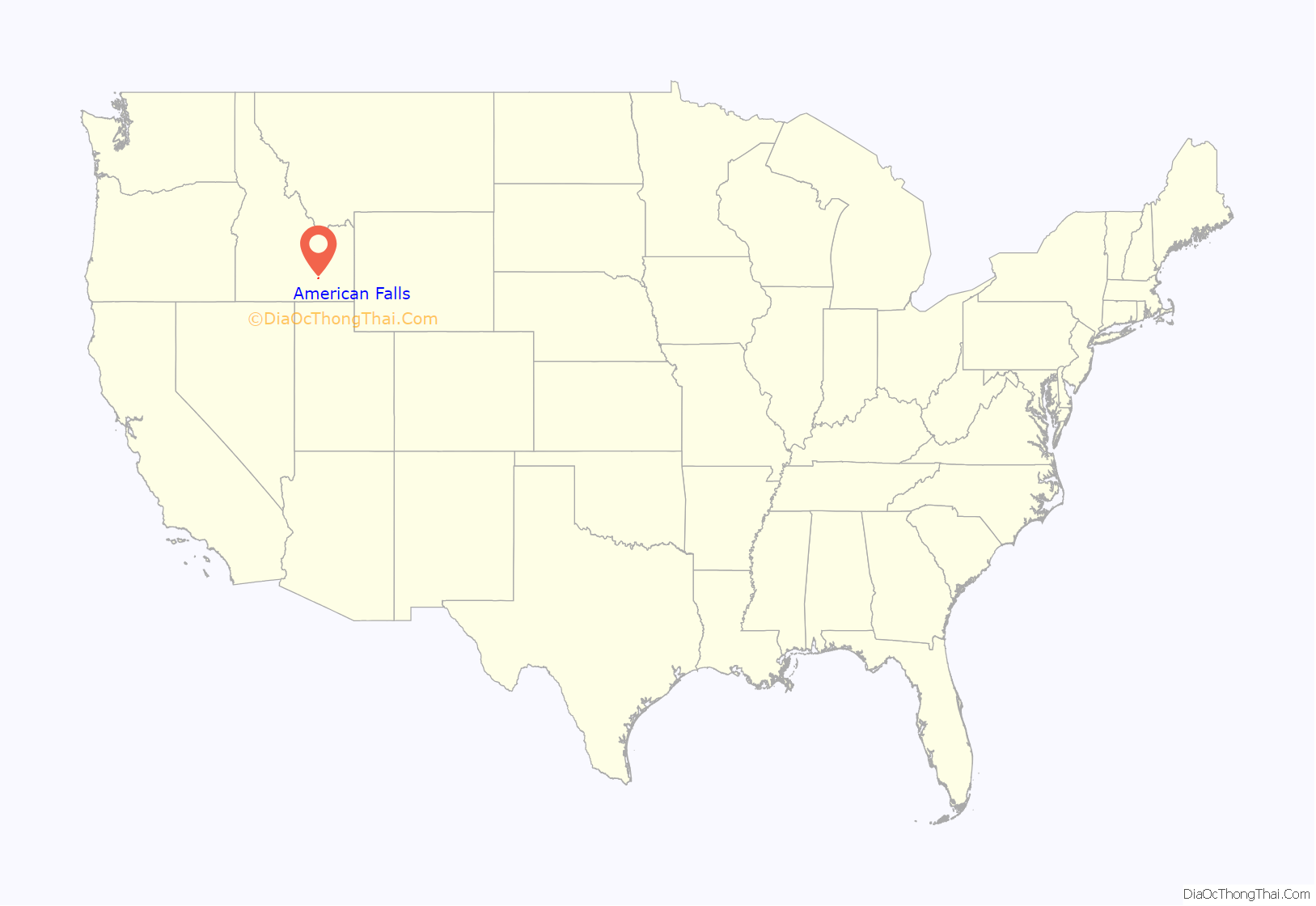
American Falls location map. Where is American Falls city?
History
American Falls was a landmark waterfall on the Snake River, named after a party of American trappers whose boat went over the falls. The Wilson Price Hunt expedition in 1811 camped at the falls one night and the expedition of John C. Frémont was here in 1843. The Oregon Trail passed north of town, through the present-day reservoir. Power plants first sprang up at the falls in 1901. American Falls was the first town in the U.S. to be entirely relocated. It was moved in 1925 to facilitate construction of the nearby American Falls Dam. The old townsite sits at the bottom of the reservoir, northwest of the present city. A larger dam was completed in 1978, downstream from the deteriorating 1927 structure, which was later demolished.
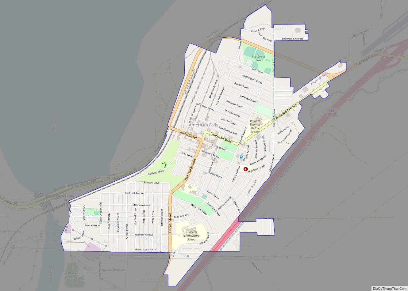
American Falls Road Map
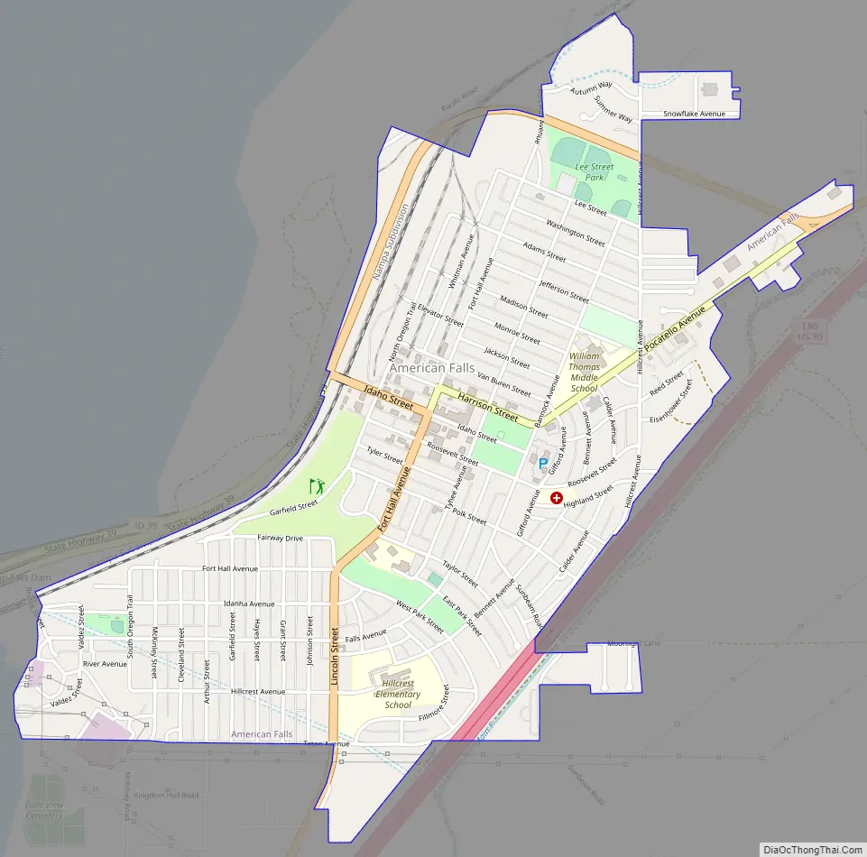
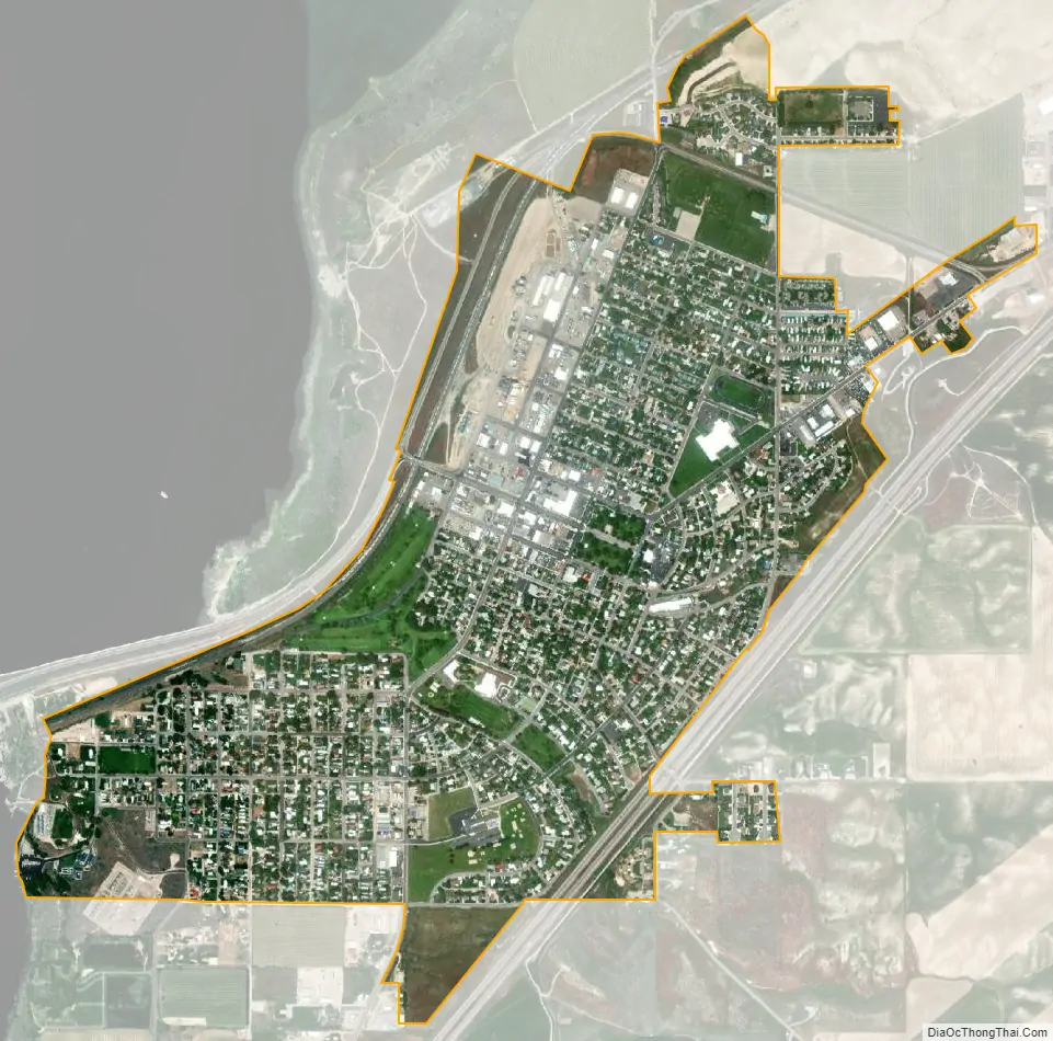
American Falls city Satellite Map
Geography
American Falls is located at 42°46′52″N 112°51′20″W / 42.78111°N 112.85556°W / 42.78111; -112.85556 (42.781121, -112.855694), at an elevation of 4,406 feet (1,343 m).
According to the United States Census Bureau, the city has a total area of 1.69 square miles (4.38 km), all of it land.
Climate
American Falls has a semi-arid climate (Köppen BSk).
See also
Map of Idaho State and its subdivision:- Ada
- Adams
- Bannock
- Bear Lake
- Benewah
- Bingham
- Blaine
- Boise
- Bonner
- Bonneville
- Boundary
- Butte
- Camas
- Canyon
- Caribou
- Cassia
- Clark
- Clearwater
- Custer
- Elmore
- Franklin
- Fremont
- Gem
- Gooding
- Idaho
- Jefferson
- Jerome
- Kootenai
- Latah
- Lemhi
- Lewis
- Lincoln
- Madison
- Minidoka
- Nez Perce
- Oneida
- Owyhee
- Payette
- Power
- Shoshone
- Teton
- Twin Falls
- Valley
- Washington
- Alabama
- Alaska
- Arizona
- Arkansas
- California
- Colorado
- Connecticut
- Delaware
- District of Columbia
- Florida
- Georgia
- Hawaii
- Idaho
- Illinois
- Indiana
- Iowa
- Kansas
- Kentucky
- Louisiana
- Maine
- Maryland
- Massachusetts
- Michigan
- Minnesota
- Mississippi
- Missouri
- Montana
- Nebraska
- Nevada
- New Hampshire
- New Jersey
- New Mexico
- New York
- North Carolina
- North Dakota
- Ohio
- Oklahoma
- Oregon
- Pennsylvania
- Rhode Island
- South Carolina
- South Dakota
- Tennessee
- Texas
- Utah
- Vermont
- Virginia
- Washington
- West Virginia
- Wisconsin
- Wyoming