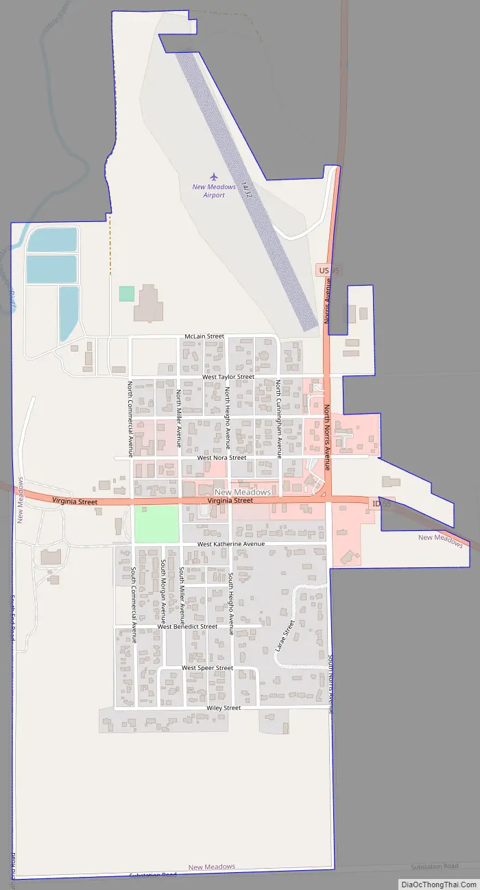
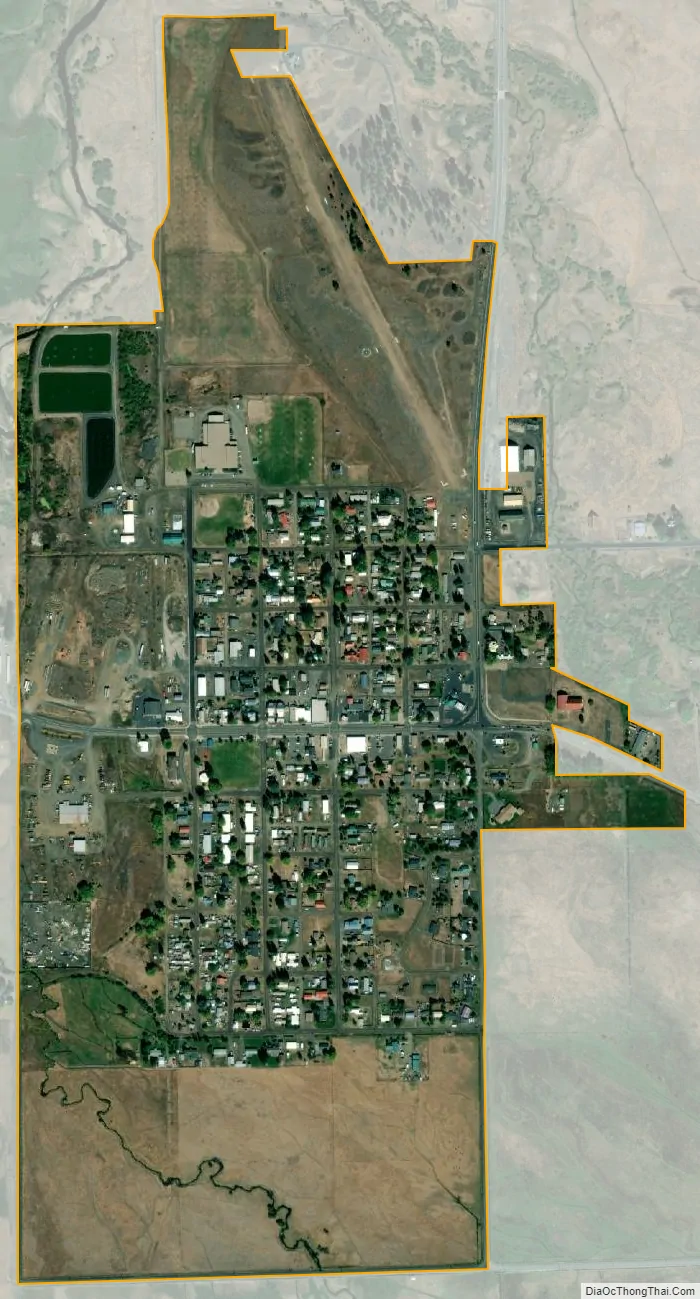
New Meadows is a rural city in Adams County, Idaho, United States, at the southern and upper end of the Meadows Valley, on the Little Salmon River. Located in the west central part of the state, just south of the 45th parallel, the population was 496 at the 2010 census, down from 533 in 2000. New Meadows is located at the junction of the primary north–south highway in the state, U.S. Route 95, and State Highway 55, which connects it with McCall and Boise.
| Name: | New Meadows city |
|---|---|
| LSAD Code: | 25 |
| LSAD Description: | city (suffix) |
| State: | Idaho |
| County: | Adams County |
| Elevation: | 3,868 ft (1,179 m) |
| Total Area: | 0.59 sq mi (1.54 km²) |
| Land Area: | 0.58 sq mi (1.51 km²) |
| Water Area: | 0.01 sq mi (0.03 km²) |
| Total Population: | 496 |
| Population Density: | 919.52/sq mi (354.78/km²) |
| ZIP code: | 83654 |
| Area code: | 208, 986 |
| FIPS code: | 1656890 |
| GNISfeature ID: | 0387535 |
| Website: | www.newmeadowsidaho.us |
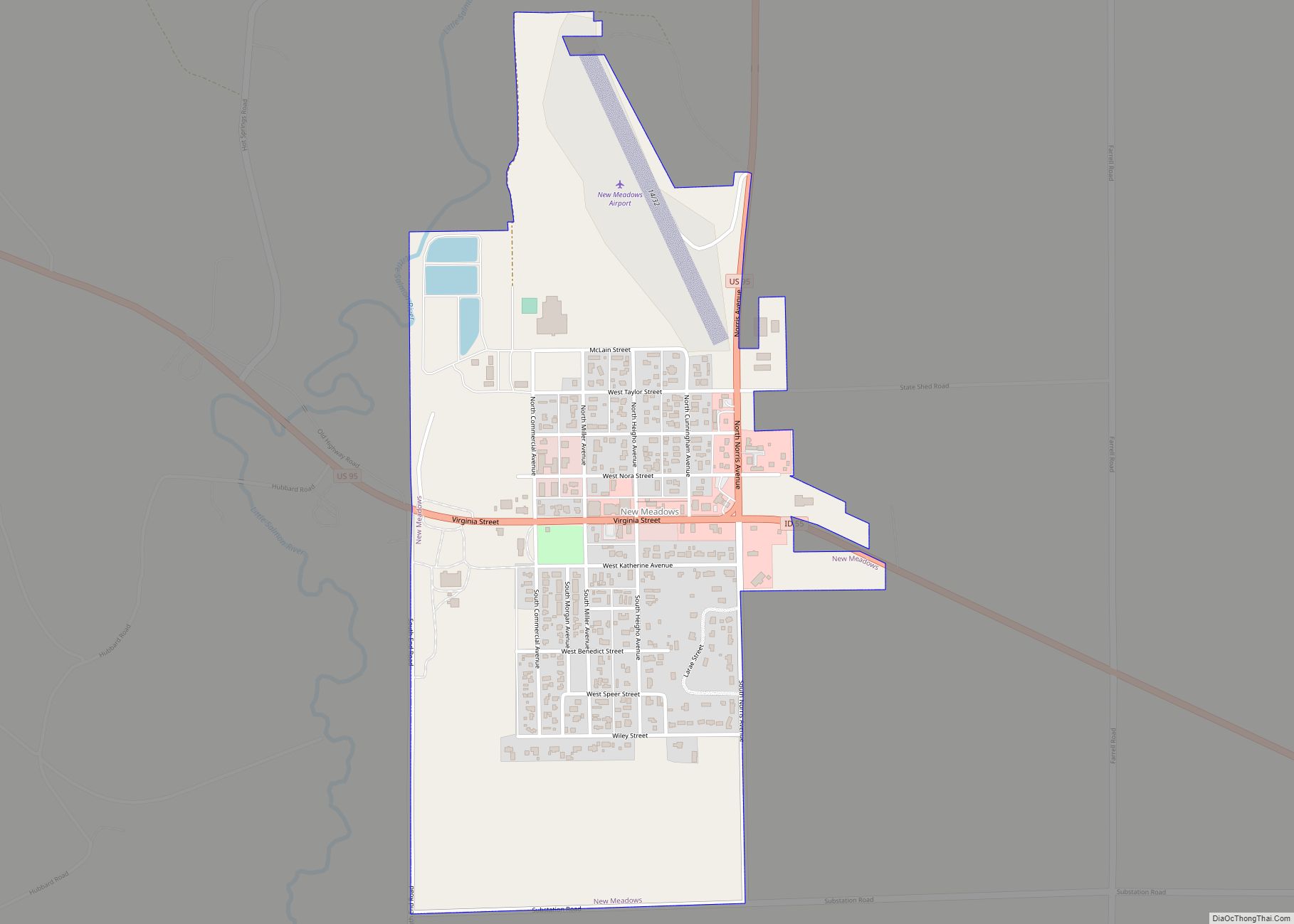
Online Interactive Map
Click on ![]() to view map in "full screen" mode.
to view map in "full screen" mode.
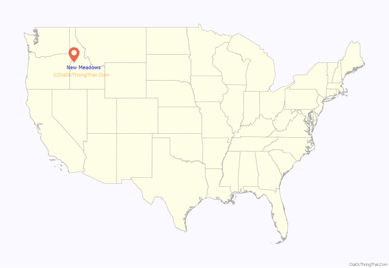
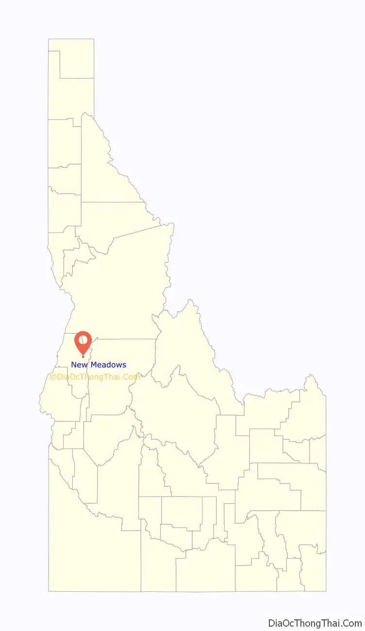
New Meadows location map. Where is New Meadows city?
History
Meadows was in Washington County before Adams County was established in 1911. The Meadows Eagle was newspaper serving the community. C. A. Hackney was the publisher.
The Pacific and Idaho Northern (PIN) Railroad ran from Weiser to an area about two miles (3.2 km) from Meadows, the site of modern-day New Meadows founded in 1911. The city of New Meadows hosts the last surviving PIN. Without the Pacific and Idaho Northern Railroad, New Meadows would arguably not have existed.
The depot was built in 1910 and served as the northern end of the PIN Railroad. It is a significant cultural and historical resource in the Payette River Scenic Byway corridor in the city of New Meadows, at the junction of US-95 and state highway 55. It is listed on the National Register of Historic Places. The depot is an asset for the community of New Meadows and currently functions as a community center for the local area. It hosted the Barn Again! Smithsonian Institution traveling exhibition in 2005, and represents early twentieth century efforts to create a north–south railroad for Idaho. Though the efforts ultimately failed, the PIN Railroad served an important function as a “farm-to-market” railroad until 1940, and then as a timber railroad for local timber outfits.
The Union Pacific acquired the line in 1936 and in 1979 abandoned the northern end of the line, from the Tamarack sawmill site north of Council to New Meadows, along US-95. The depot was a functioning facility until 1972. In 1978, ACHS acquired the title to the PIN Depot to preserve it as a repository for the history of Adams County. Since 2000, the building has been preserved from immediate deterioration. The foundation has been restored and the building now has a new roof.
New Meadows Road Map
New Meadows city Satellite Map
Geography
New Meadows is located at 44°58′13″N 116°17′7″W / 44.97028°N 116.28528°W / 44.97028; -116.28528 (44.970405, -116.285283), at an elevation of 3,868 feet (1,179 m) above sea level.
According to the United States Census Bureau, the city has a total area of 0.53 square miles (1.37 km), of which, 0.52 square miles (1.35 km) is land and 0.01 square miles (0.026 km) is water.
See also
Map of Idaho State and its subdivision:- Ada
- Adams
- Bannock
- Bear Lake
- Benewah
- Bingham
- Blaine
- Boise
- Bonner
- Bonneville
- Boundary
- Butte
- Camas
- Canyon
- Caribou
- Cassia
- Clark
- Clearwater
- Custer
- Elmore
- Franklin
- Fremont
- Gem
- Gooding
- Idaho
- Jefferson
- Jerome
- Kootenai
- Latah
- Lemhi
- Lewis
- Lincoln
- Madison
- Minidoka
- Nez Perce
- Oneida
- Owyhee
- Payette
- Power
- Shoshone
- Teton
- Twin Falls
- Valley
- Washington
- Alabama
- Alaska
- Arizona
- Arkansas
- California
- Colorado
- Connecticut
- Delaware
- District of Columbia
- Florida
- Georgia
- Hawaii
- Idaho
- Illinois
- Indiana
- Iowa
- Kansas
- Kentucky
- Louisiana
- Maine
- Maryland
- Massachusetts
- Michigan
- Minnesota
- Mississippi
- Missouri
- Montana
- Nebraska
- Nevada
- New Hampshire
- New Jersey
- New Mexico
- New York
- North Carolina
- North Dakota
- Ohio
- Oklahoma
- Oregon
- Pennsylvania
- Rhode Island
- South Carolina
- South Dakota
- Tennessee
- Texas
- Utah
- Vermont
- Virginia
- Washington
- West Virginia
- Wisconsin
- Wyoming