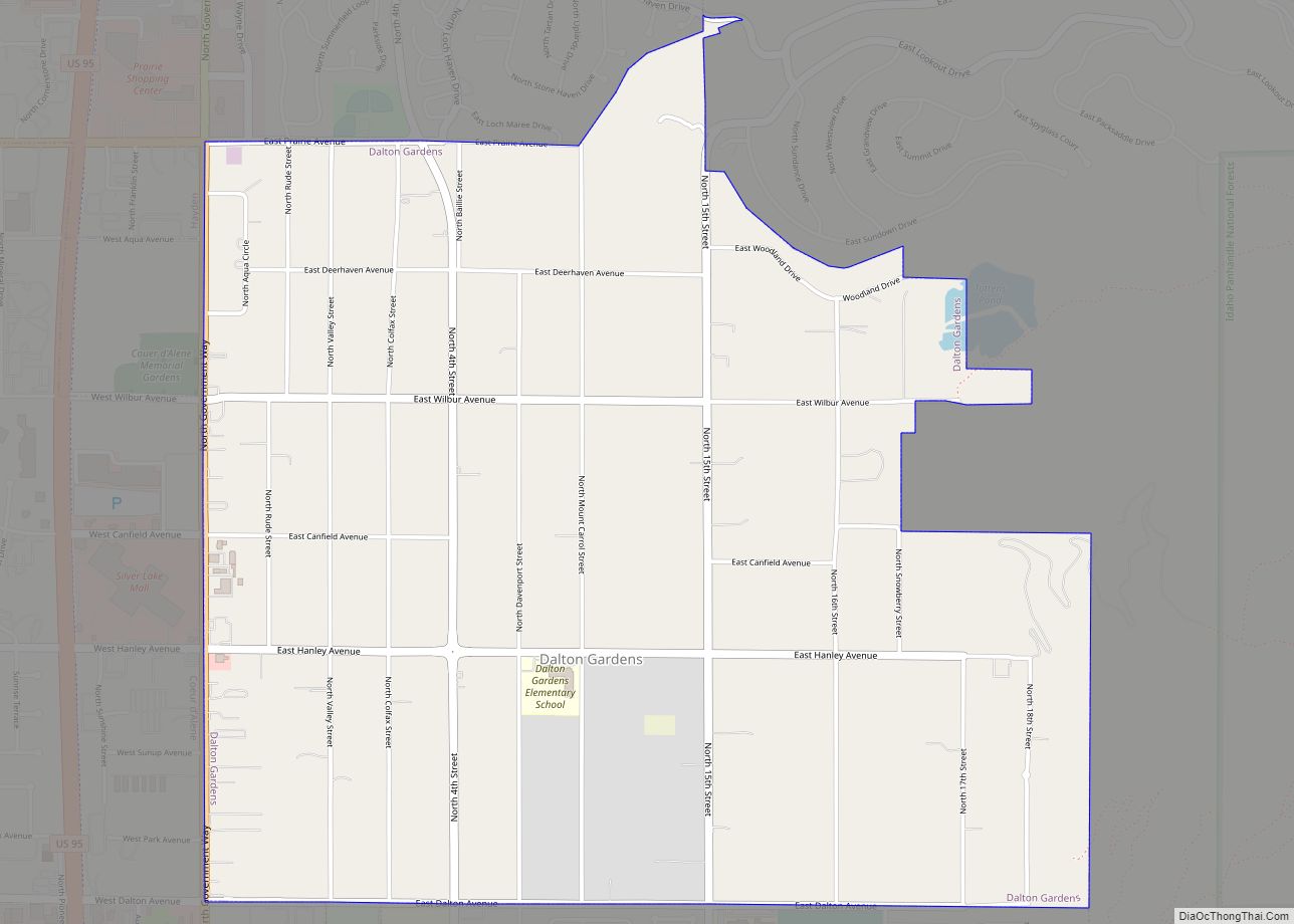
Hayden is a city in Kootenai County, Idaho, United States. Located in the northern portion of the state, it is a suburb of nearby Coeur d’Alene and its population was 15,570 at the 2020 census.
| Name: | Hayden city |
|---|---|
| LSAD Code: | 25 |
| LSAD Description: | city (suffix) |
| State: | Idaho |
| County: | Kootenai County |
| Elevation: | 2,287 ft (697 m) |
| Total Area: | 10.43 sq mi (27.02 km²) |
| Land Area: | 10.42 sq mi (26.98 km²) |
| Water Area: | 0.01 sq mi (0.04 km²) |
| Total Population: | 15,570 |
| Population Density: | 1,494.24/sq mi (577.09/km²) |
| ZIP code: | 83835 |
| Area code: | 208 |
| FIPS code: | 1636370 |
| GNISfeature ID: | 0396630 |
| Website: | www.cityofhaydenid.us |
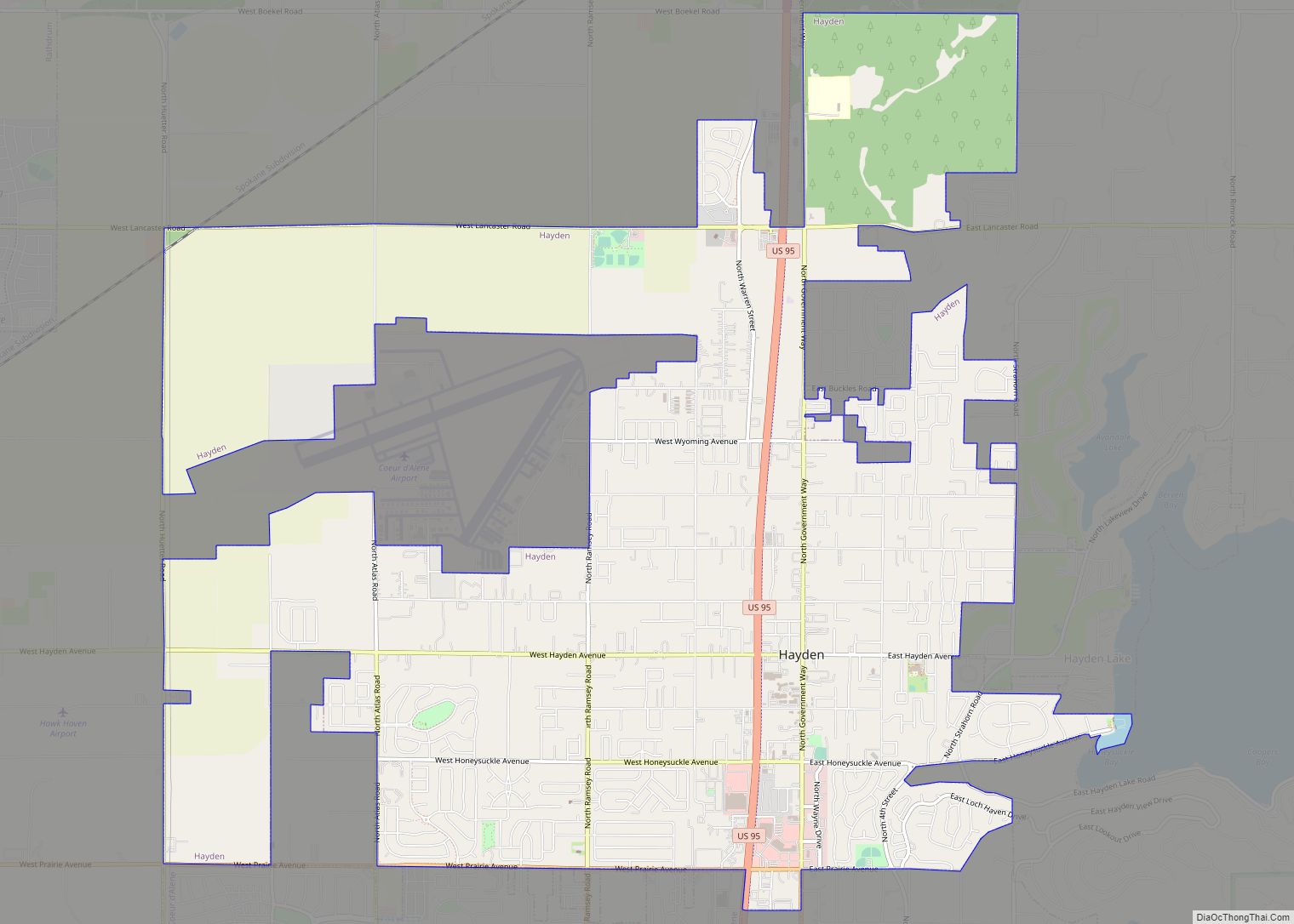
Online Interactive Map
Click on ![]() to view map in "full screen" mode.
to view map in "full screen" mode.
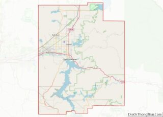
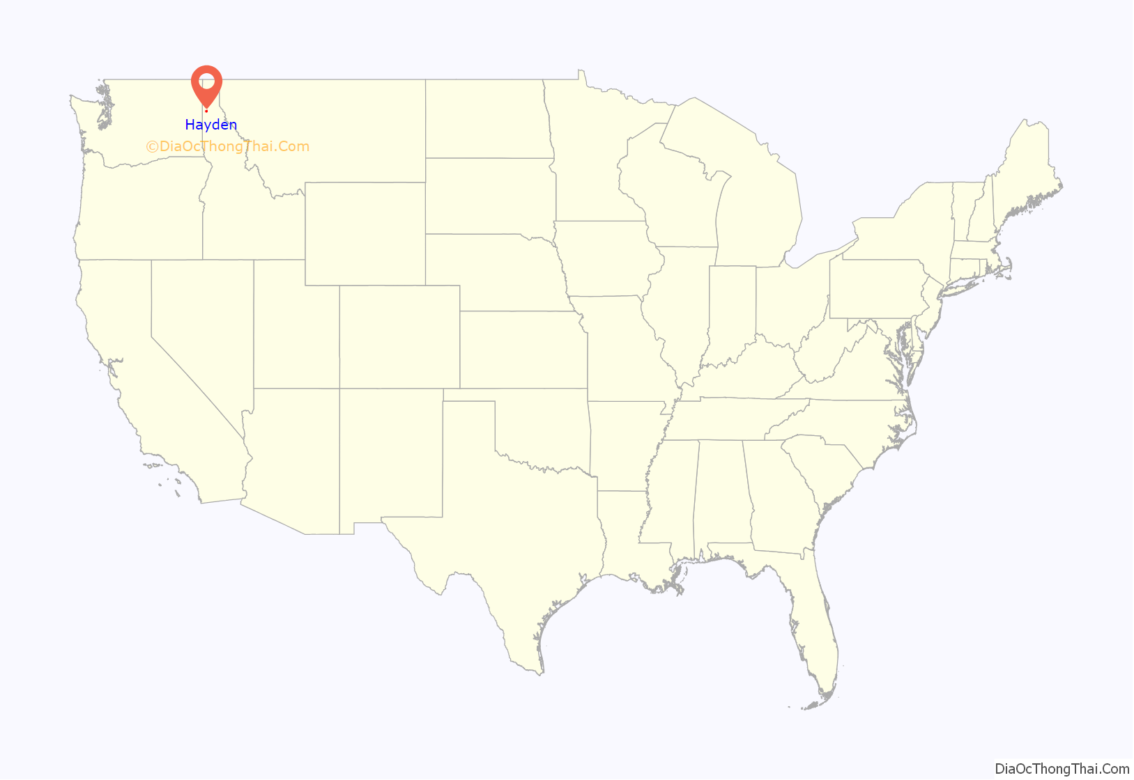
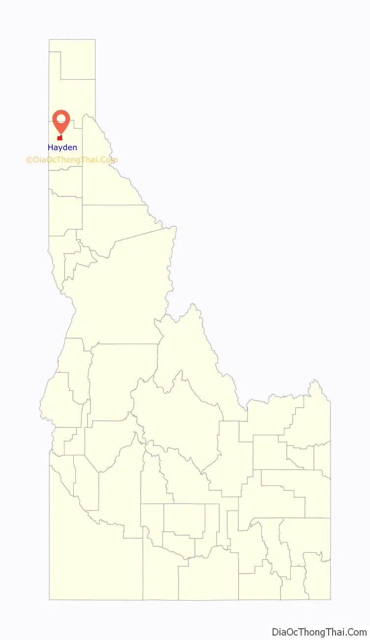
Hayden location map. Where is Hayden city?
History
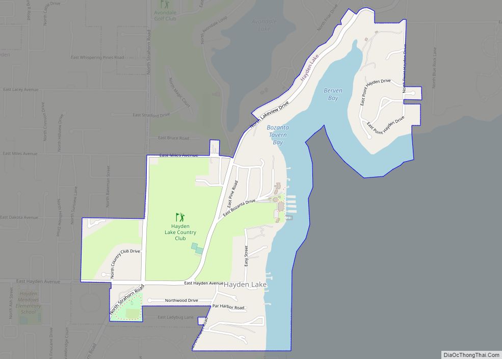
The origins of the city of Hayden has its roots in the history of Hayden Lake. The Coeur D’Alene tribe territory centered around Hayden Lake and nearby Lake Coeur d’Alene, gathering plants, including abundant huckleberries, fish and wildlife found there.The first white man to visit what is now Hayden Lake was Father DeSmet while serving as a missionary to the Coeur d’Alene Indians. While visiting, he named it Lake DeNuf and recorded several stories told by the local tribe about the lake and the surrounding area.
In the 1870s, the Lake Hayden area began attracting white settlers due to the surrounding fertile soils and rich timber resources. Legend has it that three settlers, Mat Heyden (a soldier from Fort Sherman), John Hager and John Hickey played a game of Seven-Up poker to decide who would name the lake. Mat Heyden won and eventually the spelling became standardized to Hayden. Heyden planted the first orchard in the area and established his farm on the western shore of Lake Hayden.
Development centered on this side of the lake, with its close proximity to Coeur d’Alene. At the turn of the century at least three sawmills were located on the lake. One of the mills became part of the Atlas Tie Company, supplying railroad ties across Idaho. During the early 20th century, steamboats plied the waters of Lake Hayden, serving the mills and communities around the lake.
Part of John Hickey’s land claim along Hayden Lake became Avondale Cottage, a resort built in 1903. In 1906, investors expanded and reinvented the property into Bozanta Tavern. The Swiss Chalet-inspired hotel was designed by Spokane architect KK Cutter and the grounds were designed by John Charles Olmsted, one of the Olmsted Brothers who designed New York’s Central Park. The popularity of the resort was encouraged when the Spokane and Inland Empire Railroad extended a trolley line that connected the area with Coeur d’Alene. This also made the resort easily accessible to the booming city of Spokane, WA, it attracted thousands of visitors to the area. The resort became so well known that both Presidents Theodore Roosevelt and William Howard Taft visited Bozanta. In 1910, F. Lewis Clark, a Spokane millionaire, built on the shores of Lake Hayden what was at the time considered to be the largest and most expensive house in Idaho.
Around the turn of the century, a schoolhouse began to be constructed on the shores of Lake Hayden, but was moved before its completion to make way for the Bozanta Tavern. The school building was moved closer to Government Way and finished there. In 1936 an Art Deco-inspired building was built and it still stands there today.
James Monaghan established the first general store near Lake Hayden, located approximately a half mile east of Government Way along Honeysuckle Avenue. A post office was also established there for a couple of years before relocating, along with the store, closer to Bozanta Tavern. This area, which had a stop on the electric trolley line, was developed by the Granite Investment Company, of which James Mongahan was President. Development around Monaghan and the surrounding countryside was encouraged by irrigation installed by the Malloy Brothers who established the Interstate Irrigation company. They bought up thousands of acres in the area and installed irrigation pipes from Hayden Lake.
As the logging and mining industry grew, and encouraged by irrigation from Hayden Lake, farms and businesses developed around on the west end of the lake to serve the workers. In 1906, DC Corbin took advantage of the high tariff on sugar, bought land north of the Hayden area and hired Japanese workers to farm sugar beets. Many white settlers moved into the area to prove up homesteads under the Homestead Act and the Timber and Stone Act, and worked in the logging and resort industries to help make ends meet. The area also saw poultry and dairy farms established, and by the 1920s, cherry and apple orchards were prolific. The first fruit packing plant in the area was established in 1914 and the Seiter Cannery in Post Falls was located nearby. After cold winters in the 1930s ruined many of the trees, many orchards were not replanted.
Government Way, the main road connecting the area with Coeur d’Alene, bypassed the shores of Lake Hayden by a mile and a half. With the advent of the automobile, the center of the town shifted from the lake and railroad and reoriented towards Government Way. A collection of businesses slowly developed at the intersection of Honeysuckle Avenue which connected the lake community with Government Way. By the 1950s, Government Way was designated as Highway 95 and the community of businesses servicing travelers and locals was called Hayden Village. Meanwhile, the community located on the shores of Lake Hayden became Hayden Lake. In 1972, Highway 95 was moved slightly West to reduce traffic on the main road through Hayden.
The population numbered 718 people in 1950. In 1955, the owners of Sargent’s Restaurant in Hayden Village wanted to procure a liquor license. They were stalled by Idaho’s alcohol laws. Hayden Village next sought to be annexed into Haden Lake. When that failed, the “movers and shakers” of the area had a meeting and decided the area should incorporate. The Village of Hayden was incorporated in 1955 with a total of 440 acres with a population of around 700 people. Sargent’s Restaurant was able to move forward in procuring its first liquor license and the City of Hayden in Kootenai County was established.
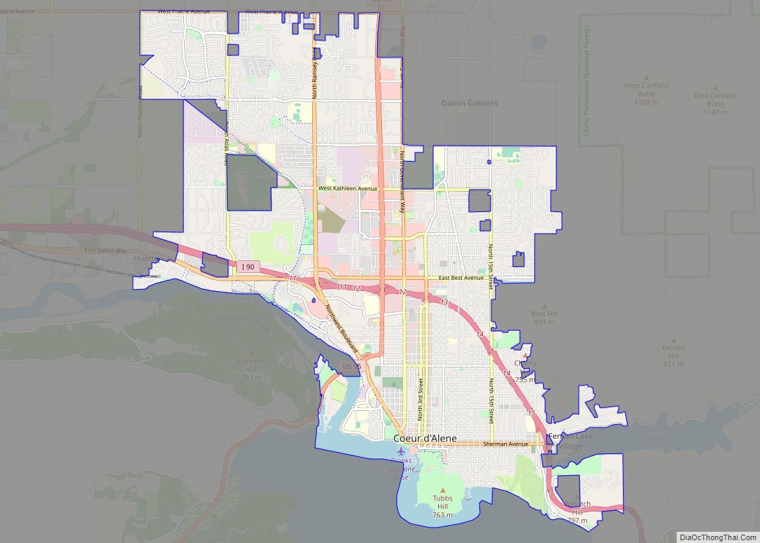
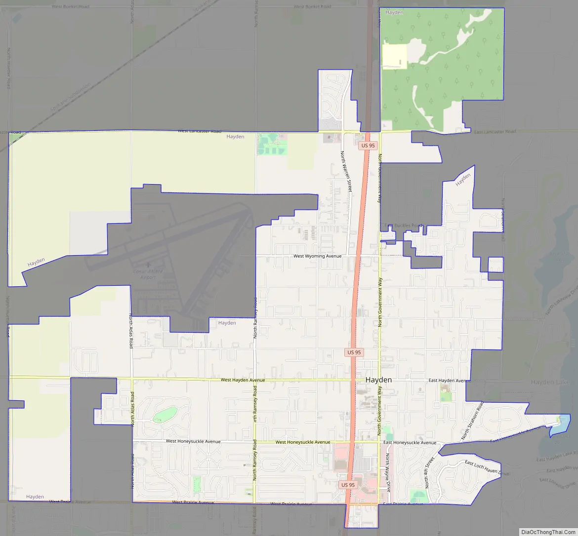
Hayden Road Map
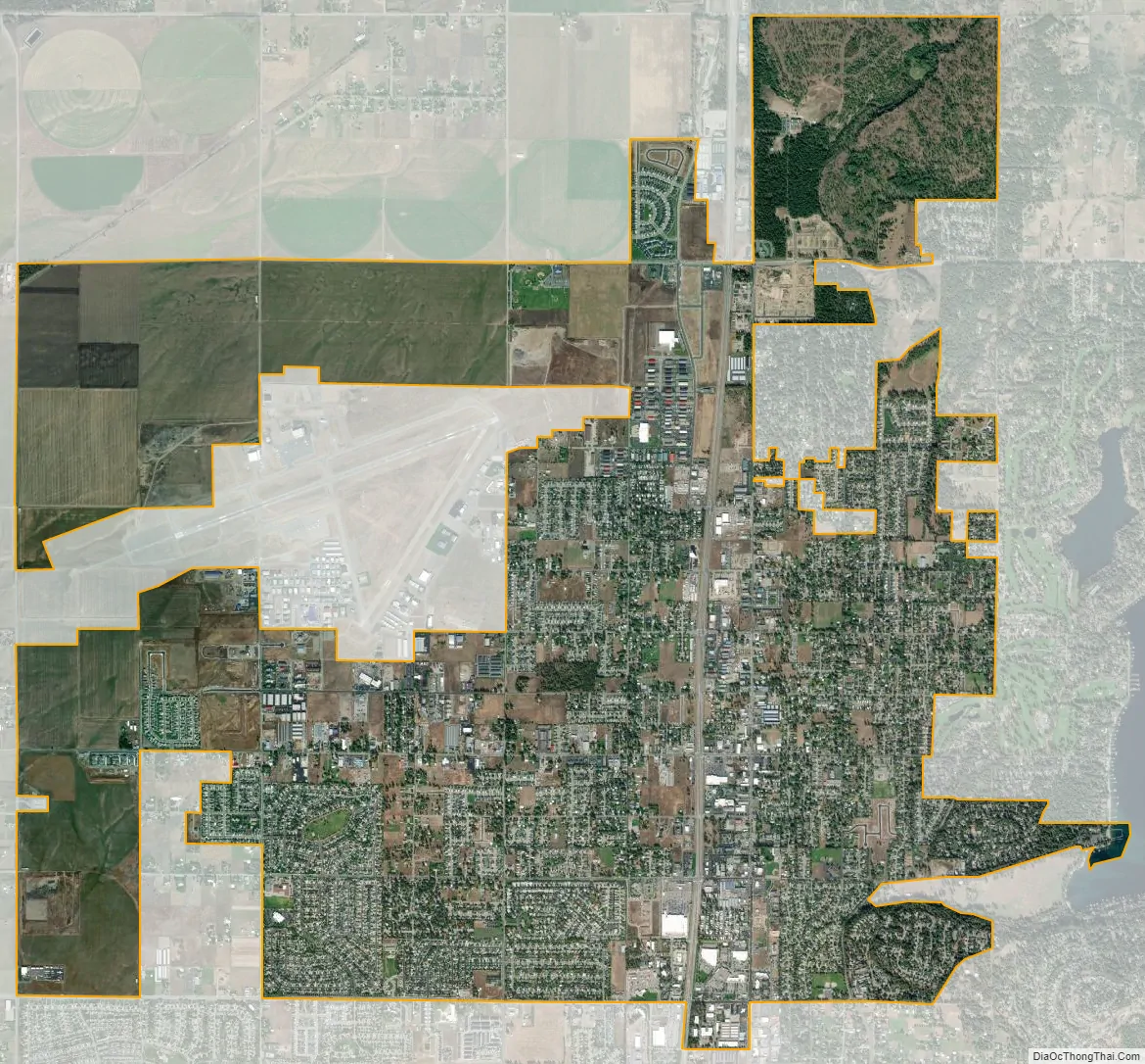
Hayden city Satellite Map
Geography
Hayden is located at 47°45′26″N 116°47′20″W / 47.75722°N 116.78889°W / 47.75722; -116.78889 (47.757112, -116.788877).
According to the United States Census Bureau, the city has a total area of 9.61 square miles (24.89 km), of which 9.60 square miles (24.86 km) is land and 0.01 square miles (0.03 km) is water. It lies at the southwestern end of Hayden Lake, and the elevation of the city is 2,287 feet (697 m) above sea level.
Transportation
Hayden is located on U.S. Route 95 at the junction of Route 41. It is also four miles (6 km) north of Interstate 90 and Coeur d’Alene. The Coeur d’Alene Airport is northwest of Hayden.
See also
Map of Idaho State and its subdivision:- Ada
- Adams
- Bannock
- Bear Lake
- Benewah
- Bingham
- Blaine
- Boise
- Bonner
- Bonneville
- Boundary
- Butte
- Camas
- Canyon
- Caribou
- Cassia
- Clark
- Clearwater
- Custer
- Elmore
- Franklin
- Fremont
- Gem
- Gooding
- Idaho
- Jefferson
- Jerome
- Kootenai
- Latah
- Lemhi
- Lewis
- Lincoln
- Madison
- Minidoka
- Nez Perce
- Oneida
- Owyhee
- Payette
- Power
- Shoshone
- Teton
- Twin Falls
- Valley
- Washington
- Alabama
- Alaska
- Arizona
- Arkansas
- California
- Colorado
- Connecticut
- Delaware
- District of Columbia
- Florida
- Georgia
- Hawaii
- Idaho
- Illinois
- Indiana
- Iowa
- Kansas
- Kentucky
- Louisiana
- Maine
- Maryland
- Massachusetts
- Michigan
- Minnesota
- Mississippi
- Missouri
- Montana
- Nebraska
- Nevada
- New Hampshire
- New Jersey
- New Mexico
- New York
- North Carolina
- North Dakota
- Ohio
- Oklahoma
- Oregon
- Pennsylvania
- Rhode Island
- South Carolina
- South Dakota
- Tennessee
- Texas
- Utah
- Vermont
- Virginia
- Washington
- West Virginia
- Wisconsin
- Wyoming