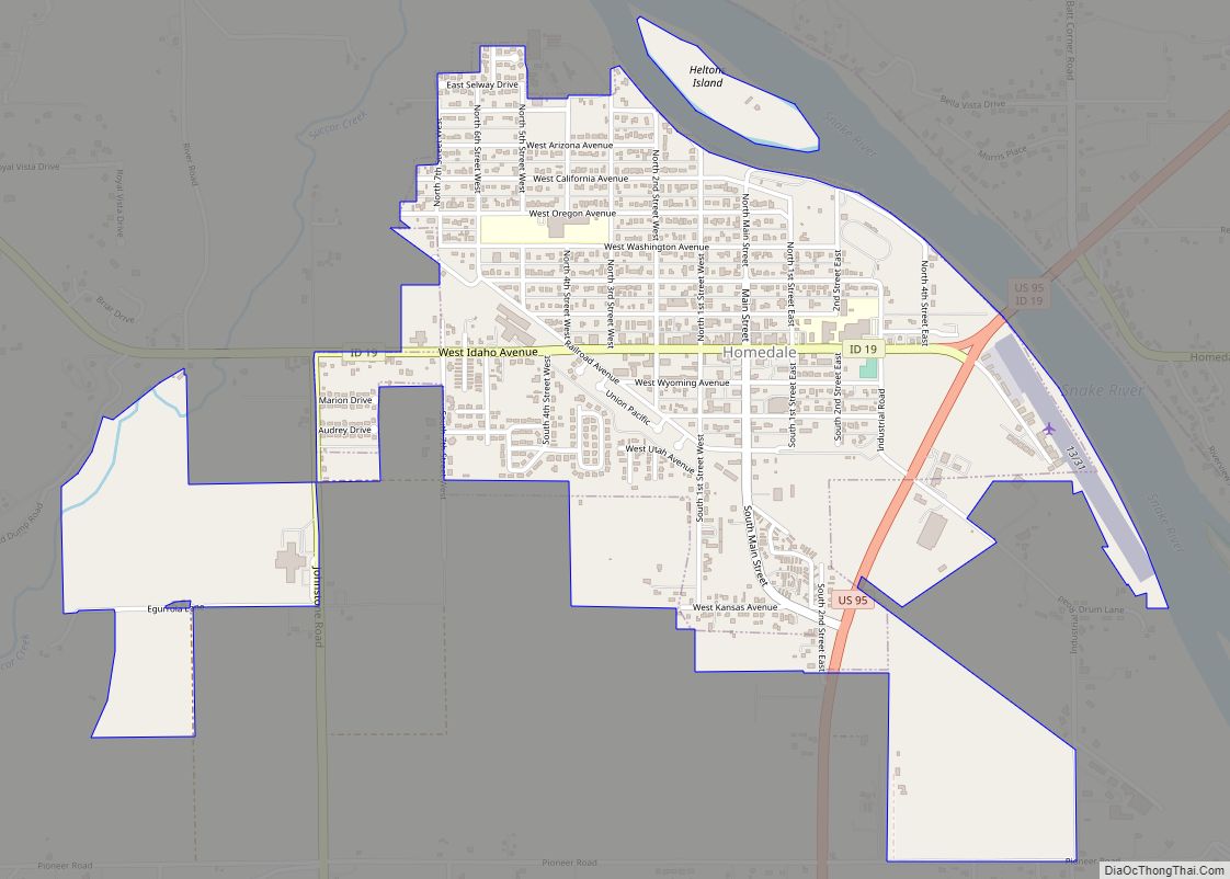
Homedale is a city in Owyhee County Idaho. The population was 2,633 at the time of the 2010 census. The town name was chosen by drawing names from a hat during a community picnic. Homedale is part of the Boise metropolitan area. It was, at one time, the terminus of a branch of the Oregon Short Line Railroad.
| Name: | Homedale city |
|---|---|
| LSAD Code: | 25 |
| LSAD Description: | city (suffix) |
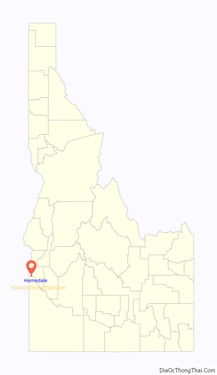
| State: | Idaho |
| County: | Owyhee County |
| Elevation: | 2,231 ft (680 m) |
| Total Area: | 1.42 sq mi (3.69 km²) |
| Land Area: | 1.41 sq mi (3.66 km²) |
| Water Area: | 0.01 sq mi (0.03 km²) |
| Total Population: | 2,633 |
| Population Density: | 1,926.35/sq mi (743.75/km²) |
| ZIP code: | 83628 |
| Area code: | 208, 986 |
| FIPS code: | 1638170 |
| GNISfeature ID: | 0396660 |
| Website: | www.cityofhomedale.com |
Online Interactive Map
Click on ![]() to view map in "full screen" mode.
to view map in "full screen" mode.
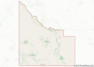
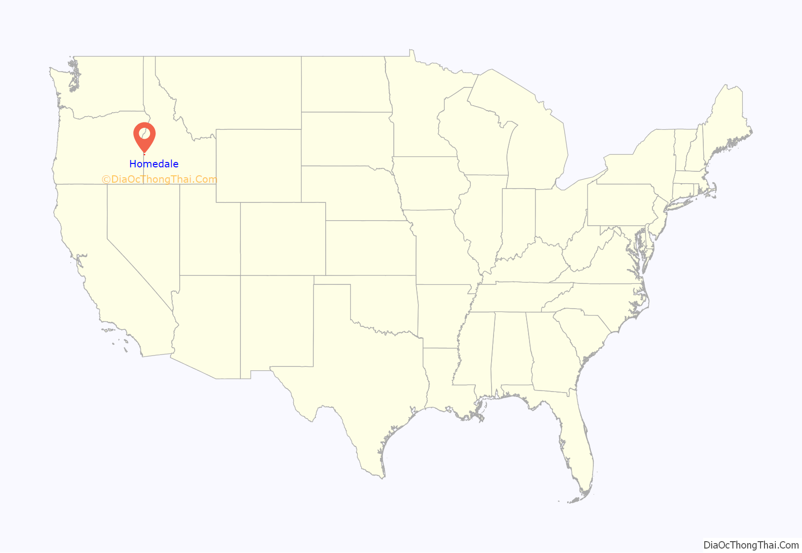
Homedale location map. Where is Homedale city?
History
Homedale was first settled by Jacob Mussell in the late 19th century. In 1898 Jacob Mussell built a ferry boat to help settlers cross the Snake River making Homedale more accessible. By 1914 Homedale had a mayor, a council, a schoolhouse, and a railroad though it wouldn’t be an official city until 1920. In 1914 Austrians were lured to Homedale and promised good farming ground. When they arrived in Homedale they found the land undeveloped though they still had to buy the land. Today there still is an Austrian Town in Homedale. Basque culture is also deeply rooted in Homedale.
Homedale Road Map

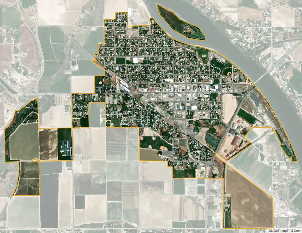
Homedale city Satellite Map
Geography
Homedale is located at 43°37′8″N 116°56′13″W / 43.61889°N 116.93694°W / 43.61889; -116.93694 (43.618980, −116.936836), at an elevation of 2,231 feet (680 m) above sea level. The city is on the Snake River, which is the border with Canyon County.
According to the United States Census Bureau, the city has a total area of 1.47 square miles (3.81 km), all of it land.
See also
Map of Idaho State and its subdivision:- Ada
- Adams
- Bannock
- Bear Lake
- Benewah
- Bingham
- Blaine
- Boise
- Bonner
- Bonneville
- Boundary
- Butte
- Camas
- Canyon
- Caribou
- Cassia
- Clark
- Clearwater
- Custer
- Elmore
- Franklin
- Fremont
- Gem
- Gooding
- Idaho
- Jefferson
- Jerome
- Kootenai
- Latah
- Lemhi
- Lewis
- Lincoln
- Madison
- Minidoka
- Nez Perce
- Oneida
- Owyhee
- Payette
- Power
- Shoshone
- Teton
- Twin Falls
- Valley
- Washington
- Alabama
- Alaska
- Arizona
- Arkansas
- California
- Colorado
- Connecticut
- Delaware
- District of Columbia
- Florida
- Georgia
- Hawaii
- Idaho
- Illinois
- Indiana
- Iowa
- Kansas
- Kentucky
- Louisiana
- Maine
- Maryland
- Massachusetts
- Michigan
- Minnesota
- Mississippi
- Missouri
- Montana
- Nebraska
- Nevada
- New Hampshire
- New Jersey
- New Mexico
- New York
- North Carolina
- North Dakota
- Ohio
- Oklahoma
- Oregon
- Pennsylvania
- Rhode Island
- South Carolina
- South Dakota
- Tennessee
- Texas
- Utah
- Vermont
- Virginia
- Washington
- West Virginia
- Wisconsin
- Wyoming